Download
1 / 7
70 likes | 92 Views
Learn about recent NRCS efforts in hurricane preparedness, including thematic maps for large animal disposal and soil suitability. Find detailed soil survey information and essential functions for decision-makers. Contact William Puckett or Micheal Golden for more information.

E N D
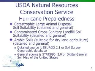
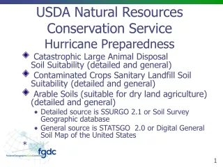
USDA Natural Resources Conservation ServiceHurricane Preparedness • Catastrophic Large Animal DisposalSoil Suitability (detailed and general) • Contaminated Crops Sanitary Landfill Soil Suitability (detailed and general) • Arable Soils (suitable for dry land agriculture) (detailed and general) • Detailed source is SSURGO 2.1 or Soil Survey Geographic database • General source is STATSGO 2.0 or Digital General Soil Map of the United States *
USDA Natural Resources Conservation Service Hurricane Preparedness • http://soils.usda.gov • http://soils.usda.gov/geography/hurricane • http://soildatamart.nrcs.usda.gov (future webservice) • http://websoilsurvey.nrcs.usda.gov/app/ • http://datagateway.nrcs.usda.gov • USDA-NRCS National Soil Geospatial Development Center, 157 Clark Hall Annex, West Virginia University, Morgantown, WV 26506 304-293-8232
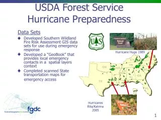
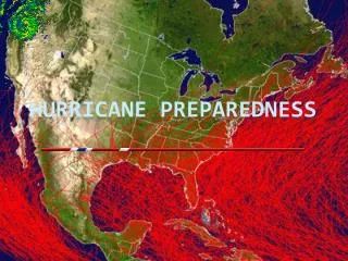
Recent Activities/NRCS Efforts • During September 2005, The National Geospatial Development Center (NGDC) and National Soil Survey Center (NSSC) prepared several thematic maps that centered on the anticipated path of Hurricane Katrina, Louisiana, Mississippi, Alabama, and Florida. • Eleven different large format maps included; the FEMA emergency designated counties; Federal and State Lands; National Land Cover Database; County populations of Cattle, Poultry, and Swine based on National Ag Census and National Agricultural Statistics Service information; Detailed Soil Survey information themes including; Suitability for Catastrophic Large Animal Disposal, Suitability for Trench Landfills, Suitability for Sources of Road Fill, Suitability for Septic Tank Absorption Fields; General Soil Map information themes such as Slight Limitations for Trench Landfills and Probable Sources for Sand.
Recent Activities/NRCS Efforts • An additional nine small format state maps for animal populations were also prepared. The creation of these map products began on a Friday afternoon using NGDC's resident national collection of Soil Survey Geographic (SSURGO) databases, State Geographic (STATSGO) database and other data. By Sunday afternoon, map products were posted to a protected web site for viewing by agency officials in Washington, DC. • The maps were fine tuned, plotted and delivered by NRCS Chief Knight to the Federal Emergency Management Agency (FEMA) headquarters in Washington, DC at the start of the next business day.
Recent Activities/NRCS Efforts • These maps were hanging in the FEMA offices and also shared in hardcopy and electronic format with NRCS State Office staff for Louisiana, Mississippi, and Alabama to assist decision makers during and following the Hurricane Katrina Emergency. • Similar maps were produced for Hurricanes Rita and Wilma to include Texas and Florida. • NGDC serves as a point of contact for Homeland Security and Emergency Response for the USDA-NRCS Deputy Area of Soil Survey and Resource Assessment. • For more information, please contact William.Puckett, Deputy Chief, Soil Survey and Resource Assessment (william.puckett@usda.gov) orMicheal Golden, Director Soil Survey Division (micheal.golden@usda.gov)
Recent Activities/NRCS Efforts • Activity: Production of hardcopy (.pdf) maps, led to distribution of ArcSDE selected datasets to FEMA and other clients after hurricane • Issue: How to provide NRCS Soil Survey and Resource Assessment Essential Function information to decision-makers when needed? • Needs or Gaps*need new approach to sharing large, detailed soils datasets for large land areas with users*essential function data queries need to be done prior to event and “on the shelf”
Recent Activities/NRCS Efforts • Needs or Gaps*need to better use FGDC relationships to MOU’s and Agreements among agencies to facilitate the sharing of large, detailed databases on some agreed time step to minimize version confusionand improve accessibility*need to assess sister agency needs for soils data relative to emergency response needs