Download
1 / 19
190 likes | 377 Views
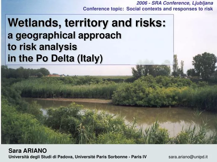
2006 - SRA Conference, Ljubljana Conference topic: Social contexts and responses to risk. Wetlands, territory and risks: a geographical approach to risk analysis in the Po Delta (Italy). Sara ARIANO

E N D
2006 - SRA Conference, Ljubljana Conference topic: Social contexts and responses to risk Wetlands, territory and risks:a geographical approach to risk analysis in the Po Delta (Italy) Sara ARIANO Università degli Studi di Padova, Université Paris Sorbonne - Paris IV sara.ariano@unipd.it
Summary • A geography of risk • Wetlands functions; Man and wetlands • Case study: Po Delta - Veneto (Italy) • The study • First results: main risks, societies, perceptions • Some conclusions: risks and territory
ENVIRONMENT MAN TERRITORY : environment modified by human action, during several phases of territorialisation (Raffestin, Turco, …) A geography of risk • RISK: • is linked to specific territorial features • influences the construction and evolution of territory • is inscribed in environment, has specific spatial features • is also a matter of scale GEOGRAPHY provides theoretical and technical instruments for the analysis of territorial processes. e.g.: theories of territorialisation, geography of complexity; spatial analysis, GIS
What is “wetland”? "Wetlands are areas of marsh, fen, peatland or water, whether natural or artificial, permanent or temporary, with water that is static or flowing, fresh, brackish or salt, including areas of marine water the depth of which at low tide does not exceed six metres" (Article 1.1). In addition Ramsar sites "may incorporate riparian and coastal zones adjacent to the wetlands, and islands or bodies of marine water deeper than six metres at low tide lying within the wetlands" (Article 2.1). (Ramsar convention, 1971) WETLANDS: FUNCTIONS and VALUES Ecological Technical Economical RISK MANAGEMENT Cultural Social
Wetlands functions and risk mitigation • HYDROLOGICAL FUNCTIONS: • flooding risk mitigation • wetlands act as retention basins • water storage • wetlands can assure water supply and maintain surface water flow in periods of droughts • BIOCHEMICAL FUNCTIONS : improving water quality= phytodepuration retention or transformation of some polluting substances and nutrients (from the use of chemical fertilizer); filtration process is especially due to abundant wetland vegetation
Man and wetlands For a long time wetlands have been undervalued and despised as unhealthy and unproductive spaces Recent “passion” for wetlands: the opinion on wetlands has changed amongst scientists and society in general. Wetlands conservation as a primary issue for biodiversity and sustainable development But sometimes wetlands are still considered as wastelands…
Case Study: Po Delta – Veneto (Italy) Between two administrative regions: Veneto and Emilia-Romagna A Regional Park, since 1997 Protected area = 12.592 ha
The study (work in progress…) • PhD work (thesis defense: 2007-8) on Po river Delta • FIRST PROJECT OF WORK: • Objectives: • Evaluating the integration of wetlands in risk management plans • Comparing people’s perceptions of wetlands and risk with management plans • Methodology: • Collecting bibliography, documents, plans and laws • Fieldwork study: interviews, schedules collecting and elaborating data • Comparing management plans and people’s perception • Hypothesis: • - People’s perception: • Undervaluation of functions of wetlands, especially about risk prevention • Undervaluation of risks • - Risk management plans: towards an integration of wetlands
A suspended river Po river embankment: normal flood level is higher than ground level Villages are often next to the embankment; increasing vulnerability
Drainage and subsidence In Po Delta, ground level is under sea-level (average: –2 / -3 m) In order to keep reclaimed lands dry, water-scooping machines have to be used continuously Subsidence, mainly due to extraction of methane until the Sixties
The evident crisis: droughts 3 severe droughts in the last 4 years: 2003, 2005, 2006 25 july 2006: the lowest hydrometric level for Po river water flow = 180 m3/s; (measured at Pontelagoscuro station) Salt water intrusion, up to 20 km from coast line Evident effects in the Delta: • agriculture: rice cultures destroyed, corn and horticulture damaged • no potable water for 15.000 inhabitants Photo: La nuova ecologia, august 11th, 2006
houses agricolture tourism energy aquaculture Valli da pesca Sacche (clams, mussels) Superposition of land uses
Gas terminal and regasification plant (Porto Levante) Termo-electrical power plant of Polesine-Camerini (Porto Tolle): conversion to “white” coal New projects for the Delta Natural park or energy park? New industrial zone at Cà Cappello (Porto Viro) Photo: The thermoelectric power plant of Polesine Camerini
Management Plans (PAI Delta) Autorita' di Bacino del fiume Po, Progetto di Piano stralcio per l'Assetto Idrogeologico del Delta (PAI-Delta), 2001. Tab. 5: Levels of danger
First results • Identification of main risks: • - Flooding risk • - Droughts • - Pollutions • Management Plans: • Based on simple calculations of flood level • Delta separated from the rest of catchment area • Wetlands’ integration in Risk Management: extremely marginal • Fieldwork study, interviews to main local actors: • institutions, economy, population • No risk at all! (maybe just droughts…) • Thanks to technology: we trust on new embankments • Wetlands?
Risk level is beyond comprehension and rationality of inhabitants “we cannot manage risk, so let’s ignore it” Looking for economic development acceptable level of risk is increased Crisis: looking for the guilty water management in catchment area: “there could be enough water, but upstream regions are favoured” Risks and reactions
Wetlands as laboratories of risk Risk as an element of a territorial system: it results from the relationship between man and the environment, in a specific territorial context. Wetlandsas “laboratory” to analyse the territorial dimension of risk: • dynamic, quickly changing environment • concentration of fluxes and relationships of actors • wetlands role in risk prevention linked to the choices of human societies, according to people’s perception • wetland properties in risk prevention: eliminating wetlands increasing vulnerability
Awareness of territorial peculiarities as a pre-condition for the creation of a culture of risk “Natural hazard” or “territorial risk” ? Po Delta is a complex territory, resulting from the interaction of human societies (both local and foreign) and a changing environment Technical representations of natural hazard, based on calculations of flood level, cannot completely explain a complex risky territorial context: vulnerability is increased by human behavior, linked to cultural, social and historical factors trust in human ability to control and “organize” nature Bonifica (reclaimed lands)
Thanks for your attention Sara ARIANO sara.ariano@unipd.it Co-tutored PhD : Università degli Studi di Padova, Dipartimento di Geografia “G.Morandini” Université Paris Sorbonne - Paris IV UMR “Espaces, Nature et Culture”