Download
1 / 11
110 likes | 279 Views
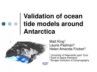
Military applications of ocean models. Jan Kristian Jensen Norwegian Defence Research Establishment Jan-Kristian.Jensen@ffi.no. Norwegian Defence Research Establishment Forsvarets Forskningsinstitutt (FFI). Ongoing projects on military meteorological & oceanographic services

E N D
Military applications of ocean models Jan Kristian Jensen Norwegian Defence Research Establishment Jan-Kristian.Jensen@ffi.no
Norwegian Defence Research Establishment Forsvarets Forskningsinstitutt (FFI) Ongoingprojectsonmilitarymeteorological & oceanographic services • Previousprojects: Metoc (2002-2006), METOC II (2006-2011) • Currentproject: GEOMETOC (2011-2015) • Main focus: Operationalinfrastructure, products and services for meteorological and oceanographic data • In closecooperationwithmet.no and theNorwegianDefence, theNavy in particular
The Royal Norwegian Navy: Heavy demand for operational services METOC = Meteorology and Oceanography Dedicated METOC department at naval base of Håkonsvern, Bergen • Education and training • Formulating user demands for services • Close and informal cooperation with met.no and FFI • Led by Lt. Commander Jon Tore Johnsen
Some crucial, but often overlooked aspects The Navy is not interested in oceanographyper se – but: Howdoesconditionsaffectthe planning and executionofnavaloperations? Importantdistinction! Infrastructureplays a vital role Information not onsome web sitesomewhere – but at my fingertips Met.no is an important partner for buildingtoday’s and tomorrowsmilitary (and civilian) infrastructure for METOC services • Norge Digitalt and EU’sINSPIRE directive for information services • Automatic data transfer from met.no to classifiedmilitarynetworks • Re-usingexistinginternet services whenimplementing services at classifiedmilitarynetwork
what products should the ocean modellers provide to the navy? • Current • Sound speed • Density • Value-added services
Current speed & direction from ocean models • It doesn’t need to be accurate in every detail – but it must be good enough to be of value in planning and execution of operations • Very high resolution modelling is needed to replicate conditions in Norway’s complicated coastal topography • Is this beyond the capabilities of today’s state of the art ocean modelling? • Use in value added products (see later slide)
Sound speed Sound speed important in submarine & anti-submarine operations Verticalpositionofthestrongest sound speed gradients is ofparticularinterest • Errors in ∂/∂zareverysignificant • Absoluteerrorsare not important as long as the gradients arereplicated • The thermocline and halocline must be adequatelyrepresented • Variability due to mesoscaladynamics must be replicated Calculated sonar performance (transmission loss) for a given set of sonar configurations and oceanographic conditions
Density Densityimportant in submarine operations – though not as crucial as sound speed gradient Requirementssimilar to sound speed: Absoluteerrorsaren’tthatcrucial, but location and strengthof gradients areimportant. Ula-class submarine
Value added servicesLeeway drift model Probabilistic drift calculationsofobjects(persons, vessels, mines, containers) or substances(oil) A large numberofparticles (N=500) areinjectedwith start pointsthatarepertubated in space&time relative to last known location. NEW: AlsobacktrackingcapabilityYoufindsomething, wheredoes it come from? Currents, wind and wavesarecrucial input to this service LEEWAY drift model GUI at kilden.met.no
LEEWAY model part ofsearch and rescuemoduleimplemented in Teleplan Maria map system (Maritime command and control system)
what products should the ocean modellers provide to the navy? • Current – is state of the art modelling good enough to provide services of value?? • Sound speed • Density • Value-added services – like the LEEWAY modeland the search and rescue module. Focus on vertical gradients