Download
1 / 29
290 likes | 309 Views
Learn about CAMEO Suite, a set of integrated software apps for emergency planning & response. Explore MARPLOT mapping & ALOHA hazard modeling programs at the Ohio GIS Conference.

E N D
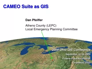
2009 Ohio GIS Conference September 16-18, 2009 Crowne Plaza North Hotel Columbus, Ohio 2009 Ohio GIS Conference September 16-18, 2009 Crowne Plaza North Hotel Columbus, Ohio CAMEO Suite as GIS Dan Pfeiffer Athens County (LEPC)Local Emergency Planning Committee
ATHENS COUNTY Computer-Aided ManagementOfEmergency Operations PROJECT9/17/09
What is CAMEO Suite • A suite of three separate, integrated software applications: • CAMEO – Database and Information Management • Database of 6,000 chemicals • Information database management tool • Facilities • Chemical Inventory • Resources • Special Locations
What is CAMEO Suite • MARPLOT - Mapping Applications for Response, Planning, & Local Operational Tasks • GIS mapping program • Switch between basemaps: standard map files, aerial photos, & topographical maps. • Customize by drawing objects on the map & specifying which layers are shown
What is CAMEO Suite • ALOHA - Aerial Locations of Hazardous Atmospheres • Modeling program that estimates threat zones associated with hazardous chemical releases • Toxic gas clouds, fires, & explosions • Threat zones where a hazard (such as toxicity, flammability, thermal radiation, or damaging overpressure) has exceeded a user-specified Level of Concern (LOC).
COORDINATION • Athens County GIS • Ohio University Voinovich Center • City of Athens • Ohio Office of Information Technology, GIS Support Center
Nelsonville Group Parks Districts Public Safety Correctional Facilities Facilities Warning Sirens RadioSTAT Athens CO Group County Sheriff 9-1-1 Towers Flood Plain Floodway Voting Precincts Hospitals SEOEMS Stations Map Sections Townships 25 foot contour lines RadioSTAT OU Airport Old Rails CURRENT GIS LAYERS
Athens CO Fire Group Fire Stations Hydrants Dry Hydrants Fire Districts Pipelines Columbia Ohio Oil Gathering Southeastern Tennessee Gas Texas Eastern CURRENT GIS LAYERS
Ohio Group School Districts Zip Codes Counties Places Athens Group Public Safety Facilities Hocking College Group Buildings Property Lines Areas Special Locations Lake Snowden Special Events CURRENT GIS LAYERS
Athens School Districts Group Athens Nelsonville/ York Trimble Federal Hocking Alexander County Water & Sewer Districts Burr Oak Water LE-AX Water Trimble Waste Water The Plains Water & Sewer Chauncey Sewer CURRENT GIS LAYERS
Athens CO EOC Exercise Hour 1 Hour 2 Hour 3 Albany Damage Path Albany Power Outage Buchtel Power Outage Northern Power Outages 6 Fest – Special Event Law Enforcement Emergency Route Mounted Unit Route Bus Route Zones Facilities Routes Festival Area CURRENT GIS LAYERS
Pelotonia Bike Tour Route Facilities Bike Path Entry Points Rural Terror Exercise Facilities CURRENT GIS LAYERS
2007 ATHENS CO AERIAL PHOTOGRAPHY • 1.4 Gigabyte file
GOALS – Tier II Information • Update all Tier II facilities information in county – Complete 07-01-2009 • Plot all Tier II facilities on map • Link all Tier II information
GOALS – Athens County • Build CAMEO database of all • Public safety facilities • Resource facilities • Special facilities • Government facilities • Plot all facilities on map • Link all facilities information • Continued use as a planning tool
LONG TERM GOALS • Continue to upgrade all database information • Continue to upgrade all map data • Increase interaction and support with local, state, and federal GIS resources