Download
1 / 26
260 likes | 392 Views
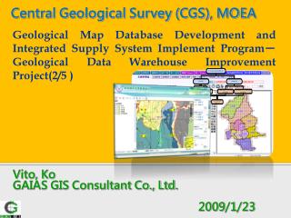
Central Geological Survey (CGS), MOEA. Geological Map Database Development and Integrated Supply System Implement Program-Geological Data Warehouse Improvement Project(2/5 ). Vito, Ko GAIAS GIS Consultant Co., Ltd. 2009 / 1 / 23. Outline. 1.Introduction to project

E N D
Central Geological Survey (CGS), MOEA Geological Map Database Development and Integrated Supply System Implement Program-Geological Data Warehouse Improvement Project(2/5 ) Vito, Ko GAIAS GIS Consultant Co., Ltd. 2009/1/23
Outline 1.Introduction to project 2. Data Warehouse System 3.Comments on Previous Project 4.Methodology and Procedures 5.Progress and Manpower 6.Expected Results 7.Budget Allocation
.Introduction to project Introduction • Secondary-year work of NGIS Spatial Data Infrastructure Plan in Phase 3 (2008-2012) • Goals: • Use advanced spatial information and information management technology to expand the original data warehouse system • Digitize CGS geological data and improve processes of establishing databases and quality of data • Build up a framework for National Geological Data Service System • Assistance to CGS and other government agencies to use GIS geological data • Enhance government’s administrative efficiency and decision making to better integration and supply of NGIS
Geological Data Warehouse System Geological data exchange Digitization of field-surveyed geological data Data inquiry and one-stop service system Geological Data Warehouse Integration of databases Connection with service components Data analysis Physical environment Promotion and customer service
Database establishment Basic geological data collecting system Free GIS + PDF 資料建置 E-forms for field survey data Geo-tag Photos 地質調查電子表單 Geo - tag 現地照片 Geo-tag text/file Geo-tag Hyperlink Geo - tag 地質文件 / Geo - tag Hyperlink Data digitization 資料數化建檔 Data management Metadata(PDF version) Metadata unabridged version) 簡易版詮釋資料建檔 完整版詮釋資料建檔 資料管理 ( PDF ) Database(survey results) Database 收納檔案資料庫 調查成果資料庫 Open-GIS Database (ORACLE) Open-XML Database 開放式 XML 資料庫 ( ORACLE ) Data QA/QC QC(automatic) 資料品質 自動化合理性檢核 QC(manual) 人工檢核 Problems & reporting control system 問題與回報管控系統 Data Inquiry Tile-acceleration 2D platform geological data integrated inquiry system Google 3D platform geological data integrated inquiry system Tile 加速 2 D 平台 Google 3 D 平台 資料查詢 地質整合查詢系統 地質整合查詢系統 Data Transfer/Circulation WMS WFS FTP SQL SOA WS 資料流通 WMS WFS FTP SQL WS Upload Application Examination Download 上架 申請 審核 下載 On-line Supply Functions of Data Warehouse System Concept of Data Warehouse
Core System (internal service) Regional Geology division Database Regional Geology division Database Basic Geological Database Structural Geology division Database Structural Geology division Database Warehouse System (external service) SOA Basic Geological Database Environmental and Engineering Geology division Database Environmental and Engineering Geology division Database WMS Integrated Inquiry System (Warehouse System) WFS Core System Geological Resource division Database Geological Resource division Database SOA Geological Knowledge Website Geological Knowledge Web-service Data Framework of Data Warehouse System Concept of Data Warehouse
Hardware Framework of Data Warehouse System Warehouse System Internet service Internet traffic monitoring server High-speed intranet of C.G.S. Firewalls of web portals & websites C.G.S.Firewall internet Web portals and service websites of NGIS Detecting system Scanning server. Abnormal conditions General user Balanced web load User identification Server 1 for application service Server 2 fro application service Basic Geological database /thematic database External storage media Concept of Data Warehouse
Work Schedule for each Year Planning of Project
Work Done in 2008 6categories of work 22items 55sub-items 5standards of geological data(drafts) 94modules of service parts 300WMS-related releases Digitization of 2digital geological maps 3exhibitions or seminars 3papers 4types of training 1back-up server
.Methodology and Procedures Specification (or modification) of standards of geological data formats 6 1 NGIS promotion and customer service Standard Establishment of geological data supply system 2 Promotion 5 Data Geological database management and updating System Establishment of physical environment for spatial information Expansion of integrated geological data warehouse system 3 4 Methodology and Procedures
1 Specification (or Modification) of Standards of Geological Data Formats Methodology and Procedures Standards of Geological Data (Draft, 2009-2010) Standards of Taiwan Stratigraphic names and usage (2009) Digital Codes for Stratigraphy and Standards of Geological Map Legends (Draft, 2009) Quality Control Standards for Geological Map Data (Draft, 2009-2010)
Methodology and Procedures Modification of standards of basic geological data (2008 v., draft) Gaps between digital geological data and existing printed maps Elimination of the gaps through establishing consistent standards of data formats Standards and criteria for quality control of digital geological data
Existing Printed Geological Maps • The same stratigraphic units are represented in different legends(texture pattern )on different area sheets • Contempary stratigraphic units are shown in different colors on different area sheets • Texture pattern representing a stratigraphic unit does not conform with lithology • The same stratigraphic unit has different names or codes on different area sheets • There is different spelling of English names for the same stratigraphic units Methodology and Procedures Problems in Geological Maps
Area sheet Stratigraphy Area sheet Stratigraphy Area sheet Stratigraphy Problems in Printed Geological Maps BiSaTung Miliao Dayuan Linko Sand Dune Chungli Dayuan Hsinchu Taoyuan Chungli Formation Taoyuan Miliao TonShe Nanto Jinshuei Shale Methodology and Procedures
Digital Geological Map • Inconsistent map formats and data between digital and existing printed geological maps • Classified coding of digital data is not based on a hierarchy of stratigraphic units • Textural patterns of stratigraphic units on digital maps do not conform with conventional ones • Formats of digital geological data need to be standardized Methodology and Procedures Problems in Geological Maps
Current Standards of Digital Geological Data Fig.ZA2 Balewan Formation (Conglomerate) Shuelian Conglomerate (Member) Fig.C48 Shebachungci Formation Fig.Z002 Methodology and Procedures Legends of stratigraphic units do not conform with conventional ones for sedimentary rock type, e.g. the legend color of Shebachungci Formation is not conventional (yellowish is better than reddish), the code is not appropriate and there is not English abbreviation
Solutions 1. Based on fundamental principles of geology 2. Based on USGS standards system used by system used by Methodology and Procedures
Specification of Standards and Practice Fundamental principles and application of geology Rationale Stratigraphic legends Stratigraphic coding Design Practice of designing legends Practice of designing codes Practice Application Prsentation of Stratigraphic data design of stratigraphic database Methodology and Procedures
Standard of geological map data Standard of basic geological data QA/QC Practice of Geological Map Flow chart of Geological Data Standard Top Transform and circulation Standard of stratigraphic name and usage refer Standard of digital stratigraphic codes and legends Position of Standards Down Amendment of geological data standard Methodology and Procedures
Goals for Modification of Standards in 2009 • Modification of standards of the basic geological data (draft) assistance in modification • Standards of geological map data (draft) 1. The same map formats for printed and digital maps 2. Set up basic geological database • 3. Complete standards of geological map data • Standards of Taiwan stratigraphic names and usage(draft) • 1. Collect Taiwan stratigraphic names and examine scales and difference in classification of formations • 2. Standardize stratigraphic names, abbreviation, usage as well as legends • 3. Standards of Taiwan stratigraphic names and usage(draft) Methodology and Procedures
Goals for Modification of Standards in 2009 • Digital codes for stratigraphy and standards of legends(draft) • 1. Design a coding system for stratigraphic names at different scales as well as standard legends • 2. Compile codes of Taiwan digital stratigraphic units and standards of legends(draft) • Standards of quality control for geological map data(draft) • 1. Digital geological maps:Data formats should conform to the standards of ISO19113, ISO19114 and ISO19138 as well as those of ISO19139 or TWSMP1.0v • 2. Geological data :Specify QA/QC criteria based on spatial characteristics of geological data (draft) ISO 19113:2002 - Geographic information -- Quality principles ISO 19114:2003 - Geographic information -- Quality evaluation procedures ISO 19138:2006 - Geographic information -- Data quality measures ISO 19139:2007 - Geographic information -- Metadata -- XML schema implementation Methodology and Procedures
2 Establishment, Management and Updating of Geological Map Data Establishment, Management and Updating of Geological Map Data Methodology and Procedures 1. Collection, establishment and updating of geological map data (1)Establish 1/50000 regional geological profiles in KML interface and web pages (2)Set up a production system for vector KML (3)Fast production of image files (4)Quick processing of 1/25,000 topographic maps about Taiwan (5)Integrate electronic map data provided by I.O.T., MOTC with the platform (6)Complete digitization of geological map data in two months after CGS publishes regional geological map data (7)Integrate monitoring of map data service with the platform and set up a delivery system of WMS 2.Surveys for map data and establishment of metadata (1)In line with MOI announcement of WSMP, integrate MOI web version of metadata with warehouse system (2)Set up and publish metadata in compliance with ISO 19139 standards 3.QA/QC of map data (1)Set up a mechanism for disposing of platform problems (2)expand the QA mechanism for map data input
Establishment of Production and Inquiry System of KML Geological Profiles Establishment, Management and Updating of Geological Map Data Methodology and Procedures • Purpose • 3D Presentation of geological profiles • Development of Service Component Modules • Module for map data input to spatial databases • Module for positioning geological profiles • Module for inquiry about geological profiles • Module for displaying information on geological profiles
Establishment of Production System of Vector KML Establishment, Management and Updating of Geological Map Data Methodology and Procedures • Purpose • Production system of vector KML geological maps which enables users to adjust legends • Development of Service Component Modules • Module for map data input to spatial databases • Module for KML conversion of spatial databases • Module for setting KML legends • Module for KMZ packaging
Tiled Base Image Map Open spatial databases ORACLE Improvement in mapping Platform Dynamic maps Block maps Pre-download 2D MapViewer 3D MapViewer XML vector map XML image map Establishment of Fast Production System of Map Layers Establishment, Management and Updating of Geological Map Data Methodology and Procedures • Purpose • Instant display of maps from the platform • Development of Service Component Modules • Module for map data input to spatial databases • Module for map data QA/QC • Module for setting display of legends • Module for examining overlap of the maps • Module for mosaic of image files • Module for fast production of map layers • Module for quickly setting map layers • Module for quickly saving map layers • Module for instant display of map layers
integrate the electronic map data of I.O.T., MOTC with the platform Integration of Electronic Map Data Provided by I.O.T., MOTC Establishment, Management and Updating of Geological Map Data Methodology and Procedures • Purpose • Enable users to overlay road network layers and geological map layers • Development of Service Component Modules • Module for map data input to spatial databases • Module for map data QA/QC • Module for setting display of legends • Module for classification of road systems • Module for examining overlap of maps