Download
1 / 55
550 likes | 749 Views
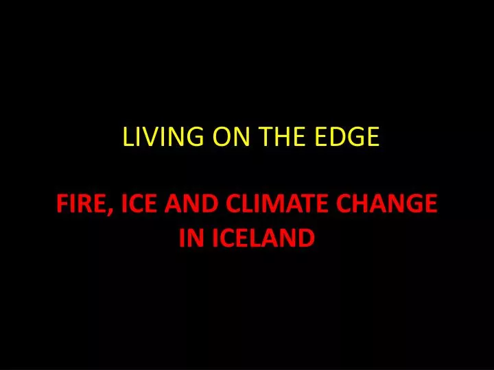
LIVING ON THE EDGE. FIRE, ICE AND CLIMATE CHANGE IN ICELAND. A modern country on the Arctic Circle. Iceland has 900 volcanoes; 22 are active There are four large volcanic centers There are four main areas of glaciation The country’s area is larger than Indiana but smaller than Kentucky

E N D
LIVING ON THE EDGE FIRE, ICE AND CLIMATE CHANGE IN ICELAND
A modern country on the Arctic Circle • Iceland has 900 volcanoes; 22 are active • There are four large volcanic centersThere are four main areas of glaciation • The country’s area is larger than Indiana but smaller than Kentucky • Population ~ 320,000 • Farming, fishing, banking, data storage, some industry, tourism • Brushed by the Arctic Circle but warmed by the Gulf Stream Iceland has no military. (Does it depend on “us”? U.S.)The last war was over cod fishing rights in 1970s.There are just over 100 prisoners in the entire country. City police force does not carry guns.Education through college is free
August, 2009Eyjafjallajokull Volcano The volcano appears dormant but small earthquakes increased at this time signaling the possible movement of magma up towards the surface.
2010 Eruption of Eyjafjallajokullbetter known as E 15 February 26: unusual seismic activity and rapid expansion of earth’s crust as magma moves up into chamberMarch 20 – 26: Fissure eruptions begins, 5 miles from crater
April 14 – May 23, 2010 • Crater erupts beneath glacier • Meltwater floods rivers, roads • Evacuation of 800 • Explosive lavas • Volcanic ash column extends 5 miles into atmosphere
April 14 – May 23, 2010 • Glacial meltwater floods and lahars • Evacuation of 800 residents.
The flood caused by the E-15 eruption • Consisted of melted glacial ice (water) • Mixed with erupted volcanic rock, glass and ash Causes a density flow that travels down grade rapidly Flows into rivers, across fields and highways Destructive powerful flow (think wet cement) Can clog rivers with debris or dislodged ice Can cause ice damming which may result in a flash flood when the ice dam is melted or broken For video: copy and paste this linkhttp://www.youtube.com/watch?v=9sryalI57oo
April 14 – May 23, 2010 Volcanic ash column extends 5 miles into atmosphere Volcanic ash is composed of fine particles of sharp-edged glass which can be ingested by jet engines. The glass melts and fuses to metal parts. This can cause catastrophic engine failure.
April 15 • Ash plume reaches northern Europe in 24 hours • Air traffic disrupted in mainland Europe • 100,000 flights canceled; 10 million affected
Volcano Explosivity Index of 4 – moderate • Volcanic lightning when ejected rock, water and ice collide • Eruption stops by May 23, 2010
So…what is it like to be LIVING ON THE EDGE IN ICELAND?
Fire active volcanic centers Climate changenear the Arctic Circle changes in climate may have dramatic consequences Iceglaciers up to 3000 feet thick 11.5% of Iceland’s surface
Iceland lies on an active plate boundary: The Mid Atlantic Ridge • The following map indicates the current model of plate boundaries; some have been seen and some have never been seen.Plate boundaries follow the pattern of earthquakes and some volcanoes on earth. • Volcanoes only occur at mid-ocean ridges, convergent boundaries (subduction zones) and hot spots.
Iceland is one of the few places on earth where the Mid Ocean Ridge lies above sea level Iceland is a place where geologists can view and study an actual divergent plate boundary • In the following map and inset, note the large mass of extruded lava (rock) that surrounds Iceland. • The gray area is the part of the Island that is above sea level; but actually, Iceland’s volcanic deposits extend out into the ocean for hundreds of miles. • Is this excessive volcanic activity along the Mid Ocean Ridge due to “hyper” volcanism on the ridge? • Or is there another source of lava such as a Hawaiian-type hot spot right along the ridge?Some geologists still argue both sides and look at trace elements for evidence of multiple distinct sources of lava from the mantle. • Most are convinced that there is a deep mantle source of magma/lavathat contributes to the large volume of erupted material that makes up Iceland.
Rift Valley Area of low elevationBounded by normal faultingLava extrudes where crust is thin
What does the Rift Valley of the Mid Atlantic Ridge look like? Area of low elevation Normal faulting at Thingvellir Lava rocks Note: low areas fill with fresh watereventually marine waters and an ocean will form between the plates
Walking through the normal fault breaks along the Mid Atlantic Ridge Thingvellir National Park
European Plate N. American Plate
View from above: Young rift valley at Thingvellir. Water occupies low lying areas. rift widens marine waters intrude ocean basin is formed Separating the North American and Pacific plates
Life on the Mid Ocean Ridge The Capital city of Reykjavik lies on the plate boundary
Top FIVE AdvantagesLiving on the Edge of a volcanic rift zone • # 1 Hot magma flows closely beneath the surface • Geothermal energy source • In 1960s, Iceland cut oil imports and switched to geothermal energy and hydrogen fuel for cars • Use of crude oil is about 20 barrels of oil per day for 300,000 (.00007 barrels per person per day) • U.S. uses 400 million barrels per day for 307,000,000 (over a barrel per person per day)
Geothermal plants located in low valleys close to the magma source within the rift European Plate
Iceland is committed to clean, green, less costly fuels. Cars and fishing boats remain the principal users of fossil fuels.A drive to convert to hydrogen fuel is underway.
# 2 Unlimited hot water and low cost electricity is generated by geothermal heat • Beneath the city streets of Reykjavik, local wells transport steam and hot water directly to homes • Homes and hotels are heated by radiators • 98% of space heating is from geothermal • Water beneath the spreading ridge is 250 degrees C at depth of 2 km
# 3 The volcanic landscape provides rich soils for farming during the long days of the short growing season in northern latitudes. • Sheep graze on the grassy plains.
# 4 Addition of real estate at no apparent cost • Surtsey Island appeared suddenly above the surface of the waters off the coast of IcelandIt has been preserved as an open and living laboratory for the study of volcanic processes, vegetation, migratory animals and high latitude environments.
November, 1963 • Eyewitness to eruption • Eruption column 4 miles • First human 3 weeks later • Plants and birds arrive • in a short time. • Studies show new mineralsnever before found on Icelandand one new to the world. • Access is now limited.
# 5 Leisure and Recreation Hot springs, sulfur-rich, silica rich waters The Blue Lagoon is a man-made outdoor spa heated by mineral waters released from a geothermal plant. The blue color is a result of dissolved silica from rocks and algae. It is one of Iceland’s most famous tourist attractions.
World Class Snorkeling and Diving in thefaults and rift valley
World class scuba site: Copy and paste link below for video of diver in crystal clear waters among the rocks of the plate boundary http://www.youtube.com/watch?v=XvdxYbK53W8&feature=related
Disadvantages of Living on the Edge of a volcanic rift zone • #1 Volcanic eruptions may be catastrohpic or darned inconvenient • #2 Eruptions can come without warning • #3 Disruption of travel plans: historic eruptions in Iceland have continued for two YEARS! • #4 The water in the shower has a strong odor of sulfur • #5 High levels of volcanic gases and particulate can enter the atmosphere, soils , water and food supply.Fluoride compounds lethal to livestockAir quality can be poor for extended time.
Living on the Edge:Iceland’s Glaciers and Europe’s largest ice cap • Glaciers are in the southeast – More precipitationMore elevation due to volcanic areasGlacers are dependent on winter snowfall that exceeds summer melt • Ice covers many volcanic peaks(glaciers in white) • Ice depth can be over800 meters or up to 3,000 feet • Note geologic ages of lava flows:pink youngestgreen olderpurple oldest • This pattern matches what one • Would expect along a spreading ridge
Top five advantages to living on the edge with Iceland’s glaciers • #1 Abundant source of fresh, clean water • Glaciers store water and release during summer dry spells • Iceland’s pure high pH own brand of bottled waterpH 8.8 is more basic (not acidic) ** this is corrected • #2 Resource for hydroelectric power • #3 Streams form habitats for fish and wildlife • #4 Open geology laboratory for accessible ice caps and outlet glaciers • #5 Recreation opportunities abound
Egilsstaoir Hydro Power Plant Iceland Clean, green, fossil-fuel-free
Spring Melt of Glaciers provides wilderness recreation
Top five disadvantages to living on the edge near Iceland’s glaciers • #1 They move. They break off. They melt. • #2 They tend to cover active volcanoes and can cause destructive flash floods or jokulhlaups (Icelandic for short-lived flooding) • #3 Because they provide abundant fresh water, industry can move in • #4 Cheap green hydroelectric power attracts industry that is not so green. • #5 A disadvantage if you don’t like the cold.
Catastrophic glacial melt 1996 eruption causedsub glacial melting. --1000 tons of ice melted filling Lake Grimsvotn from beneath. The lake filled 3 times and overflowed. Water rushed to the shore for 3 days At the outlet glacier (coast), water and 50 ft. ice blocks destroyed roads and swept away bridges • filing
1996 Flood when glacier melted destroying highway and bridge
Melting glaciers brings Iceland to the cutting edge of • Climate Change • Iceland lies at latitude 63 – 67 degrees NTwo dominating climate factors • Gulf Stream warming factor • NAO – North Atlantic Oscillation
The melting of glacial ice is a true threat to Iceland • Initially, melting ice will destroy farmlands and wildlife habitats but encourage others (forests). • Climate may seem temporary more favorable as when the Nordic people visited Iceland in the Medievilwarm period. • Much of iceland’s infrastructure for geothermal heat transport is above ground. Floods and warmed muddy earth could undermine these structures. • Melting increases river discharge and flooding of coastal transitional areas • change in salinity and water temperature of limited and fragile coastal areas
Other dramatic changes • Introduction of large quantities of cold, fresh water in an area of critical importance in the ocean conveyor. • Loss of reflectivity could lead to positive feedback and regional warming, accelerating melting of glacial ice • This, along with effects of Greenland melts, could displace the warm gulf stream and disrupt downwellingof cold, dense salty water.This would disrupt the transport of warm water towards the higher latitudes; and cold waters toward the lower latitudes of the Atlantic. • This exchange mixes ocean waters and controls moderation of temperatures over the hemisphere. This is a critical climate control which, if disrupted, could result in extreme temperatures and significant changes especially in the higher latitudes.