Download
1 / 21
220 likes | 307 Views
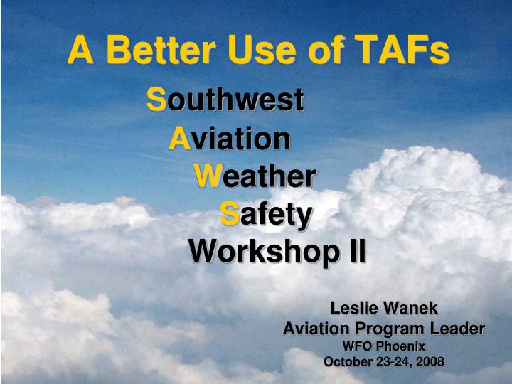
A Better Use of TAFs S outhwest A viation W eather S afety Workshop II. Leslie Wanek Aviation Program Leader WFO Phoenix October 23-24, 2008. Objectives for today…. TAF Review and Terminology NWS TAF Writing Philosophies Forecaster Best Practices

E N D
A Better Use of TAFsSouthwestAviationWeatherSafety Workshop II Leslie Wanek Aviation Program Leader WFO Phoenix October 23-24, 2008
Objectives for today… • TAF Review and Terminology • NWS TAF Writing Philosophies • Forecaster Best Practices • Use of Cumulonimbus (CB) & Vicinity (VC) • TAF Example • Aviation Forecaster Written Discussion • 30-Hour TAF Format Change
TAF Review & Terminology Terminal Aerodrome Forecast • Terminal Aerodrome Forecasts, also known as Aerodrome Forecasts, are prepared by National Weather Service (NWS) Weather Forecast Offices (WFOs). • The U.S. definition of terminal is an area within five (5) statute miles (SM) of the center of an airport’s runway complex. • A NWS TAF will consist of expected meteorological conditions significant to aviation at an airport (terminal) for a specified time period. • TAFs are a critical element of NWS aviation weather services because they are a key product in decisions on aircraft movement within the National Airspace System (NAS). NWSI 10-813 November 2007
TEMPODefined as…Temporary fluctuations in forecast meteorological conditions which are expected to last less than one (1) hour in each instance and, in the aggregate, to cover less than half of the indicated period. • Used for high probability (greater than 50%) expectations • Will not be substituted to indicate a low probability event (less than 50%) • Will not exceed four (4) hours Example… KABC 091125Z 091212 19008KT P6SM SCT010 BKN020 OVC090 TEMPO 1215 2SM RA SCT010 BKN015 OVC040… NWSI 10-813 November 2007
PROB30 groups only, indicating a 30% probability of the specified element occurring PROB30 groups will not include forecasts of significant weather in the vicinity (VC) or non-convective Low Level Wind Shear (LLWS) Will not be used in the first nine (9) hours of every TAF valid period, including amendments PROB30Defined as…Probability of occurrence of a thunderstorm or other precipitation event, with associated weather elements as necessary (wind, visibility, and/or sky condition) whose occurrences are directly related to, and contemporaneous with, the thunderstorm or precipitation event. NWSI 10-813 November 2007
LLWS in a NWS TAF will refer only to non-convective LLWS from the surface up to and including 2K ft AGL Used only in FM groups (no TEMPO/PROB30), remains prevailing until next FM change group Low Level Wind Shear (LLWS)Defined as… Wind Shear (WS), a change in horizontal wind speed and/or directions, and/or vertical speed with distance, measured in a horizontal and/or vertical direction. WS is a vector difference, composed of wind direction and wind speed, between two wind velocities. Example… KABC 220539Z 220606 21010KT 3SM BR SCT030 WS015/29065KT FM1100 24015KT 1SM TSRA BR OVC010CB FM1830... NWSI 10-813 November 2007
NWS TAF Writing Philosophies • Optimize timeliness and representativeness using the best • professional judgment • Be aware of the potential operational impact of each forecast • element and it’s associated change in Aviation Flight Category • (AFC) • Keep in mind the varying degree of NWS TAF users, including… domestic and international commercial airlines, General Aviation (GA), Civilian and Military Operations, etc. • Know your airfield’s • restrictions and • minimums
The Un-Amendable TAF… • Many pilots find TAFs are often written with such complexity that they lose utility • NWS Verification statistics indicate that PROB and TEMPO groups are overused and can hurt the value of the forecast • The cost to an airline for adding fuel for an alternate can also be high, especially for some carriers • GA Pilot…it’s a go / no go Un-Amendable TAF
Common Needs… Clear Concise Consistent Relevant Timely Accurate NWS TAF Writing Philosophies Through the TAF, NWS Forecasters have a great opportunity to enhance flight safety and save customers both time and money.
Forecaster Best Practices Goal: Avoid writing the un-amendable, ambiguous TAF and strive for an effective, practical, user-friendly TAF by… • Establishing trends and writing to Aviation Flight Categories first • Add detail to the first 6 hours of the TAF, known as the critical TAF period • Limit the use of TEMPO groups to the first 6 hours • Avoid PROB30, which users have indicated can be • confusing
Use of Vicinity (VC) & Cumulonimbus (CB) Vicinity = A donut-shaped area between circles with radii of 5 and 10 SM from the center of the runway complex of an airport. • Used only in the initial time period or in from (FM) groups, all of which forecast prevailing conditions • Used in combination with fog (FG), showers (SH), and thunderstorms (TS) • Less stringent operational impacts on users than PROB30 groups • CB = used to indicate instability in the atmosphere
Forecast Example Forecast Scenario: A 70% chance for showers and thunderstorms is forecast for a zone in the afternoon, 18 – 00 UTC (local time 11am – 5pm). At a TAF site in that zone, a 30% chance for showers and thunderstorms is forecast for early afternoon and a 70% chance for late afternoon. KTAF 231730Z 231818 14010KT P6SM SCT080CB BKN200 FM2100 17012G22KT P6SM VCTS SCT050CB BKN070 TEMPO 2224 VRB20G30KT TSRA BKN030CB Public Zone (area) forecast reads… PARTLY CLOUDY. SOUTH WIND 10 TO 15 MPH. SHOWERS AND THUNDERSTORMS LIKELY IN THE AFTERNOON. CHANCE OF RAIN 70 PERCENT. TAF reads…
Change in Flight Categories VFR/MVFR/IFR/LIFR Frontal Passage timing / cause Precipitation Type start/stop Visibility Obstructions smoke / haze Thunderstorms coverage / intensity Winds cross winds / LLWS AFD is one of the most used products the NWS issues Routinely issued 2-4 times/day Insight into Forecasters’ thought process Basic weather discussion (in non-technical wording), identifying weather-related items which may affect the operations of an airport terminal Provide users a better understanding of expected weather during Critical TAF Period AFD Aviation Discussion…Area Forecast Discussion
AFD Aviation Discussion… www.aviationweather.gov/testbed/afd
30-Hour TAF Format Change What is it? • In response to request by long haul operations for better service, the International Civilian Aviation Organization (ICAO) made provisions for a 30-hour TAF in Annex 3 for the Meteorological Service for International Air Navigation, Amendment 74. • Will likely impact TAF software de-coders worldwide since each change group will now have a date (applies to ALL locations, even those not providing 30-hour TAFs). • When is it? • New format is expected to start for the US and most other countries 00Z on the Nov 5th 2008 (5pm local MST on Nov 4th). • However some countries may delay etc…so vendors will need to be able to decode both formats for some period of time.
30-Hour TAF Format Change Old Format… KABC 152335Z 160024 13018KT P6SM BKN020 TEMPO 0812 17025G45KT 1SM TSRA SCT010CB BKN020 FM0100 15015KT P6SM BKN020 New Format… KABC 152335Z 1600/1706 13018KT P6SM BKN020 TEMPO 1608/1612 17025G45KT 1SM TSRA SCT010CB FM170100 15015KT P6SM BKN020 New Format for 24-Hour TAF Locations… KABC 152335Z 1600/1700 13018KT P6SM BKN020
30-Hour TAF Format Change Where is it produced? 32 U.S. locations will go to 30 Hour
30-Hour TAF Format Change Where to find more information… The NOAA Aviation Services Branch (ASB) has a 30 hour testbed…where vendors and users can go to download further material and practice TAFs… www.weather.gov/os/aviation/taf_testbed.shtml
Closing Remarks • TAF terminology • NWS TAF Writing Philosophies and Forecaster Best Practices • Example TAFs • AFD Aviation Discussion • Upcoming 30-Hour TAF Format Change • Questions or comments after today…you can reach me at • Leslie.Wanek@noaa.gov Thank you!
Additional Resources & References… • “TAF Writing Tips from Medford, OR”. James Reynolds, WFO Hastings • COMET Distance Learning Aviation Course DLAC2 Modules 1-2 • “TAF Writing Philosophy”. Bill South, WFO Key West • “TAF Best Practices from Phoenix, AZ”. Leslie Wanek, NWS Phoenix • “Practical TAF Writing”. Karen Oudeman, NWS Jackson • “Writing Better Aviation AFDs (or) Do you know who your customer really is?” Dustin Harbage & Brian Schoettmer, WFO Jackson • “Aviation AFD Guidance, An Airline Perspective”. Ken Widelski, WFO Lubbock • “The 30-Hour TAF, What When and Where?”, Mike Graf; NOAA Aviation Services Branch • NATIONAL WEATHER SERVICE INSTRUCTION 10-813, TERMINAL AERODROME FORECASTS. November 2007 • Cartoon: Adapted from www.CartonStock.com; Artist: Hagen, Ralph
Low Level Wind Shear(non-convective) The format of the non-convective low-level wind shear group is WShwshwshws/dddffKT, where: • WS = Indicator for non-convective LLWS • hwshwshws = Height of the top of the WS layer in hundreds of feet AGL • ddd = True direction in ten degree increments at the indicated height • ff = Speed in knots of the forecast wind at the indicated height • KT = Unit indicator for wind