Download
1 / 19
190 likes | 277 Views
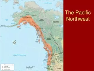
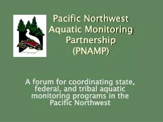
PNAMP is a forum coordinating state, federal, and tribal aquatic monitoring programs in the Pacific Northwest. It aims to develop, coordinate, and inform M&E programs, communicate with decision makers, and establish landscape metrics.

E N D
Pacific NorthwestAquatic Monitoring Partnership(PNAMP) A forum for coordinating state, federal, and tribal aquatic monitoring programs in the Pacific Northwest Jennifer M. Bayer, Coordinator (USGS)
PNAMP Objectives • Provide a technical forum to develop, coordinate and inform monitoring and evaluation (M&E) programs • Provide a forum for communication with decision makers • Be a clearing house for sample design, protocol development, and data management activities • Provide process to establish landscape/ecosystem metrics
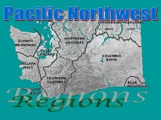
PNAMP Partners Charter signed by 19 state, tribal, federal, and regional entities: WA GSRO
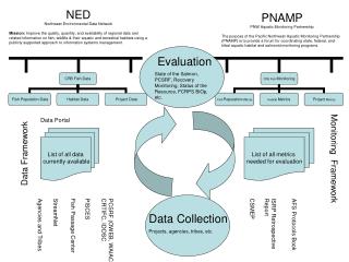
Data management (= NED, PNW RGIC) Fish population monitoring Watershed condition monitoring Other topics as interest merits Project effectiveness monitoring Estuary monitoring
PNAMP Current Tasks • Inventory of monitoring activities underway July 2006 • Integrated Survey Design for status/trend monitoring workshop July 2006 • Data Management coordination (NED, PNW RGIC) workshop May 2006 • High-level Indicatorscoordination draft complete • Facilitate regional Networking • Monitoring Practitioner’s Workshop March 2006 • Invasive Species Forum June 2006 • Remote Sensing Workshop Feb 2007
PNAMP Protocol Tasks • Protocol Tools • Protocol Manager • Protocol format (Oakely et al 2003) • Method manual/ training format
PNAMP Protocol Tasks Protocols under development • Macroinvertebrate collection • Fish population monitoring techniques • Watershed assessment (habitat) techniques • Data management standards
Macroinvertebrate Protocol • Rapid bioassessment type technique for perennial, wadeable streams • Field collection & laboratory processing sections nearly complete • Will include analytical processes before final
Macroinvertebrate Protocol Synthesis of these protocols: • OR Department of Environmental Quality • WA Department of Ecology (Ecology, 2001) • USDA Forest Service AREMP (USFS, 2004) • US EPA EMAP (Peck et al., 2000) • BLM National Aquatic Monitoring Center (Hawkins et al., 2001) New draft for review early January 2007
Fish Population Monitoring Protocols • State of the Salmon’s Salmonid Field Protocol Handbook (AFS publication) • 18 techniques • Varying degree of detail; most not down to “head to the field” details • PNAMP will facilitate further development of these (and other) methods.
Salmonid Field Protocol Handbook • Carcass Counts • Cast Nets • Electrofishing: Backpack and Drift Boat • Hydroacoustics: Rivers • Hydroacoustics: Lakes and Reservoirs • Fish Counting at Hydroelectric Projects • Redd Counts • Traps: Rotary Screw and Inclined Plane Screen • Beach Seining • Snorkel Surveys • Tangle Nets • Tower Counts • Weirs • + 5 SUPPLEMENTAL TECHNIQUES
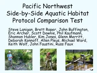
Habitat Assessment Protocols Protocol Comparison Project Objectives • Evaluate protocols to determine which are the “best” at minimizing among crew variation while maximizing differences among streams. • Determine if relationships can be developed among different protocols for the same attribute. • Do these results reflect some true value?
Protocol Comparison Project • 8 monitoring groups evaluated 12 reaches with multiple (generally 3) crews. • One intensive monitoring group (“truth”, 3 to 9 days per site) • LiDAR flights (coarse “truth”)
Protocol Comparison Project • Sinuosity • %Fines • Large Wood • Entrenchment • Median Particle Size • Gradient • Bankfull Width • Width-to-Depth • % Pool • Residual Pool Depth
Protocol Comparison Project Preliminary results are available now, but analysis is not complete January 31 meeting (Portland) to present full results and discuss next steps for final product
Data Management Standards PNAMP approach is to identify our issues & needs then work with regional data management entities to find solutions • NW Environmental Data Network (NED) • Pacific Northwest Regional Geographic Information Council (PNW RGIC)
Data Management Standards From NED: • Best Practices for Reporting Location and Time Related Data (v3.2) • Best Practices for Data Dictionary Definitions and Usage (v1.1) • Check List for Organizing Field Collection and Management of Data
Next Steps: • Facilitate discussion about methods/protocol needs • Increase involvement in technical workgroups • Increase cross-PNAMP workgroup and interaction with outside groups
More Information: www.PNAMP.org Jennifer_Bayer@usgs.gov