Download
1 / 32
360 likes | 662 Views
MIS and Participatory GIS/GPS. Group No. - 05. Mr. Lakhan Lal Mahto, GIS Expert, JSWM - SLNA Mr. Vipul Aakash, MIS Officer, JSWM - SLNA Mr. Pramod Rajak , Data Entry Operator, JSWM – SLNA Tulsi Ram , Data Entry Operator, JSWM – SLNA

E N D
MIS and Participatory GIS/GPS Group No. - 05 Mr. Lakhan Lal Mahto, GIS Expert, JSWM - SLNA Mr. Vipul Aakash, MIS Officer, JSWM - SLNA Mr. PramodRajak, Data Entry Operator, JSWM – SLNA Tulsi Ram, Data Entry Operator, JSWM – SLNA Er. Sanjay Kumar Singh, Project Manager, Jan Jagran Kendra
Agenda • MIS Architecture • MIS Work Flow • MIS Component • MIS Work Flow • Best Practices of MIS • Reporting Format (MPR, QPR, AAP) • Concept of participatory GIS based planning • Issues regarding MIS & GIS • Best Practices for GIS/GPS • Suggestions / Feedback
MIS Work Flow • DoLR stake holder • Sanctions of amount to be released for New Projects / On Going projects • Sanctions of Institutional amount to be released • State Government stake holder • Release of State share against the New projects/ Ongoing projects • SLNA stake holder • Central share to be received by SLNA • Release of Project fund to Districts • Release of Institutional amount to Districts • Expenditure of Institutional amount at SLNA level • Project Expenditure Plan / Achievement of a project at SLNA level • Capacity building Plan / Achievement of a financial year at SLNA level • Monitoring and Evaluation Plan / Achievement of a financial year at SLNA level • State Profile details of State by SLNA
MIS Work Flow • WCDC stake holder • Release of project amount to PIA/GP and Watershed Committee • Expenditure of Institutional amount at WCDC level • Project Expenditure Plan / Achievement of a project at WCDC level • Capacity building Plan / Achievement of a financial year at WCDC level • PIA stake holder • Release of Project amount to GP/Watershed Committee • Project Expenditure Plan / Achievement of a project at PIA level • Capacity building Plan / Achievement of a financial year of every project at PIA level • Financial Action Plan / Achievement of a project related to Watershed Works • Physical Action Plan / Achievement of a project related to Watershed Works • Project Outcome of a project • Convergence Details of a project • Watershed Development Fund of a project • Baseline Survey details of a project i.e. pre project status
Best Practices for MIS • Frequently Asked Questions • Develop Module Wise Activity • Logging into the Control Panel • How to change Password • Updating User information • Capacity Building Plan And Achievement • Add / View Baseline Survey • Financial Target Plan & Achievement • Develop Support Team for MIS Tools Used – Camtasia Studio
Format of MPR/QPR/AAP Monthly Progress Report Quarterly Progress Report Annual Action Plan
APPLICATION OF GIS, GPS AND REMOTE SENSING IN DETAILED PLANNING/PROJECT REPORT UNDER IWMP PROGRAMME
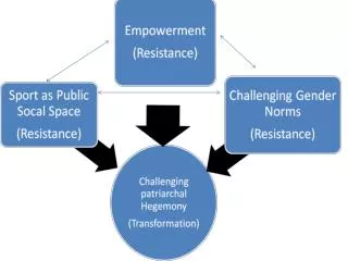
WHY ? WHERE ? WHEN ? GIS WHAT - IF ? HOW ?
Information Systems Help us to manage what we know Make it easy to organize and store, access and retrieve, manipulate and synthesize, and apply solution of problems Examples of Information Systems
Geographic Information Technologies Technologies for collecting and dealing with Geographic Information with the help of….. Global Positioning System (GPS) Remote Sensing Geographic Information System (GIS)
CARTOGRAPHY (Cartography is the study and practice of making maps ) GIS MAP
TOPOLOGICAL RELATIONSHIP CARTOGRAPHIC DESIGN GIS DATABASE ACCURATE LINK BETWEEN ATTRIBUTES AND GEOGRAPHIC ELEMENTS
WHAT IS MAP A PHOTOGRAPHS SHOWS ALL OBJECTS IN ITS VIEW IN A MAP, A CARTOGRAPHER SELECTS THE INFORMATION WHICH IS ESSENTIAL TO FULFIL THE PURPOSE OF THE MAP AND SUITABLE TO THE REQUIRED SCALE REPRESENTED WITH APPROPRIATE SYMBOLS.
BASIC CHARECTERISTICS OF MAPS • ALL MAPS HAVE TWO BASIC ELEMENTS: • LOCATIONS AND ATTIBUTES AT LOCATIONS • ALL MAPS INVOLVE TRANSFORMATION AND PROJECTION OF VARIOUS KINDS • ALL MAPS EMPLOY SIGNS TO DESIGNATE THE ELEMENTS OF REALITY
CLASSIFICATION OF MAPS • BASED ON PURPOSE: • GENERAL PURPOSE • TOPOGRAPHIC MAPS • GEOGRAPHIC MAPS • CADASTRAL MAPS • SPECIAL PURPOSE • THEMATIC MAPS • ENGG. PLAN • TOWN PLAN • HYDROGRAPHIC CHARTS • MAPS FOR BLIND
TYPE OF MAPS USED FOR IWMP • TOPOSHEET MAP: ( Source: Survey of India at 1:50,000 scale) – Use for basic ideas of the project area. • THEMATIC MAPS: 1. LULC Map, 2. FOREST Map, 3. DRAINAGE Map, 4. CONTOUR Map, 5. SLOPE Map, 6. GROUND WATER PROSPECTS Map etc.- Present situation of the Project area. • CADASTRAL MAPS: (Source: Survey and Settlement office)- Use for Planning and Plot wise proposed Action Plan map
What is GIS? • Data Management - • Manages various kinds of GIS data including vector, raster, images, tables, other data files • Data models and architectures • Conversion between formats • Import/export utilities • Interacts with RDBMS (SQL Server, Oracle, etc…)
Analysis • Spatially aware data • Attribute and spatial query • Proximity and Overlay • Advanced geo-processing techniques • Decision support • Flexible, customization • Programming, scripting (to perform analysis)
Visualization • Maps! Maps! Maps! a picture is worth a 1000 words… • Professional cartographic tool • Charts, graphs, tables, etc… • Various coordinate systems • 2D and 3D • Web, desktop, handheld, etc…
Data Types Non-spatial data—Data not tied to a location on the earth’s surface Spatial data—Data associated with a location on earth Much of the information we deal with daily has some spatial component.
Issues Regarding MIS and GIS/GPS • At the time of Data uploading in MIS, PIA facing errors and at that time there is lack of support. • JSACS is not performing the digitalization of the map on time & people are not getting benefit of this. • GIS (Digitalization of Cadastral sheet, Slope, LULC, Forest Area, Contour, Drainage, etc. ) is mandatory to incorporate in the DPR but actually its not happened in all the project.
Best Practices of GIS/GPS and Cadastral Map Present Land Use Map
Best Practices of GIS/GPS and Cadastral Map Proposed Treatment Map
Best Practices of GIS/GPS and Cadastral Map • Steps to do for develop Proposed Treatment Map • Collect all cadastral Map of the Micro Watershed • Xerox it • Conduct PRA activity at Village Level • Scan and Merge all the Blank Cadastral Sheet through Photoshop Software • Analyze PRA Map and mark it on the Final Map