Download
1 / 27
280 likes | 653 Views
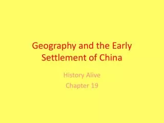
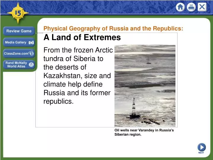
Physical Geography of Russia and the Republics: A Land of Extremes. From the frozen Arctic tundra of Siberia to the deserts of Kazakhstan, size and climate help define Russia and its former republics. Oil wells near Varandey in Russia’s Siberian region. NEXT.

E N D
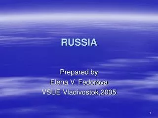
Physical Geography of Russia and the Republics: A Land of Extremes From the frozen Arctic tundra of Siberia to the deserts of Kazakhstan, size and climate help define Russia and its former republics. Oil wells near Varandey in Russia’s Siberian region. NEXT
Physical Geography of Russia and the Republics: A Land of Extremes Landforms and Resources SECTION 1 SECTION 2 Climate and Vegetation Human-Environment Interaction SECTION 3 Unit Atlas: Physical Unit Atlas: Political NEXT
Section 1 Landforms and Resources • Flat plains stretch across the western and central areas of the region. In the south and east, the terrain is more mountainous. • Many resources in Russia and the Republics are in hard-to-reach regions with brutal climates. NEXT
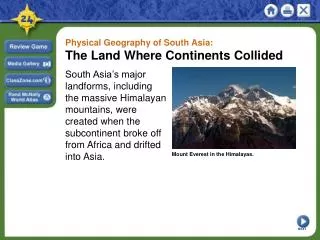
SECTION Landforms and Resources 1 Northern Landforms A Tremendous Expanse of Territory • Russia and the Republics cover 1/6 of earth’s land surface - 8 1/2 million square miles - three times the land area of U.S. - region crosses 11 time zones • Northern 2/3 of region divided into four areas Continued . . . NEXT
SECTION 1 continuedNorthern Landforms Northern European Plain • Northern European Plain an extensive lowland area • Stretches over 1,000 miles from the western border to the Urals • chernozem—world’s most fertile soil, abundant in area • 75% of region’s 290 million people live on the Plain - cities: Moscow, St. Petersburg, Kiev Image Continued . . . NEXT
SECTION 1 continuedNorthern Landforms West Siberian Plain • Ural Mountains—separate Northern European, West Siberian Plains - some see them as dividing line between Europe and Asia - some consider Europe and Asia as single continent—Eurasia • Plain lies between Urals and Yenisey River (west to east) - between Arctic Ocean and Atay Mountains (north to south) • Plain tilts northward, so rivers flow to Arctic Ocean Continued . . . NEXT
SECTION 1 continuedNorthern Landforms Central Siberian Plateau and Russian Far East • Uplands and mountains are dominant landforms • Central Siberian Plateau between Yenisey, Lena rivers - high plateaus that average 1,000 to 2,000 feet • East of Lena River is Russian Far East and system of volcanic ranges - Kamchatka Peninsula has 120 volcanoes, 20 still active • Sakhalin, Kuril islands at south of peninsula - taken from Japan by USSR after WWII; still claimed by Japan NEXT
SECTION 1 Southern Landforms The Caucasus and Other Mountains • Caucasus Mountains lie between Black and Caspian seas - border between Russia, Transcaucasia— Armenia, Azerbaijan, Georgia • Central Asia region includes “stan” republics - Kazakhstan, Kyrgyzstan, Tajikistan, Turkmenistan, Uzbekistan • Southern border a massive wall of mountains, including the Tian Shan Image Map Continued . . . NEXT
SECTION 1 continuedSouthern Landforms The Turan Plain • Between Caspian Sea and the mountains, uplands of Central Asia • Very dry, despite Syr Darya and Amu Darya rivers • Two large deserts, Kara Kum and Kyzyl Kum NEXT
SECTION 1 Rivers and Lakes Drainage Basins and Rivers •Main drainage basins (areas drained by major river, tributaries) - Arctic and Pacific oceans; Caspian, Baltic, Black, and Aral seas • Arctic basin is largest - Ob, Yenisey, and Lena rivers drain over 3 million square miles • Volga River, longest in Europe, drains Caspian Sea basin - flows 2,300 miles south from Moscow - carries 60% of Russia’s river traffic Image Continued . . . NEXT
SECTION 1 continuedRivers and Lakes Lakes • Caspian Sea is 750-mile-long (north to south) saltwater lake - largest inland sea in world • Aral Sea, east of Caspian, is also saltwater - has lost 80% of water volume since 1960 due to irrigation Lake Baikal • Deepest in world: a mile from surface to bottom at deepest point - 400 miles long, holds 20% of world’s fresh water - very clean lake, home to 1,200 unique plant, animal species NEXT
SECTION 1 Regional Resources Abundant Resources •Huge reserves of coal, iron ore, other metals • Region also a leading producer of oil and natural gas - petroleum deposits around Caspian Sea among world’s largest • Forests have 1/5 of world’s timber • Large producer of hydroelectric power due to rivers Continued . . . NEXT
SECTION 1 continuedRegional Resources Resource Management • Hard to get at, move resources due to climates, terrain, distances - many resources are in Siberia—frigid, arctic, Russian area of Asia • Mining, oil and gas production cause grave environmental damage • Hydroelectric plants damage animal and plant habitats through: - damming - discharge of unusually hot water (thermal pollution) • Leaders must balance economic needs, environmental responsibilities NEXT
Section 2 Climate and Vegetation • Much of Russia and the Republics lie in subarctic and tundra climate zones. • In the region’s southern areas, semiarid and desert climates feature warmer winters and hot summers. NEXT
SECTION Climate and Vegetation 2 A Climate of Extremes Major Climate Regions • Humid continental and subarctic climates dominate region • Continentality—effect the region’s enormous size has on its climates • Distance from sea decreases precipitation - moisture from Atlantic Ocean is lost further inland • Distance from sea also creates extreme temperatures - average Siberian temperatures are usually below 50 degrees F - Siberian temperatures can drop below –90 degrees F Map Continued . . . NEXT
SECTION 2 continuedA Climate of Extremes Major Climate Regions • Cold weather has impact on daily life - Siberians use frozen lakes and rivers as roads for part of year • Region has layer of permafrost that can reach depths of 1,500 feet • Warmer, semiarid and desert climates in Central Asia - southeast mountain wall blocks moist Indian, Pacific ocean air • Moist Mediterranean air creates subtropical climate in Transcaucasia - region’s health resorts were once tourist destinations Image NEXT
SECTION 2 Vegetation Regions Four Major Regions • The 4 major vegetation regions run east to west in wide strips Map Tundra • Mostly in Arctic climate zone; only specific vegetation can survive - mosses, lichen, small herbs, low shrubs Forest • South of tundra: - taiga—largest forest on earth, mostly coniferous - sable, fox, ermine, elk, bear, wolves - deciduous trees dominate lower latitudes Image Continued . . . NEXT
SECTION 2 continuedVegetation Regions Steppe • Temperate grassland from southern Ukraine to Altay Mountains - highly fertile chernozem soil - region is major source of grain for Russia and the Republics Desert • Wide plains in west and central areas of Central Asia • Two main deserts together cover 230,000 square miles - Kara Kum (Turkmenistan) - Kyzyl Kum (Uzbekistan) Image NEXT
Section 3 Human-Environment Interaction • The region’s harsh climate has been both an obstacle and an advantage to its inhabitants. • Attempts to overcome the region’s geographic limits have sometimes had negative consequences. NEXT
SECTION Human-Environment Interaction 3 The Shrinking Aral Sea A Disappearing Lake • Aral Sea gets water from Amu Darya and Syr Darya rivers • In ’50s, rivers are drawn on to irrigate Central Asian cotton fields - flow from rivers becomes a trickle, sea begins to evaporate Continued . . . NEXT
SECTION 3 continuedThe Shrinking Aral Sea The Effects of Agriculture • Pesticides and fertilizers for cotton are picked up by runoff - runoff—rainfall not absorbed by soil, runs into streams and rivers - chemicals carried into Aral kill all 24 native species of fish • Retreating sea waters expose fertilizers, pesticides, salt - windstorms blow them onto nearby populations • Substances increase diseases: throat cancer, typhoid, hepatitis • Central Asia child mortality rates are among highest in world Continued . . . NEXT
SECTION 3 continuedThe Shrinking Aral Sea Saving the Aral • To maintain present lake level, 9 of 18 million farm acres have to go - would cause great hardship for farmers - many argue only such drastic measures can save the Aral NEXT
SECTION 3 The Russian Winter Coping in Siberia • 32 million Siberians live with the earth’s most variable temperatures - city of Verkhoyansk can be -90 degrees F in winter, 94 degrees F in summer - most of the time it is cold • Warm weather melts ice, forms pools, swamps - become breeding grounds for mosquitoes, black flies • Buildings on permafrost sink and fall when their heat thaws ground - buildings must be set off ground on concrete pillars Continued . . . NEXT
SECTION 3 continuedThe Russian Winter War and “General Winter” • Harsh climate has helped Russia fight off invaders • In early 1800s, French leader Napoleon Bonaparte conquers Europe • Bonaparte invades Russia from Poland in 1812 - arrives in Moscow in September, as winter begins - Muscovites burn the city leaving no shelter - Napoleon retreats; cold helps doom 90% of his 100,000 men NEXT
SECTION 3 Crossing the “Wild East” The Trans-Siberian Railroad • In late 1800s, Siberia is like U.S. “Wild West” - travel is dangerous, slow •Emperor orders 5,700-mileTrans-Siberian Railroadbuilt - links Moscow to Pacific port of Vladivostok Interactive Continued . . . NEXT
SECTION 3 continuedCrossing the “Wild East” An Enormous Project • From 1891 to 1903, 70,000 workers move 77 million cubic feet of earth - clear 100,000 acres of forest; bridge several major rivers Resource Wealth in Siberia • Railroad helps populate area so resources can yield profit - in first 10 years, 5 million people use railway to settle Siberia - begin mining coal, iron ore NEXT
This is the end of the chapter presentation of lecture notes. Click the HOME or EXIT button. NEXT