Download
1 / 58
580 likes | 690 Views
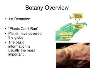
Learn about the implementation of FFMP using AMBER, customization options, basin attributes, and AMBERGIS functionality. Understand the purpose of the Basin Customization Course and display choices at WFO. Explore the ABR computation and monitoring process.

E N D
AMBER/FFMPOverview COMET Basin Customization 02-03 06 August 2002 Robert S. Davis, Pittsburgh NWSWFO
AWIPS Flash Flood Monitoring and Prediction (FFMP) • AWIPS build 5.1.2 (Early 2002) the AMBER implementation of FFMP using DHR. • Requires NSSL CD of ArcView defined watersheds and WSR-88D bin assignments. • Provides graphic display of ABR and ABR–FFG for time periods of 30,60,90,120,180,360 minutes. • Provides line graph of ABR,ABR Rate, and FFG for the same time periods. • 1 level of streams supported • FFMP small subset of AMBERGIS functionality.
FFMP Graphics • County display of CWA-maximum ABR for any stream in county displayed. Left click on Fips code to get “stream display”. • Stream display for a county- ABR for time period selected displayed for each basin. Left click on stream ID to get “line graph”. • Line graph of ABR + ABR Rate + FFG
Worthville, PA Flash Flood 05 June 2002 Jefferson County, PA
FFMP Text Data on AWIPS /data/fxa/radar/k@@@/ffmp Where @@@ is your WSR-88D ID
FFMP file archiving • ABR file is archived to hard disk on AWIPS for current GMT day and previous day only. • /data/fxa/radar/k@@@/ffmp/yyyymmdd + yyyymmdd.index for a GMT day • Index file holds the time for each volume scan. • Date file holds the ABR data for each stream (integer*2 data with a record length equal to 2 times the number of FFMP watersheds).
FFMP Basin Attributes • /data/fxa/radar/k@@@/ffmp/basinList.dat • /basinToCounty.dat • /binToBasin.dat • Radar bins are numbered consecutively from 0 to 82799 starting with radial 0.5 degrees. Bin 0 = 0.5 degrees at 0.5 km, bin 230 = 1.5 degrees at 0.5km, etc.
basinList.dat • First line in file is number of basins (5609) • Basin ID number in FFMP display is position in this file basin id =0 (2nd line), 1 (3rd line), 2 (4th line), 3 (5th line), etc. • Pfafstetter ID • Latitude/longitude of basin centroid • Name of creek
binToBasin.dat • First line is number of basins • Second line is data for watershed id=0 • 1st element (number of bins assigned) • Bin number for each assigned bin follows, if 3 bins assigned to this stream, 3 bin numbers will be listed. • Last element: area of bin summation (km2)
basinToCounty.dat • Number of counties on first line • Two letter state • County name • County Fips code • Number of streams assigned to this county • List of Basin Ids assigned to this county • County assigned by MDL lat/lon of centroid
National Basin Delineation • 30Sep1999 – NWS agrees to fund the AMBER National Basin Delineation project by NSSL for all of the continental United States. • ArcInfo used to define the watershed boundaries. • USGS 1 arc second (30 m) DEM data supplied by EROS Data Center. • www.nssl.noaa.gov/teams/western/basins • Continental U.S. completed June 2002.
NSSL Basins 18,488 Aggregated 12,784 229.5 km Range ring Aggregate: Clip all basins beyond 230 km Eliminate all segments < 2 mi2
FFMP Basins 5,608 NSSL CD FFMP
Purpose of the Basin Customization Course • To describe the content of the NSSL dataset (ArcView shapefiles and data attributes). • To provide tools that allow the local forecast office to modify, correct, or enhance the NSSL set of defined basins. • To demonstrate why modifications or additions may enhance the application of FFMP to the flash flood warning process.
Choices: Customization Options • No Customization (used delivered cd) • Minor Customization (add stream names, make minor adjustments to basins to correct errors) Must still run localization. • Major Customization (add new streams, divided existing streams) • Paul’s procedure for hydrologic connectivity, allows use of Paul’s tools.
Choices: Display options at WFO • Display FFMP graphics as delivered • Run Paul Jendrowski’s AMBER for more stream layers, 7 AWIPS radar graphic products including ABR rate + 6 user selected time periods, AMBER browser, and line graph of past 6 hours. • Use ArcView as display for geographic information.
Areal Mean Basin Estimated Rainfall ( AMBER) 1990-2002 • All watersheds in county warning area are defined to a Minimum Basin Area (MBA) of 2 mi2 to show spatial rainfall distribution. • The WSR-88D polar grid (1o by 1 km) is mapped to the defined watersheds. • Average Basin Rainfall (ABR) is computed for each watershed every volume scan. • An hourly ABR rate is determined from the single volume scan (5-6 min.) of ABR.
AMBERGIS (2000 – 2002) • Paul Jendrowski creation using ArcView. • ABR data computed and archived (5 min). • AWIPS ABR Rate display of radar umbrella. • AWIPS ABR graphic display of radar umbrella for 6 user selected time periods. • Line graph of ABR, ABR Rate, and FFG for each defined stream and rain gage. • Nine layers of streams or rain gages supported. • Alert for 3 user selected levels of ABR - FFG.
Graphical Radar Rainfall OHP – One hour rainfall STP – Storm total rainfall THP – Three hour rainfall
AMBER/FFMP Digital Rainfall AMBER/FFMP computes 5 minute rainfall using WSR-88D precipitation algorithm with Digital Hybrid Scan Reflectivity (DHR) product as input.
Digital Hybrid Scan Reflectivity (DHR) • Time interval (5-6 minutes) • Grid size (1 degree x 1 km) • Reflectivity to the nearest 0.5 dBZ
DHR Digital Rainfall Estimate 2130 – 2135 UTC Rainfall (in) .16 .30 .38 .29 .14 .24 .39 .41 .37 .20 Grid size 1o x 1km
DHR Digital Rainfall Estimate 2130 – 2135 UTC Rainfall (mm) .16 .30 .38 .29 .14 .24 .39 .41 .37 .20 Watershed Boundary…compute ABR
Average Basin Rainfall = 0.29 2130 – 2135 UTC ABR (in) .29 .29 .29 .29 .29 .29 .29 .29 .29 .29 Copy ABR back into DHR grid for FFMP or AMBERGIS graphics
Average Basin Rainfall = 0.29 2130 – 2135 UTC ABR (in) .16 .30 .38 .29 .14 .24 .39 .41 .37 .20 Divide watershed into segments??
Average Basin Rainfall = .29 in 2130 – 2135 UTC ABR (in) .20 .37 .37 .25 .25 .20 .37 .37 .25 .25 Large variation of ABR in short distances!!
Flash Flood Index (FF)FF = ABR - FFG Determining the Flash Flood Threat
Flash Flood Guidance (FFG) • ABR in a specific time period (1, 3 hours) to initiate flooding on streams. • Assumes stream at low flow level. • Assumes no rainfall since data cutoff • FFG is the amount of ABR needed to produce threshold runoff (climatic average runoff needed to start flooding of streams)
Flash Flood Guidance (FFG) • FFG = TR + SM, where TR is the threshold runoff and SM is the amount of ABR needed to initiate runoff based on soil moisture content. • Threshold runoff is constant for all watersheds 1.00” in three hours for most of eastern U.S (0.75” for western PA + WV). Ask your servicing RFC for your TR!!!
FF Index = ABR - FFGABR and FFG in inches • FF0 ABR = FFG • FF1 ABR = FFG + 1.00 inches • FF2 ABR = FFG + 2.00 inches • FF3 ABR = FFG + 3.00 inches • FF4 ABR = FFG + 4.00 inches • FF5 ABR = FFG + 5.00 inches, etc
Noble County, OH Almost a flash flood.ABR-FFG = 0.40 12 June 2002 2235-2327 UTC 1-Hour FFG = 1.70
Pine Creek Flash Flood Bucket Survey (inches) 30 May 1986 Pine Creek Watershed 68 mi2 1005 1004 1006 1007 1003 ID Name Area 1000 L Pine Cr 8.3 1001 L Pine Cr 6.2 1002 Gourdhead Run 4.1 1003 Crouse Run 3.7 1004 Willow Run 4.3 1005 Montour Run 5.5 1006 NF Pine Cr 10.1 1007 Headwaters 13.9 1002 8 6 4 2 1000 1001 Allegheny River
Little Pine Creek 30 May 1986 Area: 6.2 mi2 Time (UTC)
The Narrows Hiking Trail North Fork Virgin River Deep Creek Start of Trail Kolob Creek 3.30 1:30 Estimated hiking Time in hours. Goose Creek 1:25 Corral Hollow 0.45 “The Narrows” No safe high ground 2.45 Orderville Canyon 1:45 End of Trail Zion National Park, Utah Adapted from National Geographic Trails Illustrated
Iron County North Fork of the Virgin River Deep Creek Kolob Creek Orderville Canyon Washington County EPA RF3 Data Kane County The Narrows
NF Virgin River above the Narrows 285 mi2 KICX WSR-88D ABR (in) 2000-2200 UTC 27 July 1998 0.40 Deep Creek 128.9 mi2 0.25 NF Virgin River 70.3 mi2 Kolob Creek 30.1 mi2 0 0.97 Goose Cr 4.7 mi2 0 1-hour FFG 0.50 Corral Hollow 2.2 mi2 0 0 Orderville Canyon 41.5 mi2 0 Imlay Canyon 3.8 mi2 0.33 0 10km The Narrows 4.1 mi2
NF Virgin River above the Narrows 285 mi2 Deep Creek 128.9 mi2 KICX WSR-88D 1013 NF Virgin River 70.3 mi2 1014 1010 0.17 0.65 0 1016 0.42 Kolob Creek 30.1 mi2 1007 1015 1021 1012 1009 0.39 0.32 1020 0.41 0.01 1005 0.89 1011 1006 0.90 1008 1019 0.01 1018 1.14 1004 1-hour FFG 0.50 1017 1.76 1026 0.25 1.05 1003 1025 1000 Orderville Canyon 41.5 mi2 1002 1022 1024 0.20 ABR (in) 2000-2200 UTC 27 July 1998 0.02 0 1001 1023 0 0 10km
Deep Creek 1014 1013 North Fork of the Virgin River above the Narrows 17.0 17.9 1012 1015 1016 16.9 14.3 19.5 North Fork of the Virgin River 1011 Kolob Creek 1021 1007 12.9 22.1 15.8 1010 1020 1006 1005 19.9 1026 Orderville Canyon 1009 1019 10.1 10.1 13.5 18.0 1025 1018 xx.x = miles above trail head 5.6 1008 1004 10.0 11.2 6.5 1024 1017 5.9 6.5 1023 Goose Creek 4.4 1003 5.2 1000 3.8 1022 Corral Hollow 1002 1.7 2.0 Imlay Canyon 1001 The Narrows
Maximum Bin 176o at 20 km27July1998 Maximum rainfall on Storm Total Product 3.14 in.
North Fork of the Virgin River above the Narrows 70.3 mi2 0.97 1021 13.9 mi2 1020 15.1 mi2 0.32 0.89 ABR (in) 27 July 1998 2011-2133 UTC 1019 13.6 mi2 3.14 1.14 1018 18.4 mi2 1017 9.3 mi2 1.76 0.25 1000 “The Narrows” 1017-1021 NF Virgin River (1-5) Washington County 1000 0 Kane County
NF Virgin River Subdivisions 5000-5002 Straight Canyon(1-3) 5003-5005 NF Virgin River(2-4) 5006 Willow Canyon 5007 Hay Canyon 5008 Simon Gulch 5009 NF Virgin River(1) 5010 Rosy Canyon 5011 Stevens Canyon 5012 Ashdown Canyon 1021 5012 0.22 1020 5002 5011 0.32 0.56 5010 5000 0.49 0.71 5001 1.24 5007 0.91 3.14 5005 5006 1019 1.81 5009 5004 1.92 Washington County, UT 5008 5003 0.54 1.88 ABR 27 July 1998 2017-2133 UTC 0.09 1.44 1018 1000 1017 Kane County, UT