Download
1 / 55
550 likes | 676 Views
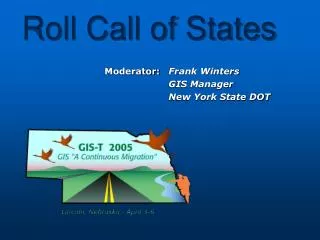
Roll Call of States. Moderator: Frank Winters GIS Manager New York State DOT. Nebraska GIS CONTACT – DICK GENRICH dgenrich@dor.state.ne.us. Recent project(s)/application(s): Local Network Graphics Creation Segments/Intersections Identifier Table

E N D
Roll Call of States Moderator: Frank Winters GIS Manager New York State DOT
NebraskaGIS CONTACT – DICK GENRICHdgenrich@dor.state.ne.us • Recent project(s)/application(s): • Local Network Graphics Creation • Segments/Intersections Identifier Table • Statewide Centerline/Address Database Creation • Adapting NECTAR Web Portal for Local Use • Interested in the following issue(s): • Routing Applications • GIS-ITS Integration • Mobile GIS • HPMS FOLLOWED BYNevadaTHENNew Hampshire
NevadaGIS CONTACT – ERIC WARMATHewarmath@dot.state.nv.us • Recent project(s)/application(s): • Creation of Non-Road Transportation Datasets • Work on Right-of-Way Project • Work on survey Monument Web Application • Completion of Traffic Count Web Application • Interested in the following issue(s): • Web Standards for GIS Apps • Improving Interagency Coordination • Software/Vendor Support Issues • Image Management Methodologies FOLLOWED BYNew HampshireTHENNew Jersey
New HampshireGIS CONTACT – DENNIS FOWLERdfowler@dot.state.nh.us • Recent project(s)/application(s): • Development of GIS Strategic Plan for NHDOT • Implementation of ESRI Maplex • Release of RFP to Obtain Color Digital Orthophotos • Interested in the following issue(s): • Asset Management • HPMS • Web Based Enterprise GIS • Crash Location and Analysis FOLLOWED BYNew JerseyTHENNew Mexico
New JerseyGIS CONTACT – GARY ZAYAS gary.zayas@dot.state.nj.us • Recent project(s)/application(s): • Pavement Condition/Winter Road Conditions & Snow Removal Ops. • Update Local Road Network Utilizing 2002 Orthophotography • Conversion of State Map & Visitor Guide to ESRI ArcMap • Geotechnical Data Management/GIS System • Interested in the following issue(s): • ArcGIS Server Applications • 2. Cartographic/Graphic Layout Enhancements • 3. Data Integration • 4. Automated Vehicle Location Applications FOLLOWED BYNew MexicoTHENNew York
New MexicoGIS CONTACT – GLENN CONDONglenn.condon@nmshtd.state.nm.us • Recent project(s)/application(s): • Handheld GPS/GIS Application for Traffic Counters Collection • Geo-Route Location Application for Crash Records Management • Base Road Network Update with New GPS Positions Collected with a Roadway Feature Inventory • Development of an Enterprise Image/Orthophotography Service Through TerraShare • Interested in the following issue(s): • Solutions to Serving up Large Catalogs of Imagery & Orthophotography • Dynamic Segmentation Applications on a PDA FOLLOWED BYNew YorkTHENNorth Carolina
New YorkGIS CONTACT – FRANK WINTERSfwinters@dot.state.ny.us Recent project(s)/application(s): 1. OS/OW vehicle screening 2. New state-wide road network 3. Survey control viewer • Interested in the following issue(s): • Field data synced with corporate database • 2. Storm water mapping • 3. Truck permit routing FOLLOWED BYNorth CarolinaTHENNorth Dakota
North CarolinaGIS CONTACT – FORREST ROBSON, P.E.frobson@dot.state.nc.us Recent project(s)/application(s): 1. 2. 3. 4. • Interested in the following issue(s): • 2. • 3. • 4. FOLLOWED BYNorth DakotaTHENOhio
North DakotaGIS CONTACT – DARCY ROSENDAHLdrosenda@state.nd.us Recent project(s)/application(s): 1. 2. 3. 4. • Interested in the following issue(s): • 2. • 3. • 4. FOLLOWED BYOhioTHENOklahoma
OhioGIS CONTACT – DAVID L. BLACKSTONEdave.blackstone@dot.state.oh.us • Recent project(s)/application(s): • MGS to GeoMedia Migration • Location Based Referencing System • Roadway Inventory Modernization • Safety Applications/System • Interested in the following issue(s): • Multi GIS Vendor Implementations • Multi-LRM LRS Models • OGC Standards • GPS Usage for Roadway Data Collection FOLLOWED BYOklahomaTHENOregon
OklahomaGIS CONTACT – JAY ADAMSjadams@odot.org • Recent project(s)/application(s): • GRIP-Enhancement for Version 3 • GEMS Project-Geographic Environmental Management System • AMPS Project-Automated Map Production system for Truck Routing and Enforcement • Integrated Video Log for GIS Web Applications • Interested in the following issue(s): • Environmental GIS Activities • Routing Applications and Activities • Asset Management Systems FOLLOWED BY OregonTHEN Pennsylvania
OregonGIS CONTACT – DENNIS J. SCOFIELDdennis.j.scofield@odot.state.or.us Recent project(s)/application(s): 1. Statewide GIS database of public roads 2. Intranet site of management system data 3. Geospatial 1stop demo proj w/ OGC-USDOT 4. Intranet geospatial data maintenance apps 5. Migrate to MicroStation v.8 and GIS layers • Interested in the following issue(s): • Import and Export of data in a distributed data maintenance model (clearinghouse) • 2. Custom GIS map production with web tools FOLLOWED BYPennsylvaniaTHENRhode Island
PennsylvaniaGIS CONTACT – FRANK DeSENDIfdesendi@state.pa.us • Recent project(s)/application(s): • Crash Data Warehouse • Homeland Security Infrastructure program • Detours and ITS • Ortho-Imagery Management • Interested in the following issue(s): • Project Management Techniques • Cartography Integration FOLLOWED BYRhode IslandTHENSouth Carolina
Rhode IslandGIS CONTACT – STEPHEN KUTskut@dot.state.ri.us • Recent project(s)/application(s): • Winter Operations Web Application • Road Name Standardization with E911 • 1:5000 Color Orthophotos • Stormwater Inventory • Interested in the following issue(s): • LRS • CAD and GIS Integration • Asset Management Applications FOLLOWED BY South CarolinaTHEN Canadian Provinces
South CarolinaGIS CONTACT – DONALD McELVEENmcelveende@dot.state.sc.us Recent project(s)/application(s): 1. Statewide Mapping Project 2. RIMS (Roadway Info Management System) 3. ITMS (Integrated Transportation Management System) • Interested in the following issue(s): • Statewide GIS Mapping Projects • 2. Internet/Intranet Transportation Apps FOLLOWED BY Canadian ProvincesTHEN Others
South DakotaGIS CONTACT – TERRY ERICKSONterry.erickson@state.sd.us • Recent project(s)/application(s): • Roadway Conditions Reporting System • Maintenance Decision Support System • Concept to Contract (C2C) STIP Module • Statewide DOT GIS Training Effort • Interested in the following issue(s): • The Role of GIS in ROW Decisions • Creation of a Statewide Parcels Layer Supporting ROW • Sharing Secure/Safe Archaeological Data • How to Acquire Utilities Data (Private Sector) FOLLOWED BYTennesseeTHENTexas
TennesseeGIS CONTACT – Kim H. McDonough Kim.McDonough@state.tn.us • Recent project(s)/application(s): • Rollout of TRIMS Web into Production • Incorporation of Statewide Ortho-Imagery into TerraShare • Initiation of a statewide CORS network • Initiation of Development of an Environmental GIS • management and Statewide Data Collection System • 5. Initiation of Environmental Justice Planning Tool • Interested in the following issue(s): • Mass Orthorectification • Metadata Solutions • GIS Metrics and Measurement Systems • ArcGIS Server Implementation Experiences • Consistency between divisions working with common data but introducing inconsistency using different methodologies • GIS Analysis for Environmental Planning FOLLOWED BYTexasTHENUtah
TexasGIS CONTACT – JIM PATTERSONjpatters@dot.state.tx.us • Recent project(s)/application(s): • Data-Centric Architecture Implementation • Roadbed Basemap w/Temporality • Enterprise GeoDatabases • Highway Condition Reporting System • Interested in the following issue(s): • Data Integration (new & legacy) • 2. Data/Application Distribution • 3. Data Security • 4. Raster Storage/Distribution FOLLOWED BYUtahTHENVermont
UtahGIS CONTACT – CHRIS GLAZIERcglazier@utah.gov Recent project(s)/application(s): 1. Asset Management 2. Linear Reference On-line 3. Excavation Permits On-line 4. RTK GPS network • Interested in the following issue(s): • Oracle SDE Raster Storage • 2. Referencing MicroStation CADD files • 3. RTK GPS network implementation FOLLOWED BYVermontTHENVirginia
VermontGIS CONTACT – SHAWN NAILORshawn.nailor@state.vt.us • Recent project(s)/application(s): • Route Logs (IRA) • Intranet Web Mapping Portal • NHS Analysis for Project Prioritization • Interested in the following issue(s): • GIS for Asset Management • 2. Managing Legacy Data to Reflect Route System Changes • 3. Core Data Integration FOLLOWED BYVirginiaTHENWashington
VirginiaGIS CONTACT – DAN WIDNERdan.widner@virginiadot.org • Recent project(s)/application(s): • Roadway Network Systems (RNS) • Comprehensive Entironmental Data and Reporting System (CEDAR) • Asset Management System (AMS) • Online Transportation Information Map • Interested in the following issue(s): • Implementing a Transportation Data Model • Enterprise GIS Across all State Government • Integration of ITS Geospatial Applications FOLLOWED BYWashingtonTHENWest Virginia
WashingtonGIS CONTACT – George Spencer • Recent project(s)/application(s): • GIS Workbench Enhancements • LRS Updates / Maintenance • Transportation Framework Progress • ArcGIS 9.0 Migration / Training Issues • Interested in the following issue(s): • GIS / Cartographic/Web Standards • Right of Way / GIS Connection • CAD / GIS Connection • LRS Maintenance / Conversion • Classification of GIS Personnel • ArcGIS Server FOLLOWED BYWest VirginiaTHENWisconsin
West VirginiaGIS CONTACT – DAVID L. MANERdmaner@dot.state.wv.us • Recent project(s)/application(s): • Appalachian Regional Commission Cost • Model Interested in the following issue(s): FOLLOWED BYWisconsinTHENWyoming
WisconsinGIS CONTACT – CURTIS PULFORDcurtis.pulford@dot.state.wi.us • Recent project(s)/application(s): • Rail Crossings Database – Phase III • Aerial Imagery Web Discovery Client • Compass GIS – Quality Assurance and Asset Management • ArcObjects Location Control Management Design • Interested in the following issue(s): • Local Roads and STN Data Model Integration • Photolog/GPS Integration • Web GIS Travel Center – info., cond., incident, routing • Enterprise GIS –architectures standards and data sharing FOLLOWED BYWyomingTHENAlabama
WyomingGIS CONTACT – BEN SAUNDERSben.saunders@dot.state.wy.us Recent project(s)/application(s): 1. Construction Reporting System 2. Enterprise GIS Data Viewer 3. County Road Integration 4. Agency Financial System Integration • Interested in the following issue(s): • Data Modeling • Asset Management • LRS and GPS Integration • Distributed Data Replication FOLLOWED BYAlabamaTHENAlaska
AlabamaGIS CONTACT – DANNY MANLEYmanleyd@dot.state.al.us Recent project(s)/application(s): 1. Oracle Spatial GeoDatabase 2. Web Portal (AADT) 3. Executive Planning System 4. Updating/Expanding Basemap Interested in the following issue(s): 1. Web-based Applications 2. Federal Grants 3. GIS Classifications FOLLOWED BYAlaskaTHENArizona
AlaskaGIS CONTACT – KERRY KIRKPATRICKkerry_kirkpatrick@dot.state.ak.us Recent project(s)/application(s): 1. GIS Interface Implementation Plan(3-5 yrs.) 2. New data collection equipment - NAVSTAR 3. Maintenance Management System data collection and data management 4. 3300 miles centerline & feature collected • Interested in the following issue(s): • Develop/deploy spatial geodatabase model • 2. Keep geodatabase & legacy system intact • 3. Web portals & present effective GIS results • 4. Integrate IS with other enterprise systems FOLLOWED BYArizonaTHENArkansas
ArizonaGIS CONTACT – JAMI GARRISONjgarrison@dot.state.az.us • Recent project(s)/application(s): • ArcIMS Map Portal (under redesign) • Conversion of Coverage LRS to Geodatabase • Statewide Functional Classification System Update • ArcGIS Geocoding to Route/Milepost (Using our Custom LRS) • Interested in the following issue(s): • Geodatabase Conversion for LRS • 2. ArcSDE Enterprise Implementation • 3. Feature Inventory/Asset Management FOLLOWED BYArkansasTHENCalifornia
ArkansasGIS CONTACT – LINDA PEARSONlinda.pearson@ahtd.state.ar.us Recent project(s)/application(s): 1. Road Log Inventory 2. Improving the LRS File 3. ADT, Vehicle %,Functional Class etc… 4. Crash Data • Interested in the following issue(s): • City streets and county roads into LRS • 2. Collecting more Transportation Data in house with Photos/Video instead of field crews FOLLOWED BYCaliforniaTHENColorado
CaliforniaGIS CONTACT – OSCAR JARQUINoscar_jarquin@dot.ca.gov Recent project(s)/application(s): 1. Accident Location Web Application (For CHP) 2. Server based DynSeg Application 3. Postmile Validator 4. Data Model for LRM • Interested in the following issue(s): • Project Management Practices • 2. Enterprise Architecture • 3. HPMS – GIS Integration • 4. GIS Governance at the State level FOLLOWED BYColoradoTHENConnecticut
ColoradoGIS CONTACT – Marvin Koleis marvin.koleis@dot.state.co.us • Recent project(s)/application(s): • RDBMS Migration – Sybase to Oracle/SDE • New Urban Boundaries and Functional Classifications Interested in the following issue(s): 1. Mobile GIS 2. GIS ERP Integration in Transportation 3. Issues with Maintaining Multiple LRS’s FOLLOWED BYConnecticutTHENDelaware
ConnecticutGIS CONTACT – JAMES SPENCER james.spencer@po.state.ct.us • Recent project(s)/application(s): • Moving from a Unit Based GIS to an Enterpris-Wide System at DOT • Integration with other Engineering Applications using Bentley’s Project Wise • Implementing a Statewide Geospatial Council • Implementing a Statewide Geospatial Portal and Web Based EOC • Hosting the 2005 TOPOFF3 Exercises • Interested in the following issue(s): • Other DOT Enterprise-Wide Solutions • Other Intergraph-Oracle Spatial Success Stories FOLLOWED BYDelawareTHENDistrict of Columbia
DelawareGIS CONTACT – Mike DelTufo • Recent project(s)/application(s): • INFORM (GIS Web Portal) • RIDE – Road Inventory Data Collection System • Multi-Agency Integration • RIMS – Road Inventory Management System Interested in the following issue(s): FOLLOWED BYDistrict of Columbia THENFlorida
The DistrictGIS CONTACT – WASHINGTON KARVEEwashington.karvee@dc.gov Recent project(s)/application(s): 1. DDOT Street Data Modeling Project 2. AVL Support 3. Event Mapping and Reporting Applications Interested in the following issue(s): 1. Web Services Applications 2. Enterprise GIS/Data Integration 3. Subsurface Asset Mapping Application FOLLOWED BYFloridaTHENGeorgia
FloridaGIS CONTACT – APRIL BLACKBURNapril.blackburn@dot.state.fl.us Recent project(s)/application(s): 1. Strategic Intermodal System 2. Enterprise Data Viewer 3. E-511/Public Transit Information System 4. Accident Data Collection System • Interested in the following issue(s): • Commercial Data Acquisition • Setting a Policy Guide to Define a LRS System(s) for Local Roads • Integration with Business System – such as ‘Work Program Environmental Screening, and Roadway Characteristics Legacy Databases’ • Geodatabase Design – Multi-Model Transportation Planning FOLLOWED BYGeorgiaTHENHawaii
GeorgiaGIS CONTACT – TODD PAYNETodd.payne@dot.state.ga.us Recent project(s)/application(s): 1. Enterprise GIS Development 2. Transportation Explorer Web Application 3. DLG-f Data Development 4. Geodatabase Modeling Interested in the following issue(s): 1. Enterprise GIS Development 2. Traffic Management Applications 3. Server GIS Applications FOLLOWED BYHawaiiTHENIdaho
HawaiiGIS CONTACT – GORO SULIJOADIKUSUMOgoro.sulijoadikusumo@hawaii.gov Recent project(s)/application(s): 1. GIS web portal using GM WebMap Pro 2. Digital photolog using GM WebMap Pro Interested in the following issue(s): 1. Linear reference systems for local roads FOLLOWED BYIdahoTHENIllinois
IdahoGIS CONTACT – Roger Kassensrkassens@itd.state.id.us Recent project(s)/application(s): 1. Communications Infrastructure database 2. SDE Implementation 3. County Reporting map system development 4. Basemap development and maintenance Interested in the following issue(s): 1. Department wide GIS 2. Data sharing between agencies 3. Technology 4. Data collection FOLLOWED BYIllinoisTHENIndiana
IllinoisGIS CONTACT – CECIL RENSHAWrenshawcv@nt.dot.state.il.us Recent project(s)/application(s): 1. Crash Information System Interested in the following issue(s): 1. Enterprise GIS 2. Unified Transportation Model FOLLOWED BYIndianaTHENIowa
IndianaGIS CONTACT – JAMES HILLjhill@indot.state.in.us Recent project(s)/application(s): 1. Develop Intra, Inter & Extranet Web Apps 2. Map Book Indexing Project 3. Aerial Photo Flight Indexing Project 4. LRS Project Interested in the following issue(s): 1. GIS Certification 2. National Map 3. Data Sharing (Federal, County & Local) 4. Transportation Metadata Creation FOLLOWED BYIowaTHENKansas
IowaGIS CONTACT – Steve Kadolphsteve.kadolph@dot.state.ia.us • Recent project(s)/application(s): • Location Reference System • Decision Support Environment (web & analyst) Pavement, Bridge, Crash, Program, GIMS) • Geographic Information Management System (Business Data) • Interested in the following issue(s): • Partner States for LRS Development FOLLOWED BYKansasTHENKentucky
KansasGIS CONTACT – BRIAN LOGANbrian@ksdot.org • Recent project(s)/application(s): • GIS Plan – GeoSpatial Enablement Strategy • KGATE – Enterprise Web Portal • Laying Groundwork for Data Sharing with Other State & Local Agencies & the Private Sector • Expansion of Imagery Data Managed & Distributed Using TerrShare (150 desktop installations plus web service); Ortho Production at KDOT Started. • Interested in the following issue(s): • Partnering • Publishing an Inventory of Data Holdings • Street Centerlines FOLLOWED BYKentuckyTHENLouisiana
KentuckyGIS CONTACT – WILLIAM JONESbillh.jones@ky.gov • Recent project(s)/application(s): • Height modernization initiative • Roadside vegetation mapping • Survey-control ARCIMS Interested in the following issue(s): 1. Software upgrade/change management 2. Database security issues 3. 3. Business process change management FOLLOWED BYLouisianaTHENMaine
LouisianaGIS CONTACT – JAMES E. MITCHELL, PH. D.jimmitchell@dotd.louisiana.gov • Recent project(s)/application(s): • Emergency Operations/Evacuation w/State Police • ITS/511/Traveler Information via Website • CADD/GIS Interoperability • Road Inventory/Asset Collection • Interested in the following issue(s): • Gathering & displaying real-time events on the Web • Moving from single-line to double-line LRS for Divided Highways • Automating Truck Permits & integrating real-time events when routes are closed • Contraflow and other Emergency Operations Support FOLLOWED BYMaineTHENMaryland
MaineGIS CONTACT – Thomas Marcottethomas.marcotte@maine.gov • Recent project(s)/application(s): • TIDE GIS (Database Warehouse in ArcView 3.3) • Highways by Exor (Network Management) • Projex GIS Web (Project Level GIS Data on ArcIMS) • Roadside Spray Web (ArcIMS site for Spray Contractors) • Interested in the following issue(s): • How to Integrate Systems into an Enterprise GIS View • How to Bring Together the Silos of Information • How to Implement with Scarce HR Resources • How to Implement GIS Web Applications FOLLOWED BYMarylandTHENMassachusetts
MarylandGIS CONTACT – JACK MARTINjmartin1@sha.state.md.us Recent project(s)/application(s): 1. Centralized Spatial Data Repository 2. Statewide Shared Centerline • Interested in the following issue(s): • CADD-GIS Interoperability • Shared Data/Vertical Integration • SDE Databases: design, performance, maintainenance • Enterprise GIS for analysis FOLLOWED BYMassachusettsTHENMichigan
MassachusettsGIS CONTACT – MARK BERGERmark.berger@state.ma.us • Recent project(s)/application(s): • Creating LRS-Based Snow & Ice Layers • Creating New ArcIMS-Based GIS Web Access • Updating all Boundary Layers to Reflect Survey-Level Town Boundaries Created by Environmental State Agency • Completing the Migration from Coverages to SDE Layers • Interested in the following issue(s): • Integrating GIS with new Asset Management software • Using vendor or Digital Recognition software to extract roadway features for Road Inventory • Expanding ArcIMS beyond the out-of-the-box capability • Developing a means for automatically incorporating the Z-value into each Road Inventory segment measure FOLLOWED BYMichiganTHENMinnesota
MichiganGIS CONTACT – GIL CHESBROchesbrog@michigan.gov Recent project(s)/application(s): 1. Pavement Data Collection 2. Asset Management 3. Linear Referencing Tools Interested in the following issue(s): FOLLOWED BYMinnesotaTHENMississippi
MinnesotaGIS CONTACT – DAN ROSSdan.ross@dot.state.mn.us • Recent project(s)/application(s): • Enterprise Data Integration with LRS • Crash Application • Traffic Application • Roadway Inventory Reporting Application • Interested in the following issue(s): • Spatial Data Warehouse • Web Map Services FOLLOWED BYMississippiTHENMissouri
MississippiGIS CONTACT – JAMES BROWNbrown@mdot.state.ms.us Recent project(s)/application(s): 1. Safety Analysis Management System (SAMS) 2. Roadway Asset Data Collection System 3. Statewide GIS and RS Data Efforts • Interested in the following issue(s): • GIS use in Environmental / Planning Process • 2. Engineering GIS Workflows FOLLOWED BYMissouriTHENMontana