Download
1 / 22
220 likes | 352 Views
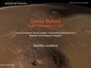
Dorrie Byford Week 3: February 1 st , 2007. Communications Group Leader / Autonomous Rendezvous / Website and Database Designer Satellite Locations. Possible Satellite Locations. Considered: Direct Earth – Mars For comparison – not possible Earth – Sun-Mars L1 – Mars

E N D
Dorrie ByfordWeek 3: February 1st, 2007 Communications Group Leader / Autonomous Rendezvous / Website and Database Designer Satellite Locations
Possible Satellite Locations • Considered: • Direct Earth – Mars • For comparison – not possible • Earth – Sun-Mars L1 – Mars • Earth – Sun-Mars L4 – Mars • Earth – Sun-Earth L4 – Mars • Earth – Sun Polar – Mars • Conditions: • 20 m diameter dish on Earth • 7 m diameter dishes in orbit / on Mars • Frequency of 8 GHz • Data rate of 35 million bps (~33.4 Mbps)
Possible Satellite Location Power Estimates • Considerations: • L1 orbit altitude > 20 mil km • Probably not possible • Very expensive (ΔV) • Sun Polar orbit out of the way • Also costly (ΔV) • Sun-Mars L4 has asteroids • Conclusions: • Comm Standpoint: • Sun-Mars L4 • Good for coverage • Easy to create redundancy (L5) • Shouldn’t be too ΔV costly • Sun Polar • Smaller satellite • Quicker relay • Need input from other groups, especially D&C and Power
Explanation of Selected Data Rate • To decide on an initial data rate, I carefully examined Dr. Damon Landau’s synodic schematics. Since various groups have been saying that we will be splitting up the launches, I was not sure exactly how many transmissions we would be sending. To get a good, conservative, estimate, I assigned command/telemetry to every unmanned vehicle that was anywhere on the chart for that synodic period. (ie. On Mars, in LEO, etc) I then assigned comm/telm/voice/HD video to every manned vehicle following the same format. A chart of my findings can be seen to the right and also in my link budget analysis. Since the largest amount was about 32 mil, I went with 35 mil to be conservative.
Satellite Configuration Scenarios • I ran 5 scenarios for satellite location. The first, Earth – Mars, is not feasible; it was just run as a comparison. See ending slides for diagrams of the scenarios. • Note that, although the Earth – L1 – Mars scenario requires a much greater distance than Earth – Mars, the total power is almost equal because the burden of sending so much data is split between two satellites.
Satellite Configuration Scenarios cont. • Another point to note is that, since the Earth has the larger 20m diameter dish, it can handle a much larger transmitting distance at a lower power. This explains why the L1 has such a lower power requirement than the other scenarios.
Link Budget Verification • While meeting with Prof Filmer, he told me that the analysis he presented in class was a simplified version of that found in the Human Spaceflight book (see References). So, on his suggestion, I cross referenced his presentation with the book and then used their two examples to validate my code. See next side for validation tests.
Validating Link Budget Analysis Mars Mission Lunar Mission
Link Budget Validated • With percent errors of .27% and .31%, respectively, the Link Budget Analysis code was validated. • After running my analysis (see next slide), I was concerned with how large my values were. As a sanity check, I went and looked at Project Legend’s Link Budget Analysis results. • After examining their values, I realized that their MORS to Earth budget link only accounted for when Earth and Mars are at their closest, 57 mil km, not the worst case scenario of 384 mil km.
Mars Reconnaissance Orbiter Comparison • Since Project Legend’s data did not work to validate my Link Budget Analysis, I researched the communications systems of current Mars orbiting satellites. The obvious choice was the Mars Reconnaissance Orbiter. This satellite, while using the Deep Space Network, is achieving data rates 10 times faster than any previous Mars transmissions. Since we will not be launching for 15+ years, it seems reasonable that we should be able to achieve at least this speed even without the use of the DSN. • A first look at my numbers proved disappointing. The DSN dish being used is 34 m - my calculations put it above 120 m.
MRO Comparison cont • One explanation for the gross error is that the analysis being used does not account for such sophisticated technologies. As I mentioned earlier, MRO is transmitting 10 times faster than any previous mission. As a test, I divided the 6 mbps by 10 and ran the code again. • This time I got an answer very close to the actual dish size on Earth. This leads me to believe that, while this analysis proves useful as an estimation of current capabilities, further work will have to be done to get accurate estimates for using upcoming technologies. • To approximate this capability, I divided my data rate by 10 and reran all of my code. These modified numbers are what appear in my first two slides.
Link Budget Calculations • Intermediate Steps • SNR_avail = SNR_req + Margin • SNR_req = constant when use BPSK and BER = 10^-5 – from figure 3 of Prof Filmer’s handout • Margin = dB wanted as buffer – set as constant at 3 by Prof Filmer • Transmitter Gain = 20.4+10*LOG(Eta)+20*LOG(f)+20*LOG(Dt) • f = Frequency (GHz) • Dt = Transmitter Antenna Diameter (m) • Eta = .55 • Space Loss = 92.45+20*LOG(f)+20*LOG(S) • S = Distance between Antennas (km)
Calculations cont • G/T = SNR_avail-10*LOG(P)-G_t+Lfs+Lother+k+10*LOG(Rd) • P = Transmitter Power (W) • G_t = Transmitter Gain (dB) • Lfs = Space Loss (dB) • Lother = Combined Loss due to Rain, Atmosphere, etc (dB) • k = Boltzmann’s Constant = -228.g dBW/K-Hz • Rd = Data Rate (bps) • Receiver Gain = GT+10*LOG(Ts) • GT = G/T • Ts = System Noise Temp (K) – constant from figure 2 of Prof Filmer’s handout • Receiver Diameter = 10^((G_r-20.4-10*LOG(Eta)-20*LOG(f))/20) • G_r = Receiver Gain • Time = D / c • D = Total distance (m) • c = Speed of Light = 3*10^8 m/s
Earth – Mars Diagram • Diagram of scenario 1 from Link Budget Analysis (LBA) • Not possible because of Sun • Used as reference Sun Mars Earth Thick line represents communication link
Earth – Sun-Mars L1 – Mars Diagram • Diagram of scenario 2 from LBA • Same colors and notations as scenario 1 Satellite Not to scale >3˚ L1 Halo Orbit
Earth – Sun-Mars L4 – Mars Diagram • Diagram of scenario 3 from LBA • Same colors and notations as scenario 1 L4 Not to scale 60˚
Earth – Sun-Earth L4 – Mars Diagram • Diagram of scenario 4 from LBA • Same colors and notations as scenario 1 L4 60˚
Earth – Sun Polar – Mars Diagram • Diagram of scenario 5 from LBA • Same colors and notations as scenario 1
Resources • Professor Filmer • Larson, Wiley J., et al. Human Spaceflight: Mission Analysis and Design. • http://marsprogram.jpl.nasa.gov/mro/mission/sc_antennas.html