Download
1 / 42
420 likes | 556 Views
STAGE 1 Twin Harbors State Park to Montesano, WA Start at the top of the hill at the ege of the beach and head east onto WA-105 2.60 Turn left onto Bayview Rd 4.19 Turn leftback onto WA-105 /Westport Rd/S Boone St 17.98 Turn right onto W Harriman St 18.40 Turn left onto S Evans St

E N D
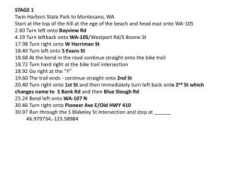
STAGE 1 Twin Harbors State Park to Montesano, WA Start at the top of the hill at the ege of the beach and head east onto WA-105 2.60 Turn left onto Bayview Rd 4.19 Turn leftback onto WA-105/Westport Rd/S Boone St 17.98 Turn right onto W Harriman St 18.40 Turn left onto S Evans St 18.68 At the bend in the road continue straight onto the bike trail 18.72 Turn hard right at the bike trail intersection 18.92 Go right at the “Y” 19.60 The trail ends - continue straight onto 2nd St 20.40 Turn right onto 1st St and then immediately turn left back onto 2nd St which changes name to S Bank Rd and then Blue Slough Rd 25.24 Bend left onto WA-107 N 30.46 Turn right onto Pioneer Ave E/Old HWY 410 30.97 Run through the S Blakeley St intersection and stop at ______ 46.979734,-123.58984
STAGE 2 Montesano to Rochester, WA Start at ______ and head east on Old HWY 410/Monte Elma Rd/W Main St 46.979734,-123.58984 9.24 Turn right onto S 3rd St/Wakefield Rd 11.11 Turn left onto S Bank Rd 16.32 Turn right to stay on S Bank Rd 18.19 Bend slight left to stay on S Bank Rd which changes name to Oakville Rd 26.33 Turn right onto Cemetery Rd 27.15 Turn right onto Elma Gate Rd E 28.47 Turn left onto Elma Gate Branch Rd 28.55 Turn right onto US-12 E 33.93 Turn left onto 183rd Ave SW 34.00 Stop at the Pendleton St SW stop sign 46.821769,-123.076294
STAGE 3 Rochester to Roy, WA Start at the Pendleton St SW stop sign and head east on 183rd Ave SW 46.821769,-123.076294 5.40 Turn left onto Old Hwy 99 SE/Tenino Grand Mound Rd SW 10.71 At the bend in the road continue straight onto W 6th Ave 10.80 Just past the intersection with W Park Ave turn left onto the Yelm Tenino Trail (no sign, just a single track trail here) 11.21 City Park (parking, RRs) 46.855708,-122.851623 14.62 Military Rd SE (parking) 46.861335,-122.781383 16.83 Johnson Creek Ln SE 46.871708,-122.738703 19.33 Minnesota St N (parking) 46.887636,-122.691218 22.09 Manke Rd SE 46.91256,-122.647689 24.90 The trail ends at Railroad street, turn right 46.941839,-122.608327 24.95 Turn right onto W Yelm Ave 26.01 The road bends left - continue onto WA-507 N 35.82 Stop where the dark asphalt ends at the lighter colored concrete at the intersection of the unsigned gravel road (Rice Kandle Rd S) 47.033614,-122.493037
STAGE 4 Roy to Orillia, WA Start at the lighter colored concrete at the intersection of the unsigned gravel road and head north on WA-507 (Rice Kandle Rd S) 47.033614,-122.493037 4.56 Bend left onto Pacific Ave S/Quinnon Rd 15.28 Turn right onto S 25th St/5th St/E 25th St 16.43 Turn left onto E Portland Ave 16.48 Turn right onto Eells St - stay on the right (east) side of the road/bridge 17.03 Turn right onto 20th St E 20.60 Turn left onto Milton Way 20.67 Bend right (straight) to remain on Milton Way 21.83 Bend right (straight) to remain on Milton Way 22.57 Turn left onto Meridian Ave E 22.63 Turn right onto Jovita Blvd E 24.53 Turn left onto W Valley Hwy E/W Valley Hwy S 25.58 Turn right onto 3rd Ave SW 25.72 Turn left and head north on the Interurban Trail (parking) 47.264888,-122.259964 28.09 15th St SW (parking) 47.296011,-122.239673 31.16 37th St NW (parking) 47.340495,-122.23919 32.09 Bend slight right to stay on Interurban Trail 33.85 Naden Ave S (parking) 47.378374,-122.242237 38.06 Stop at the large power line pole cement base at the end of S 182nd St (parking) 47.438863,-122.241813
STAGE 5 Orillia to North Bend, WA Start at the large power line pole cement base at the end of S 182nd St (parking) 47.438863,-122.241813 2.06 Turn right onto the gravel trail (no sign) and safely cross the railroad tracks 47.466036,-122.242519 2.10 Turn slight left onto Monster Rd SW 2.18 Turn right onto Jackson Pl SW 2.28 Turn left onto Longacres Dr SW 2.41 Turn left onto SW Grady Way 4.10 Bend slight left onto Main Ave S 4.38 Turn right onto S 3rd St/Hauser Way S 4.54 Bend left onto the bike path/sidewalk 4.83 Cross Bronson Way N and turn right, cross the railroad tracks, and then immediately turn left onto Sunset Blvd N 5.08 Turn right onto NE 3rd St and cross under I-5 5.92 The road bends to the right and changes name to NE 4th St and later changes name to SE 128th St 8.56 Turn left onto 164th Ave SE 9.40 Turn right onto WA-900 E/Renton Issaquah Rd SE 14.33 Turn right onto Newport Way NW 14.82 Turn right to stay on Newport Way NW 15.12 Turn left onto SE 70th St/NW Juniper St
15.60 Turn right onto Rainier Ave N ***15.75miTurn right onto Bike Path ***15.76Head south on Bike Path toward Front St N 15.80 Turn sharp left onto Front St, cross Front St, and turn right heading south on the sidewalk/bike path 16.31 Turn left onto E Sunset Way 16.71 Cross to the right side of the road at 6th Ave NE and enter the sidewalk that transitions to the Issaquah-Preston Trail (which used to be called the Issaquah Creek Trail) 47.529934,-122.025705 19.25 SE High Point Rd (parking) 47.532125,-121.980025 20.50 The trail ends, turn right and Head east on SE High Point Way (parking) 47.533255,-121.956722 21.21 At the 300th Ave SE intersection bend left onto the Preston-Snoqualmie Trail 47.531115,-121.942541 22.09 SE 87th Pl Trailhead (parking) 47.522436,-121.933824 25.78 Lake Alice Rd trailhead (parking) 47.550782,-121.887224 ***26.90 Turn right onto the Deep Creek (???) Trail 27.34 Turn left onto SE Kendall Peak St and then turn right onto Denny Peak Dr SE ***27.41 Turn right onto asphalt trail ***27.45 Turn left onto gravel trail 27.72 Turn right onto Eagle Lake Dr SE 27.95 Turn right onto unnamed asphalt road/trail 28.41 Turn left onto Snoqualmie Ridge Trail (parking) 47.530488,-121.864132
30.05 Turn right to stay on Snoqualmie Ridge Trail 30.44 Turn left onto Railroad Pl SE which becomes trail/sidewalk again after crossing Fir St 30.73 The trail ends; turn left onto SE King St and then immediately turn right onto Railroad Ave SE 47.528829,-121.825548 30.99 Turn left onto SE Newton St 31.08 Turn right onto Park Ave SE 31.88 Turn left onto the unnamed and unsigned road that intersects the Snoqualmie Valley Trail 47.522439,-121.805765 32.11 Turn right onto the Snoqualmie Valley Trail 47.522367,-121.801377 34.09 Ballarat Ave N trailhead (parking) 47.496836,-121.781734 36.31 Stop at ____ at the SE North Bend Way trail crossing 47.475636,-121.746488
STAGE 6 North Bend to Easton, WA Start at the ____ at the SE North Bend Way trail crossing 47.475636,-121.746488 ****decide which route to take to get to the John Wayne Trail Crew at (parking, PPs) 47.441963,-121.676055 Crew at (parking) 47.423979,-121.621295 Crew at 47.384869,-121.521024 or at 47.389241,-121.476679 Hyak Trailhead (parking, RRs) 47.39137,-121.39264 Road 2219 Trailhead (parking) 47.384122,-121.390096 Road _____ (parking) 47.313021,-121.350996 Road 54 (parking) 47.299838,-121.326406 Road 424 (parking) 47.276263,-121.29947 Stop at the Old HWY US-10 gate 47.256039,-121.201368
STAGE 7 Easton to Ellensburg, WA Start at the Old US HWY 10 gate and head east/southeast on HWY 10 47.256039,-121.201368 1.25 Turn left onto Lake Easton Rd 1.37 Turn right onto Iron Horse Trail/Lake Easton Rd/Railroad St 2.21 Turn right onto Cabin Creek Rd/Iron Horse Trail 2.35 Turn sharp left onto the JWPT 47.233936,-121.176991 4.91 Nelson Siding Rd 47.215983,-121.130944 8.89 Golf Course Rd (parking) 47.193475,-121.05359 10.42 Leisure Land Ln 47.180758,-121.030049 14.05 South Cle Elum Rail Yard Museum (parking) 47.183136,-120.955612 17.05 Turn right onto River Ranch Ln 47.17631,-120.894459 17.06 Turn left onto Lower Peoh Point Rd 17.24 Turn right onto Watson Cutoff Rd 17.39 Bend right to remain on Watson Cutoff Rd 17.75 Turn right to stay on Watson Cutoff Rd 18.36 Turn left onto Upper Peoh Point Rd which later changes name to Thorp Prarie Rd 28.86 Turn left onto E Taneum Rd 31.23 Turn right onto the JWPT 47.079913,-120.693448 33.63 E Depot Rd 47.054233,-120.661282 36.34 WA-97 (parking) 47.038098,-120.608534
39.84 Ellensburg Trailhead (parking) 47.007124,-120.550472 39.96 Turn left onto W 14th Ave which later changes name to Dean Nicholson Blvd 40.75 Turn right onto N Alder St 41.13 Turn left on the JWPT (parking) 47.000879,-120.531661 44.25 Cross N Ferguson Rd and stop at the gate 46.990248,-120.467132
Stage 8 Ellensburg to Vantage, WA Start at the gate and head east on the trail 46.990248,-120.467132 3.13 Hemingston Rd (parking) 46.979433,-120.401813 4.99 Leave the trail and turn right onto Prater Rd (parking) 46.973942,-120.364648 5.30 Turn left onto Boylston Rd 8.60 Turn right onto Stevens Rd 8.68 Where the pavement ends runners bear right onto the trail that heads up the hill to the JWPT (parking, PP) 46.952957,-120.297301 8.75 Turn left onto the JWPT 46.950628,-120.297076 13.32 Leave the trail and go right onto the “tunnel bypass/detour” road 46.913191,-120.234978 14.69 Turn left back onto the JWPT and head east/southeast 46.908412,-120.209593 30.09 Leave the trail and turn left heading north on the paved Huntzinger Rd which later changes name to Wanapum Rd 46.844166,-119.963495 37.08 Stop at the green ____ sign at the bottom of the I-90 on ramp 46.939182,-119.990136
Stage 9 Vantage to Warden, WA Start at the green ____ sign at the bottom of the I-90 east on ramp and head up the ramp escorted by WA DOT and State Patrol vehicles 46.939182,-119.990136 1.45 Turn right onto the I-90 off ramp and head south/southeast on WA-26 4.90 Turn left onto the gravel Rd S SW/S 1/2-SW Rd 6.23 Turn right onto Rd 10 SW (this is a change from the mapped route) 7.23 Turn right onto Rd R SW 8.22 Bend left onto Rd 11 SW 24.37 Turn right onto Rd B SW 24.56 Turn left on Rd 11.2 SW 25.56 Turn left onto Rd a SW 25.75 Turn right onto Rd 11 SW 27.78 Turn left onto WA-262 E/Rd a SE 44.74 Stop at ___ at the unsigned dirt road 46.985244,-119.175335
Stage 10 Warden to Ralston, WA Start at ___ at the unsigned dirt road and head east on WA-262 46.985244,-119.175335 2.71 Continue straight – road changes name to Rd 7 SE 3.10 Turn right onto Rd R SE 4.11 Turn left onto WA-170 E/Rd 8 SE/1st St 7.71 Turn slight right onto John Wayne Pioneer Trail 46.969535,-119.033157 9.40 RD W SE 46.959424,-119.003382 12.53 Howard Rd 46.95801,-118.938979 14.53 Johnson Rd 46.962829,-118.897483 17.85 S Roxboro Rd 46.946615,-118.833429 27.51 WA-21 (parking) 46.971497,-118.66411 28.36 Bend left onto WA-21 N and head east 46.970048,-118.646725 29.85 Turn left onto I St/WA-21 29.92 Turn right onto E 2nd St/WA-21 32.78 Turn left onto the JWPT 46.965523,-118.560684 35.20 Sievers Rd 46.960749,-118.514244 38.55 Bauer Rd 46.94619,-118.460773 41.45 Suko Rd 46.963912,-118.407562 44.85 Cross WA-261 and stop at the red and white sign on the right side of the trail 46.986657,-118.343548
Stage 11 Ralston to Lavista, WA Start at the red and white sign on the right side of the trail and head east on the JWPT 46.986657,-118.343548 1.12 Bierman Rd/Benzel Rd intersection 46.993587,-118.321921 9.92 N Marengo Rd (parking) 47.022522,-118.19416 13.18 Ritzville Benge Rd (parking) 47.050257,-118.122257 Possible crewing location at George Natt Rd 47.05014,-118.004968 24.01 Revere Rd (parking) 47.079416,-117.938279 25.04 Davis Rd (parking) 47.086196,-117.919246 28.36 Texas Lake Rd (parking) 47.083756,-117.852384 34.97 Cross WA-23, leave the trail and head northeast on W R Damrell Rd 47.116909,-117.735287 35.29 Continue straight – road changes name to Rock Lake Rd 36.51 Turn right onto Gene Webb Rd 37.10 Slight right to stay on Gene Webb Rd 37.26 Turn right to stay on Gene Webb Rd 39.21 Stop at ___ at the intersection with Stephen Rd 47.131389,-117.660947
Stage 12 Lavista to Fairbanks, WA Start at ___ at the intersection with Stephen Rd 47.131389,-117.660947 6.35 Turn right to stay on Stephen Rd 7.16 Turn left onto trail to the JWPT 7.87 Turn right onto the JWPT 11.45 Hole-In-The-Ground Rd 47.226927,-117.57458 13.45 Kenova Rd 47.206844,-117.552983 14.95 The trail ends, turn right towards the road 15.00 Turn left onto Pine City Rd 15.36 The trail starts again, bend right onto the JWPT 47.204307,-117.524468 18.04 Pine City-Malden Rd (parking) 47.227875,-117.484685 21.98 Squaw Rd 47.250121,-117.436725 26.15 S Morrow Rd 47.263519,-117.36993 ---Restrooms located at Rosalia City Park off of W 9th St 29.28 Malden Rd 47.222964,-117.371338 33.65 The JWPT merges with Pandora Rd – continue heading east/northeast 47.232851,-117.289708 34.22 Bend right to continue on the John Wayne Trail 47.238547,-117.281415 34.72 Summer Rd (parking) 47.240164,-117.270847 37.52 Engel Rd (parking) 47.221164,-117.236375 39.35 Cross Fairbanks-Seabury Rd and stop at the red and white “Old Milwaukee Road” sign 47.202685,-117.213248
Stage 13 Fairbanks, WA to Harrison, ID Start at the red and white “Old Milwaukee Road” sign and head east on the JWPT 47.202685,-117.213248 2.50 Lone Pine Rd 47.216635,-117.163703 6.58 Turn left onto Summer Rd 47.222716,-117.107468 6.63 Turn right onto Lone Pine Rd 7.77 Turn left onto Hanson Rd/Lone Pine Rd/Seahau Rd 7.85 Turn slight right onto WA-27 S 8.04 Turn slight left onto Spring St 8.36 Turn right onto Washington St and then immediately turn left onto the JWPT 47.22927,-117.07519 9.48 Catholic Cemetary Rd (parking) 47.240317,-117.05789 ****Crew: There are old restrooms at the park in Tekoa 13.70 Tekoa-Idaho Rd 47.295887,-117.039866 16.28 Turn right and then immediately turn left at the “Y” onto Indian Grove Rd 47.309231,-116.995706 17.03 Turn left onto Mowry Rd 18.05 Turn left onto Agency Rd
***18.20 Slight right toward Agency Rd ***18.38 Turn left toward Agency Rd ***18.54miTurn left toward Agency Rd ***18.63miSlight right onto Agency Rd ***18.66miTurn right to stay on Agency Rd 22.59 Turn left onto US-95 N 23.56 Turn left onto A St/Alder St 23.80 Turn right into the parking lot that leads to the Nature Path – take the nature path 47.33726,-116.892247 23.90 Turn right onto Anne Antelope Rd 47.339284,-116.893134 23.96 Turn right into the Trail of the Couer D’ Alenes Plummer trailhead parking area (parking, RRs) and run through the parking lot 47.340001,-116.891729 24.05 Turn right onto the Trail of the Couer D’ Alenes 47.340758,-116.889841 30.60 Heyburn Rd (parking) 47.360245,-116.77968 31.95 Chatcolet Lower Rd (parking, RRs) 47.374404,-116.761307 39.76 Stop at the Harrison trail sign at the intersection of Harrison St. 47.454065,-116.786976
STAGE 14 Harrison to Osburn, ID Start at the Harrison trail sign at the intersection of Harrison St. and the trail and head northeast on the the Trail of the Coeur D'Alenes. Stay on the trail all day. 47.454065,-116.786976 3.10 Springston Trailhead (parking, RRs) 47.478421,-116.732057 10.50 Medimont Trailhead (parking, PPs) 47.475448,-116.601014 15.95 Black Rock Trailhead (parking) 47.522954,-116.513683 18.15 Bull Run Lake Trailhead (parking, RRs) 47.534262,-116.475422 26.60 Cataldo Trailhead (parking, PP) 47.548472,-116.329917 28.00 E CCC Rd 47.564857,-116.315787 31.65 Enaville Trailhead (pparking, PP) 47.559963,-116.251565 33.30 Pine Creek Trailhead 47.549363,-116.224077 35.70 Smelterville Trailhead (parking, PP) 47.544446,-116.174617 37.70 Silver Mountain parking lot 47.538919,-116.133732 39.75 Park Rd 47.531024,-116.092574 41.50 Highwater Rd 47.531227,-116.057233 43.25 Stop at the trail stop sign at the Gene Day Park entrance 47.514549,-116.030542
STAGE 15 Osburn, ID to Deborgia, MT Start at the trail stop sign at the Gene Day Park entrance and head east on the Trail of the Coeur D'Alenes 47.514549,-116.030542 1.80 Osburn Trailhead (parking) 47.50349,-115.996449 4.20 Silver Valley Rd 47.490427,-115.972177 5.99 Wallace Trailhead (parking) 47.473983,-115.923681 9.15 I-90 Exit 64 short road 47.472235,-115.862627 12.76 The trail ends - turn right onto 2nd St 12.77 Turn left onto River St 13.21 Road changes name to Friday Ave 14.34 Road changes name to Willow Creek Rd 15.16 Road changes name to National Forest Develop Rd 8008 16.04 Turn left at road junction – name of road not known 16.40 Stay right at road junction 21.10 After passing Lookout Pass ski area and the I-90 interchange continue straight – road changes name to ____________ 22.10 Stay right at road junction 22.20 Stay left at road junction 24.50 Turn hard left onto snowmobile trail 25.00 Pass under I-90 28.60 Pass under I-90 again 28.67 Turn left onto _______ Rd
33.82 Turn left onto Silver Creek Rd 33.91 Turn left onto I-90 Frontage Rd 34.05 Turn right onto Nat for Dev Rd 288/Timber Creek Rd 35.20 Stay right at road junction 36.08 Turn right to stay on Nat for Dev Rd 288/Timber Creek Rd 37.96 Go right to stay on Nat for Dev Rd 288/Timber Creek Rd 39.01 Turn right to stay on Nat for Dev Rd 288/Timber Creek Rd 39.50 Remain left to stay on Nat for Dev Rd 288/Timber Creek Rd 41.58 Turn left onto Timber Creek Rd 41.59 Turn hard right onto Nat for Dev Rd 288/Timber Creek Rd 41.93 Turn right to stay on Nat for Dev Rd 288/Timber Creek Rd 42.05 Stop at TBD 47.390767,-115.408509
STAGE 16 Deborgia to Plains, MT Start at TBD and head southeast on Haugan Deborgia E 47.390767,-115.408509 3.21 Turn right onto Thompson De Borgia Rd 3.30 Turn left at Coker Ln 3.61 Turn left onto unmarked dirt road/rail trail 5.90 Turn left onto singletrack trail. Take the trail for .37 miles at which point it ends at the I-90 exit 22 off ramp. Follow the off ramp for .1 miles to 12 Mile Rd 6.37 Turn left (northwest) onto 12 Mile Rd and pass under the interstate 8.13 Slight turn right onto Old Mullan Rd 11.61 Turn right onto unnamed/unmarked dirt road 13.64 Turn right and rejoin Old Mullan Rd 17.07 Road changes name to Mullan Gulch Rd 18.32 Turn left onto Main St 19.05 Turn left onto MT-135 39.89 Turn right onto MT-200 44.15 Stop at the Flathead River Rd (double check name???) sign 47.348652,-114.740399 Note: Need to remap stages 16 and 17 due to changing stage stop/start point
STAGE 17 Plains to Arlee, MT Start at the Flathead River Rd (double check name???) sign and head east on MT-200 47.348652,-114.740399 26.42 Turn right onto MT-200/US-93 37.32 Stop at the Jocko Rd stop sign 47.152632,-114.068305 Note: Need to remap stages 16 and 17
STAGE 18 Arlee to Seeley Lake, MT Start at the Jocko Rd stop sign and head east on Jocko Rd 47.152632,-114.068305 3.11 Turn left onto Jocko Canyon Rd 12.11 Turn left to stay on Jocko Canyon Rd (Jocko Rd vice Jocko Canyon Rd???) 13.62 Road changes name back to Jocko Rd 27.00 Road changes name to N Placid Lake Rd 27.46 Slight turn right to stay on N Placid Lake Rd 29.41 Slight turn left to Placid Creek Rd 31.02 Turn right onto Placid Lakefront 31.23 Slight right onto N Placid Lake Rd/Placid LakefrontContinue to follow N Placid Lake Rd 33.61 Turn left onto S Placid Lake Rd 33.62 Turn right onto Placid Creek Rd 34.50 Slight left onto N Placid Lake Rd 35.82 Turn slight left to stay on N Placid Lake Rd 36.27 Stop at the N Placid Lake Rd stop sign 47.120023,-113.44569
STAGE 19 Seeley Lake to Helmville, MT Start at the N Placid Lake Rd stop sign and head south on MT-83 47.120023,-113.44569 2.87 Slight left onto County Rd 67/Woodworth Rd 7.24 Turn right to stay on County Rd 67/Woodworth Rd 12.44 Woodworth Rd turns slightly left and becomes Upsata Lake Rd/Upsete Lake Rd 15.54 Turn right onto Ranch Rd 16.44 Turn left onto MT-200 30.93 Turn right onto MT-141 40.45 Stop at the stop sign at Nevada Ogden Rd and head southeast on MT-141 46.827843,-112.873156
STAGE 20 Helmville to MacDonald Pass, MT Start at the stop sign at Nevada Ogden Rd and head southeast on MT-141 46.827843,-112.873156 22.96 Turn left onto US-12 E 37.53 Stop at the stop sign at Forest Service Road 1802 46.565588,-112.306284 (Note: need to remap stages 20 and 21)
STAGE 21 MacDonald Pass to Winston, MT Start at the stop sign at Forest Service Road 1802 and head east on US-12 46.565588,-112.306284 (Note: need to remap stages 20 and 21) 15.27 Turn right onto N Benton Ave 15.54 Slight turn left onto Neill Ave 15.77 Slight right onto Helena Ave 15.80 Road changes name to Cruse Ave 15.82 Turn left onto 11th Ave 17.27 Slight turn left onto I-15 BUS S 17.62 Road changes name US-12/US-287 42.21 Stop at the Silos Rd stop sign 46.41363,-111.598485
STAGE 22 Winston to White Sulpher Springs, MT Start at the Silos Rd stop sign and head southeast on US-12 46.41363,-111.598485 2.00 Turn left onto Manor Dr 2.02 Turn right onto unnamed dirt road (rail trail?) 5.11 Merge back onto US-12 7.32 Turn left onto 4th St 7.87 Turn right onto N Harrison Ave 8.13 Turn left onto US-12/Broadway St. Continue to follow US-12 40.50 Stop at the Rostad Rd stop sign 46.41758,-110.911385
STAGE 23 White Sulpher Springs to Selkirk, MT Start at the Rostad Rd stop sign and head east/northeast on US-12 46.41758,-110.911385 0.31 Turn right onto US-89 8.19 Turn left onto MT-294 35.19 Continue straight onto Grant Ave 35.41 Turn left onto Main St 37.11 Road changes name to 12W82S 38.12 Turn left onto dirt road heading toward US-12 39.21 Turn right onto US-12 40.72 Finish at the Selkirk river access road sign 46.467217,-110.222915
STAGE 24 Selkirk to Shawmut, MT Start at the Selkirk river access road sign and head east on US-12 46.467217,-110.222915 19.45 Turn right onto Central Ave N 19.73 Turn left onto 2nd St SE 20.05 Road changes name to 12E101S 21.03 Turn right onto US-12 39.93 Stop at the stop sign on dirt road that leads to Deadmans Basin Reservoir 46.322897,-109.446323
STAGE 25 Shawmut to Broadview, MT Start at the stop sign on dirt road that leads to Deadmans Basin Reservoir and head east on Route 12 46.322897,-109.446323 9.36 Turn right onto Rd 300 (signs for MT-3) 9.41 Turn right to stay onto Hwy 300 12.8 Turn left onto Van Der Voort Rd 18.64 Turn right onto Harms Rd 21.00 Turn left to stay on Harms Rd 25.8 Road changes name to Cushman Rd 27.8 Turn right onto Custer Gulch Rd 28.75 Turn left onto Granary Rd 32.01 Turn right onto MT-3 S 41.66 Stop at the Cemetary Rd stop sign and head southeast on MT-3 46.072129,-108.863103
STAGE 26 Broadview to Billings, MT Start at the Cemetary Rd stop sign and head southeast on MT-3 46.072129,-108.863103 Note – I hope to improve this stage using unmapped Billings bike trail 18.95 Turn left onto Alkali Creek Rd 22.28 Road changes name to Warfield Ranch Rd 22.66 Road chnages name back to Alkali Creek Rd 27.47 Turn left onto Indian Trail 27.93 Turn right onto Travois Trail 28.04 Turn left back onto E Alkali Creek Rd 28.97 Slight left to stay on E Alkali Creek Rd 29.05 Turn left onto E Airport Rd 29.14 Slight left onto Alkali Creek Rd 29.46 Slight left toward I-90 BUS E/US-87 S 30.04 Turn right toward I-90 BUS E/US-87 S 30.12 Turn left toward I-90 BUS E/US-87 S 30.15 Turn left onto I-90 BUS E/US-87 S 30.98 Continue onto Old U.S. 87 S 31.44 Turn right onto Hardin Rd/Old U.S. 87 S 39.38 Stop at the black mailbox at 45.733684,-108.341031
STAGE 27 Billings to Hardin, MT Start at the black mailbox at 45.733684,-108.341031. Continue south/southeast on Hardin Rd (old US 87) 40.37 Turn right onto I-90 Frontage Rd 41.48 Finish at the black mailbox at 45.731677,-107.565815. STAGE 28 Hardin to Busby, MT Start at the black mailbox at 45.731677,-107.565815. Head south on the I-90 Frontage Road 0.11 Turn left onto Sarpy Creek Rd 0.18 Turn right onto I-90 Frontage Rd 4.80 Go right to stay on the I-90 Frontage Rd heading south 10.61 Turn left onto Arienda St/Frontage Rd 10.62 Turn right onto Bala St 12.55 Turn right onto Frontage Rd 12.60 Turn left onto US-212 E 43.77 Finish at the yellow reflector topped road marker on the east side of the dirt road intersection at 45.584431,-106.856904
STAGE 29 Busby to Ashland, MT Start at the yellow reflector topped road marker on the east side of the dirt road intersection. Continue on Route 212 heading east/southeast. No turns today. Start at 45.584431,-106.856904 44.37 Finish at the Route 212/Wilbur Creek Road stop sign located at 45.565266,-106.00168 STAGE 30 Ashland to Broadus, MT Start at the Route 212/Wilbur Creek Road stop sign and continue east/southeast on Route 212 45.565266,-106.00168 30.61 Turn right to remain on Route 212 at the four way stop in Broadus. At this intersection runners can immediately cross the road to run against traffic or runners can run on the bike path with traffic until it ends and then cross the road to face traffic. 42.12 Finish at the mail box across the street from the tank storage 45.34373,-105.229933
STAGE 31 Broadus to Alzada, MT Start at the mail box across the street from the tank storage lot and head east southeast on Route 212 45.34373,-105.229933 46.28 Finish at the 212/326 sign located 50 feet from the large green Sinclair gas station sign (runners see the back side of the sign) (parking, RRs at the gas station). The sign is at the intersection of Route 212 and Route 326 45.022097,-104.406602 STAGE 32 Alzada, MT to Belle Fourche, SD Start at the 212/326 sign located 50 feet from the large green Sinclair gas station sign (runners see the back side of the sign) (parking, RRs at the gas station). The sign is at the intersection of Route 212 and Route 326. Head east/southeast on Route 212. 45.022097,-104.406602 36.42 Turn right onto US-85 44.681226,-103.853617 38.29 Finish at – to be determined 44.654825,-103.857715
STAGE 33 Belle Fourche to Roubaix, SD Start – to be determined 44.654825,-103.857715 0.49miTurn left onto S Dakota 34 E 10.84 Turn slight right onto St Onge Oil Rd 17.00 Turn left onto US-85 N 19.87 Turn left onto Polo Loop 20.58 Stay right on Polo Loop 20.99 Turn left onto US-85 S 23.47 Turn right onto US-85 S/Main St (signs for U.S. 14 Alternate W/Deadwood)Continue to follow US-85 S 24.61 Turn left onto Sherman St 25.04 Turn slight right onto Charles St 25.12 Turn right toward George S. Mickelson Trail 27.00 Kirk Rd 44.352378,-103.739671 31.03 Forest Rd 227 44.32133,-103.768705 31.60 Stay left to remain on the Mickelson Trail 33.63 Englewood Trailhead (PP) 44.297085,-103.784455 37.63 Finish at TBD 44.251059,-103.796662
STAGE 34 Roubaix to Hill City, SD Start at TBD 44.251059,-103.796662 Note: Will probably move the stage start to the Dumont trailhead. Nahant Rd (County Rd 259) 44.180488,-103.758157 Rochford Rd (L305) 44.13057,-103.73583 Rochford Trailhead (PP) 44.122084,-103.713688 Mystic Rd 44.106971,-103.653207 George Fink Rd 44.084171,-103.6266 Mystic Trailhead 44.076811,-103.639796 Tigerville-Mystic Rd (near Forest Rd 242) 44.026126,-103.658904 Ray Smith Dr 43.966164,-103.623801 County Road C308 43.939779,-103.581895 Stop at the red fire hydrant at the south side of the intersection of the Mickelson Trail and Poplar St (parking, RRs) 43.928345,-103.574685
STAGE 35 Hill City to Hot Springs, SD Start at the red fire hydrant at the south side of the intersection of the Mickelson Trail and Poplar St (parking, RRs) 43.928345,-103.574685 Note: Remap stages 34 and 35 to account for start/stop location changes Rafter J-Bar Rd 43.888862,-103.590564 White Horse Rd 43.869436,-103.621377 Crazy Horse view area (parking) 43.819325,-103.639233 Mountain Trailhead (parking, PP) 43.802819,-103.635156 Montgomery St 43.771853,-103.594404 Old Sawmill Rd (overcrossing) 43.732538,-103.606151 Carroll Creek Rd 43.695416,-103.605412 White Elephant Trailhead 43.654786,-103.589855 Pringle Trailhead (parking, PPs) 43.608783,-103.592988 Road 510 43.580018,-103.631355 Argyle Loop Rd 43.54438,-103.646443 Argyle Loop Rd 43.520956,-103.657777 Unnamed Road 43.466828,-103.68826 Finish at the Minnekahta Trailhead port-o-potty 43.431641,-103.688871
STAGE 36 Hot Springs to Oelrichs, SD Start at the Minnekahta Trailhead port-o-potty (parking, PP) 43.431641,-103.688871 8.33 County HWY 185 (overcrossing) 43.32986,-103.734462 12.78 Route 18 43.335948,-103.786622 16.05 Leave the trail and turn right onto F St (no signs) 43.29894,-103.824697 16.11 Turn left onto 2nd Ave/S Dakota 471 16.67 Continue straight as road changes name to S Dakota 471/3rd St 17.04 After crossing the railroad tracks, turn left onto Co Hwy 6e 17.28 Continue straight onto Co Hwy 6e 17.46 Turn slight right onto Co Hwy 6n 20.99 Turn left onto Co Hwy 3292 30.33 Turn left onto S Dakota 71 32.51 Turn right onto Co Hwy 6 46.18 Stop at the beginning of the “off-ramp” to Co Road 79 43.216592,-103.347489
STAGE 37 Oelrichs, SD to Chadron, NE Start at the beginning of the “off-ramp” to Co Road 79 and continue east 43.216592,-103.347489 3.99 Turn right onto US-18 E/US-385 6.49 Slight right to stay on US-385 30.86 Turn left onto unnamed road (42.903193,-103.066535) 32.12 Continue straight onto Schommer Loop Rd 32.25 Turn left onto Schommer Rd (unmarked) (42.893322,-103.045016) 32.35 Turn right onto Schommer Rd 35.26 Road changes name to Stockade Rd 36.61 Turn left onto unmarked/unnamed road that turns into 1st St (42.83778,-103.027577) 37.58 Turn right onto unsigned N Pine Ave 37.66 Turn left onto W 1st St 38.68 Turn slight left at Ridgeview Rd 38.82 Turn slight right onto unnamed road (42.830857,-102.985885) 39.67 Turn right onto McHenry Rd 39.80 Finish at the stop sign at US-20 42.828563,-102.9692 Alternate route finish is at the telephone pole at Ridgeview Rd and US-20 42.828463,-102.988592
STAGE 38 Chadron to Gordon, NE Start at the stop sign at US-20 42.828563,-102.9692 Alternate start is at the telephone pole at Ridgeview Rd and US-20 42.828463,-102.988592 17.2 Turn slight left onto Rd 46 17.72 Road changes name to N 3rd St 18.23 Road changes name to Rd 146 19.76 Turn right toward NE-87/US-20 19.79 Turn left onto NE-87/US-20 ------- Finish at the Western Sands Motel sign, our hotel for the night 42.799841,-102.204101 Need to remap this stage when the exact start location is determined.
STAGE 39 Gordon to Cody, NE Start at the Western Sands Motel sign, our hotel for the previous night, and head east on US-20 42.799841,-102.204101 Finish at 42.933364,-101.385062 Or Change finish to 42.940606,-101.334804 Need to remap this stage due to changed start location and possible changed finish location.
STAGE 40 Cody to Valentine, NE Start at 42.933364,-101.385062 Or Change start to 42.940606,-101.334804 Will need to remap this stage if changing the start location. 23.17 After running by the little town of Kilgore, turn left onto unmarked road at 42.934872,-100.945094 23.20 Turn right onto an open segment of the Cowboy Trail??? Parallel US-20 for the next six miles 29.22 Turn right toward US-20 E 29.24 Turn left onto US-20 E 43.92 Turn left onto S Thatcher St 44.10 Turn right onto the Cowboy Trail 44.76 Finish at ___ at the Comfort Inn parking lot 42.871309,-100.551438