Download
1 / 26
260 likes | 415 Views
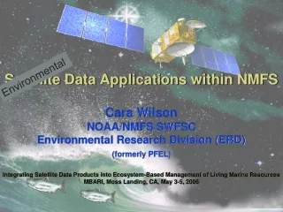
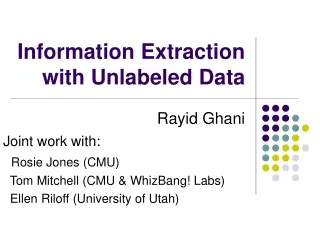
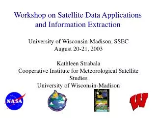
Workshop on Satellite Data Applications and Information Extraction. University of Wisconsin-Madison, SSEC August 20-21, 2003 Kathleen Strabala Cooperative Institute for Meteorological Satellite Studies University of Wisconsin-Madison. Terra. Launched: Dec. 18, 1999 10:30 am ascending

E N D
Workshop on Satellite Data Applications and Information Extraction University of Wisconsin-Madison, SSEC August 20-21, 2003 Kathleen Strabala Cooperative Institute for Meteorological Satellite Studies University of Wisconsin-Madison
Terra Launched: Dec. 18, 1999 10:30 am ascending ASTER: Hi-res imager CERES: Broadband scanner MISR: Multi-view imager MODIS: Multispectral imager MOPITT: Limb sounder
Launched: May 4, 2002 1:30 pm descending AIRS: Infrared sounder AMSR-E: Microwave scanner AMSU: Microwave scanner CERES: Broadband scanner HSB: Microwave sounder MODIS: Multispectral imager Aqua
Instruments On Board Aqua MODIS,AIRS,AMSU,HSB are included in IMAPP CERES will not be included in IMAPP AIRS- Atmospheric Infrared Sounder Measurements: Atmospheric temperature and humidity; land and sea surface temperatures; cloud properties; radiative energy flux Properties: Measures simultaneously in more than 2,300 spectral channels in the range of 0.4 to 1.7 µm and 3.4 to 15.4 µm Sponsor: NASA JPL Developer: Lockheed Martin URL: http://www-airs.jpl.nasa.gov/ MODIS-Moderate Resolution Imaging Spectroradiometer Measurements: Cloud properties; radiative energy flux; aerosol properties; land cover and land use change; vegetation dynamics; land surface temperature; fire occurrence; volcanic effects; sea surface temperature; ocean color; snow cover; atmospheric temperature and humidity; sea ice Properties: Views in 36 spectral bands from 0.4 to 14 µm Sponsor: NASA GSFC Developer: Raytheon (Santa Barbara Remote Sensing) URL: http://ltpwww.gsfc.nasa.gov/MODIS AMSR/E- Advanced Microwave Scanning Radiometer-EOS Measurements: Cloud properties; radiative energy flux; precipitation; land surface wetness;sea ice; snow cover; sea surface temp.; sea surface wind fields Properties: Views in 12 channels at six discrete frequencies in the range of 6.9 to 89 GHz Sponsor: NASDA of Japan Developer: Mitsubishi Electric Corporation URL:http://wwwghcc.msfc.nasa.gov/AMSR AMSU-Advanced Microwave Sounding Unit Measurements: Atmospheric temperature and humidity Properties: Senses in 15 discrete channels in the range of 50 to 89 GHz Sponsor: NASA GSFC Developer:Aerojet URL: http://www.aerojet.com/Weapon_Systems/Earth_Sensing/AMSU/ New AMSU info URL: http://orbit-net.nesdis.noaa.gov/crad/st/amsuclimat HSB- Humidity Sounder for Brazil Measurements:Atmospheric humidity Properties: Measures in 5 discrete channels in the range of 150 to 183MHz Sponsor: Instituto Nacional de Pesquisas Espaciais (INPE), Brazil Developer:Matra Marconi Space CERES- Clouds and the Earth's Radiant Energy System Measurements:Radiative energy flux Properties: Two sensor, one scanning cross track, the other scanning azimuthally view in three channels per scanner: shortwave (0.3 to 5 µm), longwave (8 to 12 µm), and "total" (0.3 to > 50 µm) Sponsor: NASA LaRC Developer: TRW Space & Electronics Group URL: http://asd-www.larc.nasa.gov/ceres/ ASDceres.html
AIRS Instrument Suite • AIRS, in conjunction with its companion instrument AMSU, provides a unprecedented suite of instruments for weather and climatologically studies • AIRS is a hyperspectral IR spectral photometer • 2378 IR channels • AIRS also has 4 Visible/NIR channels (8x9 pixels per AIRS spot) • AMSU-A is a MW temperature sounder with 15 channels • Combining Level-1B data from AIRS-suite instruments you can retrieve cloud-cleared IR radiances and physical parameters including: • Cloud cover & height • Surface temperature & type • Profiles of: T, q, trace gasses
Climate Studies • EOS Satellites primary mission is to understand earth’s climate and identify the causes of climate change. • DAAC products are doing just that.
TERRA MODIS NIGHTTIME 4mm SST MAY 2001 V 3.3.1 -2 5 10 15 20 25 30 35 Co MODIS/OCEAN GROUP GSFC, RSMAS
Cloud Optical Thickness(M. D. King, S. Platnick, M. Gray, E. Moody, et al) Level-3 Monthly April 2001 Level-3 Monthly April 2001 tc tc 20 16 12 8 4 0
Cloud Effective Particle Radius(M. D. King, S. Platnick, M. Gray, E. Moody, et al.) Level-3 Monthly April 2001 Level-3 Monthly April 2001 re(µm) 40 34 28 22 16 10 4
NH summer 2001 NH winter 2001/02 Seasonal percentage high clouds (<400 mb) from Terra MODIS
Terra MODIS global water vapor product Sliding 8-day mean
Near Real-time Data and Products • Direct readout Terra and Aqua data and products have proven useful too. • IMAPP (International MODIS/AIRS Processing Package) allows users with X-band receivers to calibrate, geolocate and create science data products in near-real time. • Current suite: MODIS data Calibration, geolocation, cloud mask, cloud properties (height, temperature, emissivity, phase), atmospheric profiles (T, q, total precipitable water vapor, stability indices.)
EOS Direct Broadcast at SSEC • Objective:Routine acquisition and processing of EOS direct broadcast data (NASA HQ funding). • Accomplishments: • System installed August 5, 2000. • Level-1B data and browse images have been produced automatically since January, 2001 and made available via anonymous FTP, DODS server, and Web. • IMAPP software package for processing MODIS direct broadcast data now in use in USA, UK, Germany, Russia, Japan, China, Korea, Singapore, Australia. Level-2 algorithms (cloud mask, atm. profiles, cloud height).
EOS Direct Broadcast Groundstation TeraScan SX-EOS 4.4 m antenna: First data acquired 2000/08/18 Overpass prediction 2000/10/13
International MODIS/AIRS Processing Package • Goal: Transform direct broadcast Level-0 data (initially from MODIS) to calibrated & geolocated radiances (Level-1B) and science data products (Level-2). • Features: • Ported to a range of platforms (IRIX, SunOS, AIX, HPUX, Linux), • The only required tool kit is NCSA HDF4, • Processing environment is greatly simplified, • Downlinked or definitive ephemeris/attitude data may be used, • Passes of arbitrary size may be processed, • Available at no cost; licensed under GNU GPL, • Available from: • http://cimss.ssec.wisc.edu/~gumley/IMAPP/
CIMSS Near-Real Time IMAPP automated processing applications: • MODIS L1B and science product validation • Testing of MODIS algorithm product changes • Quick look true-color images for identifying regions of spectral or meteorological interest • Support for field experiments
Example IMAPP Aqua Quicklook Image: Southwest US 19 Aug. 2003
Global Community MODIS IMAPP applications: • MODIS calibration validation over Lake Tahoe, USA. • Providing USA Weather Service forecasters with near real-time high spatial resolution imagery and products (SPORT). • Aiding the Canadian Ice Service in monitoring the amount of ice on Hudson Bay for shipping concerns. • Supplying cloud information from IMAPP as part of the European CLOUDMAP 2 project.
Simon Hook’s (JPL) MkIV Raft on Lake Tahoe withRadiometer, Meteorological Station and Temperature LoggersMODIS radiances are sent automatically for every Tahoe pass
Near Future IMAPP applications: MODIS products SST Surface reflectance Aerosol Scene classification Snow cover/Lake Ice Cloud optical properties AIRS Sounding System Software: • L1B AIRS (Release end of October), AMSU, HSB, AMSR-E • AIRS L2 products release beginning of 2004 • Utilities to collocate MODIS/AIRS pixels • Eventually combined MODIS/AIRS products
MODIS Cloud Mask (left) & Phase (right) MODIS Cloud Top Pressure MODIS Total Precipitable Water CIMSS/SSEC DB Coverage AIRS IR Window BT Images AIRS Water Vapor BT Images MODIS True Color Image
Enough Talking. Let’s look at Data!! http://wwwghcc.msfc.nasa.gov/sport/sport_observations.html http://eosdb.ssec.wisc.edu/modisdirect/ http://cimss.ssec.wisc.edu/db_products/