Download
1 / 17
170 likes | 334 Views
A new set of tools for all altimetry users. J. Benveniste (ESA), N. Picot (CNES), V. Rosmorduc (CLS) et al. Basic Radar Altimetry Toolbox & Tutorial. A Joint project between ESA and CNES Statements: 16 years of altimetry available and at least as many data formats as satellites,

E N D
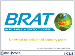
A new set of tools for all altimetry users J. Benveniste (ESA), N. Picot (CNES), V. Rosmorduc (CLS) et al.
Basic Radar Altimetry Toolbox & Tutorial • A Joint project between ESA and CNES • Statements: • 16 years of altimetry available and at least as many data formats as satellites, • A growing number of non-expert users of the data, • Scientists also need easy-to-use data products and tools! • Basic Radar Altimetry Toolbox (BRAT) • Data reading, processing and visualisation • All altimetry data from official data centres since ERS-1 (1991) • Radar Altimetry Tutorial (RAT) • A tutorial describing altimetry, for the users • technique, applications and missions • Products fact sheets and data use cases • Available on the web (http://www.altimetry.info, http://earth.esa.int/brat/), or on DVD
BRAT Data import & export ERS-1 Sensor data • Output NetCDF • Ascii dump possible • Image export (png, tif, jpg, bmp) Topex/Poseidon Along-track ERS-2 GFO Jason-1 Envisat Gridded data Cryosat
Radar Altimetry Tutorial • Applications • Geodesy & solid Earth • Ocean • Ice • Climate • Weather • Hydrology & land • Coastal • Data use cases • Altimetry • How it works • Data flow • Future improvements • Altimetry missions • Past missions • Current missions • Future missions • Products • Data • Software • Documentation • Toolbox http://www.altimetry.info http://earth.esa.int/brat/
Basic Radar Altimetry Toolbox software • Windows & Linux • Open source Data read & processed: • From several satellitesERS-1 and 2, Topex/Poseidon, Geosat Follow-on, Jason-1, Envisat, and the future Cryosat missions. • From several data centres ESA, Aviso, JPL/PoDaac, Noaa • Of several processing levelsfrom Sensor Geophysical Data Record to gridded merged data • Present version: v1.0.2
Software accessible at different levels core functions (available from C, Fortran, Matlab, IDL APIs) Data reading Select, compute and visualise data using command line mode with parameter files .exe files Graphical User Interface (GUI):use the toolbox through a windowed interface GUI
Formulas: saving expressions and selections • Formulas are combinations of data fields and functions (including arithmetic operators, + - / *) • Use: • as a ‘data expression’: to compute a combination of data fields (e.g. Sea Surface Height) • or as a data selection: to do a complex selection on the data fields • Pre-defined formulas can be used (Sea Surface Height, Sea Level Anomalies, ocean data editing for all satellite GDRs are built-in) • User-made formulas can be saved and re-used in either the same workspace, or imported in another one Formulas can be exchanged between users
Curves Maps (different projections) Data visualisation
Statistics + Minimum, Maximum Mean Sea Level Anomalies for November 1997
Hurricane Katrina Envisat Jason-1 & T/P GFO
Southern swell, May 2007 Jason-1 OSDR, 12 May 2007
Sea level anomaly seasonal variations Spring Autumn - 15 + 15 cm Winter Summer
Zoom Kinetic Energy on 17 August 2005
For more information www.altimetry.infowith a mirror on earth.esa.int/brat/