Download

1 / 70
730 likes | 971 Views
Design of UAV Systems. c 2003 LM Corporation . Communications. Lesson objective - to discuss UAV Communications including … RF Basics Communications Issues Sizing.

E N D
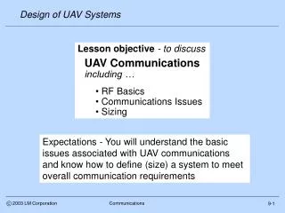
Design of UAV Systems c 2003 LM Corporation Communications • Lesson objective - to discuss • UAV Communications • including … • RF Basics • Communications Issues • Sizing Expectations - You will understand the basic issues associated with UAV communications and know how to define (size) a system to meet overall communication requirements 9-1
Design of UAV Systems c 2003 LM Corporation Communications Schedule revision • Week 4 • Sortie rate estimates • Requirements analysis • Week 5 • Communication considerations and sizing • Week 6 • Control station considerations and sizing • Payload (EO/IR and radar) considerations and sizing • Week 7 • Reliability, maintenance, safety and support • Life cycle cost • Week 8 • Mid term presentations 9-1a
Design of UAV Systems c 2003 LM Corporation Communications Importance • Communications are a key element of the overall UAV system • A UAV system cannot operate without secure and reliable communications • - unless it operates totally autonomously • - Only a few (generally older) UAVs operate this way • A good definition (and understanding) of communications requirements is one of the most important products of the UAV concept design phase 9-2
Design of UAV Systems c 2003 LM Corporation Communications Discussion subjects • RF basics • Data link types • Frequency bands • Antennae • Equations • Communications issues • Architecture • Function • Coverage • Etc. • Sizing (air and ground) • Range • Weight • Volume • Power • Example problem 9-3
Design of UAV Systems c 2003 LM Corporation Communications Data link types • Simplex - One way point-to-point • Half duplex - Two way, sequential Tx/Rx • Full duplex - Two way, continuous Tx/Rx • Modem - Device that sends data sent over analog link • Omni directional - Theoretically a transmission in all directions (4 steradian or antenna gain 0) but generally means 360 degree azimuth coverage • Directional - Transmitted energy focused in one direction (receive antennae usually also directional) • - The more focused the antennae, the higher the gain • Up links - used to control the UAV and sensors • Down links - carry information from the UAV (location, status, etc) and the on-board sensors 9-4
Design of UAV Systems Civil Radio band designation 1-10 kHz VLF (very low frequency) 10-100 kHz LF (low frequency) 100-1000 kHz MF (medium frequency) 1-10 MHz HF (high frequency) 10-100 MHz VHF (very high frequency) 100-1000 MHz UHF (ultra high frequency) 1-10 GHz SHF (super high frequency) 10-100 GHz EHF(extremely high frequency) Note - NATO designations cover almost the same frequency ranges US Military and Radar bands 1-2 GHz L Band 2-4 GHz S Band 4-8 GHz C Band 8-12 GHz X Band 12-18 GHz Ku Band 18-27 GHz K Band 27-40 GHz Ka Band 40-75 GHz V Band 75-110 GHz W Band 110-300 GHz mm Band 300-3000 GHz mm Band NATO D Band E/F Band G/H Band I Band J Band K Band K Band L Band M Band Satellite band designation S Band 1700-3000 MHz C Band 3700-4200 MHz Ku1 Band 10.9-11.75 GHz Ku2 Band 11.75-12.5 GHz Ku3 Band 12.5-12.75 GHz Ka Band 18.0-20.0 GHz c 2003 LM Corporation Communications Frequency bands 9-5
Design of UAV Systems c 2003 LM Corporation Communications UAV frequencies • Military and civilian UAVs communicate over a range of frequencies • An informal survey of over 40 UAVs (mostly military, a few civilian) from Janes UAVs and Targets shows: Up links Band % using VHF (RC) 13% UHF 32% D 6% E/F 11% G/H 21% J 15% Ku 2% Down links Band % using VHF 0% UHF 17% D 19% E/F 13% G/H 23% J 17% Ku 9% Higher frequency down links provide more bandwidth 9-6
Design of UAV Systems c 2003 LM Corporation Communications More basics • Carrier frequency • - The center frequency around which a message is sent • - The actual communication or message is represented by a modulation (e.g. FM) about the carrier • Bandwidth • - The amount (bandwidth) of frequency (nominally centered on a carrier frequency) used to transmit a message • - Not all of it is used to communicate • - Some amount is needed for interference protection • - Sometimes expressed in bauds or bits per second but this is really the data rate 9-7
Design of UAV Systems • How much real data can be sent (bits per second) • - A typical voice message uses a few Kbps and can be transmitted on a single frequency channel • - Real time video can require Mbps and must be transmitted across a range of frequencies • - Still images can be sent at low data rates over time • Sometimes described using telecom line notation • - T1 = 1.5 mbps; T3 = 45 mbps, etc • Related to bandwidth but not directly • - Synchronization, error checks and other factors involved • - Limited data shows a 70% relationship c 2003 LM Corporation Communications Data rate Many people use band width and data rate as synonymous terms. Even though not rigorously correct, we will do likewise 9-8
Design of UAV Systems c 2003 LM Corporation Communications Polarity • The physical orientation of an RF signal • - Typically determined by the design of the antenna • - But influenced by ground reflection • Two types of polarization, linear and circular • - Linear polarity is further characterized as horizontal (“h-pole”) or vertical (“v-pole”) • - A simple vertical antenna will transmit a vertically polarized signal. The receiving antenna should also be vertical • - V-pole tends to be absorbed by the earth and has poor ground reflection (tracking radars are V-pole). • - H-pole has good ground reflection which extends the effective range ( used for acquisition radars) • - Circular polarity typically comes from a spiral antenna • - EHF SatCom transmissions are usually circular • - Polarization can be either right or left hand circular 9-9
Design of UAV Systems c 2003 LM Corporation Communications And more • Antenna gain - a measure of antenna performance • - Typically defined in dBi = 10*log10(P/Pi) • - where P/Pi = ability of an antenna to focus power vs. theoretical isotropic (4 steradian) radiation • - Example - an antenna that focuses 1 watt into a 3deg x 3 deg beam (aka “beam width”) has a gain of • 10*Log10(1/3^2/1/360^2) = 41.6 dB • - For many reasons (e.g., bit error rates) high gain antennae (>20dBi) are required for high bandwidth data • Example - 10.5 Kbps Inmarsat Arero-H Antenna • - For small size and simplicity, low gain antenna (< 4 dBi) are used………... for low bandwidth data • Example - 600 bps Inmarsat Aero-L Antenna 9-10
Design of UAV Systems c 2003 LM Corporation Communications Examples Inmarsat L (600 bps) Weight = 8 lb, ? dB Inmarsat I (4.8 Kbps) Weight = 18 lb, 6 dB Inmarsat H (≈9.6 Kbps) Weight = 102 lb, 12 dB Data and pictures from http://www.tecom-ind.com/satcom.htm, weights = antenna + electronics 9-11
Design of UAV Systems c 2003 LM Corporation Communications More basics - losses • Free space loss • - The loss in signal strength due to range (R) • = (/4R)^2 • - Example : 10 GHz (=0.03m) at 250 Km = 160.4 dBi • Atmospheric absorption • - Diatomic oxygen and water vapor absorb RF emissions • - Example : 0.01 radian path angle at 250 Km = 2.6 dB • Precipitation absorption • - Rain and snow absorb RF emissions • - Example : 80 Km light rain cell at 250 Km = 6.5 dB Examples from “Data Link Basics: The Link Budget”, L3 Communications Systems West 9-12
Design of UAV Systems c 2003 LM Corporation Communications Communications issues • Architecture • Military • Commercial • “Common” • Function • Up link (control) • Launch and recovery • Enroute • On station • Payload control • Down link (data) • Sensor • System status • Coverage • Local area • Line of sight • Over the horizon • Other issues • Time delay • Survivability • Reliability • Redundancy • Probability of intercept • Logistics 9-13
Design of UAV Systems c 2003 LM Corporation Communications Military vs. civil • Military communications systems historically were quite different from their civilian counterparts • With the exception of fixed base (home country infrastructure) installations, military communications systems are designed for operations in remote locations under extreme environmental conditions • They are designed for transportability and modularity • - Most are palletized and come with environmental shelters • Civilian communications systems were (and generally still are) designed for operation from fixed bases • Users are expected to provide an environmentally controlled building (temperature and humidity) Now, however, the situation has changed 9-14
Design of UAV Systems Commercial Satellite Military Satellite c 2003 LM Corporation Communications Communication types • Military operators now depend on a mix of civilian and military communications services • - Cell phones and SatCom have joined the military Global Hawk example 9-15
Design of UAV Systems Requires no other systems to operate anywhere in the world Integrated http://www.fas.org/man/dod-101/sys/ac/equip/tbmcs.htm http://www.fas.org/man/dod-101/sys/smart/bgm-109.htm c 2003 LM Corporation Communications Military communications • Military communications systems generally fall into one of two categories • Integrated - multiple users, part of • the communications infrastructure • Dedicated - unique to a system Dedicated 9-16
Design of UAV Systems c 2003 LM Corporation Communications UAV architectures • UAV communication systems are generally dedicated • The systems may have other applications (e.g. used by manned and unmanned reconnaissance) but each UAV generally has its own communications system • US military UAVs have an objective of common data link systems across all military UAVs (e.g.TCDL) • Multiple UAV types could be controlled • Frequencies or geographic areas are allocated to specific UAVs to prevent interference or “fratricide” • UAV communications equipment is generally integrated with the control station • This is particularly true for small UAVs and control stations • Larger UAVs can have separate communications pallets 9-17
Design of UAV Systems c 2003 LM Corporation Communications US common data links • Excerpts from - Survey of Current Air Force Tactical Data Links and Policy, Mark Minges, Information Directorate, ARFL. 13 June 2001 • A program which defines a set of common and interoperable waveform characteristics • A full duplex, jam resistant, point-to-point digital, wireless RF communication architecture • Used with intelligence, surveillance and reconnaissance (ISR) collection systems • Classes & tech base examples • Class IV (SatCom) - DCGS (Distributed Common Ground System) • Class III (Multiple Access) - RIDEX (AFRL proposed) • Class II (Protected) - ABIT (Airborne Information transfer) • Class I (High Rate) - MIST (Meteorological info. std. terminal) • Class I (Low Rate) - TCDL (Tactical CDL) 9-18
Design of UAV Systems Ku band SatCom terminal (D = 6.25m, W = 13950 lb) “MIST” UHF LOS antenna UHF SatCom terminal (D = 2m, W =6500 Lb) c 2003 LM Corporation Communications Global Hawk GDT GDT = Ground “data terminal” 9-19
Design of UAV Systems c 2003 LM Corporation Communications Global Hawk ADT ADT = Air “data terminal” 9-20
Design of UAV Systems c 2003 LM Corporation Communications TCDL ADT & GDT Range goal - 200 Km at 15Kft 9-21
Design of UAV Systems c 2003 LM Corporation Communications Next subject • Architecture • Military • Commercial • “Common” • Function • Up link (control) • Launch and recovery • Enroute • On station • Payload control • Down link (data) • Sensor • System status • Coverage • Local area • Line of sight • Over the horizon • Other issues • Time delay • Survivability • Reliability • Redundancy • Probability of intercept • Logistics 9-22
Design of UAV Systems http://www.fas.org/irp/program/collect/pioneer.htm http://www.fas.org/irp/program/collect/pioneer.htm Enroute Launch and Recovery http://www.fas.org/irp/program/disseminate/uav_tcs.htm On station Payload c 2003 LM Corporation Communications Control functions 9-23
Design of UAV Systems 2/28/2001 c 2003 LM Corporation Communications Launch and recovery • Located at the operating base • Control the UAV from engine start through initial climb and departure….and approach through engine shut down • Communications must be tied in with other base operations • - Usually 2-way UHF/VHF (voice) and land line • Also linked to Mission Control (may be 100s of miles away) Global Hawk Launch Recovery Element 9-24
Design of UAV Systems 2/28/2001 c 2003 LM Corporation Communications Enroute • Launch and recovery or mission control responsibility • Control the UAV through air traffic control (ATC) airspace • - Usually 2-way UHF/VHF (voice) • Primary responsibility is separation from other traffic - particularly manned aircraft (military and civil) • - UAV control by line of sight, relay and/or SatCom data link Global Hawk Mission Control Element 9-25
Design of UAV Systems c 2003 LM Corporation Communications On station • Primary mission control responsibility • Control the UAV air vehicle in the target area using line of sight, relay and/or SatCom data link • - Bandwidth requirements typically 10s-100s Kpbs • Control sometimes handed off to other users • - Mission control monitors the operation http://www.fas.org/irp/program/collect/predator.htm http://www.fas.org/irp/program/collect/predator.htm 9-26
Design of UAV Systems c 2003 LM Corporation Communications Payload • Primary mission control responsibility • Control the sensors in the target area using line of sight, relay and/or SatCom data links • - Sensor control modes include search and spot • - High bandwidth required (sensor control feedback) • Sensor control sometimes handed off to other users SAR radar control EO/IR sensor control 9-27
Design of UAV Systems c 2003 LM Corporation Communications Down links • Down links carry the most valuable product of a UAV mission • UAV sensor and position information that is transmitted back for analysis and dissemination • - Exception, autonomous UAV with on board storage • Or UCAV targeting information that is transmitted back for operator confirmation • Real time search mode requirements typically define down link performance required • Non-real time “Images” can be sent back over time and reduce bandwidth requirements • Line of sight down link requirements cover a range from a few Kbps to 100s of Mbps, SatCom down link requirements are substantially lower 9-28
Design of UAV Systems c 2003 LM Corporation Communications Radar “imagery” • High resolution “imagery” (whether real or synthetic) establishes the down link bandwidth requirement • Example - Global Hawk has 138,000 sqkm/day area search area at 1m resolution. Assuming 8 bits per pixel and 4:1 compression, the required data rate would be 3.2 Mbps to meet the SAR search requirements alone* • - In addition to this, the data link has to support 1900, 0.3 m resolution 2 Km x 2 Km SAP spot images per day, an equivalent data rate of 2.0 Mbps • - Finally there is a ground moving target indicator (GMTI) search rate of 15,000 sq. Km/min at 10 m resolution, an implied data rate of about 5Mbps • Total SAR data rate requirement is about 10 Mbps *See the payload lesson for how these requirements are calculated 9-29
Design of UAV Systems EO spot image IR spot image 2/28/2002 c 2003 LM Corporation Communications EO/IR data EO/IR requirements are for comparable areas and resolution. After compression, Global Hawk EO/IR bandwidth requirements estimated at 42 Mbps* This is why Global Hawk has a high bandwidth data link * Flight International, 30 January 2002 9-30
Design of UAV Systems c 2003 LM Corporation Communications System status data • Air vehicle system status requirements are small in comparison to sensors • - Fuel and electrical data can be reported with a few bits of data at relatively low rates (as long as nothing goes wrong - then higher rates required) • - Position, speed and attitude data files are also small, albeit higher rate • - Subsystem (propulsion, electrical, flight control, etc) and and avionics status reporting is probably the stressing requirement, particularly in emergencies • Although important, system status bandwidth requirements will not be design drivers • - A few Kbps should suffice • Once again, the sensors, not system status, will drive the overall data link requirement 9-31
Design of UAV Systems c 2003 LM Corporation Communications Next subject • Architecture • Military • Commercial • “Common” • Function • Up link (control) • Launch and recovery • Enroute • On station • Payload control • Down link (data) • Sensor • System status • Coverage • Local area • Line of sight • Over the horizon • Other issues • Time delay • Survivability • Reliability • Redundancy • Probability of intercept • Logistics 9-32
Design of UAV Systems c 2003 LM Corporation Communications Local area communications • Close range operations (e.g., launch and recovery) typically use omni-directional data links • - All azimuth, line of sight • - Air vehicle and ground station impact minimal • Communications must be tied in with other base operations • - Usually 2-way UHF/VHF (voice) and land line Omni-directional antennae 9-33
Design of UAV Systems Global Hawk Pioneer Dipole Steerable Dish http://www.fas.org/irp/program/collect/pioneer.htm c 2003 LM Corporation Communications Long range comms (LOS) • Typically require directional data links • - RF focused on control station and/or air vehicle • - Impact on small air vehicles significant • - Impact on larger air vehicles less significant • - Significant control station impact • Communications requirements include air traffic control • - Usually 2-way UHF/VHF (voice) Hunter http://www.fas.org/irp/program/collect/pioneer.htm 9-34
Design of UAV Systems http://www.fas.org/irp/program/collect/pioneer.htm TUAV c 2003 LM Corporation Communications Over the horizon options • Relay aircraft - existing line of sight equipment • Minimal air vehicle design impact • Major operational impact SatCom • Low bandwidth - minimal design impact, major operational • High bandwidth - major impact (design and operational) 9-35
Design of UAV Systems Design issues • Transmitter, receiver • - Size • - Weight • - Location • Antennae • - Ditto • Power and cooling • Cost and complexity Ku-band antenna Diameter = 1.22 m Operational issues • Link availability • Bandwidth availability • Logistics • - Transportability • Operations and support cost D = 6.25m, W = 13950 lb c 2003 LM Corporation Communications Global Hawk SatCom 9-36
Design of UAV Systems c 2003 LM Corporation Communications • Architecture • Military • Commercial • UAV • Function • Up link (control) • Launch and recovery • Enroute • On station • Payload control • Down link (data) • Sensor • System status • Coverage • Local area • Line of sight • Over the horizon • Other issues • Time delay • Survivability • Reliability • Redundancy • Probability of intercept • Logistics 9-37
Design of UAV Systems c 2003 LM Corporation Communications Other issues - time delay • The time required to transmit, execute and feed back a command (at the speed of light) • - A SatCom problem • Example: • - 200 Km LOS @ c = 3x10^5 Km/sec • - Two way transmission time = 1.33 msec • - Geo stationary Satcom at 35,900 Km • - Two way transmission time = 240 msec Inmarsat M (500 msec?) Raw data from, Automated Information Systems Design Guidance - Commercial Satellite Transmission, U.S. Army Information Systems Engineering Command (http://www.fas.org/spp/military/docops/army/index.html) 9-38
Design of UAV Systems c 2003 LM Corporation Communications Time delays and UAVs • Also known as data “latency” or “lag” • - Limited by speed of light and “clock speed” • All systems have latency • - Human eye flicker detection - 30 Hz (33 msec delay) • - Computer screen refresh rate - 75 Hz (13 msec) • - Computer keyboard buffer latency - 10 to 20 msec • - LOS communications - 2 msec • - LEO SatCom - 10 msec • - MEO Satcom - 100 msec • - GEO Satcom - 200 to 300 msec • - Typical human reaction - 150-250 msec • Acceptable overall system lag varies by task • < 40 msec for PIO susceptible flight tasks (low L/D) • < 100 msec for “up and away” flight tasks (high L/D) • When OTH control latency > 40 msec, direct control of a UAV is high risk (except through an autopilot) 9-39
Design of UAV Systems c 2003 LM Corporation Communications Other issues - redundancy • The preferred reliability solution • Separate back up data link(s) • Most modern UAVs have redundant data links • Global Hawk has 4 (two per function) • - UHF (LOS command and control) • - UHF (SatCom command and control) • - CDL (J-band LOS down link) • - SHF (SatCom Ku band down link) • Dark Star also had four (4) • Predator, Shadow 200 have two (2) • Most UAVs also have pre-programmed lost link procedures • - If contact lost for TBD time period (or other criteria) return to pre-determined point (near recovery base) • - Loiter until contact re-established (or fuel reaches minimum levels then initiate self destruct) 9-40
Design of UAV Systems Wide beam Max. power Adversary Narrow beam Min. power c 2003 LM Corporation Communications Probability of intercept • Probability that an adversary will be able to detect and intercept a data link and be able to • 1. Establish track on the UAV position • 2. Interfere with (or spoof) commands • Purely a military UAV issue • No known civil equivalent • Some well known techniques • - Spread spectrum • - Random frequency hopping • - Burst transmissions • - Difficult to detect and track • - Power management • - No more power than required to receive • - Narrow beam widths • - Difficult intercept geometry 9-41
Design of UAV Systems c 2003 LM Corporation Communications More issues • Power and cooling • Communications equipment (especially transmitters) require significant power and cooling to meet steady state and peak requirements • - At low altitudes, meeting these power and cooling requirements typically is not an issue • - At high altitude, both are a problem since power and cooling required ≈ constant and …. • - Power available approximately proportional • - Cooling air required(cfm) approximately proportional 1/; one reason why high-altitude aircraft use fuel for cooling (also keeps the fuel from freezing!) 9-42
Design of UAV Systems c 2003 LM Corporation Communications Other issues - logistics A significant part of transport requirements are associated with communications equipment C-141B transport configuration 9-43
Design of UAV Systems c 2003 LM Corporation Communications Next subject • RF basics • Data link types • Frequency bands • Antennae • Equations • Communications issues • Architecture • Function • Coverage • Etc. • Sizing (air and ground) • Range • Weight • Volume • Power • Example problem 9-44
Design of UAV Systems hmin D2 D1 h2 h1 Re c 2003 LM Corporation Communications Line of sight (LOS) calculations - Given 2 platforms at distance (D1+D2) apart at altitudes h1 and h2 above the surface of the earth: • D1+D2 Re*{ArcCos[(Re+hmin)/(Re+h2)]+ • ArcCos[(Re+hmin)/(Re+h1)]} (9.1) • Re ≈ 6378 km (3444 nm) • hmin = intermediate terrain or weather avoidance altitude (≈ 20kft)* • ArcCos[ ] is measured in radians • *not applicable if h1 and/or h2 lower than hmin - From geometry where and 9-45
Design of UAV Systems c 2003 LM Corporation Communications RF line of sight • Due to earth curvature and atmospheric index of refraction, RF transmissions bend slightly and the RF line of sight (LOS) is > the geometric LOS by a factor ≈ √4/3 (Skolnik, Radar Handbook, page 24-6) • Another equation for communication LOS can be found using a simple radar horizon equation from Skolnik (page 24-8) where: • - LOS(statute miles) ≈ √2*h(ft) (9.2) • or • - LOS(nm) ≈ 0.869√2*h(ft) (9.3) • Note that the ratio of Eqs 9.1 and 9.3 for h1 = hmin = 0 and h2 = h is √4/3 ; e.g. LOS (Eq 9.1) = 184 nm @ h2 = 30Kft while LOS (Eq 9.3) = 213 nm • - We will assume that the √4/3 factor will correct any geometric LOS calculation including 9.4 when h1 and h2min ≠ 0 9-46
Design of UAV Systems • From geometry, the slant range (LOS’) will be given by: • (Re+h)^2 = LOS’^2 + Re^2 -2*LOS’*Re*Cos (/2+) • or • LOS’^2 - [2*Re*Cos (/2+)]*LOS’ + [Re^2 - (Re+h)^2] = 0 • where LOS is the root of a quadratic equation of the form a*x^2+bx+c = 0 or x = [-b±sqrt(b^2-4*a*c)]/2*a • which we then multiply by √4/3 to adjust for atmospheric effects (9.4) c 2003 LM Corporation Communications Grazing angle effects • Given a platform at altitude h at grazing angle above the horizon: LOS’ Local horizon LOS h • Ignore the small differences between LOS and LOS’ • The equation predicts published Global Hawk comm ranges at 0.75 Re 9-47
Design of UAV Systems c 2003 LM Corporation Communications Airborne relay • A system level solution for an organic over the horizon (OTH) UAV communications capability • Requires that relay UAV(s) stay airborne at all times • - For extended range and/or redundancy • Also requires separate communication relay payload • - In addition to basic UAV communication payload • But relay platform location is critical. Example: • Four (4) WAS UAVs loiter at 27 Kft and one (1) ID UAV loiter at 10 Kft over a 200 nm x 200 nm combat area located 100 nm from base • Two (2) WAS UAVs closest to base function as communications relays for the three other UAVs • Typical terrain altitude over the area is 5 Kft • How would a WAS relay have to operate to provide LOS communications to the ID UAV at max range? 9-48
Design of UAV Systems c 2003 LM Corporation Communications Relay example • LOS defines max communication distance for relay • - At =0.75, LOS from base = 156.7 nm vs. 158 nm req’d • At hmin = 5 kft, LOS from ID UAV at 10 Kft to WAS relay at 27 Kft = 269.2 nm vs. 212 nm req’d • WAS altitude inadequate to meet base relay requirement • Altitude increase to 27.4 Kft required 200 nm x 200 nm 269.2 nm 156.7 nm 212 nm 158 nm 10 Kft 27 Kft 100 nm 9-49