Download
1 / 26
260 likes | 292 Views
Explore the advancements in hurricane forecasting through 1-D and 3-D ocean models, upwelling effects, SST cooling, and track prediction accuracy. Learn about the GFDN team's supercomputing excellence for fleet safety and warfighter decision superiority.

E N D
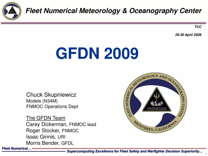
Fleet Numerical Meteorology & Oceanography CenterTCC29-30 April 2009 GFDN 2009 Chuck Skupniewicz Models (N34M) FNMOC Operations Dept The GFDN Team Carey Dickerman, FNMOC lead Roger Stocker, FNMOC Isaac Ginnis, URI Morris Bender, GFDL Fleet Numerical… Supercomputing Excellence for Fleet Safety and Warfighter Decision Superiority…
Ocean response to hurricane forcing: 1. Vertical mixing/entrainment A T M O S P H E R E Wind stress → surface layer currents Current shear → turbulence Turbulent mixing → entrainment of cooler water O C E A N Warm sea surface temperature Sea surface temperature decreases Cool subsurface temperature Subsurface temperature increases This is a 1-D (vertical) process from Ginnis et al., “Developing Coupled Tropical Cyclone-Wave-Ocean Models for Transition to Operations”, 63th Interdepartmental Hurricane Conference, St. Petersburg, FL, 2009.
Ocean response to hurricane forcing: 2. Upwelling A T M O S P H E R E Cyclonic wind stress → divergent surface currents Divergent currents → upwelling Cyclonic hurricane vortex Upwelling → cooler water brought to surface O C E A N Warm sea surface temperature Cool subsurface temperature This is a 3-D process from Ginnis et al., “Developing Coupled Tropical Cyclone-Wave-Ocean Models for Transition to Operations”, 63th Interdepartmental Hurricane Conference, St. Petersburg, FL, 2009.
SST cooling within hurricane inner-core in 3D and 1D ocean models Hurricanes have historically translated in the Gulf of Mexico: < 5 m s-1 73% and < 2 m s-1 16% of the time in the western tropical North Atlantic at < 5 m s-1 62% and < 2 m s-1 12% of the time from Ginnis et al., “Developing Coupled Tropical Cyclone-Wave-Ocean Models for Transition to Operations”, 63th Interdepartmental Hurricane Conference, St. Petersburg, FL, 2009.
Typhoon Cimaron: November 2nd , 0000 UTC, 2006 Demonstrates Importance of Upwelling for Slow Moving Storm 1-D Coupling 3-D Coupling HOUR 0 HOUR 0 1-D Coupling 3-D Coupling HOUR 120 HOUR 120
Significantly Improved Prediction of Track and Intensity( Typhoon Cimaron: November 2nd , 0000 UTC, 2006) MAXIMUM WINDS 3-D Coupling CENTRAL PRESSURE 1 3-D OCEAN COUPLING 2 2006 OPERATIONAL GFDN 3 1-D OCEAN COUPLING 3-D Coupling
GFDN Forecast Performance: Intensity Forecast Validation against “Old” Northern Indian Ocean - io012008 North Atlantic - al022008 North Eastern Pacific - ep022008, ep052008 Southern Hemisphere - sh232008, sh262008, sh282008 Northwestern Pacific - wp042005, wp212005, wp042006, wp112006, wp212006, wp222006, wp052007, wp072007, wp072008
GFDN Forecast Performance: Statistical Typhoon Intensity Prediction Scheme (ST5D) Validation Northern Indian Ocean - io012008 North Atlantic - al022008 North Eastern Pacific - ep022008, ep052008 Southern Hemisphere - sh232008, sh262008, sh282008 Northwestern Pacific - wp042005, wp212005, wp042006, wp112006, wp212006, wp222006, wp052007, wp072007, wp072008
GFDN Forecast Performance: Tracks TRACK ERROR (NM) Northern Indian Ocean - io012008 North Atlantic - al022008 North Eastern Pacific - ep022008, ep052008 Southern Hemisphere - sh232008, sh262008, sh282008 Northwestern Pacific - wp042005, wp212005, wp042006, wp112006, wp212006, wp222006, wp052007, wp072007, wp072008
IMPROVED TRACK AND INTENSITY SKILL AT ALL TIME LEVELS FOR SELECTED WPAC CASES (2005-2007) AVERAGE TRACK SKILL AVERAGE INTENSITY SKILL from Bender et al., “Upgrades to the GFDN model for 2009 and Beyond”, 63th Interdepartmental Hurricane Conference, St. Petersburg, FL, 2009.
GFDN STATUS - TODAY • Operational on A2 since Oct 2008. • Atlantic: 3-D Princeton Ocean Model (POM) forecast with GDEM ocean climatology initialization. NOGAPS (NCODA low resolution) SST analysis. • Pacific: 1-D POM with 3-D NCODA analysis initialization. NCODA high resolution SST analysis.
GFDN STATUS – June 2009 • Adding Asymmetry Factor. DONE. Operational in January. • Adding altimetry data assimilation for Atlantic to define Gulf of Mexico Loop Current. DONE Operational in April. • With University of Rhode Island, adding POM-3D in the Pacific. Delivery in March. Operational in May.
OVERALL REDUCED INTENSITY ERRORS WITH 3-D COUPLING COMPARED TO 1-D 1-D GFDN 1-D GFDN 3-D GFDN 3-D GFDN from Bender et al., “Upgrades to the GFDN model for 2009 and Beyond”, 63th Interdepartmental Hurricane Conference, St. Petersburg, FL, 2009.
REDUCED TRACK ERRORS IN DAYS 4 AND 5WITH 3-D COUPLING OLD GFDN from Bender et al., “Upgrades to the GFDN model for 2009 and Beyond”, 63th Interdepartmental Hurricane Conference, St. Petersburg, FL, 2009.
ISSUES • Joint JTWC / FNOC review of SOPs (in progress) • Need an independent review of GFDN upgrades by JTWC. • Need to watch GFDL vs GFDN (GFS vs NOGAPS) • NOAA has stopped funding for GFDL. FNMOC relies on GFDL/URI developers for maintenance.
2008 Northern Hemisphere Homogeneous TC Forecast Error (nm) 01 August 2008 – 17 September 2008 150 116 86 68 50 Number of Forecasts
GFDN DONE BACKUP SLIDES FOLLOW
Atmospheric Boundary Layer Heat & Humidity Flux Momentum & KE Flux Turbulence Sea Spray Wave induced stress Reynolds stress Airflow separation Intermittency Air-Sea Interface Nonbreaking Waves Breaking Waves Stokes drift Momentum & KE Flux Bubbles Intermittency of Momentum & KE injection MORE PHYSICS TO COME (Langmuir) Turbulence Ocean Boundary Layer from Ginnis et al., “Developing Coupled Tropical Cyclone-Wave-Ocean Models for Transition to Operations”, 63th Interdepartmental Hurricane Conference, St. Petersburg, FL, 2009.
2008 Atlantic Non-Homogeneous TC Forecast Error (nm) • Interpolated Model Guidance • AVNI – Global Forecast System (GFS) run at NCEP • GFDI – GFDL model run at NCEP • HWFI – Hurricane WRF run at NCEP • NGPI – Navy global model (NOGAPS) run at FNMOC • GFNI – GFDL model run at FNMOC • EGRI –UK Met Office global model • EMXI – ECMWF global model • TVCN – Consensus of above models (at least two) • AEMI – NCEP GFS ensemble mean 251 160 314 204 131 Number of Forecasts from Goerss, J., “Ensemble, Corrected Consensus, and Weighted Consensus TC Track Forecasts”,63th Interdepartmental Hurricane Conference, St. Petersburg, FL, 2009.
2008 Eastern North Pacific Non-Homogeneous TC Forecast Error (nm) 238 178 130 90 57 Number of Forecasts from Goerss, J., “Ensemble, Corrected Consensus, and Weighted Consensus TC Track Forecasts”,63th Interdepartmental Hurricane Conference, St. Petersburg, FL, 2009.
NCEP COMPARISON: Apples to Oranges The following is from storm AL172008, which was an early November 2008 TC. It's the one AL storm with some history that was forecast by the OPAL OPS GFDN. FORECAST VERIFICATION RESULTS AVERAGE TRACK ERRORS (NM) FOR HOMOGENEOUS SAMPLE • 00 12 24 36 48 72 96 120 • GFDN 6.4 34.0 63.1 96.2 119.1 167.1 147.1 0.0 • GFDL 6.0 43.8 63.5 74.4 82.5 111.6 262.5 0.0 • #CASES 14 14 12 10 8 4 1 0 • AVERAGE INTENSITY ERRORS (KT) FOR HOMOGENEOUS SAMPLE • 00 12 24 36 48 72 96 120 • GFDN 12.7 18.8 25.6 33.5 37.9 16.0 27.0 0.0 • GFDL 9.2 20.6 18.3 14.8 14.4 26.0 39.0 0.0 • NCHG 0.0 24.6 43.3 51.5 53.1 40.0 5.0 0.0 • #CASES 14 14 12 10 8 4 1 0
2008 Western PacificHomogeneous TC Forecast Error (nm) (UKMet)
JTWC TRACK ERRORS (WESTPAC - 96-120 Hours) • 96 Hr 120 Hr • 2004 206 275 • 2005 212 263 • 2006 216 309 • 187 214 • 301 447 • Goal 200 250 from Falvey et al., JTWC 2008 Report, 63th Interdepartmental Hurricane Conference, St. Petersburg, FL, 2009.
JTWC TRACK ERRORS (WESTPAC - 96-120 Hours) • 96 Hr 120 Hr • 2004 206 275 • 2005 212 263 • 2006 216 309 • 187 214 • 301 447 • Goal 200 250 from Falvey et al., JTWC 2008 Report, 63th Interdepartmental Hurricane Conference, St. Petersburg, FL, 2009.
JTWC INTENSITY ERRORS(WESTPAC 24 - 120 Hours) • 24 Hr 48 Hr 72 Hr 96Hr 120Hr • 2004 11 17 21 23 26 • 2005 12 18 24 25 25 • 2006 13 17 20 22 24 • 13 18 20 24 26 • 12 19 21 22 28 from Falvey et al., JTWC 2008 Report, 63th Interdepartmental Hurricane Conference, St. Petersburg, FL, 2009.