Download
1 / 22
220 likes | 359 Views
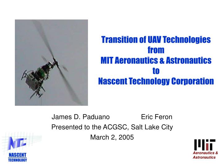
Aeronautics & Astronautics. NASCENT TECHNOLOGY. Transition of UAV Technologies from MIT Aeronautics & Astronautics to Nascent Technology Corporation. James D. Paduano Eric Feron Presented to the ACGSC, Salt Lake City March 2, 2005. MOTIVATION – MIT UAV TECH OPPORTUNITIES.

E N D
Aeronautics & Astronautics NASCENT TECHNOLOGY Transition of UAV Technologiesfrom MIT Aeronautics & Astronauticsto Nascent Technology Corporation James D. Paduano Eric Feron Presented to the ACGSC, Salt Lake City March 2, 2005
MOTIVATION – MIT UAV TECH OPPORTUNITIES Aeronautics & Astronautics • MIT HAS CONTRIBUTED TO SEVERAL PROGRAMS ON UAV COORDINATION AND CONTROL • Software Enabled Control (DARPA) • Autonomous Integrated Network of Systems (AINS – ONR) • Mixed-Initiative Control of Autonomous Teams (MICA – DARPA) • Precision Autonomous Landing Adaptive Control Experiment (PALACE – US Army, NASA Ames) • Faculty participating: John Deyst (Draper collaborations) Eric Feron (LIDS) Jon How (formerly Stanford) Jim Paduano (through NTC) • FLIGHT DEMONSTRATIONS USING MIT AUTONOMOUS MINIATURE HELICOPTER • Aggressive Maneuvering • MILP-Based Flight Control • Multi-Vehicle Coordination and Associated Optimization Methods • MANY SBIR/STTR OPPORTUNITIES TO COMMERCIALIZE
NASCENT TECHNOLOGY CORPORATION Aeronautics & Astronautics • NTC began commercializing MIT Technologies in 2001 • Autonomous Highly Maneuverable Miniature Helicopter • Tools for Multi-vehicle Coordination • Flight Test Services • Small, but Growing Base of SBIR, STTR and Aerospace Customers • SBIR: SOCOM, NSWC, MDA, DARPA • STTR: ONR (AINS Program) • Other: • Lockheed Martin Systems Integration – Owego • TechnoSciences, Incorporated • Oregon Graduate Institute • MIT (flight test support) • Three full-time, Three part-time employees
AHMMH-1MIT Designed, NTC Built Flight System Aeronautics & Astronautics • Seven copies built to date (MIT, LMSI, AFRL) • API created to enable interface with various ground stations (TCP/IP/CORBA, AMUST-D, MIT Multi-vehicle, NTC) • Upgraded for long range, endurance, and higher lift • Collaborative requirements definition with ETGI, other potential customers Know-how to re-create aggressive helicopters has migrated from MIT students to NTC employees
LMSI Proposed MMH/VTUAV/SonoUAV Team Demo Lockheed Martin Systems Integration - Owego • Flight Management • Supports up to 16 UAVs – Sensor workload limited • Control of UAVs Flight Mode (Route, Loiter, Direct-To-Home) • Automated Onboard Route Planning • Speed and Altitude Adjustments Route Monitor triggers automated route replanning when a UAV route is jeopardized by threats. Fuel Guardian monitors each UAV fuel usage and warns the operator of potentially dangerous low fuel situations. • Sensor Management • Controls for Sensor Pointing (Auto, Location, and Fixed Forward) • Sensor Coverage History • Video Display Window
LMSI 3-Vehicle Demonstration 17 August 2004ACR ‘Silver Fox’ and NTC AHMMH-1 as TUAV/VTUAV Surrogates Lockheed Martin Systems Integration - Owego Sensor Console Huey Avionics Testbed MMH Surrogate Dotted elements are currently under integration on base MMH program Router/Switch • Embedded Computer • Reduced Workload Command and Control • Integrated Digital Map smUAV Video FLIR Processor 802.11 smUAV Comms smUAV Radio Interoperable TCDL Mux/Demux ARC210 Radios ARC210 Radios RFA RFA TUAV Surrogate - Nascent Technology/ Cornell and ACR VTUAV Surrogate – Nascent Technology AHMMH-1 Demonstrates migration of MMH manned/unmanned airborne system architecture with VTUAV/TUAV Surrogates
Other Activities Aeronautics & Astronautics • Flight demonstration of visibility-minimization guidance algorithms (for MIT) • Vehicle performed an on-line computed path plan based on virtual urban map, reducing visibility to defined point • ONR-STTR Two-vehicle demonstration of deceptive area search • Flight test complete 20 November 2004 • Tactical Tomahawk Weapon Control System (TTWCS) operator interface • Imbedded algorithms to optimally place missiles • Help Navy to take advantage of TTWCS loiter capabilities • Optically-Enabled Flight • Laser range-finder integrated into avionics • DARPA program initiated Jan ’05 for optic-flow integration • Acquiring an automotive radar for testing and possible integration • Negotiating Marketing Agreement with ETGI • Enforcement Technology Group Inc. • Markets to Police, Special Ops, ‘Three-Letter Organizations’
Deceptive Area SearchScaled-down search area Aeronautics & Astronautics
Deceptive Area Search Aeronautics & Astronautics
Multi-vehicle Planning Interface Developed for Tactical Tomahawk… …applicable to multi-vehicle coordination under human supervisory control
Multi-vehicle Planning InterfaceDeveloped for Tactical Tomahawk, applicable to multi-vehicle coordination under human supervisory control Aeronautics & Astronautics
Multi-vehicle Planning InterfaceDeveloped for Tactical Tomahawk, applicable to multi-vehicle coordination under human supervisory control Aeronautics & Astronautics
What missions would benefit from MIT/NTC vehicles & algorithms? Aeronautics & Astronautics • Aggressive Autonomous Helicopter: Any mission requiring… … persistent observation (as opposed to fly-by) at close range … flight at low altitude in obstacle-rich environments … urban canyon sensor emplacement missions … organic support of troops advancing through urban environments • Algorithms: • Fast, cooperative navigation to a target point in threat-laden environment • Optimal coverage of multiple surveillance/target points (placement of assets) • Deceptive reconnaissance of a planned route where ambush is possible • Low Cost Flight Test: For testing sensors, multi-vehicle algorithms, etc.
EXAMPLE: SENSOR EMPLACEMENT SCENARIORef: Army Field Manual 100-5, Staff Organizations and Operations • Scenario: • Nonlinear urban battlefield: Combat or Stability and Support Operation (SASO) • Intelligence Preparation of the Battlefield (IPB) completed to identify known or • templated enemy locations • Imagery available prior to operations to identify urban grid of major/minor roads • GOAL: provide persistent recon of NAIs and key intersections to prevent enemy from ambushing ground element • Assumptions: • Multiple UAVs organic at battalion and brigade • Analysts available in unit headquarters (TOC/TAC) to assess UAV imagery real-time • Sufficient communications channels and bandwidth to enable UAVs to communicate between each other and relay data to headquarters (TOC/TAC) • UAV sensors capable of identifying enemy ambushes Recon Mission Priorities 1. Timely, persistent recon of NAIs and potential ambush sites to answer Commander’s PIR 2. Provide situation awareness of enemy activities in key locations 2. Remain stealthy
Intelligence Preparation of the Battlefield (IPB) Step 1: Define the Battlefield Environment • Identify major road network Step 2: Describe the Battlefield’s Effects • Weather analysis • Identify friendly, neutral, and insurgent supported areas Step 3: Evaluate the Threat • Develop threat model and doctrinal template Step 4: Determine Threat Courses of Action (COAs) • †Develop Named Areas of Interest (NAIs) – zones necessary to observe to determine the enemy COA; observing NAIs is the key to determining whether the enemy can and will ambush a convoy • Develop event template and event matrix – anticipated threat actions triggered by activity in NAIs ~8 miles TAA Operations Officer (S3) develops ground route OBJ
Intelligence Preparation of the Battlefield (IPB) Step 1: Define the Battlefield Environment • Identify major road network Step 2: Describe the Battlefield’s Effects • Weather analysis • Identify friendly, neutral, and insurgent supported areas Step 3: Evaluate the Threat • Develop threat model and doctrinal template Step 4: Determine Threat Courses of Action (COAs) • †Develop Named Areas of Interest (NAIs) – zones necessary to observe to determine the enemy COA; observing NAIs is the key to determining whether the enemy can and will ambush a convoy • Develop event template and event matrix – anticipated threat actions triggered by activity in NAIs TAA Intelligence Officer (S2) develops NAIs† OBJ
TAA Operations Officer (S3) develops alternate routes OBJ
Operations Officer (S3) and Intelligence Officer (S2) develop and publish Recon and Surveillance (R/S) Order tasking two UAVs (White and Red) and 50 sensor emplacements to recon NAIs and convoy route TAA OBJ Note: Ground convoy can depart at any time following the launch of the UAVs/sensors depending on the mission, threat and unit Tactics, Techniques and Procedures (TTPs)
Red and White UAVs begin ‘deceptive’ reconnaissance of planned and alternate routes Sensors are placed in NAIs, either launched from TAA or from UAVs TAA OBJ
Red and White UAVs begin ‘deceptive’ reconnaissanceof planned and alternate routes Sensors are placed in NAIs, either launched from TAA or from UAVs TAA OBJ White UAV remains within comm range of sensors Red UAV forges ahead, relays comms from forward sensors through white UAV
Aeronautics & Astronautics
Spiral 2 Laboratory Configuration Lockheed Martin Systems Integration - Owego Joystick Takeoff/ Landing Simulated UAVs TUAV2 Silver Fox Autopilot and Closed Loop Simulator Real TUAVs TUAV1 VTUAV Surrogate Autopilot and Closed Loop SImulator Visualization Autopilot GPS IMU AUAV Aircraft Model Minimal TUAV where needed Control Station Low Level Autopilot Ground Control Station Team Management Control Station Lab Network Comm Link Rugged Console UAV Laboratory supports integration with the MMH avionics system labs Net-Centric Testbed Forward Platform Relay Platform Ship Platform