Large-scale Satellite Image Browsing using Automatic Semantic Categorization and Content-based Retrieval
320 likes | 661 Views
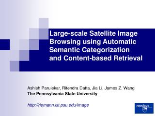
Large-scale Satellite Image Browsing using Automatic Semantic Categorization and Content-based Retrieval. Ashish Parulekar, Ritendra Datta, Jia Li, James Z. Wang The Pennsylvania State University http://riemann.ist.psu.edu/image. Outline. The Problem The Data Related Work Our Approach

Large-scale Satellite Image Browsing using Automatic Semantic Categorization and Content-based Retrieval
E N D
Presentation Transcript
Large-scale Satellite Image Browsing using Automatic Semantic Categorizationand Content-based Retrieval Ashish Parulekar, Ritendra Datta, Jia Li, James Z. Wang The Pennsylvania State University http://riemann.ist.psu.edu/image
Outline • The Problem • The Data • Related Work • Our Approach • Results • Conclusion
Problem: How to effectively query on a very large collection of satellite imagery for semantically meaningful regions ? Use semantic categorization combined with CBIR on small “patches” of the images
Query Formulation Query “patch” – pertaining to some semantics, e.g. mountains Satellite Image Database Ranked Results • Purpose ? • Geography - Find mountainous regions with snow-caps (low-level semantics). • Forestry – Find forests of a certain density, analyze deforestation (mid-level semantics). • Military – Find air-bases in certain regions of the world (high-level semantics).
Outline • The Problem • The Data • Related Work • Our Approach • Results • Conclusion
The Data • Freely available multi-spectral imagery – • Satellite: Landsat 7 • Sensor: Enhanced Thematic Mapper Plus (ETM+) • WWW: http://glcf.umiacs.umd.edu/data/landsat/ • Resolution: ~ 30 Meters. • Seven Bands (R, G, B, NIR, SWIR1, SWIR2, TIR) • Size (approximate) • 6000 x 6600 pixels • 180 Km x 196 Km • ~ 64MB ( TIFF format, each band) Visual NIR SWIR
Outline • The Problem • The Data • Related Work • Our Approach • Results • Conclusion
Classifiers • Rigid Classifiers • Neural networks • P. D. Heerman and N. Khazenie • H. Bischof and W. Schneider • Decision trees • A. S. Kumar and K. L. Majumder • Genetic algorithms • B. C. K. Tso and P. M. Mather • Markov Random Fields • A. H. S. Solberg et al. • Soft classifiers • Fuzzy Logic • G. M. Foody • L. Bastin • Decision Fusion • J. A. Benediktsson and I. Kanellopoulos • L. Jimenez et al.
Improving Performance with Features/Data • Texture to improve performance • R. M. Haralick et al. • M. F. Augusteijn et al. • B.S. Manjunath et al. • Structure to improve performance • P. Gong and P. J. Howarth • Multi-source data • L. Bruzzone et al. • E. Binaghi et al. Browsing and Querying Archives • Content-based Image Retrieval • W. Y. Ma and B. S. Manjunath • C.-S. Li and V. Castelli • S. Newsam et al. • Information Mining • M. Datcu and K. Seidel • H. Daschiel and M. Datcu
Limitations of Current Approaches • Difficulty in defining classes • Continuum of variety • Subjectivity • No major improvement in classification accuracy • G. G. Wilkinson, “Results and Implications of a Study of Fifteen Years of Satellite Image Classification Experiments,” IEEE Trans. On Geoscience and Remote Sensing, 2005. • Recognition of higher-order semantics • More focus on spectral than spatial dimensions • Scalability of complex querying and browsing • Flexibility to handle diverse applications
Outline • The Problem • The Data • Related Work • Our Approach • Results • Conclusion
Summary of Our Approach • Practical implementation on large-scale archives • Flexibility to adapt to various applications of satellite imagery, e.g., Geography, Military, Metallurgy, Agriculture etc. • Exploiting spectral and spatial information using a generative model for semantic categorization (supervised learning) • Handling of untrained classes (supervised learning) • Using a scalable CBIR system for efficient querying and browsing (unsupervised)
Training and Querying Patches • Patches • 128 x 128 pixels – NIR Bands (why ?) • 40 samples per semantic category • Military/ Geography Application – 4 classes/categories • Difficulties • Ambiguity • Untrained Classes • Normalization Mountain Crop Field Residential Urban
Overview of the System • Classification • Generative Classifier: Two-dimensional Multi-resolution Hidden Markov Models (2-D MHMM) • Handling untrained classes • Discriminative Classifier: Support Vector Machines • Querying for fast retrieval • Integrated Region Matching (IRM) measure used in SIMPLIcity system Query patch Database search using IRM 40 x K training patches K trained 2D-MHMMs Patch Class K Likelihood scores Random samples from trained and untrained classes Trained biased SVM Query Results
Details of the Architecture • Efficient database design • Pre-computation of classes using 2D-MHMM for faster response • Suitable user interface and visualization (Common CBIR issue)
2-D MHMM • Extends the HMM to 2-D and over multiple resolutions by a Markov chain • J. Li et al., “Multiresolution Image Classification by Hierarchical Modeling with Two-Dimensional Hidden Markov Models,” IEEE Trans. on Information Theory, 2000. • Reflects inter-scale and intra-scale dependence • States: hierarchical Markov mesh, unobservable • Features: Color (LUV space) and texture (Daubechies wavelet) on 4x4 blocks • Builds models of semantic categories from training samples
2-D MHMM • Start from the conventional 1-D HMM • Extend to 2-D transitions • Conditional Gaussian distributed feature vectors • Then add Markovian statistical dependence across resolutions • Use EM algorithm for parameter estimation • Shown effective in modeling generic semantic categories for image annotation • J. Li and J. Z. Wang, “Automatic Linguistic Indexing of Pictures by a Statistical Modeling Approach,'' IEEE Trans. on Pattern Analysis and Machine Intelligence, 2003.
SVM • Not practical to train all concepts • May not be available or required • May not be meaningful to the given context • May be too costly • Samples not belonging to a trained classes add noise to the query results • Solution: Automatically determine untrained sample and eliminate from consideration • Train an SVM (RBF Kernel) on the likelihood scores for samples from trained and untrained concepts • Bias classification towards low false negatives
IRM • IRM defines an image-to-image distance as a weighted sum of region-to-region distances • Different names in different fields (e.g., Mallows Distance) • Weighting matrix is determined based on significance constraints and a ‘MSHP’ greedy algorithm • Successfully used in the generic content-based image retrieval system SIMPLIcity • J. Z. Wang et al., “Semantics-Sensitive Integrated Matching for Picture Libraries,” IEEE Trans. on Pattern Analysis and Machine Intelligence, 2001.
Outline • The Problem • The Data • Related Work • Our Approach • Results • Conclusion
Classification Results 2D-MHMM: SVM: Patch is from a trained class when it actually is : 96.05% Patch is from an untrainedclass when it actually is: 53.7%
Retrieval Results http://riemann.ist.psu.edu/image
Retrieval Results http://riemann.ist.psu.edu/image
Conclusions • Proposed a convenient learning-based approach for large-scale browsing and retrieval of satellite image patches • Combine semantic categorization and CBIR • 2-D MHMM and IRM complement each other to boost retrieval performance • SVM has been effectively used to deal with patches from untrained categories • Lack of Homogeneity in Data • Sun Elevation • Seasonal changes of terrain • Appropriate normalization procedure ? Other solutions ? • Optimizing size of patch • Larger size – more efficient, can capture larger semantics • Smaller size – less ambiguous patches, more accurate results • What is optimal for a given Application ? Formal procedure to determine this ?
Acknowledgement • This work was supported by the U.S. National Science Foundation • Discussions with satellite image analyst Bradley Farster at the Penn State Applied Research Laboratory were helpful