Download
1 / 14
140 likes | 298 Views
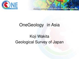
The Global Map Experience: Some Lessons for OneGeology?. One Geology Workshop Brighton, U.K., March 2007 D. R. Fraser Taylor Chair, International Steering Committee for Global Mapping &

E N D
The Global Map Experience: Some Lessons for OneGeology? One Geology Workshop Brighton, U.K., March 2007 D. R. Fraser Taylor Chair, International Steering Committee for Global Mapping & Distinguished Research Professor of International Affairs, Geography and Environmental Studies, Carleton University, Ottawa, Canada fraser_taylor@carleton.ca
What is Global Map • An initiative coordinated by the International Steering Committee for Global Mapping • 172 national mapping agencies and regional bodies worldwide are participating • 1:1 million digital map of the world with 8 data layers • Geographical Survey Institute of Japan has hosted the Secretariat since 1996
Geographical Layers 8 geographical layers Land Cover Land Use Transportation Vegetation Boundaries Elevation Drainage Population Centers
Global Map Background • The United Nations Conference on Environment and Development (Rio de Janeiro, 1992) recognized the need to coordinate environmental data and spatial information for useful decision making to address global environmental challenges and support sustainable development. • The Global Map concept resulted, through the Ministry of Land, Infrastructure, and Transport of Japan in 1992 as an integral and formally recognized part of the U.N. Agenda 21 Action Program with the objective being to produce Global Map in cooperation with National Mapping Organizations (NMOs) of the world to address environmental issues.
Global Map Formation • The International Steering Committee for Global Mapping (ISCGM) was established in February 1996 to implement the Global Mapping Project. • There are Currently 20 members, 2 advisors, and 11 representatives of liaison organizations including international organizations and academic institutions in surveying and mapping disciplines. • The current Chair of ISCGM is D.R.F. Taylor, Carleton University, Canada. • The Geographical Survey Institute of Japan (GSI) provides and supports a secretariat for ISCGM.
Global Map Formation • Steering Committee members include the heads of NMOs from Australia, Bangladesh, Canada, China, France India, Iran, Japan, Kenya, the Republic of Korea, Malaysia, Mexico, New Zealand, Niger, South Africa, the United Kingdom, U.S.A. • Other representatives are the Scientific Committee on Antarctic Research (SCAR) and EuroGeographics. • The Global Mapping Project relies on voluntary international collaboration and and participation from all NMOs of the world.
Progress of Global Mapping Project Asia Japan (2000) Lao PDR (2000) Nepal (2000) Sri Lanka (2000) Thailand (2000) Bangladesh(2001) Mongolia (2001) Philippines (2001) Kazakhstan (2003) Kyrgyz (2003) Myanmar (2003) Iran (2005) Europe Macedonia (2006) Latvia (2006) Most raster data of current Global Map are compiled from GTOPO30 and GLCC, contribution of United States of America. (As of 2006.12.13) Latin America Colombia (2001) Panama (2002) Mexico (2003) Argentina (2006) 63%of the global land area coverage Middle East Jordan (2006) Oceania Australia (2001) Samoa (2004) Africa Kenya (2002) Burkina Faso (2003) Botswana (2003) Swaziland (2004) The map is for the purpose of reference and the boundaries are not authorized by any organizations. Others Tristan da Cunha (2006) Antarctica (2006)
Global Map Implementation • Data for 27 countries and regions already released data released (including Antarctica) • Data for over 40 other countries awaiting verification • Target completion data: December 2007
Some Lessons • Learn from the experience and mistakes of previous international efforts such as the International Map of the World • The importance of process as opposed to product - a “bottom up’ approach with “top down” support of the national mapping agencies • The importance of national control of data and the possibility of “value added” to meet other national needs, e.g. Kenya, Brazil
Some Lessons (continued) • The importance of a well-funded secretariat over a sustained period of time. • Patient and careful preparation and wide consultation before launching • A clear focus and purpose with firm targets and a demonstration of use and utility of Global Map • Capacity building and national pride (JICA, GSI Japan, ESRI; Intergraph • The importance of partnerships but a clear distinction between members and partners
Some Lessons (continued) • UN endorsement and support. Constant and sustained efforts to ensure Global Map appears in both the political declarations and the Action Plans of relevant UN summits • Active participation in related international efforts e.g. GEOSS
Problems and Challenges • Ensuring effective participation • Updating specifications in a rapidly evolving field • Interoperability and regional datasets (PCGIAP, PCIDEA, EuroGlobal Map, Global Map of the Americas, CODI-ECA)
New Developments • Cooperation with new World Bank initiative on disaster mitigation and management • Joint Board of the Geospatial Information Societies (FIG, ISPRS, ICA, IAG, IAMT, GSDIA, ISCGM, IHO) and cooperation on capacity building • Cooperation with OneGeology. What form should this take?
ISCGM Web Site: http://www.iscgm.org/ • Global Map data for 27 countries / regions • Global Map Specifications • Global Map News Letter (Quarterly) • And more…