Wireless Emergency Alerts
This document provides an overview of the National Weather Service (NWS) Wireless Emergency Alerts (WEA), including activation statistics, real-life examples where WEA has saved lives, and ways to improve the effectiveness of this alert system. It discusses specific instances of tornado warnings that resulted in timely evacuations, highlights the need for better technology to reduce alert fatigue, and outlines communication strategies to increase public awareness of WEA warnings. The document also emphasizes the importance of consistent messaging across devices and services.

Wireless Emergency Alerts
E N D
Presentation Transcript
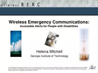
Wireless Emergency Alerts Michael Gerber NOAA/National Weather Service Silver Spring, MD NWS Partners Meeting August 5, 2013
Overview • NWS WEA activation • Statistics and feedback • Examples of lives saved • Opportunities to improve • Getting the word out
WEA Messages Originated by NWS Legend tzT = timezone ddd= three letter abbreviation for day of the week
NWS Warnings Activating WEA(Approximate) Severe Weather Season
WEA Credited with Saving Lives • WEA messages received within seconds of warning issuance • Elmira, NY (July 26, 2012) – 10 mile tornado. 2000 structures damaged. No major injuries. • Adairsville, Georgia (Jan 29, 2013) –Vehicles stopped on I-75. Watched tornado cross highway. • Jefferson Co, MS (Feb 21, 2013)– Woman looked outside and saw tornado backlit by lightning. Family got in the bathtub. Tornado heavily damaged bedroom where they would’ve been sleeping. • Yell and Pope County, Arkansas (Apr 10, 2013) – “I would have drove right into it. I was able to stop and keep others at the store from driving into it with the info from the alert. Despite limited cell service, I received cell alerts and was able to take cover in Jessieville and avoid driving into the brunt of the storm.” – Red Cross Emergency Manager • East Windsor, CT (July 1, 2013) – Up to 34 lives saved (29 children). Tornado WEA prompted soccer dome manager to evacuate everyone. Seconds later, dome thrown high above highway. Warning: Extreme language in this video
Opportunities for Improvement Hone in on optimal WEA activation to minimize alert fatigue/opt-outs • Current NWS activation by event type, but exploring options which allow flexibility with flash floods, blizzards, ice storms, dust storms, etc. • Consistency- Android users can opt-out of severe and still get extreme WEA, but not iPhone NWS to participate in new FCC Federal/industry working group on WEA Better convey actual warning area to WEA for NWS zone based warnings • WEA targeting counties (FIPS), since WEA only understands FIPS, polygons, and circles • Polygons would be optimal Derechoservice assessment recommends activation for extreme thunderstorms Android iPhone
Getting the Word Out • Set realistic expectations – WEA Is a bell ringer, not a replacement for traditional warning systems • Create one-page web/social media/handout preparemetrokc.org/WirelessEmergencyAlertFlier.pdf • New Ready/FEMA /Ad Council PSAs • :30 Spot: http://www.youtube.com/watch?v=K9U_iOYx3aM • :15 Spot: http://www.youtube.com/watch?v=y-btLGsjQYc • Spanish Version: http://www.youtube.com/watch?v=iltPObaagWk • CTIA links to WEA information for each major carrier at ctia.org/wea • NWS FAQ at weather.gov/wirelessalerts • Contact your wireless carrier for more information
WEA PSAs Launched May 2013 FCC allows broadcast or transmission of a simulated WEA in PSAs developed by FEMA. http://transition.fcc.gov/Daily_Releases/Daily_Business/2013/db0531/DA-13-1301A1.pdf 15 second spot 30 second spot Spanish 30 second
Common Alerting Protocol (CAP) Drives WEA XML-based industry standard = low cost of entry for commercial developers <event>Flash Flood Warning</event> <urgency>Immediate</urgency> <severity>Severe</severity> <certainty>Likely</certainty> <effective>2010-06-03T14:00:00-05:00</effective><expires>2010-06-03T17:00:00-05:00</expires> <senderName>NWS Memphis (Western Tennessee, Eastern Arkansas and Northern Mississippi)</senderName> <headline>Flash Flood Warning issued June 03 at 2:00PM CDT valid until June 03 at 5:00PM CDT by NWS Memphis</headline> <description>DOPPLER RADAR ESTIMATES 1 TO 3 INCHES OF RAINFALL HAS OCCURRED OVER THE PAST HOUR…</description> <instruction>MOST FLOOD DEATHS OCCUR IN AUTOMOBILES. NEVER DRIVE YOUR VEHICLE INTO AREAS WHERE THE WATER COVERS THE ROADWAY…TURN AROUND...DONT DROWN</instruction> <polygon>36.20,-88.93 36.18,-88.91 36.05,-88.84 35.99,-89.17 35.99,-89.19 35.98,-89.21 35.94,-89.30 36.17,-89.31 36.21,-89.04 36.20,-88.96 36.22,-88.95 36.20,-88.93</polygon> <valueName>CMAMtext</valueName> <value>Flash Flood Warning this area til5:00 PM CDT. Avoid flood areas. Check local media. -NWS</value> Alert information at its most granular levels GIS Friendly
CAP Production Now Hazard Services (future) CAP WMO CAP WGUS55 KABQ 010055 FFWABQ NMC041-010300- /O.NEW.KABQ.FF.W.0058.130801T0055Z-130801T0300Z/ /00000.0.ER.000000T0000Z.000000T0000Z.000000T0000Z.OO/ BULLETIN - EAS ACTIVATION REQUESTED FLASH FLOOD WARNING NATIONAL WEATHER SERVICE ALBUQUERQUE NM 655 PM MDT WED JUL 31 2013 THE NATIONAL WEATHER SERVICE IN ALBUQUERQUE HAS ISSUED A * FLASH FLOOD WARNING FOR... SOUTHEASTERN ROOSEVELT COUNTY IN EAST CENTRAL NEW MEXICO * UNTIL 900 PM MDT * AT 653 PM MDT...NATIONAL WEATHER SERVICE DOPPLER RADAR INDICATED VERY HEAVY RAIN FROM A THUNDERSTORM 7 MILES WEST OF LINGO...OR ABOUT 30 MILES SOUTH OF PORTALES. THE STORM PRODUCING VERY HEAVY RAIN WAS NEARLY STATIONARY. 2 TO 3 INCHES OF RAIN HAS ALREADY FALLEN WITH THIS STORM. FLASH FLOODING IS LIKELY ALONG COUNTY ROAD 33 WEST OF LINGO AS WELL AS STATE HIGHWAY 114. PRECAUTIONARY/PREPAREDNESS ACTIONS... DO NOT DRIVE INTO AREAS WHERE WATER COVERS THE ROADWAY. MANY FLASH FLOOD DEATHS OCCUR IN AUTOMOBILES. && LAT...LON 3358 10306 3357 10351 3366 10351 3365 10358 3371 10361 3394 10305 3359 10305 <alert xmlns="urn:oasis:names:tc:emergency:cap:1.2"> <identifier>NWS-130404-484497-358210</identifier> <sender>w-nws.webmaster@noaa.gov</sender> <sent>2013-07-31T18:55:42-06:00</sent> <status>Actual</status> <msgType>Alert</msgType> <scope>Public</scope> <code>IPAWSv1.0</code> <info> <category>Met</category> <event>Flash Flood Warning</event> <responseType>Avoid</responseType> <urgency>Immediate</urgency> <severity>Severe</severity> <certainty>Likely</certainty> <eventCode> <valueName>SAME</valueName> <value>FFW</value> </eventCode> <effective>2013-07-31T18:55:42-06:00</effective> <onset>2013-07-31T18:55:00-06:00</onset> <expires>2013-07-31T21:00:00-06:00</expires> <senderName>NWS Albuquerque NM</senderName> <headline>Flash Flood Warning issued July 31 at 6:55PM MDT expiring July 31 at 9:00PM MDT by NWS Albuquerque NM</headline> <description>THE NATIONAL WEATHER SERVICE IN ALBUQUERQUE HAS ISSUED A * FLASH FLOOD WARNING FOR... SOUTHEASTERN ROOSEVELT COUNTY IN EAST CENTRAL NEW MEXICO <alert xmlns="urn:oasis:names:tc:emergency:cap:1.2"> <identifier>NWS-130404-484497-358210</identifier> <sender>w-nws.webmaster@noaa.gov</sender> <sent>2013-07-31T18:55:42-06:00</sent> <status>Actual</status> <msgType>Alert</msgType> <scope>Public</scope> <code>IPAWSv1.0</code> <info> <category>Met</category> <event>Flash Flood Warning</event> <responseType>Avoid</responseType> <urgency>Immediate</urgency> <severity>Severe</severity> <certainty>Likely</certainty> <eventCode> <valueName>SAME</valueName> <value>FFW</value> </eventCode> <effective>2013-07-31T18:55:42-06:00</effective> <onset>2013-07-31T18:55:00-06:00</onset> <expires>2013-07-31T21:00:00-06:00</expires> <senderName>NWS Albuquerque NM</senderName> <headline>Flash Flood Warning issued July 31 at 6:55PM MDT expiring July 31 at 9:00PM MDT by NWS Albuquerque NM</headline> <description>THE NATIONAL WEATHER SERVICE IN ALBUQUERQUE HAS ISSUED A * FLASH FLOOD WARNING FOR... SOUTHEASTERN ROOSEVELT COUNTY IN EAST CENTRAL NEW MEXICO Convert
WEA is a bell ringer and doesn’t replace other alerting systems • While WEA is new, early results are promising as lives saved • Occasional hiccups and opportunities to improve, service evolving • “Big Four” carriers performing better than required by the FCC regulations by geotargeting WEA broadcasts at the sub-county level • More work needed by all partners to get the word out about WEA