I.B Soil Conservation Systems
I.B Soil Conservation Systems. Rabi H. Mohtar Professor, Environmental and Natural Resources Engineering Executive Director, Strategic Projects, Research & Development Qatar Foundation mohtar@purdue.edu or rmohtar@qf.org.qa July 2013. Materials To Be Covered .

I.B Soil Conservation Systems
E N D
Presentation Transcript
I.B Soil Conservation Systems Rabi H. Mohtar Professor, Environmental and Natural Resources Engineering Executive Director, Strategic Projects, Research & Development Qatar Foundation mohtar@purdue.edu or rmohtar@qf.org.qa July 2013
Materials To Be Covered • Principles of Soil Physics • Sediment Transport • Erosion Control • Soil Mechanics • Slope Stabilization This review will provide you with an overall understanding and not necessarily makes you an expert! I.B Mohtar
Sources • Environmental Soil Physics; Hillel; 1998 Hillel (1998) • Essentials of Soil Mechanics & Foundations, 7th ed.; McCarthy; 2007; McCarthy (2007) • Soil and Water Conservation Engineering • 4th ed. Schwab, Fangmeier, Elliott, Frevert: Schwab et al (1993) • 5th ed. Fangmeier, Elliott, Workman, Huffman, Schwab: Fangmeier et al (2006) • Design Hydrology & Sedimentology for Small Catchments; Haan, Barfield, Hayes: Haan et al (1994) • USLE/RUSLE: USDA Agricultural Handbook No. 537 (1978) • Cuenca, R. H. 1989. Irrigation System Design - An Engineering Approach. Prentice-Hall, Inc., Englewood Cliffs, NJ. 552 pp. Cuenca (1989). • Ward, Elliot 1995 (Environmental Hydrology, Lewis Publishers). • http://cobweb.ecn.purdue.edu/~abe325/: Mohtar soil and water resources conservation course. I.B Mohtar
Soil Physics & Mechanics • Soil classes and particle size distributions • Basics of soil water • Water Content • Water Potential • Water Flow • Soil strength & mechanics I.B Mohtar
Soil Classes & Particle Sizes Hillel (1998) page 61 I.B Mohtar
Soil Classes & Particle Sizes - 2 ISSS classification is easiest • Sand 0.02-2.0mm (20-2000μ) • Silt 0.002-0.02mm (2-20μ) • Clay <0.002mm (<2μ) I.B Mohtar
Soil Classes & Particle Sizes – 3 Soil Textural Triangle Example 1: Find the soil texture for this soil: • 50% sand, • 20% silt I.B Mohtar Hillel (1998) page 64
Soil Classes & Particle Sizes – 4 Particle size distribution Example 2 Draw in a sandy clay loam? Hillel (1998) page 65 I.B Mohtar
Pedon Soil Structure and Functionality Clay particles Primary peds Inter-ped pore space Mineral grains Primary soil mapping unit Clay pore space Primary soil mapping unit Soil type REV Horizon = Pedostructure = Primary ped = Geomorphological unit Clay plasma porosity (micro-porosity) Vertical porosity (cracks, fissures) Interpedal porosity (macro-porosity) Pedostructure, primary peds, primary particles, are functionally defined and quantitatively determined using the shrinkage and potential curve measurement + Pedostructure + Primay particles and pedological features + Primary peds and free mineral grains I.B Mohtar Mohtar (2008)
0 Soil Water Content • Mt = Ms + Mw + Ma • Vt = Vs + Vw + Va • t = total, s = solids, w = water, a = air • ρb = bulk density = Ms/Vt≈ 1.1-1.4 g/cc (why dry basis?) • ρp = particle density = Ms/Vs ≈ 2.65 g/cc • Porosity = (Vw + Va) / Vt ≈ 25-60% • ρw = water density = Mw/Vw = 1.0 g/cc I.B Mohtar
Soil Water Content – 2 • Water content wet basis: Ww = Mw / (Ms + Mw) • Water content dry basis: W = mass wetness = Mw / Ms • Volumetric water content: θ = Vw/Vt = Vw / (Vs + Vw + Va) I.B Mohtar
Calc.: Soil Water Content Soil Water Example 3. Given: • Soil with 30% water content dry basis Find? • Best guess at equivalent inches of water in the top foot of soil? I.B Mohtar
Calc.: Soil Water Content – 2 • Mw / Ms = 0.30 • Mw = Vw * ρw • ρb = Ms / Vt; Ms = Vt * ρb I.B Mohtar
Calc.: Soil Water Content – 3 • Mw / Ms = (Vw * ρw)/(Vt * ρb) = (Vw / Vt)(ρw / ρb) • θ = Vw/Vt • θ *(ρw / ρb) = 0.3; θ = (ρb / ρw) * 0.3 • θ = 0.3 *(1.3/1.0) = 0.39 • 0.39 * 1 ft * 12”/ft = 4.7” I.B Mohtar
Soil Water Potential soil characteristic curve Hillel (1998) page 157 I.B Mohtar
Soil Water Potential – 2 Cuenca (1989) page 58 I.B Mohtar
Soil Water Management Ward, Elliot 1995 (Environmental Hydrology, Lewis Publishers) I.B Mohtar
Soil Water Potential – 3 Fangmeier et al (2006) page 337 I.B Mohtar
Soil Water Potential – 4 Hillel (1998) page 162 I.B Mohtar
Calc.: Soil Water Potential Soil Water Potential Example 4. • Given: • Mercury tensiometer • SG = 13.6 • Situation as shown • Find: • Total potential at point C • Is point C above or below the current water table? Cuenca, (1989) page 64 I.B Mohtar
Calc.: Soil Water Potential - 2 • Pick datum • Add pressures • Suction • Water depth • Gravity • T = z + p + pos • z = + 80 cm • p = ? • T = -86cm • Point C is above water table. Why? I.B Mohtar
Soil Water Flow • q = A*K*H/L • K = (q*L)/(A*H) • K values A H L q Fangmeier et al (2006) page 261; Schwab et al (1993) page 359; Haan et al (1994) page 430 I.B Mohtar
Calc.: Soil Water Flow Darcy Law Application Example 5. • Given: • Need 50000 gpd through a 1-ft thick sand filter with K = 8 ft/d, and a total driving head of 3 ft • Find? • Required diameter for circular tank? I.B Mohtar
Calc.: Soil Water Flow – 2 q = A*K*H/L; A = (q*L)/(K*H) I.B Mohtar
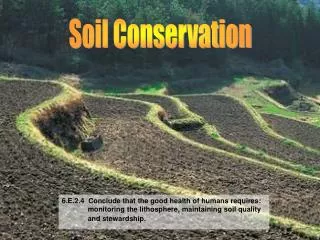
Soil Erosion and Sediment Yield • Hillslope erosion • Channel system erosion • Sediment delivery to streams • Sediment transport in streams • Slope stability I.B Mohtar
Hillslope soil erosion • Background • Detachment • Raindrop impact • By turbulent overland flow • Runoff • Transport downslope • By runoff Schwab et al (1993) pp:91-111; Fangmeier et al (2006) pp:134-156; Haan et al (1994) pp:238-285 I.B Mohtar
Hillslope Soil Erosion Background At the top of the slope • Detachment by raindrop impact • Transport by shallow sheet flow • Sheet erosion USDA-NRCS I.B Mohtar
HillslopeSoil Erosion Background - 2 • Lower on slope • Small flow concentrations • Start to cut small channels • Rills • Roughly parallel • Head straight downslope • Random formation • Flow from sheet areas between rills • Sheet and rill erosion USDA-NRCS I.B Mohtar
Hillslope Soil Erosion Background - 3 • Bottom of hillslope • Ends at concentrated flow channel • Low area in macrotopography • “ephemeral gullies” USDA-NRCS I.B Mohtar
HillslopeErosion Factors • Rainfall erosivity • Intensity • Total storm energy • Soil erodibility • Topography • Slope length • Steepness • Management • Reduce local erosion • Change runoff path • Slow and spread runoff => deposition I.B Mohtar
USLE/RUSLE • A = R * K * LS * C * P • A = average annual soil erosion (T/A/Y) • R = rainfall erosivity (long empirical units) • K = soil erodibility (long empirical units) • R * K gives units of T/A/Y • LS = topographic factor (dimensionless, 0-1) • C = cover-management (dimensionless, 0-1) • P = conservation practice (dimensionless, 0-1) I.B Mohtar
USLE/RUSLE – background • Empirical approach been in use since 1960 • >10000 plot-years of data • International use • Unit Plot basis; LS = C = P = 1 • Near worst-case management • R from good fit rainfall-erosion • K from K = A / R • C and P from studies • Sub-factors in later versions I.B Mohtar
USLE/RUSLE – approach • Lookup • Maps, tables, figures • Databases • Process-based calculations • Show changes over time • Where don’t have good data I.B Mohtar
R factor – rainfall erosivity Haan et al (1994) pp:251; Haan et al (1994) Appendix 8A; Schwab et al (1993) 99(SI); Fangmeier et al (2006) pp:143(SI); USDA (1978) pp:1-5 • Maps • R(customary SI) = 17.02 * R(customary US) S4 I.B Mohtar
K factor – soil erodibility • Soil surveys, NASIS, Haan et al (1994) 261-262; USDA 6 • Erodibilitynomograph: Haan et al (1994) 255; Schwab et al (1993) 101; Fangmeier et al (2006) pp144; USDA (1978) pp: 7 • No short-term OM I.B Mohtar
LS – Topography Factor • New tables & figures • Haan et al (1994) 264; USDA (1978) 8 • Know susceptibility to rilling • High for highly disturbed soils • Low for consolidated soils I.B Mohtar
C – cover-management factor • Part of normal management scheme • Lookup: Schwab (1993) 102; Fangmeier et al (2006) pp: 146; Haan et al (1994) 266; Hillel (1998) Appendix 8; USDA (1978) 9 • It Changes over time I.B Mohtar
C – Cover-Management Factor - 2 • Subfactor approach (RUSLE) • C = PLU * CC * SC * SR * SM; all 0-1 • PLU = prior land use • roots, buried biomass, soil consolidation • CC = canopy cover; % cover & fall height • SC = exp(-b * % cover) • b = 0.05 if rills dominant; 0.035 typical; 0.025 interrill • SR = roughness; set by tillage, reduces over time • SM = soil moisture; used only in NWRR I.B Mohtar
P – Conservation Practice Factor • Common practices • Contouring, strip cropping, terraces • Change flow patterns or cause deposition • Lookup tables • Schwab (1993) pp:103; Fangmeier et al (2006) pp:146; Haan et al (1994) pp: 281; USDA (1978) pp:10 I.B Mohtar
Calc.: USLE/RUSLE Example 9: • Given: • Materials in handout • 3-Acre construction site near Chicago • Straw mulch applied at 4 T/A • Average 20% slope, 100’ length • Loamy sand subsoil • Fill (loose soil) • Find: • Erosion rate in T/A/Y I.B Mohtar
Calc: USLE/RUSLE – 2 • R = 150 (HO.1) • K = 0.24 (HO.7) • LS = 4 (HO.8-high rilling) • C = 0.02 (HO.9) • P = 1.0 • A = R * K * LS * C * P = 2.9 T/A/Y I.B Mohtar
Calc: USLE/RUSLE – 2.1 Example 10: • Given: • Materials in handout • 16-A site near Dallas, TX • Silty clay loam subsoil • Average 50% slope, 75’ length • Cut soil • Find: • By what percentage will the erosion be reduced if we increase our straw mulch cover from 40% cover to 80% cover? I.B Mohtar
Calc: USLE/RUSLE – 2.2 • Only thing different is C • Only subfactor different is SC • SC = exp(-b * %cover) • For consolidated soil, b = 0.025 • SC1 = exp(-0.025 * 40%) = 0.368 • SC2 = exp(-0.025 * 80%) = 0.135 • Reduction = (0.368 – 0.135)/0.368 = 63% I.B Mohtar
Sediment Delivery • USLE/RUSLE for hillslopes • Erosion • Delivery • Erosion critical for soil resource conservation • Delivery critical for water quality • Movement through channel system I.B Mohtar
Sediment Delivery – 2 I.B Mohtar
Sediment Delivery – 3 • SDR (Sediment Delivery Ratio) • Hillslope erosion • Empirical fit for watershed delivery • Channel erosion/deposition modeling • Erosion • Transport • Deposition I.B Mohtar
Sediment Delivery Ratio • Haan et al (1994) pp:293-299 • SDR = SY / HE • SDR = sediment delivery ratio • SY = sediment yield at watershed exit • HE = hillslope erosion over watershed I.B Mohtar
Sediment Delivery Ratio – 2 • Area-delivery relationship Haan et al (1994) pp:294 I.B Mohtar
Sediment Delivery Ratio – 3 • Relief-length ratio • Relief = elev change along main branch • Length = length along main branch Haan et al (1994) page .294 I.B Mohtar
Sediment Delivery Ratio – 4 • Forest Service Delivery Index Method Haan et al (1994) pp:295 I.B Mohtar