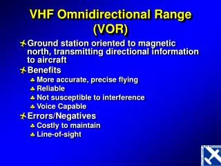
VHF Omnidirectional Range (VOR)
VHF Omnidirectional Range (VOR). Ground station oriented to magnetic north, transmitting directional information to aircraft Benefits More accurate, precise flying Reliable Not susceptible to interference Voice Capable Errors/Negatives Costly to maintain Line-of-sight. VOR.

VHF Omnidirectional Range (VOR)
E N D
Presentation Transcript
VHF Omnidirectional Range (VOR) • Ground station oriented to magnetic north, transmitting directional information to aircraft • Benefits • More accurate, precise flying • Reliable • Not susceptible to interference • Voice Capable • Errors/Negatives • Costly to maintain • Line-of-sight
VOR • Omnidirectional reference signal • Directional signal from antenna rotating @ 1800 rpm • Receiver uses phase discrimination • Navigation in polar coordinates (rho-theta) Distance Measuring Equipment (DME) & often Tacan are colocated with VOR
VOR Capabilities • VHF – 108.0-117.95mhz • Line of sight • 1 LOP at a time • 2 receivers give 2 LOPs (fix) • VOR + DME = LOP & Arc (fix) • Not sensitive to aircraft heading • Fly to or from a VOR or intercept a radial • Radial – courses oriented FROM the station
VOR Types • High • 1,000 – 14,500; 40NM • 14,500 – 18,000; 100NM • 18,000 – 45,000; 130NM • 45,000 – 60,000; 100NM • Low • 1,000 – 18,000; 40NM • Terminal • 1,000 – 12,000; 25NM * All altitudes AGL
The Principle of the VOR 360 Magnetic North 045 315 135º 270 090 135 225 180 VOR receiver gives 1 LOP called a Radial
Parts of a VOR system Receiver Course Deviation Indicator (CDI) To/From ind. Omni bearing selector
Flying the VOR • Initial Tracking • Tune, Identify, Twist • Turn OBS to center needle and figure out position (use FROM) • Note heading on top of card • If flying FROM station (radial), then turn to that heading • If flying TO station, put reciprocal heading on top and center, then turn to that heading
Flying the VOR • Wind Correction • Further away, more correction is needed to get back on track • At 60NM from station, 1° = 1NM • Generally, when within 20NM, 20-30° in direction of needle works • Once needle centers, turn back towards original heading, but add wind correction of 5°
Flying the VOR • Station Passage • CDI will become very sensitive, and then begin to oscillate • Flag will switch from TO/OFF/FROM • Switching Radials • During station passage, turn OBS to new course to fly
Flying the VOR • Intercepting • If needle is alive, then turn towards it as if you were tracking it • If full deflection, first center needle to find what radial you are on • Twist OBS back to desired course • Parallel that course • Turn 30-60 in direction of needle, depending on distance from station • Once needle is alive, turn back in direction of desired course • Follow tracking procedures
Distance Measuring Equipment (DME) • Radio signal sent out from aircraft to ground station. Ground station interprets this signal and sends back. Equipment in aircraft measures time and converts to nautical miles. • Errors • Diagonal (slant-line) distance from station to aircraft – not lateral • Becomes greater the closer you get to the station • Greatest when directly over station at high altitudes • Limited number of queries • Uses • Intersections/Fixes • IAP • Groundspeed
Types of Navigation Systems • Pilotage • Dead Reckoning • Radio Navigation • ADF • VOR/DME/RNAV • Electronic Navigation • Loran • GPS • Inertial • Celestial
Area Navigation (RNAV) • Generic name for a system that permits point-to-point flight • Onboard computer that computes a position, track, and groundspeed • VOR/DME • Loran • GPS • Inertial
LOng RAnge Navigation (LORAN) • Collection of antennas throughout the United States transmit signals • Aircraft receiver calculates position based on intersection of multiple signals
Global Positioning System (GPS) • GPS = Global Positioning System • A space based, all-weather, jam resistant, continuous operation, worldwide radio navigation system. • Provides extremely accurate 3D location data as well as velocity and time.
GPS • System of 24 satellites, 4/5 of which are in view at all times • Receiver uses 4 of these to determine position of aircraft • Each satellite transmits code, which contains satellite position and GPS time • Receiver, knowing how fast signal was sent and at what time, calculates position
GPS Glossary • RAIM – Receiver Autonomous Integrity Monitoring • Determines if satellites are providing correct data • WAAS – Wide Area Augmentation System • Collection of ground receivers take satellite data and correct it for atmospheric conditions • Works based on known position of ground stations • LAAS – Local Area Augmentation System • Same as WAAS, but on a smaller, more precise scale • For terminal area around airport
LOP – 1 Sphere R1 • Single range can lie anywhere on a sphere Courtesy of Leica Geosystems
LOP – 2 Spheres • Two ranges will intersect on a line, defined by the intersection of two spheres Courtesy of Leica Geosystems
LOP – 3 Spheres • Three spheres intersect at a point • Three ranges needed to resolve lat/long/altitude Courtesy of Leica Geosystems
Civilian Uses Marine Navigation Air Navigation Surveying Search and Rescue Collision avoidance Agriculture Military Uses Marine Navigation Air Navigation Rendezvous Close Air Support Mine Warfare Unmanned Aerial Vehicles (UAVs) GPS Uses
Inertial Navigation System • Dead-Reckoning • Self-contained source of: • Position, groundspeed, & heading • Does not even need a receiver • Cannot be jammed • Gets better with use • Applies a calibration correction after each flight
Primitive Accelerometer M No Acceleration 0 Acceleration M 0 X Acceleration from the right F = kx = ma a = kx/m
Inertial Navigation Principles • Acceleration is vectorially summed in x, y, & z. • Output is compensated movement of the platform & for curvature & rotation of the earth.
Inertial Navigation Systems • Early systems required precise mechanical parts • Bigger is more accurate • Modern systems can be: • Mechanical (platform) • Simple gyros • Accurate • Electronic (strapdown) • Few moving parts • Smaller • Cheaper
Inertial Navigation Systems • Aircraft systems use • Pendulum accelerometers or MEMS • Micro-electromechanical sensors • Ring laser gyros • To measure angular change • INS complements GPS Mechanical Ring Laser Gyro
Types of Navigation Systems • Pilotage • Dead Reckoning • Radio Navigation • ADF • VOR/DME/RNAV • Electronic Navigation • Loran • GPS • Inertial • Celestial
Advantages No power required Self contained Cannot be jammed Available everywhere Disadvantages Dusk & dawn only Clear weather only Slow for aircraft Needs the art of nav. Navigator’s skill Requires computation At least data entry Celestial Navigation
Circle of Equal Altitude DeRemer & McLean Global Navigation
Types of Errors • Error increases with distance • VOR/DME, ADF • Error increases with time • DR, Inertial • Reliability Concerns • GPS, Loran, Celestial • Human error
Which Types of Navigation are Important to a Student Pilot? • Pilotage • Dead Reckoning • Radio Navigation ADF VOR/DME/RNAV • Celestial • Electronic Navigation Loran GPS Inertial
If Something Seems Wrong, it Probably is! • Be suspicious. • Check and recheck. • If you cannot tell your passengers your ETA at the destination, you are not navigating.
What can you do if you’re lost? • Assume you’re near your DR position • Do not assume a huge wind just came up • Use your VOR/DME or 2 VORs • Look on the chart for landmarks • Especially those that are shown small • If you miss a checkpoint, hold your heading & look for the next one • Do not guess where you are! If all else fails, CALL ATC (after all, YOU are paying for it)