Download
1 / 42
430 likes | 519 Views
Municipal Planning to protect natural resources . Supported by a grant from the Wellborn Ecology Fund. Why should towns plan to address natural resources and systems?. Because your town depends upon its environment.

E N D
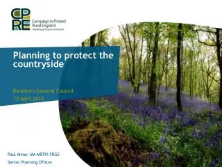
Municipal Planningto protect natural resources Supported by a grant from the Wellborn Ecology Fund
Why should towns plan to address natural resources and systems? Because your town depends upon its environment. Your citizens need clean water, healthy soil, clear air, open lands, abundant wildlife and a pleasing natural environment.
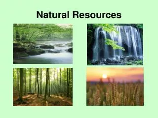
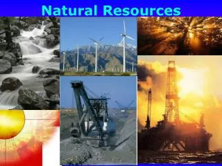
Nature’s Value Natural systems provide “green infrastructure” or “environmental services” that are often not recognized because they are “free,” at least until you lose them. Most drinking water in Vermont is not treated to make it drinkable, because Nature has already done so. Soil, rain and sunlight provide the basis for our food and wood for building and heat.
Nature’s Value Natural resources are valuable to your residents Natural resources and ecosystems are an economic engine Natural resources are part of the excellent quality of life in Vermont
Your town depends upon clean water • Groundwater - private wells and many public wells rely upon clean groundwater for drinking and for commercial activities. • Surface water – Recreational business, your citizens and wildlife rely upon clean surface water.
Wetlands are… Areas that are inundated by surface or ground water often enough that they serve as habitat for plants and animals that need saturated soil at least part of the year, allowing them to grow and reproduce. Commonly known as ponds, bogs, fens, marshes, wet meadows, shrub swamps, and wooded swamps.
Wetland Classes • A Class I wetland: • is identified on the Vermont significant wetlands inventory maps as a Class I wetland; or • has exceptional or irreplaceable contribution to Vermont's natural heritage. • A Class II wetland: • is identified on the Vermont significant wetlands inventory maps as a Class II wetland; or • merits protection, based on an evaluation of the extent to which the wetland serves the functions and values set forth in state law. • A Class III wetland is a wetland that is neither a Class I nor a Class II wetland.
Wetlands provide…. Many valuable and irreplaceable functions that benefit the public: Surface and ground water quality maintenance Flood water storage and erosion control Threatened and endangered species habitat Open space, recreation and educational opportunities Fish and wildlife habitat
Wetlands facts In Vermont, only 220,000 acres (4% of the land area in the state) have been identified as wetlands on the National Wetlands Inventory Maps. ANR estimates that an additional 80,000 acres of wetlands exist in Vermont that have yet to be identified. More than 35% of the original wetlands in Vermont have been lost. Development is now the primary cause of wetland loss. State NWI maps are being updated and it is much easier now for towns to improve the state maps through local mapping.
Riparian Buffers are: Strips of grass, shrubs and trees along the banks of rivers and streams. The single-most effective protection for our water resources in Vermont. Regulate stream flow. Stabilize stream banks and beds. Filter out sediment and pollution from runoff. Provide wildlife and aquatic habitat. Provide recreation and improve aesthetic values.
Your town depends upon clean soil • You depend upon food, and farmers and gardeners depend upon healthy, fertile and uncontaminated soil to grow that food. • Trees and other vegetation depend upon adequate soil, and wildlife depends upon the vegetation for food and shelter. • Humans depend upon healthy forests for fiber and fuel.
Forests jobs clear water stability to the landscape biological diversity scenic vistas wildlife habitats diverse recreational opportunities Vermont's forests are valuable ecologically, economically and socially. Covering 75 % of the state, forests provide:
Beneficial Forests Our clean air and water are in large part due to the filtering effects of trees above and below ground. Forests provide food, fuel and fiber. Forests create soil, cycle nutrients, sequester carbon and filter the air. Forests provide diverse habitat for plant and animal life. Forests reduce the effects of drought, floods and severe wind.
Your town depends upon wildlife • Outdoor recreation such as fishing and hunting depends upon wildlife. • Wildlife such as hornets, swallows and bats control insect pests. • Wildlife such as bees and wasps pollinate plants, including crops. • Your residents and visitors enjoy bird watching and viewing other wildlife.
Forest Habitat Contiguous forest habitat supports the biological requirements of many plants and animals; Large tracts of forest supports viable populations of wide-ranging animals by providing travel corridors for genetic exchange and allowing access to important feeding and reproductive habitat.
Forest Fragmentation Gaps in forests and barriers to wildlife movement created by roads and associated development. Disrupts natural connections between habitats that are essential for the movement, and ultimately the survival, of many species of large, wide-ranging carnivores such as black bears, bobcats, and fishers. Can lead to increased predation, invasive species, and vulnerability to natural disturbances. The smaller the habitat patch, the smaller the number of species that can occupy that habitat. Even small mammals such as mice and shrews are adverse to crossing roads or paths just a few feet wide.
Your town depends upon clean air • Citizens need clean air for their health. • Trees and plants need clean air to flourish. • Buildings need clean air to last longer. • Industry needs clean air to avoid costly regulation.
Why should towns plan to address natural resources and systems? Because Vermont’s planning statute requires and encourages it!
What planning tools can towns use to address natural resources and systems? • TOWN PLAN • 24 VSA 4381 • A comprehensive planning program to prepare, maintain and implement a plan that may be consistent with the goals in Section 4302. • OPEN SPACE PLAN • 24 VSA 4432(3) • A plan to support the Town Plan “to guide public and private conservation strategies”
Where to begin? The Town Plan The Town Plan is the tool that: communities can use to provide background information on the ecological value of wildlife and natural systems. allows communities to set policies on protection of valued natural resources which form the basis for regulatory standards in bylaws. includes inventories and maps of natural resources.
Town Plan Requirements Town Plans must address 10 different elements (24 VSA 4382) including at least the following three items: • “ a statement of objectives, policies and programs of the municipality . . . to protect the environment.” • “ a land use plan, consisting of a map and statement of present and prospective land uses, indicating those areas for forests, . . . and open spaces reserved for flood plain, wetland protection, or other conservation purposes.” • “a statement of policies on the preservation of rare and irreplaceable natural areas, scenic and historic features and resources.
Town Plan Requirements • “ a statement of objectives, policies and programs of the municipality . . . to protect the environment.” • Example: It is a policy of the town to support the active use and management of forest lands by private landowners. • Example:It is a policy of the town to protect steep slopes and ridgelines from inappropriately sited development.
Town Plan Requirements • “a land use plan, consisting of a map and statement of present and prospective land uses, indicating those areas for forests, . . . and open spaces reserved for flood plain, wetland protection, or other conservation purposes.” • A development constraints map can be used when developing the Future Land Use Map. This map can show wetlands, steep areas, good or poor septic soils, prime farmland, deeryards, Natural Heritage Areas. • The Future Land Use Map is best used to define future districts.
Town Plan Requirements • “a statement of policies on the preservation of rare and irreplaceable natural areas, scenic and historic features and resources.” • Example Wetland Policy: Structural development or intensive land uses shall not be located in significant wetlands or within buffer zones (contiguous areas with a significant wetland that serve to protect those values and functions sought to be preserved by its designation) to significant wetlands. • Example Wildlife Habitat Policy: Development other than isolated houses and camps shall be designed so as to preserve continuous areas of wildlife habitat. Fragmentation of wildlife habitat is discouraged. Effort shall be made to maintain connecting links between such areas.
Towns are encouraged to plan for natural resources. Town Plans may be consistent with the goals in 24 VSA section 4302. • “to plan development so as to maintain Vermont’s historic settlement pattern of compact village and urban centers separated by rural countryside.” • “to identify, protect and preserve important natural features of the Vermont landscape, including significant natural and fragile areas; outstanding water resources, including lakes, rivers, aquifers, shorelands and wetlands; and significant scenic roads, waterways and views.” • “to maintain and improve the quality of air, water wildlife and land resources.”
Addressing the Goals in 4302 • Proposed land use plans can create differences in development density, for example: • village/town centers • rural areas and • conservation areas. • Special studies recommended in the Plan can call for: • inventories of priority natural resources • open space planning and protection.
What is Open Space? • Land without structures in service, usually in its natural state. • May be part of the working landscape for agriculture or forestry use. • May serve place-making, aesthetic, cultural, or resource protection functions. • May have historic or recreational structures not limited by their size (although size may be an important consideration). • May allow for appropriate access to natural areas. • Permits unorganized recreation opportunities such as hiking rather than more organized recreational opportunities that use public facilities such as town maintained recreational fields. • These lands are what most residents agree make your town the great place it is today.
What does an Open Space Plan do? • Identifies resources • Informs development applicants about town policies • Ensures individual land conservation meets overall plan
Content of an Open Space Plan • Definition • Purpose • Inventory (natural, cultural, pristine, built) • History • Benefits • Themes • Areas • Goals and Strategies from Public Process • Short and long term conservation priorities
Plan Specificity Molgano decisionAct 250 town plan/zoning tests • start with town plan-> too vague • then zoning-> too vague • Ignore both JAM Golf LLC decision • regulations in South Burlington struck down due to lack of specificity • Open Space Plan can help JAM proof your bylaw/plan E-Notes – http://www.nrb.state.vt.us/lup/publications.htm#enote
Defining “rural character” Examples • Sparsely populated countryside marked by open fields and a working landscape. • Village center that is tightly clustered with minimal setbacks and a mix of uses.
Protecting “rural character” • If your goal is to preserve open space or protect critical natural habitat, then your plan needs to outline how that might be done and using what tools. • Examples: • Minimize critical wildlife habitat impacts • Numeric/certification based requirements • Five lots or more requires a natural communities study completed by an experienced ecologist
Future Land Use Areas • Include a purpose statement. • Explain the types of uses that are appropriate for maintaining the area’s purpose.
Open Space Plan Data • Habitat Block Priority and Connectivity • Town Natural Community Mapping • Scenic Road Inventory • Views/Gateway Inventory • Hikes/loops on roads • Special Places • Historic/Cultural (barn/cellar hole inventory)
How are Open Space Plans used in Development Review? • Triggered by subdivision application • Plat cross-referenced with plan inventory • If meets/overlaps forwarded to Conservation Commission • Site walk with Conservation Commission and applicant • Develops recommendations, forwards to DRB
Voluntary Natural Resource Protection Opportunities • Education • Conservation Reserve Enhancement Program (USDA) • Wildlife Habitat Improvement Program, Farm & Ranchland Protection Program (NRCS) • DEC River Management Corridor Easements • Current Use Ag. & Forest • Land Trusts (Upper Valley LT, Vermont LT), Orange County Headwaters, Taylor Valley
Resources PUBLICATIONS Chittenden County Natural Areas Planning Guide, Chittenden County RPC, September 2009. Conserving Vermont’s Natural Heritage, Vermont Fish and Wildlife Department, 2004. http://www.vtfishandwildlife.com/library/Reports_and_Documents/Conserving_Vermonts_Natural_Heritage/Cover.pdf Practical Ecology, Dan Perlman & Jeffrey Milder, 2005. Implementation Manual, http://www.vpic.info/pubs/implementation/ Woodland ,Wildland, Wetland, http://www.vtfishandwildlife.com/books.cfm?libbase_=Wetland,Woodland,Wildland Websites Native Plants - http://www.wildflower.org/collections/collection.php?collection=VT Bylaws - http://www.vtfishandwildlife.com/cwp_zoning.cfm Natural Resources Contacts HABITAT Jens Hilke, Conservation Planning Biologist Vermont Dept. of Fish and Wildlife, Barre, Vermont, (802) 476-0126 jens.hilke@state.vt.us RIPARIAN BUFFERS Mike Kline, Fluvial Geomorphologist, River Management Program Vermont DEC, Waterbury, Vermont, (802) 241-3774 mike.kline@state.vt.us WETLANDS Rebecca Chalmers, Wetlands Ecologist Vermont DEC, Barre, Vermont, (802) 476-2678 rebecca.chalmers@state.vt.us WILDLIFE Forrest Hammond, Wildlife Biologist Vermont Dept. of Fish and Wildlife, Springfield, Vermont, (802) 885-8832 forrest.hammond@state.vt.us Kim Royar, Wildlife Biologist Vermont Dept. of Fish & Wildlife, Springfield, Vermont, (802) 885-8831 kim.royar@state.vt.us NATURAL COMMUNITIES Eric Sorenson, Ecologist, Non-Game & Natural Heritage Program Vermont Dept. of Fish and Wildlife, Waterbury, Vermont, (802) 241-3714 eric.sorenson@state.vt.us
Thanks for coming ! www.trorc.org