Download
1 / 21
210 likes | 401 Views
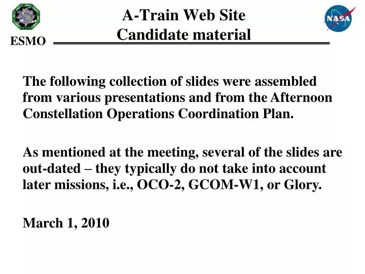
A-Train Web Site Candidate material. The following collection of slides were assembled from various presentations and from the Afternoon Constellation Operations Coordination Plan.

E N D
A-Train Web SiteCandidate material • The following collection of slides were assembled from various presentations and from the Afternoon Constellation Operations Coordination Plan. • As mentioned at the meeting, several of the slides are out-dated – they typically do not take into account later missions, i.e., OCO-2, GCOM-W1, or Glory. • March 1, 2010
A-Train Orbital Configuration(Through launch of GCOM-W1) Additional drawings are available for other time periods
Afternoon Constellation Project Scientists & Mission Operations Control Centers
Afternoon Constellation Science Opportunities Aura CALIPSO OCO Aqua Glory CloudSat PARASOL OCO - CO2 column OMI - Cloud heights OMI & HIRLDS – Aerosols MLS& TES - H2O & temp profiles MLS & HIRDLS – Cirrus clouds CALIPSO- Aerosol and cloud heights Cloudsat - cloud droplets PARASOL - aerosol and cloud polarization OCO - CO2 MODIS/ CERES IR Properties of Clouds AIRS Temperature and H2O Sounding Updates include: MLS-CloudSat coincidence plus others
1. 4 km Cloudsat 0.5 km MODIS Band 3-7 0.09 km CALIPSO Cloud 5.3 x 8.5 km TES “A-Train” Nadir Footprints 6x7 km POLDER 13.5 km AIRS IR; AMSU & HSB m wave OCO 1x1.5 km Washington DC USGS Map
30 25 20 15 10 5 0 Vertical Resolution of the “A Train” Aura Aqua CALIPSO Cloudsat OCO AMSU HSB Km AIRS TES MLS HIRDLS 0.03 1.5-2 1.5 2.3 1 2 0.5 Vertical resolution in km
A-Train Science Goals and Requirements for Coincident Observations The Afternoon Constellation enables near-coincident, co-located observations for some instruments on different constellation spacecraft.. By combining the information from several sources the scientists derive more complete answers to many questions than would be possible from any single satellite. Some of the most important science questions are listed here followed by examples of how the data from the Afternoon Constellation are used by scientists to answer these questions. • What are the major aerosol types and how do observations match global emission and transport models? Aerosol height information obtained by CALIOP (on CALIPSO) will be combined with data on aerosol size distribution and composition obtained by the Polarization and Directionality of the Earth's Reflectances (POLDER) instrument on PARASOL, MODIS (on Aqua), and APS (on Glory). CALIOP also provides additional information on aerosol shape and a qualitative classification of aerosol size; scientists plan to use profile data from CALIPSO to improve information from OMI (on Aura) on the global distribution of absorbing aerosols. The combination of APS and MODIS views of ocean glint will allow the determination of absorption by aerosols to be extended from the UV (from OMI) into the visible and near infrared. APS estimates of aerosol mixed layer depth will also allow for improved estimates of aerosol absorption by OMI. • How do aerosols contribute to the Earth Radiation Budget (ERB)/climate forcing? Data from CALIOP, POLDER, APS, MODIS and OMI will all help answer this question. Data from CERES is crucial for providing information on the ERB. Data from AIRS, HSB and AMSR-E (all on Aqua) will provide information on how aerosol climate forcing changes with atmospheric humidity. In conjunction with data from CloudSat’s Cloud Profiling Radar (CPR), these sensors offer an unprecedented opportunity to understand what role aerosols play in changing cloud properties and thus changing the ERB.
A-Train Science Goals and Requirements for Coincident Observations (concluded) • How does cloud layering affect the Earth Radiation Budget? Data obtained by CloudSat’s CPR, augmented by data from both CALIPSO’s CALIOP and Aqua’s MODIS, will provide the first global survey of vertical cloud structure. Scientists plan to use data from CALIOP and MODIS to help augment the cloud detection capabilities of the CPR. • What is the vertical distribution of cloud water/ice in cloud systems? Information from CALIOP, CPR, HSB, AMSR-E, and MLS will be combined to produce vertical profiles of cloud systems. Combining information from CPR, CALIOP, POLDER and APS is expected to shed light on the nature of mixed phase clouds (clouds composed of both water and ice) and help improve parameterizations of these processes in atmospheric models. The combination of APS and MODIS and/or AIRS will allow for a more detailed examination of the conditions under which super-cooled water clouds exist and facilitate physically based parameterizations of this phenomenon in atmospheric models. • What is the role of Polar Stratospheric Clouds in ozone loss and denitrification of the Arctic vortex? CALIOP data will provide direct information on polar stratospheric cloud height and, in some instances, on cloud type. HIRDLS will also provide some cloud height information. Combined with temperature readings, nitric acid, and chlorine oxide concentrations obtained by MLS and column ozone amounts from OMI, information will be obtained on the role of polar stratospheric clouds in Arctic chemical processes. • Source: • Afternoon Constellation Operations Coordination Plan. Derived from “Formation Flying: The Afternoon (A-Train) Satellite Constellation”, NASA Facts, FS-2003-1-053-GSFC, February 2003, and from the Afternoon Constellation MOWG Presentations, March 2003
A-Train Mission Summary Source: Afternoon Constellation Operations Coordination Plan. GCOM-W1 needs to be added
EOS Aqua Investigates the Earth's water cycle, including evaporation from the oceans, water vapor in the atmosphere, clouds, precipitation, soil moisture, sea ice, land ice, and snow cover on the land and ice. Instruments • AIRS: Atmospheric Infrared Sounder – Obtains highly accurate temperature profiles within the atmosphere • AMSU-A: Advanced Microwave Sounding Unit – Obtains temperature profiles in the upper atmosphere (especially the stratosphere) and provides a cloud-filtering capability for tropospheric temperature observations • HSB: Humidity Sounder for Brazil – 4-channel microwave sounder aimed at obtaining humidity profiles throughout the atmosphere. • AMSR-E: Advanced Microwave Scanning Radiometer for EOS – Uses a twelve-channel, six-frequency, microwave radiometer system to measures precipitation rate, cloud water, water vapor, sea surface winds, sea surface temperature, ice, snow, and soil moisture • MODIS: Moderate Resolution Imaging Spectroradiometer – Similar to Terra • CERES: Clouds and the Earth's Radiant Energy System – Similar to Terra
EOS Aura Researches the composition, chemistry, and dynamics of the Earth’s atmosphere as well as study the ozone, air quality, and climate. Instruments • HIRDLS: High Resolution Dynamics Limb Sounder – Observes global distribution of temperature and composition of the upper troposphere, stratosphere, and mesosphere • MLS: Microwave Limb Sounder – Uses microwave emission to measure stratospheric temperature and upper tropospheric constituents • OMI : Ozone Monitoring Instrument – Distinguishes between aerosol types, such as smoke, dust, and sulfates. Measure cloud pressure and coverage, which provide data to derive tropospheric ozone. • TES: Tropospheric Emission Spectrometer – High-resolution infrared-imaging Fourier transform spectrometer that offers a line-width-limited discrimination of essentially all radiatively active molecular species in the Earth's lower atmosphere.
PARASOL (Polarization and Anisotropy of Reflectances for Atmospheric Science coupled with Observations from a LIDAR) A CNES satellite that studies the role of clouds and aerosols Instrument POLDER: Improve the microphysical and radiative property characterization of clouds and aerosols for model improvement. Source: CNES
CloudSat • NASA satellite with the Cloud Profiling Radar (CPR) instrument, a 94-GHz nadir-looking radar • Measures the power backscattered by clouds as a function of distance from the radar. • Developed jointly by NASA’s Jet Propulsion Laboratory (JPL) and the Canadian Space Agency (CSA). • Will advance our understanding of cloud abundance, distribution, structure, and radiative properties. • First satellite-based millimeter-wavelength cloud radar • > 1000 times more sensitive than existing ground weather radars • Able to detect the much smaller particles of liquid water and ice (ground-based weather radars use centimeter wavelengths) Cloud Profiling Radar
CALIPSO • Joint NASA/CNES satellite • Three instruments: • Cloud-Aerosol Lidar with Orthogonal Polarization (CALIOP): Two wavelength polarization-sensitive Lidar that provides high-resolution vertical profiles of aerosols and clouds • Wide Field Camera (WFC): Fixed, nadir-viewing imager with a single spectral channel covering the 620-670 nm region • Imaging Infrared Radiometer (IIR): Nadir-viewing, non-scanning imager
Aerosol Polarimetry Sensor (APS) Total Irradiance Monitor (TIM) Cloud Camera
Afternoon Constellation Mission Operations Working Group (MOWG) Charter • Ensure the integrity and safety of the constellation through cooperative agreements and actions • Agree on the baseline Constellation orbital configuration • Provide forum for defining changes to the baseline Constellation configuration • Define the data to be exchanged and the means of doing so • Facilitate coordination of cooperative science campaigns • Review specific mission plans that might impact the other Constellation missions • Provide the forum for discussing and resolving issues between member satellites
A-Train Data Depot The primary objective of Data Depot (ATDD), is to process, archive, provide access, visualize, analyze and correlate distributed atmosphere measurements from various A-Train instruments along A-Train tracks. The Depot will enable the free movement of remotely located A-Train data so that they are combined to create a consolidated, almost synoptic, vertical view of the Earth's atmosphere. Once the infrastructure of the Depot is in place, it will be easily evolved to serve data from all A-Train data measurements: one-stop-shopping. URL:http://disc.gsfc.nasa.gov/atdd/
The A-Train Data Depot Goals • Provide a tool that allows A-Train sensor data to be provided with first order temporal and spatial correlations (coincidence) already performed for the scientist. • Be responsive to the data and service needs of the A-Train Cloud/Aerosol community • Provide services (i.e., expertise) that will facilitate the effortless access to and usage of ATDD data • Collaborate with scientists to facilitate the use of data from multiple sensors for long term atmospheric research