Download
1 / 25
260 likes | 443 Views
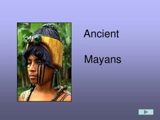
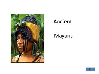
The Ancient Mayans. I. Maya Civilization (1000 BC- 1500 AD). A. Geography Located in today ’ s Mexico, at the Yucatan Peninsula. Mayan Background. Locating the Maya

E N D
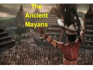
The Ancient Mayans
I. Maya Civilization (1000 BC- 1500 AD) A. Geography Located in today’s Mexico, at the Yucatan Peninsula
Mayan Background Locating the Maya The Maya civilization was one of the most dominant societies of Mesoamerica (a term used to describe Mexico and Central America before the 16th century Spanish conquest). The Mayans were centered in one geographical area covering all of the Yucatan Peninsula. This showed that the Maya remained relatively secure from invasion by other Mesoamerican peoples.
Mayan Area • The topography of the area greatly varied from volcanic mountains, which comprised the highlands in the South, to a porous limestone shelf, known as the Lowlands, in the central and northern regions. • The southern portion of the Lowlands were covered by a rain forest with an average height of about 150 feet.
Mayan Area • Scattered savannas and swamps, or bajos, appeared sporadically, interrupting the dense forests. • The northern Lowlands were also comprised of forests but they were drier than their southern counterparts, mainly growing small thorny trees. • February to May was the dry season characterized by air that was intensely hot and uncomfortable.
Southern Lowlands Covered by a rainforest about 150 ft. Contained: scattered savannas and swamps, or bajos Northern Lowlands Also comprised of forests – much drier, mainly grew small thorny trees Geography Cont. - Lowlands
OKAY, BACK TO THE Geographical TOUR! Aim: What were the Geographical Features of the Mayan Civilization?
Highlands Climate: Much cooler and drier; fertile soil Volcanic Highlands: Source of obsidian, jade, and other precious metals used to develop a trade Subject to tsunamis, volcanoes, and earthquakes Lowlands Produced crops used for their own personal consumption (ex. Maize) Played an important role in transportation route Rivers created from the 160 in. of rainfall per year were vital to civilization as a form of transportation for both people and materials. Geography Cont. – Highlands vs. Lowlands
Geography Cont. – The Rivers • Series of rivers originate in the mountains and flows towards the Pacific Ocean and Gulf of Mexico. • Serve as passageways for canoes to travel from city to city • In the Classic Period: Rivers provided water for human consumption and access to trade routes • Northern Yucatan lowlands • NO MAJOR RIVERS
Geography Cont. –The Rain Forest • Covers the majority of Mesoamerica • Provides warmth, sunlight and water producing a variety of plants • Soil: thin and poor • For survival, plants develop highly efficient root systems that absorb nutrients from dead plants • Lowlands – stretches from northwestern Honduras through the Peten region of Guatemala and into Belize and the Chiapas
Geography Cont. –The Rain Forest • Rain forests belong to the tropical wet climate group. • Almost all rain forests lie near the equator.
Geography Cont. –The Soil • Best soils found in southern highland valleys where volcanic eruptions have enriched the earth • Spring-like climate and fertile valleys have made southern highlands a popular place to settle, despite volcanic threats
Geography (end) • The geographical dispersion of the Mayan peoples across the region resulted in the evolution of numerous languages which are related but distinctive and prevent different Maya groups today from understanding each other • Because of the damp climate, the Mayans were unable to store their crops from year to year.
Mayan Agriculture • Permanent raised fields • Terracing • Forest Gardens • Managed Fallows • Shifting Cultivation • Wild Harvesting
Mayan Agriculture Cont. • Mayans use slash and burn method to clear land for farming • Main food source is from farming: Mayans plant corn (maize), cacao, maguey, bananas, squash, beans, and cotton for weaving. • Meat was rarely eaten because it is expensive and/or hard to find. • Dogs and turkeys were the main animals kept as pets and/or food.
Underground caves called cenotes (se-NO-tes) were a vital supply of water. • Mayans learned to build underground reservoirs (chultuns) to store rainwater in places where there were no natural cenotes. • Mayans used this technique on the tropical rainforests where there was not enough ground water.
POP QUIZ WITH GEI’DA!! Aim: What were the Geographical Features of the Mayan Civilization?
This was the term used to describe Mexico and Central America before the 16th century Spanish conquest?
During these months were thedry season characterized by air that was intensely hot and uncomfortable?
Because of the damp climate, the Mayans were unable to store their crops from year to year?
These three bodies of water surrounded the Ancient empire of Maya?