Download
1 / 22
230 likes | 377 Views
Explore the implementation and Level-2 products of the Sentinel-4 and Sentinel-5 missions, focusing on their benefits for Copernicus Atmosphere Services. Learn about GEOstationary and Low Earth Orbit aspects, hourly revisit times, air quality monitoring, and the synergy of UVN and FCI instruments. Gain insights into the characteristics, performance estimates, and development challenges of Sentinel-4 Level-2 products, including aerosol data, aerosol layer height, and surface reflectance retrieval.

E N D
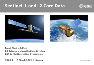
Sentinel-4 and -5Status and Level-2 Products Ben Veihelmann, JörgLangen, Dirk Schüttemeyer, Paul Ingmann ESA/ESTEC OMI Science Team Meeting 18 March 2014, KNMI, De Bilt, The Netherlands
Overview • Sentinel-4: mission implementation and Level-2 products • Sentinel-5: mission implementation and Level-2 products • AROMAT campaign: preparation of future validation
The Sentinel Missionsfor Copernicus Atmosphere Services GEOstationary (GEO) • Hourly revisit time over Europe • Mainly air quality • Diurnal cycle of tropospheric composition • Sentinel-4 Low Earth Orbit (LEO) • Daily revisit time global coverage • Climate, air quality, ozone & UV • Tropospheric & stratospheric composition • Sentinel-5 • Sentinel-5 Precursor
Sentinel-4/-5/-5P Mission Implementation (1) on MTG sounder (GEO) (2) on MTG imager (GEO) (3) on MetOp-SG (LEO) (4) on dedicated platform (LEO) (5) on SNPP/JPSS (LEO) (*) synergy on higher data level UVN = Ultraviolet + Visible + Near infrared FCI = Flexible Combined Imager IRS = InfraRedSounder LI = Lightning Imager UVNS = UVN + Short wave infrared VII = Visible/Infrared Imager (MetImage) IAS = Infrared Atmospheric Sounder (IASI-NG) 3MI = Multi-viewing, -channel, -polarisation Imager TROPOMI = TROPOspheric Monitoring Instrument VIIRS = Visible Infrared Imaging Radiometer Suite CrIS = Cross-track Infrared Sounder OMPS = Ozone Mapping Profiler Suite MTG = Meteosat Third Generation MetOp-SG = MetOp-Second Generation SNPP = Suomi National Polar-orbiting Partnership JPSS = Joint Polar Satellite System
Sentinel-4/UVN Instrument Courtesy Astrium
Sentinel-4/UVN Instrument Characteristics Radiometric accuracy1.8% (315-500 nm), 2.3% elsewhere Polarisation sensitivity<0.7% Spectral features<0.05% Signal-to-Noise Ratiocompliant Spatial Sampling8 km at 45˚N Geographic Coverage Area (GCA) Europe + Sahara Repeat Cycle1 h over Reference Area (RA) 300 400 500 600 700 800 UV-vis NIR Wavelength (nm)
Sentinel-4 Level-2 Products Who takes care of IRS alone products such as CO, HNO3?
Sentinel-4 Level-2 Performance Estimate(IUP, RAL, Noveltis) Assumptions • polluted scenario at 50˚N, 15h local time • radiometric offset error small, spectral calibration successful • cloud fraction up to 20%
Sentinel-4 Level-2 Performance Estimate(IUP, RAL, Noveltis) • Valuable aerosol data from O2A band • in morning/afternoon expected Assumptions: European background aerosol profile User requirement Aerosol Optical Depth Noise Error Total Column R. Siddans, STFC Rutherford Appleton Laboratory 06h 09h 12h 15h 18h Boundary Layer
Sentinel-4 Level-2 Processor Development Challenges Tropospheric NO2 diurnal variation • good precision and accuracy • avoid diurnal biases! • need to account for • surface anisotropy • tropospheric profile • stratospheric sub-column • aerosol vertical distribution • aerosol phase function Aerosol layer height • from O2A band • little heritage • spectroscopy • pseudo-noise mitigation • spectral calibration • computational speed Aerosol & surface characteristics • joint retrieval from aggregated data • little heritage • processor architecture • computational speed
Sentinel-4 Level-2 Pre-development SURMACED (BIRA, GC, LOA, IM)GPGPU (LOA, Catalyst) Objective • Aerosol & surface reflectance from temporally aggregated radiance • Application to real satellite measurements • Validation based on real measurement Approach • SURMACED (finalised): GRASP algorithm, performance demonstrated for favourable illumination conditions (summer), driver NO2 retrieval • GPGPU (ongoing): Proxy data from GOCI, reference from AERONET and PARASOL GOCI on COMS Bi-directional Reflectance Factor, 440 nm, various surface types
Sentinel-4 Level-2 Pre-development AEROPRO (KNMI) Objectives • Aerosol layer height retrieval from O2A-band • Application to real satellite measurements • Validation based on collocated measurements Status • GOSAT (0.016 nm) + airborne lidar finalised • GOME-2 (0.5 nm) + ground based lidar almost finalised • poster Bram Sanders GOME-2 on MetOp CarbonExp Campaign 2011 TANSO on GOSAT Lidar on FAAM CarbonExp Campaign 2011 Collocated GOSAT target mode airborne lidar CarbonExp Campaign 2011
Sentinel-4 Level-2 Processor Development ITT early 2014 Build on heritage Challenges Consortium formation now!
Mission Elements: Sentinel–5LEO Atmospheric Mission Applications: • air quality, climate forcing and stratospheric ozone, tropospheric chemistry Instrumentation: • UV-VIS-NIR-SWIR spectrometer • Use of thermal IR sounder, cloud • imager and polarisation imager • UV-Visible (270-500nm) • NIR (685-775nm) • SWIR (1590–1675nm; 2305-2385nm) • Spectrometers with spectral resolutions between 0.25 nm and 1.0 nm • Spatial sampling with 50 (T)/15 (G) km < 300nm and 15 (T)/5(G) km > 300 nm • Global daily coverage • Sun-synchronous Low Earth Orbit platform at 824 km mean altitude • Embarked on EPS-SG, operated by EUMETSAT
Possible Level-2 Products from Sentinel-5 UVNS SO = stratospheric ozone AQ = air quality CL = climate (1) Only observed in strongly polluted areas (volcanic eruptions, major power plants) (2) Priority 1 not as geophysical product itself, but for use in correcting retrievals of other products (3) Priority 2 for instrument development; priority 1 for Level-2 product development
Possible Sentinel-5-relevant Level-2 Products from other instruments on Metop-SG IAS (IASI-NG) O3 and CO profiles SO2, NH3, CH3OH, HCOOH CH4, H2O, HNO3, PAN C2H2, HCN CFC-11, CFC-12, C2H4, N2O, HONO, CO2, volcanic ash 3MI aerosol/cirrus optical depth aerosol single scattering albedo, effective radius, refractive index surface reflectance VII (MetImage) aerosol/cirrus optical depth aerosol type, effective radius, single scattering albedo cloud characterisation
Sentinel–5 scientific study activities Consolidation of requirements • radiometric errors (offset, scaling, spectrally varying) • spatial co-registration (cloud, surface albedo impact), spatial resolution • spectral resolution vs. SNR • knowledge of slit function • added value of O2-B band Performance assessment • error budget • band trade-offs (eg. 2-band vs. 3-band CH4 retrieval) • vertically resolved aerosol product • spectroscopic errors • fluorescence
AROMAT (Airborne ROmanian Measurements of Aerosols and Trace gases) • Objectives • To combine airborne, satellite and coincident ground activities • To investigate consistency and complementarity of different measurement approaches • Targets • NO2, SO2, and aerosols in exhaust plumes of large power stations (Turceniand Rovinari)and around the Bucharest urban area. • Setup • 2 imaging DOAS, scanninglidar, NO2sondes • high pollution levels and strong gradients
Sentinel-4 and -5Status and L2 Products Ben Veihelmann, JörgLangen, Dirk Schüttemeyer, Paul Ingmann ESA/ESTEC Thanks for listening! OMI Science Team Meeting 18 March 2014, KNMI, De Bilt, The Netherlands
Preliminary spectral fit-windows per Level-2 product UV-Visible band Near Infrared band
Sentinel-4 Instrument on Meteosat Third Generation (MTG) MTG-Sounder InfraRed Sounder (IRS) Sentinel-4/UVN (S4/UVN) MTG-Imager Flexible Combined Imager (FCI) Lighting Imager (LI) UVN = UV + Visible + Near infrared