Download
1 / 26
260 likes | 350 Views
This comprehensive guide explores the principles, technologies, and applications of satellite-based environmental science, covering topics such as atmospheric radiation absorption and spatial resolution. Learn about data acquisition, processing, and analysis techniques using advanced tools like GIS and image analysis software. Discover how satellite data helps monitor phenomena like snow cover and sea temperature, aiding in areas such as snowmelt modeling and climate studies. Understand the importance of data management, metadata documentation, and connectivity for effective utilization of satellite data. Stay informed about the latest advancements and challenges in Earth system science and satellite technology.

E N D
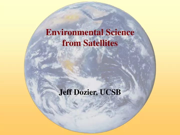
Environmental Sciencefrom Satellites Jeff Dozier, UCSB
Atmospheric absorption of solar and infrared radiation NASA Goddard Institute for Space Studies http://www.giss.nasa.gov
Measurement scale constrained by physics and technology (and money) • Spatial resolution (IFOV/GSD) and coverage (field-of-view/regard) • Optical diffraction sets minimum aperture size • Spectral resolution (Dl) and coverage (lmin to lmax) • Narrow bands need bigger aperture, more detectors, longer integration time • Radiometric resolution (S/N, NEDr, NEDT) and coverage (dynamic range) • Aperture size, detector size, number of detectors, integration time • Temporal resolution (revisit) and coverage (repeat) • Pointing agility, period for full coverage
Spatial, spectral characteristics of some multispectral sensors
Aircraft hyperspectral data (AVIRIS) 0.4 m 2.5 m
SeaWiFS image—global chlorophyll July 1997 - Sept 1998 Provided by the SeaWiFS Project, NASA/Goddard Space Flight Center and ORBIMAGE
Surface elevation from interferometric radar (full resolution image is available from the JPL SRTM image website)
Applications: snowmelt modeling(Molotch et al., GRL, 2004) Snow Covered Area net radiation> 0 degree days > 0 Where: mq= Energy to water depth conversion, 0.026 cm W-1 m2 day-1
Surface wetness with AVIRIS, Mt. Rainier, 6/14/96 AVIRIS image, 409, 1324, 2269 nm precipitable water, 1-8 mm liquid water, 0-5 mm path absorption vapor, liquid, ice (BGR)
A Use Present B Collect Retrieve C Store Search Information Lifecycle Collect Store Present Use Search Retrieve
2005 status • Universal connectivity (except Africa, South America) • Internet • Web • Comprehensive analysis environments • GIS, image analysis (ArcGIS, ENVI) • Matrix manipulation (IDL, MATLAB, …) • Standard formats • Metadata (FGDC, …) • Data (XML, GeoTIFF, …)
A Do complex analyses, many with off-the-shelf tools B Retrieve/publish data from/to the Web C Can’t find somebody else’s data / they can’t find yours How good is your web site? Can’t remember what you did / how you did it How good are your notes? Your conclusions are in the archival literature;where are your data? How good are your backups? 2005 report card
Local Storage management Everything onlineand accessible Metadata management Everything documented and findable Everything connected to where it came from Global Federation Distributed data centers look like a single system Service management Discover, query, describe, and retrieve information Namespace management Same names for same things Major Missing Pieces Personal data centers Digital libraries
Earth System Science Workbench: conceptual model (ESIP—Earth Science Information Partners) • Experiment • Network of models • … ingesting / synthesizing data • … generating products • Notebook • Persistent storage that can be queried • Keeps track of all experiments • Laboratory • Experiment execution environment
CD-ROM Combining sensors: sea-surface temperature and height HRPT Data Handling HRPT Gridding calibrate, de-cloud, aggregate TeraScan extrapolate HRPT downlink AVHRR image SST “super data” SST grid GOAL: Local and advective components of upper ocean heat balance: TOPEX Data Handling TOPEX Gridding ocean height grid ocean height “super data” TOPEX points MGDR cracker calibrate, aggregate extrapolate
avhrr_L0 AVHRR Level 0 product AVHRR telemetry ingest avhrr_ingest Hand navigation details avhrr_l1b AHVRR Level 1B product Hand navigation avhrr_ procedure handNav avhrr_ AVHRR Level 1B: navd_l1b Multi-channel navigated sea surface avhrr_ temperature sstModel algorithm avhrr_sst Sea surface temperature (SST) Copy avhrr_ navigated copyNav image avhrr_ navd_sst SST: navigated
AHVRR Level 1B product avhrr_l1b Multi-channel sea surface temperature algorithm avhrr_ sstModel Sea surface temperature avhrr_sst (SST) # SST experiment wrapper # $L1B is the input Level 1B AVHRR image file # $SST is the output SST image file # run legacy command "nitpix": creates SST image from L1B image $base_temp = 5.0; $temp_step = 0.1; ... system("nitpix base_temp=$base_temp temp_step=$temp_step ... $L1B $SST"); # start recording ESSW metadata beginXMLBld($ENV{USER}, "PRODUCTION"); # get metadata for input file $L1B_ID = findSciObjFromFile($L1B);
AHVRR Level 1B product avhrr_l1b Multi-channel sea surface temperature algorithm avhrr_ sstModel Sea surface temperature avhrr_sst (SST) # create metadata for SST experiment $exp = createExperimentMetadata("avhrr_sstModel"); $exp_step = createExpStepMetadata($exp, "avhrr_sstExpStp"); addValue($exp_step, "avhrr_sstExpStp.base_temp", $base_temp); addValue($exp_step, "avhrr_sstExpStp.temp_step", $temp_step); ... saveToDB($exp_step, "avhrr_sstExpStp"); closeMetadata($exp_step); # connect input and output images to experiment registerExperimentInputs($exp, $L1B_ID); registerExperimentOutputs($exp, $SST_ID); # finish recording ESSW metadata endXMLBld();