Download
1 / 107
1.08k likes | 1.36k Views
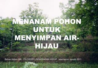
MENANAM POHON UNTUK MENYIMPAN AIR-HIJAU. Bahan kajian MK. FILOSOFI LINGKUNGAN HIDUP, soemarno, ppsub 2011. www.thecottagekey.com/watershed.htm. Peran pohon dalam siklus air. Trees: The Original Multi-taskers. Provide social, ecological, and economic benefits

E N D
MENANAM POHON UNTUK MENYIMPAN AIR-HIJAU Bahan kajian MK. FILOSOFI LINGKUNGAN HIDUP, soemarno, ppsub 2011
Trees: The Original Multi-taskers • Provide social, ecological, and economic benefits • Their leaves and roots clean the air we breathe and the water we drink Their beauty inspires tourist and other people. FOTO SMNO 2009
Benefits of Trees in Urban Areas • Save Energy • Improve air quality • Extend life of paved surfaces • Increase traffic safety • Increase real estate values • Increase sociological benefits • Protect our water resources FOTO SMNO 2009
Storm Water and the Hydrologic Cycle • Urbanization dramatically alters the hydrologic cycle • Increases runoff • Increases flooding frequency • Decreases infiltration and groundwater recharge • Nationwide impervious surfaces have increased by 20% in the past 20 years
More Trees Means Less RunoffSome Statistics • Fayetteville, Arkansas: increasing tree canopy from 27-40% reduced their storm water runoff by 31% • South Miami residential study found that a 21% existing tree canopy reduces the storm water runoff by 15% For every 5% of tree cover added to a community, storm water is reduced by approximately 2% FOTO SMNO 2009
How Do Trees Effect Stormwater? • Above ground effects: • Interception, evaporation and absorption of precipitation • Ground surface effects: • Temporary storage • Below ground effects: • Infiltration, permeation and filtration
Above Ground Effects Absorption of a small portion of rainwater into leaves or stems • Intercept rainwater on leaves, branches and trunks – slowing its movement • Evaporation of some of this intercepted precipitation of the tree surfaces FOTO SMNO 2010
Ground Surface Effects Leaf litter and other organic matter can hold precipitation and stemflow on a site, reducing the amount and peak rates of runoff Roots and trunk bases of mature trees tend to create hollows and hummocks on the ground FOTO SMNO 2008
Below Ground Effects • Organic material from leaf litter and other tree detritus tends to increase infiltration rates by increasing pore spaces in soil • Organic material also increases the moisture-holding capacity of these sites • Root mats of trees also tend to break up most soils further improving infiltration and moisture-holding capacity
Below Ground Effects cont • Deep roots tend to improve the rates of percolation of water from upper soil horizons into lower substrates • Trees take up water through their roots that is eventually transpired onto leaf surfaces and evaporated • Tree roots act as natural pollution filters (biofilters) using nitrogen, phosphorus and potassium
EPA’s Tree Canopy Target Goals • Set to protect a community’s green infrastructure and maximize the environmental benefits • For metropolitan areas east of the Mississippi • Average tree cover for all land use 40% • Suburban residential 50% • Urban residential 25% • Central business districts 15% FOTO SMNO 2009
Apa saja jasa lingkungan taman mangga? FOTO SMNO 2009
Complicating Factors • Presence of soil compaction • Presence of soil textural discontinuity • Has the site been disturbed in the past? • Management of the ground surface • Is litter layer removed? • Is soil surface exposed in winter? • How much of the surface is like a natural forest? (number and size of trees)
Water Movement in Soils • Forces affecting the energy of soil water • Matric force (absorption and capillary) • Gravity • Osmotic forces • Field Capacity is the amount of water held in the soil after gravitational water had drained away • Movement of water is the soil is controlled : • Gravitational forces if saturated • Matric forces if unsaturated
Soil Factors Influencing Infiltration • Infiltration is the mode of entry of all water into the soil • Rate of infiltration determined: • Initial water content • Surface permeability • Internal characteristics of the soil • Intensity and duration of rainfall • Temperature of soil and water
Soil Factors Influencing Infiltration cont. • Microrelief under trees provides catchment basins during heavy rains • Removal of litter layer reduces the infiltration rate • Forest soils have a high percentage of macropores • The frost type found in forest soils promotes infiltration year-long Soil compaction reduces the infiltration rate FOTO SMNO 2008
Importance of the Litter Layer • Absorbs several times its own weight • Breaks the impact of raindrops • Prevents agitation of the mineral soil • Discourages formation of surface crusts • Increases soil biotic activity • Increases incorporation of organics • Slows down lateral movement of water
Affect of Micropores in the Soil • Develop in old root channels or from burrows and tunnels made by insects, worms or other animals • Lead to better soil structure • Increases organic matter incorporation • Increases percolation rates and root penetration
Soil Frost Types • Granular • Small frost crystals intermingled with soil particles • Found in woodland soils with litter • May be more permeable than unfrozen soil • Honeycomb • Has loose porous structure • Found in highly aggregated soils and also formed in organic layers and litter layers
Source and fate of water added to a soil system. The proportion of the soil occupied by water and air is referred to as the pore volume. The pore volume is generally constant for a given soil layer but may be altered by tillage and compaction. The ratio of air to water stored in the pores changes as water is added to or lost from the soil. Water is added by rainfall or irrigation. Water is lost through surface runoff, evaporation (direct loss from the soil to the atmosphere), transpiration (losses from plant tissue), and either percolation (seepage into lower layers) or drainage.
Components of Ground Water Use and Sources of Recharge There is a substantial amount of ground water recharge from surface water and ground water used to irrigate agricultural crops. Some of the irrigation water flowing in unlined ditches and some of the water that is applied to irrigate crops infiltrates into the soil, percolates through the root zone and recharges the ground water basins
Ground water Ground water occupies the zone of saturation. Ground water moves downward through the soil by percolation and then toward a stream channel or large body of water as seepage. The water table separates the zone of saturation from the zone of aeration. The water table fluctuates with moisture conditions, during wet times the water table will rise as more pore spaces are occupied with water. Ground water is found in aquifers, bodies of earth material that have the ability to hold and transmit water. Aquifers can be either unconfined or confined. Unconfined (open) aquifers are "connected" to the surface above.
Aquifers replenish their supply of water very slowly. The rate of ground water flow depends on the permeability of the aquifer and the hydraulic gradient. Permeability is affected by the size and connectivity of pore spaces. Larger, better connected pore spaces creates highly permeable earth material. The hydraulic gradient is the difference in elevation between two points on the water table divided by the horizontal distance between them. The rate of ground water flow is expressed by the equation: Ground water flow rate = permeability X hydraulic gradient Groundwater flow rates are usually quite slow. Average ground water flow rate of 15 m per day is common. Highly permeable materials like gravels can have flow velocities of 125 m per day.
Ground water in an aquifer is under pressure called hydrostatic pressure. Hydrostatic pressure in a confined aquifer pushes water upward when a well is drilled into the aquifer. The height to which the water rises is called the peizometeric surface. If the hydrostatic pressure is great enough to push the peizometeric surface above the elevation of the surface, water readily flows out as an artesian well. www.uwsp.edu/geo/faculty/ritter/geog101/textb...
Following an infiltration event, in which the entire soil profile becomes saturated with water (indicated by a solid vertical line corresponding to a water saturation of 1.0), water will drain from the soil profile primarily under the influence of gravity (i.e., the pressure gradient is negligible). Assuming that no additional water enters the system, the soil water saturation profile at static equilibrium (dashed line) will decrease from a value of 1.0 in the saturated zone (groundwater and capillary fringe) to a value corresponding to field capacity below the root zone. In effect, the soil water profile is analogous to a soil water retention (pressure-saturation) curve. Hence, the solid and dashed lines represent the limits in water content (saturation) between which soil water percolation occurs in soils overlying an unconfined aquifer. www.informaworld.com/smpp/95829679-70617050/c...
Water is recharged to the ground-water system by percolation of water from precipitation and then flows to the stream through the ground-water system. ga.water.usgs.gov/edu/earthgwdecline.html
Water pumped from the ground-water system causes the water table to lower and alters the direction of ground-water movement. Some water that flowed to the stream no longer does so and some water may be drawn in from the stream into the ground-water system, thereby reducing the amount of streamflow. .
Contaminants introduced at the land surface may infiltrate to the water table and flow towards a point of discharge, either the well or the stream. (Not shown, but also important, is the potential movement of contaminants from the stream into the ground-water system.)
Water-level declines may affect the environment for plants and animals. For example, plants in the riparian zone that grew because of the close proximity of the water table to the land surface may not survive as the depth to water increases. The environment for fish and other aquatic species also may be altered as the stream level drops.
Forests and the Hydrologic Cycle The surface water in a stream, lake, or wetland is most commonly precipitation that has run off the land or flowed through topsoils to subsequently enter the waterbody. If a surficial aquifer is present and hydraulically connected to a surface-water body, the aquifer can sustain surface flow by releasing water to it. In general, a heavy rainfall causes a temporary and relatively rapid increase in streamflow due to surface runoff. This increased flow is followed by a relatively slow decline back to baseflow, which is the amount of streamflow derived largely or entirely from groundwater. During long dry spells, streams with a baseflow component will keep flowing, whereas streams relying totally on precipitation will cease flowing. Generally speaking, a natural, expansive forest environment can enhance and sustain relationships in the water cycle because there are less human modifications to interfere with its components. A forested watershed helps moderate storm flows by increasing infiltration and reducing overland runoff. Further, a forest helps sustain streamflow by reducing evaporation (e.g., owing to slightly lower temperatures in shaded areas). Forests can help increase recharge to aquifers by allowing more precipitation to infiltrate the soil, as opposed to rapidly running off the land to a downslope area.
Implications of Frost Types • Forests and prairies rarely yield runoff regardless of steepness, even when frozen Forested areas provide storm water protection and protect the quantity and quality of groundwater FOTO SMNO 2009
FOTO SMNO 2011 The impact of urban trees on hydrology is extremely variable and complex, in general increases in tree cover and tree size over a site will result in reduced total runoff amounts and peak runoff rates.
Trees and Storm Water: • Trees have a relatively greater effect on smaller storm runoff amounts than on large storm events • Surface and below-ground effects on runoff are much more significant than the above-ground effects • All of the effects on runoff are greatest when urban trees are large and well-established on undisturbed sites
Contact Information: Mindy Habecker Dane County UW-Extension 224-3718 Habecker@co.dane.wi.us
www.aucklandcity.govt.nz/.../hgiapp15.asp Typical root systems are made up of a combination of four types of roots: major lateral roots sinker roots woody feeder roots non-woody feeder roots.
Tree and Root System on Bank of Darling River, Kinchega National Park, Outback, New South Wales, Australia