Enhancing USGS Streamflow Monitoring for Water Resource Management
200 likes | 311 Views
Learn about USGS Streamgaging Program, uses of streamflow data for water infrastructure design, flood forecasting, habitat management, and more. Explore challenges and innovations in streamgaging network stability.

Enhancing USGS Streamflow Monitoring for Water Resource Management
E N D
Presentation Transcript
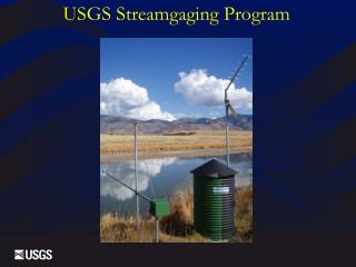
U.S. Geological Survey Streamgaging Program J. Michael Norris (mnorris@usgs.gov) Coordinator, National Streamflow Information Program
Discuss: • USGS streamgaging program • Uses of streamflow information • National Streamflow Information Program (NSIP)
*3,200,000 river reaches – 1 streamgage per 430 river reaches San Francisquito Cr. nr. Stanford, CA Pacific Cr. nr Moran, WY . The U.S. Geological Survey currently collects streamflow data at over 7,500 streamgages*
Expanding Uses of Streamflow Information • Resource appraisal and allocation • Design of Nation’s water infrastructure • Flood hazard planning and forecasting • Reservoir and power operations • Water quality management • Instream flows for habitat conditions • Understanding changes of streamflow • Recreational safety • More . . . .?
Use of Streamflow Information for Resource Appraisal And Allocation • Municipal water supply • Irrigation • Manufacturing • Hydropower • Habitat
Use of Streamflow Information for the Design of the Nation’s Water Infrastructure • Dams • Navigational locks and dams • Bridges • Culverts • Water Treatment facilities
Use of Streamflow Information for Flood Hazard Planning and Forecasting • NWS • Streamflow Forecast Model Calibrations • Model Verification • Streamflow Forecasting • FEMA • Flood plain delineations • Food Insurance Rate Maps
Use of Streamflow Information for Reservoir and Power Operations • Amount of water available in low-flow conditions. • Amount of water available today. • Amount of water expected in the future both short and long term
Use of Streamflow Information for Water Quality Management and Instream Flows for Habitat Conditions • TMDL’s • Quantity and timing of flows critical for habitat
Use of Streamflow Information for Understanding Changes of Streamflow and Recreational safety • Land use, water use, and climate changes • Recreational safety and enjoyment
What are the Issues? • Network’sability to meetlong-standing Federalgoals declinedbecause of: • An increasing instability in the networkcaused by a loss of critical streamgagesdue to the way the streamgaging program is funded. • New issues and new technologies haveincreasedthe demand for streamflow information. • New technologies are needed to: • Improve reliability • Decrease costs • Decrease uncertainty
Funding for USGS Streamgaging Network, FY 2008 Total $136.6M
Five National Streamflow Information Program Goals • 1. Stabilize the streamgaging network • National backbone network of streamgages to meet Federal needs • Modernize and harden the network streamgages 4,744 NSIP Federal Goal Streamgages (914 streamgages meet more than one need)
National Streamflow Information Program (cont.) • 2.Floods and droughts • 3. Regional assessments of streamflow characteristics • 4. Improved information delivery • 5. Methods development and research
SECURE Water Act Stakeholder Support