Download
1 / 60
810 likes | 1.14k Views
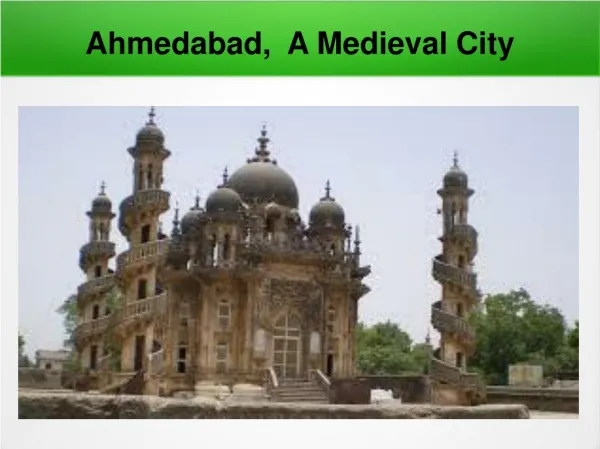
AHMEDABAD: The River and the City 3 rd December 2008. GANDHINAGAR. DELHI. INDIA. AHMEDABAD. MUMBAI. AHMEDABAD. AHMEDABAD. RAJKOT. VADODARA. SURAT. LATITUDE : 23 O 4’ N LONGITUDE : 72 O 34’ E CLIMATE : HOT AND DRY TYPE SOIL TYPE : BROWN SANDY & CLAYEY

E N D
AHMEDABAD: The River and the City 3rd December 2008
GANDHINAGAR DELHI INDIA AHMEDABAD MUMBAI AHMEDABAD AHMEDABAD RAJKOT VADODARA SURAT LATITUDE : 23O4’ N LONGITUDE : 72O34’ E CLIMATE : HOT AND DRY TYPE SOIL TYPE : BROWN SANDY & CLAYEY VEGETATION : DRY DECIDUOUS TYPE *Source: Google Earth website Location and General Information Ahmedabad City Region
MAIN CATCHMENT AREA OF SABARMATI RIVER ARAVALI HILLS NEAR UDAIPUR MAIN CATCHMENT AREA OF SABARMATI RIVER RANN OF KUTCH TOPOGRAPHY : ROCKY IN EXTREME SOUTH, LEVEL PLAIN RISING TOWARDS NORTH AND EAST GEOLOGY : COVERED BY RECENT AND SUB-RECENT FORMATIONS TEMPERATURE : MONTHLY MEAN SUMMER-410C ; MONTHLY MEAN WINTER-18.80C HUMIDITY : MONSOON MONTHS R.H. 80% ; NON MONSOON MONTHS R.H. 30% RAINFALL : 800mm PER ANNUM *Source: Google Earth website Location and General Information Ahmedabad City Region
2 4 5km 0km 1 3 • The topography of city shows that the land slopes towards South . • The slope of the city is 1:750 (approx) • The area under water-bodies is 38.54 km approx. 2.96% of the total area. • The prime surface water body in Ahmedabad is the river Sabarmati, which flows from North to South and divides the city into two parts; East and West. • It is not a perennial river. At Eastern side of the city, two minor rivers cross the region i.e. The Khari river and the Meshwa river. A number of ponds / lakes / water bodies are also present in the city. • Due to rapid urbanization some lakes / water bodies have become extinct. About 36 lakes / water bodies have dried up in last 28 years. LEGEND: N 1m interval Source: AUDA reports, A.M.C. website Water Bodies and Topography Ahmedabad City Region
N • Every village had its own pond, which was the source of water. • Size of pond varied from 20 ha to 80 ha depending on the size of the village. • These ponds now remain dry during summer months. • Important ponds in Ahmedabad are Kankaria filled with water throughout the year; and Chandola lake which remains dry even in monsoon. Kankaria Lake Chandola Lake VILLAGE SETTELEMENTS WATER BODIES PLAN SHOWING THE LOCATION OF THE VILLAGES AND THE CITY AS CORRESPONDING TO THE WATER BODIES Source: Unpublished Thesis work Niketa, CEPT student Relation of Water Bodies and the City Evolution of the City
Topography shapes patterns Land and Water : Flow, storage, use, waste, reuse cycles. Regulate speed and direction of flow through urban pattern to stabilise water and soil cycles.
Street Layout, Neighbourhood Limits and Internal Structureaffected by topography.
N • The area of city during the period 1411-1770 was 5.3 sq.km. • The establishment of the first textile mill in 1861 was a landmark. With expansion of this industry, development began to spill over (beyond city walls) towards the north-east & south-east of walled city, but only on the Eastern side of the river. • Construction of Ellis Bridge in 19th century opened up the Western side for urban expansion – mainly Residential. • Industrial development – Eastern side. • Commercial development – Walled City. • City extended beyond present municipal limits & crossed limits of AUDA on Western side. • After 1982 growth was observed on main transportation routes, where agriculture was predominant. GROWTH OF AHMEDABAD (1411-2000) 1411 1932 1857 1936 1884 1939 1901 1956 1911 1958 1920 1959 1928 1960 2000 Source: Unpublished Thesis work, CEPT student Growth of Ahmedabad Evolution of the City
N • The direction of slope is almost parallel along the flow of the river Sabarmati. (NE-SW) • A few elevation points ‘tekras’ are observed in western Ahmedabad. Depression zone is present near the city of Mahemdabad. • Open / vacant land occupies an area of 17.23 Sq.km. and is 3.6% of the total area of urban complex. AUDA BOUNDARY Regional topography-sheet showing the extend of AUDA boundary. Source: Thesis work Richa Garg, LA,CEPT student Topographic Sheet and AUDA boundary Ahmedabad City Region
The Formative Period: Formal Structure and An Architecture of Community and Individuality
The very large, the very small. Consolidation, readability,association.
Similarity of sequencing at all scales. Unit Neighbourhood Cluster Locality City
Smallest scale typologically ordered.Accretive growth, similarity of patterns.
Directness, Simplicity and Frugal Means: A Possible Indian Architecture ?