Download
1 / 45
450 likes | 512 Views
Explore the activities, achievements, and challenges faced by the Suriname Hydrographic Office in their efforts towards marine safety, surveys, chart updates, and capacity building. Learn about projects such as river assessments, maritime safety publications, and oceanographic endeavors.

E N D
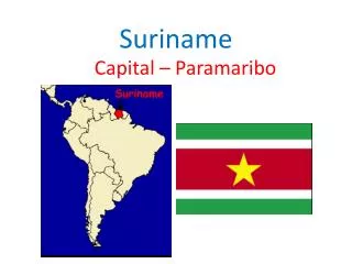
18th Meso American-Caribbean Sea Hydrographic Commission Conference29 November – 2 December 2017 Cuba- VaraderoSuriname National Report Bernice Mahabier, Manager Nautical Management Maritime Authority Suriname
Table of Contents • Introduction • Hydrographic Office Service • Surveys • New charts & updates • New publications & updates • MSI • C-55 • Capacity building • Oceanographic activities • Other activities • Main achievements during the year, • Main challenges and/or obstructions,
Coppename river project • Project: • Assessment shipping channel, river users and other activities • Stakeholder meetings • Survey of navigation channel and berth’s • (in use and potential areas) • Planning of ATON’s • Production of Chart and ENC
Coppename river surveys 2017 For the planning of outdated national chart 2225
Leading line Suriname River Leading Line VBH- VBL
Additional surveys • Monitoring of specific areas • Survey of harbor for dredging or nautical depth determination. • Investigative surveys
New publications and updates • Tide table 2018 • List of Lights 2018 • The release of Shipping Notices for the nautical accessibility of ISPS certified ports and for all rivers .( minimum depth , average tidal rise Neap tide and Springtide, harbor and ship requirements)
Marine Safety Information Existing infrastructure for transmission Partial radio warnings for coastal area through VTC . NtM published in local papers and website, emailed to mariners. NtM submitted to the NAV Area coordinator Currently Drafting of a plan for infrastructure in accordance with GMDSS Master Plan Fase 1: VHF coverage Area A1 :currently VHF channel 16 communication for 20NM in approaches to ports Fase2: MF coverage Area A2
C-55 Status of hydrographic survey of all navigable waters, including internal waters, out to the limits of the EEZ: (Please refer to the guidance given in the introductory text “Analysis of the Status of Surveys”.) Survey coverage, where: A = percentage which is adequately surveyed. B = percentage which requires re-survey at larger scale or to modern standards. C = percentage which has never been systematically surveyed. The constant flow of sediments from the Amazone River creates migrating mud banks along the coast which move in westward direction. These banks have great impact on the river systems; therefore have impact on the approaches to the ports.
C-55 1.2 Status of hydrographic survey of all navigable waters, including internal waters, out to the limits of the EEZ of dependent territories:
C55 2.1 Status of nautical charting within the limits of the EEZ Coverage of charts published by your organisation, where: A = percentage covered by INT series, or a paper chart series meeting the standards in M-4. B = percentage covered by Raster Navigational Charts (RNCs) meeting the standards in S-61. C = percentage covered by ENCs meeting the standards in S-57.
Capacity building Training received • IALA -Level1 Aids to navigation manager course, May to June 2017, Suriname . • KOICA- Training for Ocean Observation and Hydrographic Surveying (Policy-maker)September 2017, Seongnam & Busan, Republic of Korea Required Internship/ training: • Tidal analysis • Side Scan Sonar image interpretation • Multibeam data acquisition and processing • Data management • SDI for wider use
CB Support Training offered: • IALA manager level 1 training course – Form October – November 2018- Paramaribo Suriname
Bilateral projects • Member of IC-ENC for ENC validation and distribution • MoU Suriname – UKHO- ENC and paper Chart production • MoU Suriname – France-co-production of boundary chart • MOU MAS- IALA- training center and membership In progress • MoU Suriname – Brazil DNH for capacity building • MoU MAS - University of Suriname • MoU MAS - Polytechnic College
Oceanographic activities • Offshore seismic project and drilling along the coast of Suriname by the National State oil Company
National project with hydrographic component • Establishment of Suriname Maritime Academy in conjunction with IALA for training in Aids to Navigation • Drafting of Risk assessment project • Preparation IMO Audit for 2018 (IMSAS)
Other activities • National Working groups: • NationalClimate Outlook Forum (NCOF) • MAS participated in the National Post-deforestation 2000 – 2009 and 2000 – 2015 Land Use Land Cover Maps project organized by the Forest Cover Monitoring Unit of the Foundation for Forest Management and Production Control (SBB) as an initiative of the Amazon Cooperation Treaty Organization (ACTO). • Global Climate Change Alliance (GCCA)+ Suriname Climate Change Adaptation project office and activities Government of Suriname, the European Union and the UNDP
Other activities Participation in IHO Working Groups • MEIP • MICC Geospatial studies • Climate change : WWF -Suriname establishing a national database for environment • Disaster prevention Flood modeling for Paramaribo
Establishment of the Suriname ATON Academy ( SAA) • Accreditation of the SAA based on IALA Recommendation E-141
SOLAS V Regulations 4 -Navigational Warnings: WWNWS 9 – Hydrographic Services 10 – Ships Routeing 11 – Ships Reporting Systems 12 – Vessel Traffic Services 13 – Aids to Navigation Services 19-2.4 – AIS
Countries that expressed interest : Mexico, Columbia, Belize ,Argentina ,Guatemala, Guyana, Trinidad& Tobago, St. Kitts & Nevis, Venezuela, Barbados and Suriname. Difficulties encountered: Availability of resources and language barrier Participants for the manager course 7 : Belize ,Argentina ,Guatemala, Guyana,St. Kitts & Nevis, Barbados and Suriname
Hosting of the IHO –15th CBSC meeting from June 7-9 ,2017 in Suriname
Hosting of the IHO – 9th IRCC meeting from June 12 -14 ,2017 in Suriname
UKHO Technical 21st February visit regarding chart production
Maritime boundaries National legislation on Maritime zones completed Maritime boundary with France completed
Main challenges and/or obstructions Obstructions/ Challenges • Delay is purchase of MB system • Data management( less people more products)
Conclusions Great efforts has been made to garantee save navigation in the Surinames waters, but Suriname is aware of the challences we have to face in the future.