Download
1 / 26
260 likes | 287 Views
This paper discusses using satellite rainfall data for climate modeling perspective and its importance in understanding extreme daily rainfall events. It focuses on Southern Africa's vulnerability to rainfall variations and the need for high-resolution data. The MIRA dataset of satellite-derived rainfall estimates is evaluated for its accuracy and compared with climate models. The study aims to improve our knowledge of extreme rainfall events and their impacts on vulnerable regions.

E N D
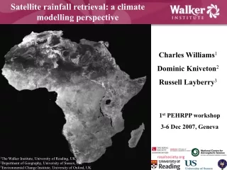
Satellite rainfall retrieval: a climate modelling perspective Charles Williams1 Dominic Kniveton2 Russell Layberry3 Title 1st PEHRPP workshop 3-6 Dec 2007, Geneva 1The Walker Institute, University of Reading, UK 2Department of Geography, University of Sussex, UK 3Environmental Change Institute, University of Oxford, UK
Background • Well-established that climate change will significantly alter climatic variability, as well as mean climate (e.g. Tegart et al. 1990) • Changes in climate variability = changes in extreme climate events e.g. increasing frequency of flooding, drought, etc – likely to be of far more significance for environmentally vulnerable regions • Changing climate variability may also result in change of other rainfall parameters e.g. a later start date of the wet season (e.g. Kniveton et al. 2007) • Better understanding of extreme daily rainfall is important, because recent rainfall-related disasters e.g. Katrina have demonstrated impact of rainfall variability and extremes on society • Generally agreed that developing countries suffer more from extreme rainfall events because, being environmentally and socio-economically vulnerable before occurrence of extreme event, developing countries are more sensitive to such disasters
Southern Africa • Region of relative low and variable rainfall • Dependence on rainfed agriculture • High social pressures e.g. • Migration • Tourism • Population pressures • Economic/scientific underdevelopment • Widespread disease • Famine • Extreme poverty • Governmental corruption • HIV/AIDS crisis • Civil war
However…… Rainfall variability = function of scale, so high spatial and temporal resolution data needed to identify extreme rainfall events – as resolution increases, so too does ability to ‘see’ extremes • Need for daily high spatial resolution rainfall data due to lack of gauge data • Need for data set over prolonged period Spatial coverage of GTS gauge dataset (1990-2000)
Lack of consensus I: Climate models HADCM3: SW Africa wet CSIRO: SW Africa dry M. Todd, pers. comm.
Lack of consensus II: High-resolution rainfall retrievals 20 November 2004 PERSIANN 3B42 NRL-Blended CMORPH From: http://essic.umd.edu/~msapiano/PEHRPP/index.html
Microwave Infrared Rainfall Algorithm (MIRA) Todd et al. (2001), Layberry et al. (2006) MIRA Dataset of satellite-derived rainfall estimates, comprising 10 year’s worth of data, 1993-2002, covering Africa at 2-hourly resolution & at 0.1° lat/long. Validation for southern African half of dataset (0º – 34ºS, 10º – 50ºE) at daily resolution • Process: • For every grid cell (0.5°) for every month (1993-2002), Meteosat cloud top temperature and PM instantaneous rain rates from SSM/I sampled (when they occurred within 30 minutes of each other) • Histograms of both temperature and rain rate derived for each grid cell (where rainfall was present) • Histogram matching applied (e.g. assuming coldest temperature = highest rain). Thus temperature/rain rate relationship is established • Relationship applied to full resolution (2-hourly, 0.05°) Meteosat IR temperature data, then finalrain rates averaged over each day and binned to 0.1° to make final datasetfor validation
Data availability • Southern Africa (south of Equator): daily rainfall data at 0.1 km spatial resolution from 1993-2002 • Northern Africa (north of Equator): daily rainfall data at 0.1 km spatial resolution from 1996-2002 • Both available by request from • d.r.kniveton@sussex.ac.uk
MIRA validation II: Comparison with GPI, for example date 1 January 2000 GPI MIRA
MIRA validation III: Comparison with NCEP, for example event Integrated rainfall between 16th - 24th January 2002 - a high rainfall event NCEP reanalysis MIRA Kalnay et al. (1996)
MIRA validation IV: Example score – HSS • MIRA = significantly better than GPI for all years • +ve correlation between skill of estimates and number of gauges: more gauges = greater agreement. Suggests remaining disagreement between MIRA/GTS may be due to low number of gauges as well as errors from MIRA?
MIRA / climate model comparison I: MethodWilliams et al. (2007b) • 10-year climate model integration, 1993-2001 • Model: • Global mode = HadAM3 (2.5° x 3.75°) • Regional mode = PRECIS(0.5° x 0.5°), run over southern African domain & driven at lateral boundaries by ERA-40 • Daily rainfall from model compared to MIRA, for full 1993-2001 period, monthly (January & July) and seasonally (Nov-April (NDJFMA) & DJF) • Rainfall was firstly compared over entire domain as daily spatial averages, secondly at pixel scale as temporal means, & thirdly number/spatial distribution of extreme pixels • Extreme rainfall investigated at pixel scale, with definition adapted from that used by Samel et al.(1999) • Definition used here: extreme pixel (on any given day) = any pixel where rainfall > 1.5% of climatological total for that pixel
MIRA / climate model comparison II: HadAM3 results Means NDJFMA January DJF All months Differences (MIRA-HadAM3) over southern Africa, 1993-2001. Mean differences in mm day-1. Solid line = zero contour
MIRA / climate model comparison II: HadAM3 results (cont.) July
MIRA / climate model comparison II: HadAM3 results (cont.) Means NDJFMA January DJF All months Differences (MIRA-HadAM3) over southern Africa, 1993-2001. Mean differences in mm day-1. Solid line = zero contour Standard deviations NDJFMA January DJF All months
MIRA / climate model comparison II: HadAM3 results (cont.) Number of extreme pixels over southern Africa, 1993-2001 (top), and spatial patterns of total extreme pixels (bottom) • MIRA = 19,645 extreme pixels • HadAM3 = 14,233 extreme pixels Difference MIRA HadAM3
MIRA / climate model comparison III: PRECIS results Means DJF All months Differences (MIRA-PRECIS) over southern Africa, 1993-2001. Mean differences in mm day-1. Solid line = zero contour January
MIRA / climate model comparison III: PRECIS results (cont.) Standard deviations DJF All months Differences (MIRA-PRECIS) over southern Africa, 1993-2001. Solid line = zero contour January
MIRA / climate model comparison III: PRECIS results (cont.) Number of extreme pixels over southern Africa, 1993-2001 (top), and spatial patterns of total extreme pixels (bottom) • MIRA = 831,921 extreme pixels • PRECIS = 567,218 extreme pixels Difference MIRA PRECIS
Possible conclusions from MIRA / climate model comparisons • HadAM3 reproduces both spatially averaged rainfall and rainfall at pixel scale (as shown by MIRA) with some accuracy • HadAM3’s ability to reproduce daily rainfall variability is spatially and temporally dependent – over wetter (drier) regions / during wet (dry) periods, HadAM3 underestimates (overestimates) rainfall variability relative to MIRA • HadAM3 reproduces the majority (~72%) of daily rainfall extremes highlighted by MIRA • Both MIRA and HadAM3 show a similar spatial distribution of rainfall extremes, with a higher number of extremes over subtropical Africa which decreases towards equator • Differences between PRECIS and MIRA are similar to those from HadAM3 integration (as expected, as essentially the same model but run at higher spatial resolution) • PRECIS identifies ~68% of rainfall extremes shown by MIRA, less than the ~72% identified by HadAM3 – may be because of the high spatial resolution of PRECIS which requires higher spatial accuracy • However, higher spatial resolution of PRECIS is important when identifying number of rainfall extremes, because many more extremes can be identified. Advantageous if, for example, extremes are then used as a basis for composite analysis within rainfall variability studies (e.g. Williams et al. 2007a)
Problematic regions MIRA-HadAM3 MIRA-PRECIS Difference in mean rainfall, January Difference in total extreme pixels
Summary and future needs • Need for high spatial/temporal resolution rainfall data in order to study rainfall extremes (particularly devastating for developing regions) • Certain regions e.g. southwestern Africa = particularly problematic for both models and satellite-based rainfall retrieval methods, because: • Region of low/variable rainfall • Region of primarily convective and/or locally controlled rainfall (as opposed to large-scale), with which both models and rainfall retrievals have problems • Lack of rain gauges Therefore, future data collection (from satellite-based rainfall retrievals) should focus on these regions
Thank you for your time. Visit www.walker-institute.ac.uk
References Kalnay, E., Kanamitsu, M., Kistler, R., Collins, W., Deaven, D., Gandin, L., Iredell, M., Saha, S., White, G., Woollen, J., Zhu, Y., Chelliah, M., Ebisuzaki, W., Higgins, W., Janowiak, J., Mo, K., Ropelewski, C., Wang, J., Leetmaa, A., Reynolds, R., Jenne, R. & Joseph, D. (1996). ‘The NCEP/NCAR 40- year reanalysis project’. Bulletin of the American Meteorological Society. 77 (3): 437–471 Kniveton, D., Layberry, R. & Williams, C. (2007). ‘Trends in the start of the wet season over Africa’. International Journal of Climatology. Submitted Layberry, R., Kniveton, D., Todd, M., Kidd, C. & Bellerby, T. (2006). ‘Daily precipitation over southern Africa: a new resource for climate studies’. Journal of Hydrometeorology. 7 (1): 149–159 Tegart, W., Sheldon, G. & Griffiths, D. (1990). ‘Impacts Assessment of Climate Change’. Report by Working Group II of the Intergovernmental Panel on Climate Change. Australian Government Printing Service. Canberra, Australia Todd, M., Kidd, C., Kniveton, D. & Bellerby, T. (2001). ‘A combined satellite infrared and passive microwave technique for estimation of small scale rainfall over the global tropics and subtropics’. Journal of Atmospheric and Oceanic Technology. 18: 742–755 Williams, C., Kniveton, D. & Layberry, R. (2007a). ‘Climatic and oceanic associations with daily rainfall extremes over southern Africa’. International Journal of Climatology. 27 (1): 93-108 Williams, C., Kniveton, D. & Layberry, R. (2007b). ‘Assessment of a climate model to reproduce rainfall variability and extremes over southern Africa’. International Journal of Climatology. In review