Download
1 / 45
450 likes | 728 Views
Hydric Soil AND THE FARM BILL Use of the Definition, Criteria, Field Indicators and Technical standard. Lenore Matula Vasilas Soil Scientist NRCS Soil Survey Division. Not Covered. Hydrophytic vegetation and wetland hydrology factors Mapping conventions

E N D
Hydric Soil AND THE FARM BILLUse of the Definition, Criteria, Field Indicators and Technical standard Lenore MatulaVasilas Soil Scientist NRCS Soil Survey Division
Not Covered • Hydrophyticvegetation and wetland hydrology factors • Mapping conventions • Legislative issues other than those specifically related to hydric soils
National Technical Committee for Hydric Soils • 7 CFR Part 12.30 NRCS responsibilities regarding wetlands. • (a) Technical and coordination responsibilities. In carrying out the provisions of this part, NRCS shall: • (1) Oversee the development and application of criteria to identify hydric soils in consultation with the National Technical Committee for Hydric Soils and make available to the public an approved county list of hydric soil map units, which is based upon the National List of Hydric Soils;…
National Technical Committee for Hydric Soils • NRCS • Chris Smith, NHQ, chair • Shawn Finn, MA • Steve Lawrence, GA • Aaron Miller, NM • Steve Monteith, NSSC • Paul Rodrigue, MS • Lenore Vasilas, NHQ • USACE • Chris Noble • USEPA • Ralph Spagnolo • USFS • Vacant • BLM • Robert Boyd • USFWS • Jim Dick • University • Richard Griffin, Prairie View • Wade Hurt, Univ. of FL • Chien-Lu Ping, Univ of AK • Mike Vepraskas, NCSU
Delineation Methodology for FSA • The Corps of Engineers Wetland Determination and Delineation Manual and Regional Supplements with Variances • NRCS relies more often on off-site determinations (hydric soils list and soil survey maps) • Soils information written in consultation with NTCHS • Supplements adopted NTCHS Field Indicators • Supplements adopted 14 day hydrology requirement • Hydric soils definition wording differences • Soon to be updated manual will eliminate many method inconsistencies between CWA and FSA and, therefore, eliminate many of the current variances
To be considered a hydric soil the soil must meet__________ • The hydric soils definition. • The characteristics of a map unit component on the hydric soil list • A field indicator of hydric soils • The technical standard. • Any of the above. • All the above.
To be considered a hydric soil the soil must meet__________ • The hydric soils definition. • The characteristics of a map unit component on the hydric soil list • A field indicator of hydric soils • The technical standard. • Any of the above. • All the above.
Hydric Soils Definitions • Food Security Act • a soil that, in its undrained condition, is saturated, flooded, or ponded long enough during the growing season to develop an anaerobic condition that supports the growth and regeneration of hydrophytic vegetation [16 U.S.C. 3801(a)(12)]. • NTCHS • a soil that formed under conditions of saturation, flooding, or ponding long enough during the growing season to develop anaerobic conditions in the upper part (Federal Register, 1994)
Determining You Meet the Definition • Map unit component listed as hydric on the Hydric Soils List • Meets at least one of the Field Indicators of Hydric Soils in the United States • Has the characteristics of a problematic hydric soil and the site has been proven to also meet hydrophytic vegetation and wetland hydrology factors • Meets the Hydric Soil Technical Standard
Original Database Selection Criteria for the National List of Hydric Soils • Originally a list of soil series • Original criteria required a water table and water table data • Original list was queried from old SSSD database and not NASIS • State and Survey Area lists were lists of map units and different than the National List • Original state and county list had to be significantly hand edited by states
Changes to Criteria for Populating the National List • Federal Register 12234 Vol. 77, No. 40 Wednesday, February 29, 2012 • Based on deliberations of the NTCHS • 30 day public comment period • Fixed issues related to changes in database and changes to format (list of series vs. list of map units) • Biggest issue was water table requirement in old criteria but not in definition of hydric soil
Drained vs. Undrained Same Soil Series but Possibly Different Map Units
New Criteria • (1) All Histels except Folistels and Histosols except Folists; or • (2) Map unit components in Aquic suborders, great groups, or subgroups, Albolls suborder, Historthels great group, Histoturbels great group, or Andic, Cumulic, Pachic, or Vitrandic subgroups that: • (a) Based on the range of characteristics for the soil series, will at least in part meet one or more Field Indicators of Hydric Soils in the United States, or • (b) Show evidence that the soil meets the definition of a hydric soil; • (3) Map unit components that are frequently ponded for long duration or very long duration during the growing season that: • (a) Based on the range of characteristics for the soil series, will at least in part meet one or more Field Indicators of Hydric Soils in the United States, or • (b) Show evidence that the soil meets the definition of a hydric soil; or • (4) Map unit components that are frequently flooded for long duration or very long duration during the growing season that: • (a) Based on the range of characteristics for the soil series, will at least in part meet one or more Field Indicators of Hydric Soils in the United States, or • (b) Show evidence that the soils meet the definition of a hydric soil.
Where to Find Hydric Soils List? • The National List of Hydric Soils can be found on the NTCHS website (http://soils.usda.gov/use/hydric/) • National Coverage • Updated yearly • Local List of Hydric Soils can be found on Soil Data Mart or Web Soil Survey (http://soils.usda.gov/) • Soil Data Mart data grouped by Survey Area • Web Soil Survey has size limit • Updated as official data is updated
When to use the Hydric Soils Lists? • General planning • Preliminary data gathering • Along with other info for off-site determinations • Identification of potential WRP sites
Working on New Report in NASIS • Hydric • All major and minor components are hydric • Predominantly Hydric • All major components are hydric but some minor components non-hydric • Partially Hydric • Complex with at least one major component hydric and one major component non-hydric • Predominantly Non-hydric • All major components non-hydric and at least one minor component hydric • Non-Hydric • All major and minor components non-hydric
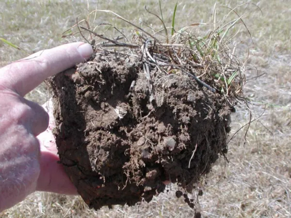
Field Indicators • Field indicators are soil morphological features used to identify hydric soils • The features result from soil genesis in the presence of “anaerobic conditions” • They are used for on-site verification
Development of Field Indicators • Continuous process • On-going since mid-80’s • Inter-agency • Including universities, private sector, federal, state, and local agencies • Multi-disciplinary • Soil scientists, hydrologists, botanists
Hydromorphic Processes • Reduction, translocation, and precipitation of iron and manganese • Accumulation and differential translocation of organic matter • Reduction of sulfur
Hydric Soil Indicators • Indicators are not intended to replace or relieve the requirements contained in the Hydric Soil Definition • Indicators are used to identify the hydric soil component of wetlands; however, there are some hydric soils that lack one of the currently listed indicators
Proof positive • If it meets a Field Indicator it is a hydric soil • If it does not meet a Field Indicator it may still be a hydric soil if it meets the definition of a hydric soil
Three Major Divisions • All soils • Use regardless of texture • Mostly organic based indicators • Sandy soils • Loamy soils • Use sandy indicators in sandy layers, and loamy indicators in loamy layers
Rules for Field Indicator Use • A chroma of 2 or less means that the chroma cannot be higher than 2 • Values should be rounded to the nearest color chip • Except for F8, F12, F19, F20 and F21 all mineral Field Indicators must have less then 15 cm (6 in) of a chroma > 2 above the indicator.
Soil Surface • In al LRRs, for Field Indicators A1, A2, and A3 begin measurements at the actual soil surface. • In LRRs R, W, X, and Y, all other observations begin at the top of the mineral surface. • In LRRs F, G, H, and M, we begin our observations at the actual soil surface if the soil is sandy and for all other observations at the muck or mineral surface • For all other LRRs we begin all other observations at the muck or mineral surface.
Combining Indicators • It is permissible to combine certain hydric soil indicators if all requirements of the indicators are met except thickness • The most restrictive requirement for thickness of layers must be met
Example of a Soil That is Hydric Based on a Combination of Indicators • 3-6 inches meets F6 Redox Dark Surface, but thickness requirement is 4 inches • 6 to 10 inches meets F3 Depleted Matrix requirements, but thickness requirement is 6 inches • Add the 3-6 inch and 6 to 10 inch layer thicknesses together to get 7 inches which is thicker than the most restrictive requirement of 6 inches
Example of a Soil That is Hydric Based on a Combination of Indicators • 0 to 3 inches meets F6 Redox Dark Surface, but thickness requirement is 4 inches • 3 to 6 inches meets S5 Sandy Redox, but thickness requirement is also 4 inches • Combine the thickness of the 2 layers to get 6 inches
Key to Soils that Lack Field Indicators • Dig a hole to 6 in. • Do organic soil materials or mucky modified layers exist? • Does chroma ≤ 2 exist? • Are there any distinct or prominent redox concentrations as soft masses or pore linings? • Is there a hydrogen sulfide odor? • Are you in a depression, on a floodplain, in red parent material or within 200 m of an estuarine marsh and 1 m of mean high water? • If answer is no to all questions, the soil will not meet an indicator.
Loamy Depressions • F8. Redox Depressions • In CD’s subj. to ponding, 5% or more redox conc. in a layer 2 cm or more thick entirely within upper 15 cm.
F19. Piedmont Floodplain Soils • Chroma less than 4 and 20 percent or more redox concentrations
F20. Anomalous Bright Loamy Soils • Within 200 m of estuarine marshes or waters and within 1 m of mean high water • Chroma less than 5 and 10 percent redox concentrations
Red Parent Material F3. Depleted Matrix F21. RED Parent Material
Technical Standard for Hydric SoilsRequirements • Saturated, Ponded, or Flooded conditions • Water table measurements • Well and piezometers • Reducing Conditions • Redox potential measurements • Reduced Iron (Fe II) measurements • Alpha-Alpha Dipyridyl • IRIS tubes • In-situ pH measurements • On-site precipitation data • Replicates
NTCHS Web Site Updates I am in the process of updating to delete obsolete tech. notes and provide more complete and up-to-date info on hydric soil issues. If there is any info you would like to see on the page let me know.
National Hydric Soil Projects • National Wetland Condition Assessment • EPA • Potential Wetland Landscapes Map based on gridded SSURGO • Association of State Wetland Managers Wetland Mapping Consortium
NRCS Training Opportunities on Hydric Soils • NEDC Courses • Advanced Hydric Soils – Meridian, MS August 20 – 25th, 2012 • SSSA Hydric Soils Field Tour • Cincinnati, OH, Saturday, October 20, 2012
Questions??????? Lenore.Vasilas@wdc.usda.gov