Download

1 / 11
110 likes | 132 Views
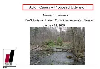
This report assesses the impact of extending the Acton Quarry on traffic conditions in the study area, including the haul routes and boundary intersections. The study area extends beyond the typical scope of a traffic impact study and includes existing conditions and future projections.

E N D
Acton Extension Update Traffic Presentation June 8, 2009 Community Liaison Committee
Summary • Traffic Impact Assessment • Haul Routes • Overview of Application Impact on Traffic Conditions • Study Area of Traffic Assessment • Extraction Phasing and Resulting Traffic Conditions • Conclusions
Traffic Impact Assessment • MMM Group was retained by Dufferin Aggregates to prepare a Traffic Impact Assessment • This Report was to assess whether the existing Acton Quarry haul route could continue to accommodate the truck traffic related to the Acton Quarry Extension, on the boundary roadway intersections, as well as the other roadways along the existing haulage routes within the study area. • The existing haul routes include some minor arterial roadways in Georgetown to the east, enroute to markets in that area.
Overview of Application Impact on Traffic Conditions • The quarry is currently licensed for 4.0 million tonnes of extraction per year. • The application to extend the quarry operation would not change this. Thus, the maximum extraction permitted annually would remain at 4.0 million tonnes. • This application would utilize the existing Acton Quarry haul routes and simply extend the life of the quarry rather than increase the quarry demand, which fluctuates from year to year depending on demand. • This differs from most traffic impact assessments where the volume of traffic is expected to increase as a result of the proposed change, or intensity of the land use.
Study Area • The study area has been extensively extended beyond what typically would be addressed in a traffic impact study, at the request of the JART committee. • The study area extends as far south as Highway 401 for both the Highway 25 and Trafalgar Road corridors, and as far east as Winston Churchill Boulevard for the Highway 7 and River Road routes. It covers all the anticipated primary haulage routes within the Region of Halton, with the exception of local deliveries. • The study area was not extended into Peel Region, beyond one intersection with Winston Churchill Boulevard, since as noted, the study area considered herein already extends substantially beyond that typically considered in a traffic impact study.
Study Area (cont.) Beyond a substantially extended study area, other key elements of this expanded approach include the following: • Examination of two horizon years – 2013 and 2018. • Reliance on extensive haul truck data from Dufferin Aggregates relating to existing operations, including seasonal, daily and hourly variations. Unlike assessments related to proposed quarries where various assumptions need to be made, the advantage herein is the availability of actual data related to existing operations. • Examination of both August and October existing conditions, which represent quarry conditions during different seasonal travel patterns (i.e. summer and commuter conditions) along the boundary road network. • Examined the spring load conditions. • Examination of two peaks periods for the existing operations. • Examination of both average load (50th Percentile) conditions and peak load conditions during these peak hours.
Site Access / Entrances • The quarry is served by four driveways today. • The driveway onto 4th Line (Driveway #1) is considered to be the main driveway. All trucks traveling to and from 4th Line have been restricted to using only this driveway since there are a number of sharp and unsafe turns along 22nd Sideroad between 4th Line and Driveway #3, which is situated to the west of 4th Line. • The easterly driveway on 22nd Sideroad (Driveway #3) is restricted to trucks which are using the Regional Road 25 corridor. During the spring season, all of the quarry traffic uses this driveway to access or egress the quarry due to the half load restrictions imposed along 4th Line (March and April). • The westerly driveway on 22nd Sideroad (Driveway #2) is used for heavy vehicles associated with quarry operations to travel between the north and south portions of the quarry. This driveway has been signalized in order to provide appropriate gaps to allow heavy vehicles to cross 22nd Sideroad. • Similar to Driveway #2, the driveway onto 3rd Line (Driveway #4) serves heavy vehicles that travel between the east and west portions of the quarry south of 22nd Sideroad. Again, this simply serves as a crossing as these vehicles are limited to internal quarry operations. • The existing site driveways are proposed to be retained and to continue to be used under the future operations. However, a new site driveway is proposed onto 3rd Line South to serve the Phase 7 extension. In addition, a new quarry truck crossing is proposed on 3rd Line North between Phases 1 and 4 and traffic signal will be installed at this intersection.
Extraction Phasing and Resulting Traffic Conditions • Phase 4 – Continued use of existing processing plant, existing entrance/exit, and established haul routes. • Phase 5 – Continued use of existing processing plant, existing entrance/exit, and established haul routes. • Phase 6 – Continued use of existing processing plant, existing entrance/exit, and established haul routes. • A portable processing plant is also permitted in Phases 5 and 6. If processing occurs, material will be shipped directly from this phase, with trucks traveling north on 3rd Line and continued use of existing established haul routes. • Phase 7 – Will operate concurrently with Phases 5 and 6. Continued use of existing processing plant and continued use of existing entrance / exit and established haul routes • If portable processing occurs, Phase 7 will operate in the same manner as Phases 5 and 6.
Conclusion • In summary, it is important that the road network in the broad study area safely and effectively accommodate all the traffic modes, both today and in the future. This includes the Acton Quarry related traffic. Even considering an overly conservative scenario it is concluded that the existing haul routes are built to an appropriate standard and can continue to accommodate truck traffic from the Acton Quarry Extension. It is recommended that: • 3rd Line South be upgraded to a sufficient standard to accommodate truck traffic from 3rd Line South; and • Traffic Signal be installed at the proposed 3rd Line crossing between Phases 1 and 4, similar to those on 22nd Sideroad crossing. • As noted, unlike typical traffic impact studies which address the traffic impacts related to expanded or new developments, the Acton Quarry already has permissions in place to extract and haul 4.0 million tonnes of aggregates annually. This will not change in the future. The application is simply intended to extend the life of the quarry.
HGRS_Master 05/01/2020