Download

1 / 18
180 likes | 204 Views
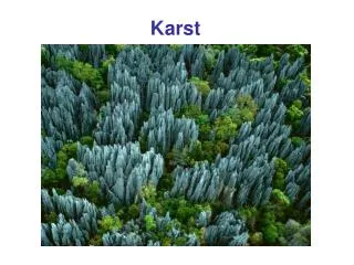
Is there a karst system anywhere else on earth that shows such a complex output?. THE CASTLETON KARST HYDROGEOLOGICAL SYSTEM, DERBYSHIRE, UK: A CHALLENGE FOR MODELLERS. Professor John Gunn School of Geography, Earth & Environmental Sciences. The Peak District karst.

E N D
Is there a karst system anywhere else on earth that shows such a complex output? THE CASTLETON KARST HYDROGEOLOGICAL SYSTEM, DERBYSHIRE, UK: A CHALLENGE FOR MODELLERS Professor John Gunn School of Geography, Earth & Environmental Sciences
The Peakshole Water Catchment Coalpithole No 10 shaft ~5 sq km mudstone & sandstone with 14 sinking streams ~8.5 sq km limestone with dolines & dispersed recharge >25km accessible conduit >30 sections of phreatic conduit explored by divers 3 springs
THE SPRINGS 20m
Relationship between Giant’s Hole (P12 sink), Speedwell Cavern and the springs 1070m
1-hour discharge and rainfall – Peakshole Water 1176 L/s 02:00 986 L/s 09:00 489 L/s 05:00
To understand the discharge from the springs we need to go inside Speedwell Cavern Vadose streamway Whirlpool Rising Sump has been explored for 143m from dive base to a maximum depth of 10m Epiphreatic streamway Main Rising Sump has been explored for 250m from dive base to a maximum depth of 72m.
2-minute water depth (cm) during the following 3-hour period
Four types of hydrograph for rhythmic karst springs(from Bonacci & Bojanic, 1991)Type (d) is closest to MR & WR although no air bubbles & much greater complexity: “a great number of groundwater reservoirs either connected in series or in parallel”
Based only on PW hydrographs Bottrell & Gunn (1991) advanced a possible hydraulic model to explain the flow-switching
Whirlpool Rising is ~235m north & ~8.35m higher than Main Rising 235m +8.35m Whirlpool Rising 242.35m asl 8.35m Main Rising 234m asl It is hypothesised that water pressure builds up behind the sediment. Under some conditions this may contribute to the pulsing behaviour and at other times flow may virtually cease until the next very large flood during which the barrier ‘bursts’. There are also likely to be ‘water-hammer’ effects and there are probably similar phreatic loops further upstream -75m Water rises through ‘liquid sand and silt’
SUMMARY • The data reveal a greater level of complexity than is present in any published data set that I am aware of. • The sumps, 235m apart and at different elevations, exhibit both flow switching (the dominant flow from the allogenic sinks sometimes enters via MR and at other times via WR) and nonlinearity (rapid changes of depth and temperature but with no consistent periodicity). • Depth changes can be as rapid as +20cm and -18cm per minute. • From the inlet sumps vadose streams flow to a downstream sump that connects with RW & SM but can overflow via PCR. • Some of the complexity is retained in the spring output response (RW & SM) but this is damped by flow down the vadose stream and by the downstream sump.
The challenges for karst hydrogeologists and modellers (1) Is there a karst system anywhere else on earth that shows such a complex output? (2) how can an apparently simple system develop such a complex output? (3) are there any tools that would allow deductions to be made on the system geometry purely based on the spring output? (4) are there any tools that could provide a reasonable prediction of output?
THANK YOU! Flood level Flood level Main Rising