Download
1 / 78
780 likes | 787 Views
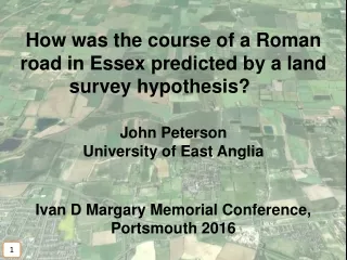
John Peterson from the University of East Anglia presents his hypothesis on how the course of a Roman road in Essex was predicted through land surveying. He discusses the development of earlier ideas, the confirmation of a new route, and the reasons why previous models went wrong. The presentation explores the wider context of the road and the use of large-scale Roman landscape surveying and planning.

E N D
How was the course of a Roman road in Essex predicted by a land survey hypothesis? John Peterson University of East Anglia Ivan D Margary Memorial Conference, Portsmouth 2016 1
Outline 1. Large-scale surveying and planning of Roman landscape: theory and possible practice 2. Development of earlier ideas about the course of Roman road 300, Radwinter to Great Chesterford 3. Confirmation of a new route, and a new model 4. Why did earlier models go wrong? 5. The wider context of the road 2
ext Military design and construction based on limitatio Preliminary Survey SURVEY limitatio LANDMARKS termini MAP forma Other Constraints Written ORDERS ROADS, FORTS, etc 5
Great Chesterford Road 300 (part) Landscape here was the basis for a hypothetical limitatio (Peterson 1988). 9
Proposed limitatio based on calculated OS coordinates. Road 300, traced from OS 1:25.000 mapping. 11
A 1:1 relationship? (Peterson 1990) 12
The same area on Google Earth The same relationship appears, but how far might it extend? 13
Development of earlier ideas about the course of Roman road 300, Radwinter to Great Chesterford 14
One definition of the road line: Essex Historic Environment Record (HER) Card PRN 211 (accessed February 2011) OS grid references in another hand, probably added after 1948. 15
Part of the line defined by the “Phillips” OS coordinates. 16
The whole “Phillips” Line. Refutation of the centuriation hypothesis? 17
However, another line has been published (Eckhardt et al 2009). Part of the alternative line (OS grid references kindly provided by Peter Brewer). 18
Question: where did this other line come from? 19
Answer: from the second part of the same record (in an entry probably predating the definition by OS grid references) 20
This road is aligned upon the South Gate of the walled town of Great Chesterford. Authority: Major J. G. S. Brinson (1950) 21
The early Brinson line (1950), as implied by Eckhardt et al (2009) and Medlycott (2011). Great Chesterford Another refutation? 22
A closer look at Great Chesterford. South Gate (later renamed East Gate). 23
Overlaid plan (Medlycott 2011). Brinson line. 26
The section of the road excavated in 1980 points the “wrong” way! Site of East Gate excavation (1980). 27
This part of Bassett’s (1982) alternative line has greater merit ... 29
... but the whole Bassett line, in purple, is not so convincing (the Brinson line also shown). 30
The Bassett line diverts to take in a “Jug and Patera” burial. 31
... but it does not fit those marks that could represent the road. Bassett Line 34
Confirmation of a new route, and a new model 35
This line, passing through intersections of limites, as already seen to the southeast, fits the previously observed crop/soil marks much better. 36
And, close by on the same line, we see ... Further crop marks, see next slide 37
... a further (previously unrecorded) mark on the same line, ... 39
... which is more clear in grey with heightened contrast ... 40
... and on a Bing image overlaid in the same position, where two parallel marks are clear. 41
Their separation may be measured using the Google Earth ruler. 12m 43
Several parts of road 300 may provisionally be modelled by a long thin polygons, 12m wide, with their southern side diagonal (at 1:1) to the limitatio. Double trace, see next slide. Note: only the trace on the southern side is visible here. 44
There are gaps, but this projected course under Great Chesterford village has not yet been refuted. Confirmed by geophysics and excavation. Projected. 48
So, there are clear spatial relationships between the early fort, road 300 and the limitatio. 49