Download
1 / 20
200 likes | 216 Views
Learn about the origin, types, and characteristics of air masses and fronts, and how they influence weather patterns. Discover how to observe air masses using instruments and understand the different types of fronts and their associated weather changes. Gain insight into the formation of mid-latitude lows and the weather conditions associated with low-pressure systems, fronts, and high-pressure areas.

E N D
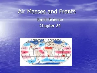
Air Masses and Fronts Earth Science Chapter 24
Origin of an Air Mass • Air mass: a huge section of lower troposphere having same kind of weather (temp & air pressure) throughout. • Air masses can be several thousand kilometers in diameter & several kms deep. • Air masses originate where winds are light, typically polar & subtropical high-pressure belts.
Kinds, Sources, & Paths of Air Masses • Temperature of air masses depends upon where it comes from (polar or tropical). • Humidity of air mass depends on whether it comes from land or sea. • Are named for source regions (or places of origin).
Naming Air Masses • Common names for air masses and their characteristics: • Maritime Tropical (mT): air mass from tropical seas, typically warm and humid. • Continental Tropical (cT): air mass from tropical land area, typically hot and dry. • Maritime polar (mP): air mass comes from cold ocean waters, typically cold and humid. • Continental polar (cP): mass comes from land areas in high latitudes, typically cold and dry. • Continental Artic (cA): air masses come from ice-covered Artic regions, and are very cold and dry
Weather in an Air Mass • So large they take days to pass over a location. • Weather inside is typical of the area over which air mass originated. • Changes in the air mass depend upon how much time that has passed since it left the source.
Skies in an Air Mass • Meteorologists have found that the conditions in an air mass depend upon the difference in temperature between the air mass and the ground. • If the ground is warmer: • Bottom layer is unstable and convection form cumulus clouds, visibility is good • If the air mass is dry, weather should be dry • If the air mass is humid, showers may occur • If the ground is colder: • Bottom layer is stable • Inversions form & visibility is poor • Condensation & precipitation will likely occur.
Observing an Air Mass • Meteorologists use a balloon-carried package of instruments (rawinsonde) to observe air masses. • The rawinsonde contains a radio transmitter that sends signals about temperature, air pressure, and relative humidity. • The balloon can carry the rawinsonde up to heights of more than 30 km. • Tracking of the rawinsondealso gives info on wind speed and direction.
What is a Front? • A front is the boundary between two air masses. • The front is where the temperature and humidity of the two air masses meet & change. • An approaching front means a change in weather is coming. • The greater the difference between the air masses the greater the change in the weather.
Characteristics of Fronts • Observations have shown that fronts have certain characteristics • Fronts tend to have gentle slopes. • Frontal surfaces may reach heights of 5 km, affect weather in an area several hundred kilometers wide. • Fronts almost always bring precipitation because warm air is rising and experiences cooling / condensation.
Kinds of Fronts • There are four kinds of fronts: • Cold front: • cold air displaces warm air • Typically has a steeper slope and moves slower due to friction with the ground surface • Warm front: • Warm air is pushing ahead and displacing colder air • Has a gentle slope and less friction • Stationary front: • Neither air mass is being displaced, and the front is not moving • Similar weather to a warm front • Occluded front: • Cold front overtakes a warm front • Warm air is lifted off the ground by the cold front
How Mid-Latitude Lows Form • A low starts as a kink or wave in the polar front that moves from east to west. • A cyclone or low forms when the warm air bulges over into the cold region of low pressure. • This causes an occluded front which can last for three days or more.
Weather Associated with Lows, Fronts, & Highs • The weather changes that occur when a low passes north of a location: • Long period of steady precipitation in advance of warm front. • Warming and slow clearing after warm front passes. • Showery precipitation as the cold front passes • Cooling and rapid clearing associated with new cold air mass.
Front Symbol Quiz!!! 1. 2. 3. 4.
Warm-Front Weather • Warm front affects weather long before rains arrive. • Clouds begin arriving: cirrus, cirrostratus then stratiform clouds. • Next, nimbostratus clouds arrive followed by precipitation. • Warming occurs once front has passed. • These conditions also typical of stationary fronts.
Cold-Front Weather • Cold fronts: steeper & faster moving. • Air ahead of a cold front is unstable, therefore cumulonimbus clouds form & thunderstorms & precipitation are likely. • Once front passes, temperatures drop rapidly & wind speed increases. • Rain usually ends shortly after the front passes.
Weather in a High Pressure area • Between lows & their fronts lie anticyclones: areas of high pressure. • A high represents a single air mass with winds blowing outward. • Bright clear weather usually present with small cumulus clouds & heavy dews and frosts at night. • Inversions may form in mornings, trapping pollution.