Download
1 / 23
230 likes | 247 Views
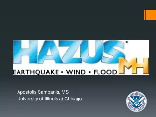
Apostolis Sambanis, MS University of Illinois at Chicago. What is HAZUS?. HAZUS is an add-on to ArcGIS to estimate physical, economic, and social impacts of disasters. It graphically illustrates the limits of identified high-risk locations due to natural disasters.

E N D
Apostolis Sambanis, MS University of Illinois at Chicago
What is HAZUS? • HAZUS is an add-on to ArcGIS to estimate physical, economic, and social impacts of disasters. It graphically illustrates the limits of identified high-risk locations due to natural disasters. • HAZUS is supported and promoted by FEMA for the purpose of providing communities with the means to identify risk from natural hazards. • Available from FEMA free of charge (requires ArcGIS license)
HAZUS-MH is a planning tool that estimates damage and losses resulting from natural hazards What is HAZUS-MH? • It is an estimation tool, NOT a deterministic tool • It is a planning tool, NOT an engineering tool • Engineering-level data (i.e. Hydrology & Hydraulic studies) can be input to increase accuracy, but results still produce planning-level estimations • It also assesses population needs related to emergency management • It also allows users to compare results from different study case scenarios, including mitigation actions HAZUS-MH is an empirical model based on observation and experiment
What is a Hazard? • From our EOHS 572 course: • “a property or situation that in particular circumstances could lead to harm” (Royal Society, 1992) • A condition or situation which has the potential to create harm to people, property of the environment Royal Society, 1992. “Risk Analysis, Perception and Management.” The Royal Society, London.
Supported Hazards • Hurricane Wind • Riverine and Coastal Floods • Earthquakes • Storm Surge (with most current version, combines flood and hurricane features)
History • Program initiated in 1992 • Earthquake model first released in 1997 • Hurricane and Flood model development initiated in 1998 • Annual updates along with interim patches as required • Most recent version has Storm Surge option
Loss Estimation Process • Identify physical landscape • Identify hazard • Consider what is at risk • Analyze social and economic impacts • Produce maps, tables, and reports
HAZUS-MH: Models FLOOD HURRICANE EARTHQUAKE
Background Inventory • HAZUS-provided inventory • General building types and occupancies • Lifelines • Replacement costs • Demographics • Hazard-specific • Specific building types • Elevation • Building configurations
Integrating User-Provided Data • Non-Hazard Data Integration Tools • Comprehensive Data Management Systems (CDMS) enables integration of locally developed non-hazard data • CDMS validates that user data are compliant with HAZUS requirements • Hazard Data Integration • User-provided hazard maps (soils, elevation, liquefaction, etc.) can enhance the accuracy of loss estimations • Each model includes tools for integrating user-provided hazard maps
Output (Cont’d) Physical Impacts Social Impacts and Economic Impacts
MODEL Flood Hurricane/Wind Earthquake Hazard RESULTS ANALYSIS HAZUS-MH: Methodology Direct Loss Economic Business Interruption Shelter Social Casualties Inventory Building Stock Essential Facilities High Potential Loss Facilities Transportation Utilities Hazardous Materials Demographics/Population Agricultural Products Vehicles PARAMETERS & SCHEMES Loss Estimation Essential Facilities Damage Assessment Emergency Response Functionality Transportation Utilities Water Power System Performance Transportation
Applications in Mitigation Planning & Emergency Management Emergency Preparedness Response & Recovery HAZUS-MH Loss Reduction (Mitigation)
HAZUS Applications:Emergency Preparedness • Develop emergency response plans • Temporary housing • Debris removal • Emergency power and water • Emergency medical services • Evacuation/emergency route clearance • Organize response exercises
HAZUS Applications:Mitigation • Mitigation Assessment • Identify ‘at-risk’ communities • Mitigation Measures • Strengthen existing structures • Strengthen window/door openings and siding • Mitigation Programs • Adopt and enforce hazard-resistant building codes • Land use planning
HAZUS Applications:Response and Recovery • Post-disaster damage assessment • Response planning for critical transportation outages • Identify critical infrastructure • Recovery action planning • Long-term economic recovery planning
How Does HAZUS Support Emergency Management? • IDENTIFY vulnerable areas • ASSESS level of readiness and preparedness to deal with a disaster before disaster occurs • ESTIMATE potential losses from specific hazard events • DECIDE on how to allocate resources for most effective and efficient response and recovery • PRIORITIZE mitigation measures that need to be implemented to reduce future losses (what if)
Who is HAZUS User? • HAZUS is used by a variety of communities and organizations across the United States: • Local and State Government • Federal Agencies • Educational Institutions • Private Industry • Others • Considerable international interest