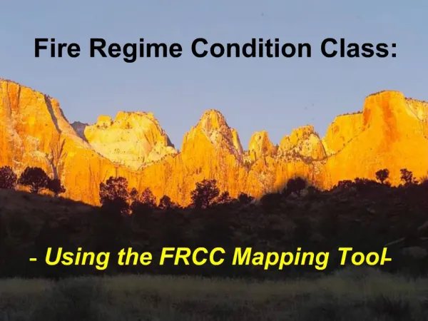
National Manual Version 1.55: Forest Land Condition Determination
This manual outlines new procedures for determining accessible forest land conditions with updated attributes and codes. It details the steps to delineate conditions and major changes from previous manuals. The guide includes rules for accessible forest land, nonforest land, water categories, and condition subclassification.

National Manual Version 1.55: Forest Land Condition Determination
E N D
Presentation Transcript
Condition Class Determination National Manual Version 1.55
Condition Class Determination • Only delineate conditions on plots that have at least one accessible forest land condition. • Do not delineate conditions on plots that are completely nonforest, inaccessible, or hazardous • New procedures to determine extent of forest land area due to national integration • New condition attributes and codes due to the national movement toward “normalized” data
Three Basic Steps • Delineate conditions based on Condition Status: • Basically, is it Accessible Forest Land or not? 2. Subdivide Accessible Forest Land based on seven condition defining attributes 3. Subdivide Nonforest Land
Step 1: Delineate Condition Status • Delineate the plot into the following condition status categories: • Accessible forest land • Nonforest land • Noncensus water • Census water • 5 Denied access area • 6 Area too hazardous to visit • 7 Area that is not in the sample (Mexico) • 9 Lost subplot/past condition data (forest only) • Change from previous manuals: • Noncensus water is now its own separate condition status and is always delineated • Use code 9 when past forest condition data is not available, or forested subplot is not relocated
Delineating Condition Status • Accessible forest land (Code 1) • Must be at least 1.0 acre in size, and 120.0 feet wide • Nonforest land (Code 2) • Must be at least 1.0 acre in size, and 120.0 feet wide • Exception: Developed nonforest conditions can be any size (30 series land use codes) • Noncensus water (Code 3): • Linear water courses between 30.0-200.0 feet wide • Bodies of water between 1.0-4.5 acres • Census water (Code 4): • Linear water courses 200.0 feet wide or larger • Bodies of water 4.5 acres or larger
Delineating Condition Status • The rest of the condition classes can be any size: • Denied access (Code 5) • Hazardous area (Code 6) • Area not in the sample (Code 7) • Lost subplot/condition data (Code 9) • Note: Only use the lost subplot/condition data for accessible forest conditions • Nonforest subplots are never lost • Record Condition Status code 2 for nonforest conditions on a plot that has no past condition data
Delineating Condition Status • Major change in determining the boundaries of accessible forest conditions: • Nonforest conditions that are less than 120 feet wide or less than 1.0 acre do not stop a forest land condition from continuing across the nonforest entity • This includes developed nonforest entities like right-of-ways, even though they are delineated as a nonforest condition on the plot • Also includes noncensus water courses between 30-120 feet wide, even though they are delineated as a nonforest condition on the plot
Definitely Forest Forest Utility Line 90 feet 25 ft Road Forest? 30 ft Definitely Nonforest Delineating Condition Status
Delineating Condition Status Limit on size of forest area between nonforest conditions: • Individual pieces of forest conditions divided by nonforest land cannot be smaller than 30 ft x 120 ft • These individual pieces have to be within 120 ft of forest land that is 120 ft wide and 1.0 acre
Developed Nonforest Forest Piece Forest land >120 ft and >1.0 acre Delineating Condition Status
Delineating Condition Status Another major change in determining boundaries of accessible forest land: • Application of the 90 degree rule • When bisecting forested points that are less than 90 degrees, no distinct boundary line exists on the the ground • Classify the entire subplot according to where the subplot center falls • If subplot center lands in the side of the woods that is greater than 120 feet wide, then the whole subplot is forest • If the subplot falls in the side of the woods that is less than 120 feet wide, then the whole subplot is nonforest
Delineating Condition Status Forest point with no distinct boundary. Location of subplot center determines condition status of entire subplot. In this case, the whole subplot is forest: This rule holds true if the forest and nonforest areas in the above diagram were reversed. In that case the subplot would be nonforest.
Step 2: Subdivide Accessible Forest Land • Subdivide accessible forest land on the plot into smaller forest conditions due to differences in any of the following condition defining attributes: • Past Condition Status • 2 Reserved Status • 3 Owner Group • 4 Forest Type • 5 Stand Size Class • 6 Regeneration Status (formerly “Stand Origin”) • 7 Tree Density • Past Condition Status is a new condition defining attribute • Codes are listed from highest to lowest priority
Subdividing Accessible Forest (Status Code 1) • Major change to size requirement of within forest conditions: • Size of within forest conditions must now be 120 feet wide and 1.0 acre • Special size exemption for “riparian areas” – 30 feet wide and 1.0 acre • Associated with water course or body of water • Differ in at least one of the condition defining variables • Must be within forest – 30 ft strip of woods associated with a river that runs through nonforest land is not a forest condition
Subdividing Accessible Forest (Status Code 1) Addition of Past Condition Status to forest condition defining attributes: • All reverted forest areas are recorded as separate conditions on the plot • Regardless of size • Regardless of similarity between all other forest condition defining attributes • Must be within forest – 30 ft strip of woods in middle of a large pasture is not a forested condition
Step 3: Subdivide Nonforest Land Nonforest land conditions generally recorded as one condition Census water still its own separate condition status and is always delineated on the plot • Change from previous manuals: • Noncensus water is its own separate condition status • Now it is always delineated on the plot from other nonforest land conditions if present • Subdivide landcleared conditions (Past Condition Status = Forest) from other nonforest conditions on the plot
Subdividing Nonforest Land (Status Code 2) Nonforest land areas usually recorded as one condition • Example: • Both a road and pasture land are on the current plot • Both were nonforest at last inventory • Both areas are recorded as ONE nonforest condition status This procedure is NOT different than the previous manuals
Subdividing Nonforest Land (Status Code 2) • Exception to grouping nonforest land uses: • Landcleared areas • Regardless of size and width • Example: • Both a road and pasture land are on the current plot • Only the road was nonforest at the last inventory • The pasture land was forest at last inventory • These are recorded as TWO separate nonforest conditions on the plot, because the pasture was landcleared This procedure IS different from the previous manuals!
Boundary Changes • Do not map the following “indistinct” boundaries on a subplot: • Do not map the 120 foot line on a subplot when bisecting a point that is less than 90 degrees • Stand Size must be at least 2 classes apart for it to delineate separate conditions on a subplot
SK 1 & 3 Plots Forest area that narrows to a point with no distinct boundary. The whole subplot is forest. Initial, or replacement plots are no problem. The whole subplot is forest. GREEN AREA: Present LU = 01 New Past LU = 01 OLD LU is not recorded on SK1 or 3 plots
SK 2 Plots • On SK2 plots, the 120 foot line was mapped on the subplot last survey • Need to show the area on the subplot that switched land uses due to landclearing, reversions, and procedural change • Record the same boundary as previous crew • Combination of Present Land Use, New Past Land Use, and OLD Land Use will indicate the procedural change • Record Similar Identified Condition Number
SK 2 Plots Forest area that narrows to a point with no distinct boundary. The whole subplot is forest. Last time the green area was forest and the red area was nonforest. Record the old crew’s boundary. Red area is separate condition. GREEN AREA: Present LU = 01 New Past LU = 01 OLD LU = 01 RED AREA: Present LU = 01 New Past LU = 01 OLD LU = Nonforest Record Similar Identified Condition > 0