Download
1 / 7
70 likes | 235 Views
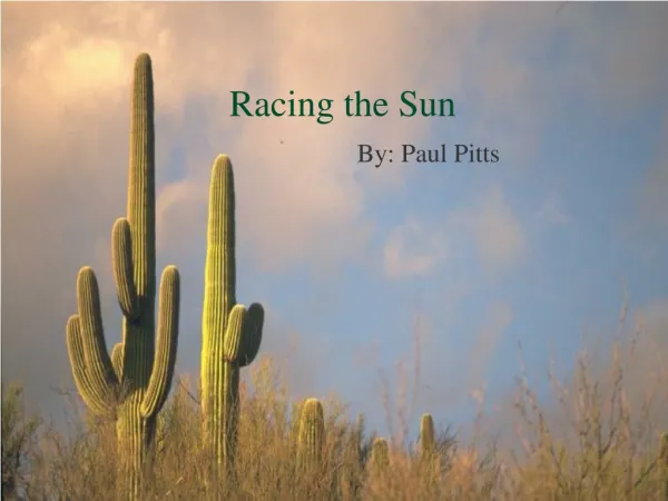
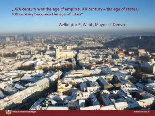
,, XIX century was the age of empires , XX century – the age of states , XXI century becomes the age of cities” Wellington E. Webb, Mayor of Denver. 1. VILNIUS : FACTS & FIGURES. ≈30 km. ≈50 km. 16 m illion inhabitants in a 300 km radius Vilnius population 5 27 930

E N D
,,XIX century was the age of empires, XX century – the age of states, XXI century becomes the age of cities” Wellington E.Webb, Mayor of Denver 1
VILNIUS: FACTS & FIGURES ≈30 km ≈50 km • 16 million inhabitants in a 300 km radius • Vilnius population 527 930 • Daytime population 680000 • Metropolitan area population800000 • Vilnius County generates ~ 40% of Lithuania’s GDP. • Fastest Internet upload speed in the world • One of the most multilingual people in the EU • 20 universities and colleges in Vilnius • 10th place in the World in Smart City rankings • Best tap water quality
VILNIUS CHALLENGE: URBAN COMPARISON OF URBAN STRUCTURES Paris Area – 105 sq km Population – 2211297 Density–21,060 /sq km Vilnius Area – 402 sq km Population – 527 930 Density–1,340 /sqkm2 Barcelona Area – 101 sq km Population – 1621537 Density–16,055 /sq km The area of Vilnius is 4 times larger than Barcelona or Paris Density is very low
CURRENT MODEL OF THE URBANISTICAL STRUCTURE CENTRAL ZONE XII-XIX century MIDDLE ZONE XX century PERIFERRIAL ZONE XX-XXI century “3 zones with different problems”
STRATEGIC OBJECTIVES UNTIL 2015 Polycentric development 120 ha for the conversion in the city center • To concentrate on the city center, to avoid the extensive development by all directions • To move out the industry from the central city territories
DEMOGRAPHICAL CHALLENGES Men Women Decrease of population from 25 till 50 years Elderly people live in the city center, younger - moved to suburbs.
CONVERSION PROJECT-PARK OF ARCHITECTURE • Conversion of 78 ha • Istage – 5 ha development of the former factory territory “Skaiteks“ • Planned multifunctional sustainable quarter with 2200 inhabitants; • Planned investments into Skaiteks factory conversion till 2021 m.~ 400 MLTL • Best example of PPP where the city invest in to the contaminated soil cleaning, building the infrastructure, rehabilitating public spaces