Urban Drainage & Flood Control District Flood Warning Program
250 likes | 459 Views
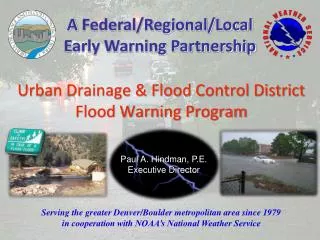
A Federal/Regional/Local Early Warning Partnership. Urban Drainage & Flood Control District Flood Warning Program. Paul A. Hindman, P.E. Executive Director. Serving the greater Denver/Boulder metropolitan area since 1979 in cooperation with NOAA’s National Weather Service.

Urban Drainage & Flood Control District Flood Warning Program
E N D
Presentation Transcript
A Federal/Regional/Local Early Warning Partnership Urban Drainage & Flood Control District Flood Warning Program Paul A. Hindman, P.E. Executive Director Serving the greater Denver/Boulder metropolitan area since 1979in cooperation with NOAA’s National Weather Service
Flood Warning Program Primary Mission Provide local governments with early notifications of potential and imminent flood threats (primarily flash flood threats) in time to take appropriate defensive actions. Saving lives and property
A NEW CHALLENGE The Fourmile Canyon Fire Labor Day September 6, 2010
Gold Hill…Summerville…Salina…Wallstreet...Logan Mill…Crisman…Betasso…Orodell…Boulder Mountain Lodge Fourmile creek flood risk assessment Last update: 3-18-2011
FMC Burn Area & Boulder Creek Watershed 1,145 ac 4,577 acres 389 ac
Twenty homes along Fourmile Creek are at risk from flood flows ranging from 500 to 1,500 cfs—a highly likely event. An additional 30 homes are at risk of flooding from larger floods (1,500 to 6,000 cfs) and 11 more from less likely, but possible events approaching 10,000 cfs. This brings the total to 61 homes threatened. An additional 10 to 15 homes adjacent to Gold Run are also at high risk from flooding and debris flows.
Three commercial properties along Fourmile Creek at risk from flood flows ranging from 500 to 6,000 cfs. The Boulder Mountain Lodge is the highest risk facility of the three.
High debris flows will further increase flood risk by reducing the capacity of the channel and road crossings to convey floodwater.
Hydrologic ModelsHigh flood threat from commonly occurring rainfall BC 1894 Flood 12,000 cfs BC Typical Annual Snowmelt Peaks 500 to 1,000 cfs BC = Boulder Creek FMC = Fourmile Creek FMC-BA 100% saturated at start of rainfall Boulder properties at risk BC 1969 Flood FFW for Boulder ?? FMC FMC Typical Annual Peaks < 100 cfs Pre-burn runoff experience
Significant damages and life-threatening conditions expected from flood peaks ranging for 500 to 1,000 cfs on Fourmile Cr. Represents range of peaks from other models. Other models assume average antecedent watershed condition at start of rainfall. FMC-BA 100% saturated at start of rainfall Debris flow threat per USGS FFW for Fourmile Cr FFA for FMC
Fourmile Creek Peak Runoff Estimates 1,700 cfs will overtop SH 119 NOTES: Vieux peaks assume saturated BA at start of rain, i.e. worst case scenario Burn area outfall located ~5 miles upstream from Boulder city limit (canyon mouth). Fourmile Creek confluence w/Boulder Creek located ~2 miles upstream of Boulder. Peak discharge estimates in cfs relate only to runoff from the FMC Burn Area.
Fourmile Creek Saturated Watershed – Worst Case 1,700 cfs will overtop SH 119 NOTES: All models assume saturated BA at start of rain, i.e. worst case scenario WWE adjusted slightly to best fit data plot. Burn area outfall near Crisman located ~5 miles upstream from Boulder city limit (canyon mouth). Fourmile Creek confluence w/Boulder Creek located ~2 miles upstream of Boulder. Peak discharge estimates in cfs relate only to runoff from the FMC Burn Area. Last update: 3/18/2011
Short Travel Time/Minimal Attenuation Flood hydrograph routed to 6th Street in Boulder Approximate magnitude of 1969 flood on Boulder Creek Hydrograph routed 5 miles from FMC-BA to western Boulder city limit (Boulder Creek canyon mouth). 1 hour
June 3, 2002 Rainfall history
Most intense rainfall measurement 1990 – 2010 (21 years) May 15, 2003 75-minute rainfall totals ending at 8:35 PM Peak 1-hour at Betasso2.35” Boulder Creek at Bridge
ALERT System Rainfall Record Analysis by Water & Earth Technologies, Inc.
Measured Rainfall Events > 0.9” in 1-hour37 days between 1990 & 2010 2 days in May 5 days in June 20 days in July 9 days in August 1 day in September
Measured Rainfall >0.5” & < 0.9” in 1-hr151 days between 1990 & 2010 15 days in April 18 days in May 29 days in June 31 days in July 34 days in August 24 days in September
Some Facts & Opinions • One-hour rainfall measurements from the ALERT System exceeded 0.9” on 37 days in the past 21 years at one or more locations within a 6-mile radius from the center of the FMC-BA. • 0.75” to 1.25” of rainfall over the FMC-BA is capable of producing flood peaks on Fourmile Creek that could overtop SH 119 (Qcap ~1,700 cfs unobstructed) • As little as 500 cfs will threaten existing private drive crossings along FourmileCreek, which is highly likely from 1-hour rainfalls exceeding 0.5” • The number of private homes and other habitable structures at risk from flooding in the FMC-BA and along Fourmile Creek downstream is large (60-75). • The Boulder Mountain Lodge is at very high risk of inundation due to its location being a short distance upstream of SH 119, which can backup floodwaters to a depth of 19-feet or more when flow rates exceed 1,000 cfs. • Liquid propane tanks pose a significant threat that could impact Boulder. • The May 30, 1995 estimated peak flow of 400-500 cfs on Fourmile Creek was likely the largest in recent memory. • The May 15, 2003 storm...a 100-year rainfall at the Betasso…produced an estimated peak flow of only 400 cfs in Fourmile Creek. That would look much different today.