Download

1 / 12
120 likes | 302 Views
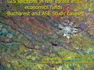
GIS solutions in real estate and economics fields -Bucharest and ASE Study cases-. Gavris Alexandru Academia de Studii Economice din Bucuresti Facultatea de Relatii Economice Internationale. Summary. Whats GIS – a short recap Real Estate – whats the best location

E N D
GIS solutions in real estate and economics fields-Bucharest and ASE Study cases- Gavris Alexandru Academia de Studii Economice din Bucuresti Facultatea de Relatii Economice Internationale
Summary • Whats GIS – a short recap • Real Estate – whats the best location • Economics – how much we’ll earn/ is there an easier way of teaching • Geography – are we living/building/teaching/selling on Earth • Case studies: Bucharest and proposals for ASE
What's 2 know about GIS? • Programs that make life easier in real estate and economics • Show me the map • A map worth x$ more than any word • Definition: analyze, store, create, manage, amaze and tell the real story of geography (space)
GIS solutions GIS Desktop Web GIS GIS Servers LBS/Mobile/ Wireless Idea Source: ESRI presentation
Real estate – what do we want? • Best location (identification, local pressure) • Space availability for construction • Time management (dead-line or the age of the buildings) • Clear and without error data • Reducing costs • Better integration GIS has all of these
Advantages of GIS for Real Estate • Determining the attraction areas • Determining the consumers preferences and their typology • The right location among other competitors • Clear recommendations focused on real estate situation • Making maps which can be useful at the moment but also at any (maps of situation, maps of evolution) • Obtaining of a whole image of the markets • Evolution modeling
Economics – as for ASE • Business analysis (spatial) • Real estate – hopefully well be soon implemented • Marketing – any market has its own location which intersects • Programming and software editing • Using economics data for agricultural land use • Testing location theories through visual models – case studies • Integration in economics of the best solutions from various fields • Calculating statistics easily and visualization of the data for a given area • Integration of our economics research to the national programs and more over to the administrative departments • Economic flows • Space analyses of finance and banking GIS can answer 2 all these and more
Geography • Did I tell u that we are interested in location, location, location • Manage 2 link the previous fields through GIS technology • Improves analysis Real estate
Is there a single free space where we can build in Berceni large housing estate
Model of teaching GIS for economics • Defining GIS • Benegits of GIS to real estate, administration, research • Types of GIS analysis used for real estate: marketing, management, and finacial analysis • Bussines and mapping data for real estate • Location GIS data for salers, brokers etc • Hands on analysis of a sample GIS real estate data set