Optimizing New Cell Tower Location in Seattle Using GIS Analysis
This presentation discusses the process of finding the best location for a new cell tower in the Seattle area to enhance service coverage. It includes data collection on land features, such as elevations, environmental restrictions, and current cell tower locations. Data analysis involved merging non-build areas, creating buffers around existing towers, and identifying suitable sites based on available land parcels. The results show increased cell coverage and improved access through higher elevations, while avoiding areas with building restrictions. The study references sources like WAGDA, KCGIS, and FCC Wireless Telecommunications Bureau.

Optimizing New Cell Tower Location in Seattle Using GIS Analysis
E N D
Presentation Transcript
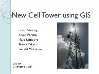
New Cell Tower using GIS FawmSaefong Bryan Pereira Marc Lamothe Trevor Takara Gerald Mickelsen CEE 424 December 5th, 2011
Presentation Contents • Intro/Objectives • Data Collection • Data Analysis • Results/Conclusion • Works Cited
Intro/Objectives • Find a location for a new cell tower in the Seattle area • Increase service in areas with less coverage • Create better access through higher elevations • Find the most suitable location based on land features
Data • Elevations (Seattle area) • Environmental non-build areas (seismic, erosion, coal mines, landslides) • Hydraulic non-build areas (floodways, floodplains) • Buildings and Land Parcels • Current Cell Towers
Coals Mines and Seismic Coal Mines Seismic Projection: NAD_1983_StatePlane_Washington_North_FIPS_4601_Feet
Erosion and Landslides Erosions Landslides Projection: NAD_1983_StatePlane_Washington_North_FIPS_4601_Feet
Floodways and Floodplains Floodways Floodplains Projection: NAD_1983_StatePlane_Washington_North_FIPS_4601_Feet
Data Analysis • Merge non-build areas to create a single layer • Create 5 miles buffer around existing cell towers • Locate area to build new cell tower and examine existing buildings/parcels
Single non-build layer Projection: NAD_1983_StatePlane_Washington_North_FIPS_4601_Feet
Current Cell Towers With 5 Mile Buffer Projection: NAD_1983_StatePlane_Washington_North_FIPS_4601_Feet
Location for New Cell Tower Projection: NAD_1983_StatePlane_Washington_North_FIPS_4601_Feet
New Cell Tower Projected Coverage Projection: NAD_1983_StatePlane_Washington_North_FIPS_4601_Feet
Final Product Projection: NAD_1983_StatePlane_Washington_North_FIPS_4601_Feet
Results/Conclusion • Found the best location for a new cell tower • Increased cell coverage in the city • Avoided areas that were unable to build on
Works Cited • WAGDA • KCGIS • FCC Wireless Telecommunications Bureau