Tornadoes....The recent Oklahoma experience.
1.07k likes | 1.34k Views
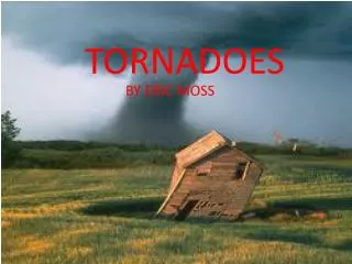
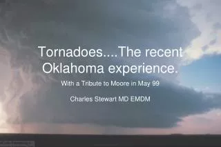
Tornadoes....The recent Oklahoma experience. With a Tribute to Moore in May 99 Charles Stewart MD EMDM. Evolution of the tornado. Formation of a Thunderstorm.

Tornadoes....The recent Oklahoma experience.
E N D
Presentation Transcript
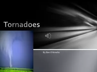
Tornadoes....The recent Oklahoma experience. • With a Tribute to Moore in May 99 • Charles Stewart MD EMDM
Formation of a Thunderstorm • When the ground warms and the high air is cold… the warm air near the surface rises. As it cools, the water vapor will condense, forming clouds
Ordinary Thunderstorms • Three stages have been identified in ordinary thunderstorms: • an unstable atmosphere and vertical updrafts keep precipitation suspended • entrainment of dry air that causes cooler air from evaporation, triggering downdrafts and falling precipitation and gust fronts • weakening updrafts and loss of the fuel source after 15 to 30 minutes.
Severe Thunderstorms • Severe thunderstorms produce a minimum of • 3/4 inch hail and/or • wind gusts of 50 knots and/or • tornado winds. • In ordinary storms, the downdraft and falling precipitation cut off the updraft. • In severe storms, winds aloft push the rain ahead and the updraft is not weakened and the storm can continue maturing. • The single supercell storm shown here maintained its structure for hours
Multicell Storms Cool downdrafts leaving a mature and dissipating storm may offer relief from summer heat, but they may also force surrounding, low-level moist air upward. Hence, dying storms often trigger new storms, and the successive stages may be viewed in the sky.
Pre-frontal Squall Lines Pre-frontal squall lines identify major storms triggered by a cold front that may contain several severe thunderstorms, some possibly supercells, extending for more than 1000 kilometers. This 1989 storm spawned 25 tornadoes, the worst killing 25 people.
Mesoscal Convective Complex An organized collection of thunderstorms extending across a large region is a mesoscale convective complex (MCC). MCC's can regenerate new storms and last for upwards of 12 hours and may bring hail, tornadoes, and flash floods. They often form beneath a ridge of high pressure.
Gust front and Microburst • Turbulent air forms along the leading edge of the gust front, which can generate tumbling dust clouds. • Such gust fronts and associated cold dense air often feel like a passing cold front, and may cause a 1 to 3 mb local rise in pressure, called a mesohigh.
Shelf Cloud • When unstable air is prevalent near the base of the thunderstorm, the warm rising air along the forward edge of the gust front is likely to generate a shelf, or arcus, cloud.
Trailing Stratified Clouds • An extensive region of stratified clouds may follow behind a squall line. • This figure shows a loop of rising and falling air that supplies the moisture to the stratiform clouds and associated light precipitation
Wind Shear Formation • When winds aloft blow in one direction and winds on the surface blow in another direction, they create a horizontally rotating mass of air This is wind shear formation --- the ‘roll cloud’.... more later.
Dry Line Formation Abrupt geographic changes from moist to dry dew-point temperature, called drylines, form in western TX, OK, and KS in the spring and summer. Cool air pushes hot and dry air over the warm moist air, at the height of the central plains. Such mixing causes large scale instabilities and the birth of many supercell storms.
Thunderstorm Movement • Middle troposphere winds control individual thunderstorms. • Dying storm downdrafts spawn new storms so the storm system moves rightwards relative to the upper level winds. • Here upper level winds move storms to the northeast, but downdrafts generate new cells to the south, which eventually cuts off moisture to the old cell.
Lightning & Thunder Charge differences between the thunderstorm and ground can cause lightning strokes of 30,000°C, and this rapid heating of air will creates an explosive shock wave called thunder, which requires approximately 3 seconds to travel 1 kilometer.
Lightning Stroke Development Charge layers in the cloud are formed by the transfer of positive ions from warmer hailstones to colder ice crystals. When the negative charge near the bottom of the cloud is large enough to overcome the air's resistance, a stepped leader forms. A region of positive ions move from the ground toward this charge, which then forms a return stroke into the cloud.
Types of Lightning Nearly 90% of lightning is the negative cloud-to-ground type, but positive cloud-to-ground lightning can generate more current and more damage. Several names, such as forked, bead, ball, and sheet lightning describe forms of the flash. Distant, unseen lightning is often called heat lightning.
Lightning Rods & Fulgurite Metal rods that are grounded by wires provide a low resistance path for lightning into the earth, which is a poor conductor. The fusion of sand particles into root like tubes, called fulgurite, may result.
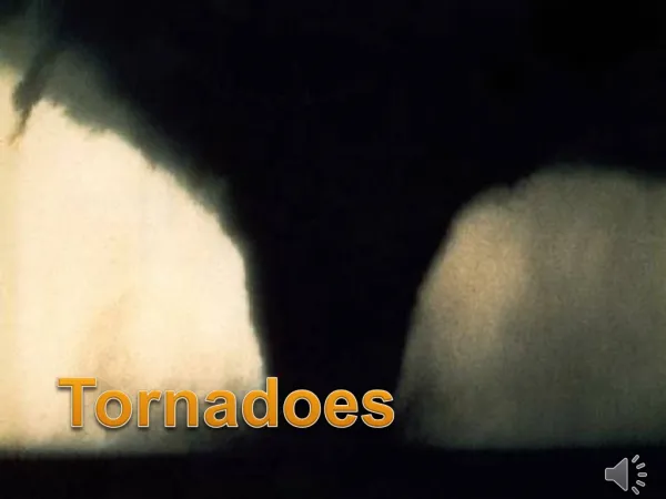
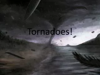
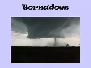
Tornado A rapidly rotating column of air often evolves through a series of stages, from dust-whirl, to organizing and mature stages, and ending with the shrinking and decay stages. Winds in this southern Illinois twister exceeded 150 knots.
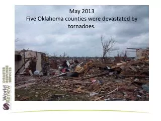
Tornado Occurrence Tornadoes from all 50 states of the U.S. add up to more than 1000 tornadoes annually, but the highest frequency is observed in tornado alley of the Central Plains. Nearly 75% of tornadoes form from March to July, and are more likely when warm humid air is overlain by cooler dryer air to cause strong vertical lift.
The 4 “New Tornado Alleys” Recent researchshows that there are really 4 separate tornado alleys… Tornado alley Hoosier alley Dixie alley Carolina alley
Transition... • How we get from.... • To here:
Wind Shear initiates rotation... Remember wind shear formation --- the ‘roll cloud’ -
The first sign that a supercell may form a tornado is rotating clouds at the base of the storm, which may lower and form a wall cloud, shown in this picture.
Rotation Moved From Horizontal to Vertical Spinning horizontal vortex tubes created by surface wind shear may be tilted and forced in a vertical path by updrafts. This rising, spinning, and often stretching rotating air may then turn into a tornado. This changes the roll cloud into a vertical formation: A tornado
Tornado Wind Speed As the tornado moves along a path, the circular tornado winds blowing opposite the path of movement will have less speed. For example, if the storm rotational speed is 100 knots, and its path is 50 knots, it will have a maximum wind of 150 knots on its forward rotation side.
Suction Vortices... A system of tornadoes with smaller whirls, or suction vortices, contained within the tornado is called a multi-vortex tornado. Damage from tornadoes may include its low pressure centers causing buildings to explode out and the lifting of structures. Human protection may be greatest in internal and basement rooms of a house.
Tornado Occurrence Tornadoes from all 50 states of the U.S. add up to more than 1000 tornadoes annually, but the highest frequency is observed in tornado alley of the Central Plains. Nearly 75% of tornadoes form from March to July, and are more likely when warm humid air is overlain by cooler dryer air to cause strong vertical lift.
Tornado Watch... or Warning? Tornado watches are issued = tornadoes are likely Tornado warning = a tornado has been spotted. Once the storm has passed, the magnitude of the storm is classified based on damage done by the storm. – This is the ENHANCED Fujita scale.
Tornado Breeding Superstorms Supercell thunderstorms may have many of the features illustrated here, including a mesocyclone of rotating winds formed when horizontal vorticity was tilted upwards.
Rear Flank Downdraft Supercell thunderstorm development may create an area where the updraft and counterclockwise swirl of upper winds converge into a rear flank downdraft. This downdraft can then interact with lower level inflow winds and spawn a tornado.
Non-Supercell Tornadoes If a pre-existing wall cloud was not present, than any tornado formed is not from a supercell storm. These tornadoes are often not as strong as those formed by supercells.
A single Doppler radar unit can uncover many features of thunderstorm rotation and movement, but cannot detect winds parallel to the antenna. As such, data from two or more units might be combined to provide a complete view of the storm. Doppler lidar (light beam rather than microwave beam) provides more details on the storm features, and will help measure wind speeds in smaller tornadoes. Doppler Radar
NEXRAD Wind Analysis • NEXt Generation Weather RADar (NEXRAD) • Uses Doppler measurements to detect winds • moving toward (green) • moving away (blue) • Which shows areas of rotation and strong shear.
Waterspout Warm, shallow coastal water is often home to waterspouts, which are simply a tornado over water The waterspout does not draw water into its core, but is a condensed cloud of vapor. A waterspout may, however, lift swirling spray from the water as it touches the water surface.
Comparing Beaufort, Fujita, and Mach Scales These scales have wind speed defined first, impacts/damage were assigned to wind speeds. M1.0 F12 M0.8 Beaufort: V = 1.870B3/2mph F – scale: V = 14.1(F+2)3/2mph Mach scale: V = (742 +1.3)Mmph M0.7 M0.6 F5 B17 F4 F3 B11 B9 F2 B7 F0 B5 F1 B3 B1 0 1 2 3 4 5 6 7 8 9 10 11 12 Fujita Scale 0 1 2 3 4 0.6 1.0 5 6 7 8 9 10 11 12 Mach Scale Beaufort Scale
Fujita Tornado Scale The Fujita scale is designed to show the wind speed. Damage assessment was derived after the fact… this led to a few problems.
The Enhanced Fujita Scale The Enhanced Fujita scale is a damage assessment scale that is related to wind speed. Damage assessment drives the calculation and assignment of the ‘EF’ number.
EF has 28 Damage Indicators Residences Commercial/retail structures Schools Professional buildings Metal buildings/canopies Towers/poles Vegetation
Each indicator has “Degrees Of Damage” Note some consecutive DODs have larger overlap than others Example DODs for a Framed House DI (FR12 or DI2)