Download

1 / 20
200 likes | 401 Views
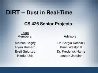
DiRT - Dust in Real-Time: The Specification Process. Marcos C. Bagby, Ryan A. Romero, Brett L. Sulprizio, Hiroko Uda, Joseph R. Jaquish, Frederick C. Harris, Jr. Introduction. Overall Goal Desert Research Institute Immersive Visualization Lab. Desert Terrain. Introduction.

E N D
DiRT - Dust in Real-Time: The Specification Process Marcos C. Bagby, Ryan A. Romero, Brett L. Sulprizio, Hiroko Uda, Joseph R. Jaquish, Frederick C. Harris, Jr.
Introduction • Overall Goal • Desert Research Institute • Immersive Visualization Lab. • Desert Terrain
Introduction • Short Term Goal • Therefore, we need to simulate/model Dust • Realistic • Videos • Real time simulation might be difficult.
Introduction • This project is an ongoing research project that could not be completed in 1 semester. • In Senior Projects the students use a streamlined software engineering process to design and implement their projects.
Requirements Specification • Two Types • Functional • Non-Functional
Requirements Specification • Functional • R01 [1] DiRT shall use volumetric fog extensions. • R02 [1] DiRT shall simulate dust dissipation. • R03 [1] DiRT simulates wind patterns. • R04 [3] DiRT shall check to see if current computer hardware can run the simulation. • R05 [2] DiRT shall display the current frame rate. • R06 [1] DiRT shall allow the user to start the simulation. • R07 [1] DiRT shall allow the user to stop the simulation at any time. • R08 [1] DiRT shall display the methods of dust simulation. • R09 [3] DiRT shall allow the user to change the terrain. • R10 [1] DiRT shall allow the user to change the point of view. • R11 [3] DiRT shall enable the user to customize the lighting.
Requirements Specification • Functional • R12 [1] DiRT shall support a free form camera. • R13 [1] DiRT shall support a first person pilot camera view. • R14 [3] DiRT shall allow the user to load terrain maps. • R15 [2] DiRT enables the user to change the screen resolution. • R16 [2] DiRT shall enable the user to switch from pilot view to free camera perspective. • R17 [1] DiRT shall use the keyboard to control vehicle movement. • R18 [1] DiRT shall enable the pilot to fly/drive the vehicle. • R19 [2] DiRT shall enable the user to change the model used for the vehicle. • R20 [3] DiRT shall enable the user to toggle the terrain to on, off, wire-frame, smooth, and smooth + wire-frame. • R21 [3] DiRT shall enable the user to change the speed of the simulation (slow down or speed up).
Requirements Specification • Non-Functional • T01 DiRT will be able to run all dust methods in real-time. • T02 DiRT will ask a user to choose a displaying method from the three: • 1. Volumetric fog dust • 2. Diffuse reflection dust. • 3. Particle system. • T03 DiRT shall be implemented with OpenGL and Qt. • T04 DiRT shall be a cross-platformapplication. • T05 DiRT shall be written in C++.
To better understand the functionality of DiRT, the system has been divided into use cases. This figure presents the interaction of the user with DiRT EnableFogDust EnableRefractionDust EnableParticleDust ToggleTerrain DriveByKeyboard DriveByMouse ControlCamera ChangePerspective ChangeHeightMap ChangeTerrainMap Use Case Modeling
As part of the process the team constructed a use case / requirement traceability matrix. This partial matrix shows how the use cases and requirements interact. Use Case Modeling
The system architecture is divided into various subsystems. Architectural Design
Architectural Design • The structure of DiRT was done using an object oriented approach. • As such there were several charts and diagrams built to clarify the design. • The first was a class diagram.
Qt Libraries GLFractal 2 1 -glFogCoordfEXT : PFNGLFOGCOORDFEXTPROC -g_nWallTex : GLuint -object : GLuint -xRot : GLfloat -yRot : GLfloat -zRot : GLfloat -scale : GLfloat -eyex : int -eyey : int -eyez : int -fogdense : double -hMap : HeightMap* -displayListTex : GLint -displayListColor : GLint -displayListMesh : GLint -camera : double[16] -tex :Glint[1] -glContext : QGLContext* -scrollVal : double -stereo : bool -stereoEye : bool -tx, -ty, -tz : double -rx, -ry, -rz : double -x : int[2] -y : int[2] -RADIUS : double -voldegree : float -radiuslen : float -alpha : double -beta : double -gamma : double -eyeX, -eyeY, -eyeZ: GLdouble -eye : GLdouble[4] -at : GLdouble[4] -up : GLdouble[4] 1 Class QSlider Class VBox 1 1 1 1 3 Class Qdialog 1 Class QCheckBox Class QRadioButton 1 1 1 1 3 1 1 Class Line 1 1 1 Class QLabel Class QLCDNumber 1 HeightMap N #width : int #height : int #xCorner : double #yCorner : double #cellSize : double #min : double #max : double #noVal : double #data : double* -swapInPlace( buffer : void*, size : int ) : void* -loadAscii( fileName : char* ) : HeightMap* -loadBinary( filename : char*) : HeightMap* +getWidth() : int +getHeight() : int +getXCorner() : double +getYCorner() : double +getCellSize() : double +getInvalidFlag() : double +getMinimum() : double +getMaximum() : double +getTrueMinimum() : double +getTrueMaximum() : double +getEntry( row : int, col : int ) : double& +getRow( row : int ) : double* +getData() : double* +setHeightMap( heightMap : HeightMap* ) : void +setTextureFile( path : char* ) : void #initializeGL() : void #paintGL() : void #resizeGL( w : int, h : int ) : void #OnDisplay() : void #LoadTexture ( filename : char*, eWrap : GLenum, nTex : GLuint ) : void #keyPressEvent( e : QKeyEvent* ) : void #drawGLQuad( x : float, y : float, z : float ) : void #drawDustVol( theta : float, radius : float ) : void #DisplayTerrain() : void #drawBox() : void #isTolerableRowDiff( row : int, coll : int, col2 : int ) : int #isTolerableColumnDiff( col : int, row1 : int, row2 : int ) : bool #setHeightMap( heightMap : HeightMap* ) : void #renderRowTex( row : int ) : void #renderRowColor( row : int ) : void #renderMesh() : void #renderSmoothedMesh( showColors : bool ) : void Class Diagram (partial)
The second was a system activity chart which is shown here System Activity Chart
Current Status • Terrain Input • video
Current Status • A lot of work has continued on this portion because of the importance to the whole system • We have a paper going out tomorrow describing a new algorithm for triangle decimation that increases performance dramatically here • This is important because the data sets are HUGE!!!
Future Work • Other Preliminary Work • Data Selection • Back to DiRT • Three Methods • Volumetric Fog • Diffuse Reflection • Particle Systems • Probably not effective due to the processing power needed. • Video Example