Download
1 / 17
170 likes | 300 Views
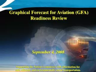
The Graphical Forecast for Aviation (GFA) aims to support the nation’s commerce by providing timely information for safe, efficient, and environmentally sound transportation. This initiative includes the development of Graphical AIRMET (G-AIRMET) to offer more precise snapshots than current AIRMET. With automated generation of AIRMET text and standardized graphical products, GFA enhances situational awareness for aviation professionals. Phased implementation ensures that critical information is made available promptly, benefiting users with improved data and ease of access.

E N D
GFA ReviewDecember 13, 2007 Supporting the Nation’s commerce with information for safe, efficient, and environmentally sound transportation.
GFA Production Motivations • Greater spatial and temporal resolution than current AIRMET • 3 hour snap shot as opposed to 6 hour time smear • Increase product issuance • Creating graphical product that is geo-referenced form (BUFR) to allow product to be displayed in end user systems • Standardize AIRMET text product by deriving it from graphical product in a automated fashion Supporting the Nation’s commerce with information for safe, efficient, and environmentally sound transportation.
Graphical Forecast for Aviation GFA • Two Phased Implementation • Phase I • Development and implementation of a Graphical AIRMET (G-AIRMET) and automatically generated AIRMET text • Phase II • Development and implementation of a full GFA • Benefit • Allows more important portion of the GFA to be available in graphical form much sooner than field the complete GFA all at once Supporting the Nation’s commerce with information for safe, efficient, and environmentally sound transportation.
Step 4 Graphical AIRMET G-AIRMET Step 5: Operational G-AIRMET (1stQ FY09) Step 4: Experimental G-AIRMET (FY07-08) Step 3: Standardized Text AIRMET (Nov 2006) Step 2: Draft AIRMET (Dec 2005) Step 1:Draft FROM LINE (July 2005) • Step 4: Experimental production and delivery of the G-AIRMET • Snapshots used to produce text • Currently Smear used to produce text • Currently snapshots generated on midnight shift for 1 bulletin • Operational Text produced from GraphicallyProduced Experimental Snapshots • Currently Operational Text produced from graphically produced smear • Access to experimental BUFR for evaluation • Currently BUFR message produced forinternal evaluation • Routine display of snapshots onTestbed website • Currently not routinelyavailable Supporting the Nation’s commerce with information for safe, efficient, and environmentally sound transportation.
Step 5 Graphical AIRMET G-AIRMET Step 5: Operational G-AIRMET (1st Q FY09) Step 4: Experimental G-AIRMET (FY07-08) Step 3: Standardized Text AIRMET (Nov 2006) Step 2: Draft AIRMET (Dec 2005) Step 1:Draft FROM LINE (July 2005) • Step 5: Operational production and delivery of the G-AIRMET • BUFR snapshots operational • G-AIRMET integratedinto ADDS • Issuance frequency doubled • Intermediate routine updates • Operational snapshotsused to producetext Supporting the Nation’s commerce with information for safe, efficient, and environmentally sound transportation.
G-AIRMET Creation Process • Create G-AIRMET hazard snap shot object using NMAP2 tools • NMAP2 generates AIRMET text product using a suite of algorithms: • Polygon combine – for 6 hour time smear • Polygon snapping to aviation relative geographic points • Polygon clipping to forecast boundaries • Polygon point reduction and splitting to ensure that generated text product complies with AIRMET text length specification • Post processing to create BUFR and web products with required attributes from NMAP2 generated objects • http://aviationweather.gov/testbed/gfa/ Supporting the Nation’s commerce with information for safe, efficient, and environmentally sound transportation.
Software DevelopmentAccomplishments FY07 • GAIRMET functionality added as part of NAWIPS baseline development • Four operational NAWIPS releases addressing GAIRMET requirements • Refinements to delivered functionality based upon GFA team evaluations of operational releases and inter-release test executables • Functionality highlights • Product formatting • Additional and improved algorithms to support generation of standardized AIRMET text from graphical snap shot and derived From-Line polygons • BUFR generation • Web generation attribute setting • Forecaster efficiency • Automatic generation of freezing hazard polygons and contours • Automatic label placement for GFA polygons • Numerous GUI improvements • From-Line editing to support forecaster quality control Supporting the Nation’s commerce with information for safe, efficient, and environmentally sound transportation.
Software Development FY08 Plans • Address outstanding Step 4/5 critical items • Address refinements- based upon GFA team evaluation - all quarters • Continue and expand AWC collaborative development Supporting the Nation’s commerce with information for safe, efficient, and environmentally sound transportation.
AWC FY07 Activities • Step 3 Completion – Nov 2006 • Evaluations of G-AIRMET releases • Summer 2007 Experiment • Spring and Fall Midnight Experiment • Training Development • Negotiations with NWSEO • Preparation for Proof of Concept testing • G-AIRMET Take-off Development Supporting the Nation’s commerce with information for safe, efficient, and environmentally sound transportation.
AWC Planned FY08 Activities • Winter ‘07/’08 • Software Evaluation/Proof of Concept • Feb 22nd – Production Concept Decision by AWC LOT • FAA Preliminary Hazard Assessment (PHA)? • FAA Operational Suitability Evaluation (OSE)? • June 2008 • Step 4 operational production • G-AIRMET Experimentally available • October 2008 • Step 5 operational production • G-AIRMET primary unrestricted product Supporting the Nation’s commerce with information for safe, efficient, and environmentally sound transportation.
GFA Development Resources • Fiscal Year 2007 • Funding from Aviation Initiative Funds • 245K ~ 2 contractors (NCO) • 5K travel (AWC) • NCO resources - ~ 4 • Software Development, Planning • AWC resources ~ 5 • Training, Evaluations, Planning, Software Development, Documentation • AWC collaborative development has been highly successful • Fiscal Year 2008 • Funding from Aviation Initiative Funds • 245K ~ 2 contractors (NCO) • 5K travel (AWC) • NCO resources - fractional • Software Development, Planning • NCO resources required for AWIPS-2 and other NAWIPS core projects • AWC resources - ~ 5+ • Plan to continue and extend AWC collaborative development • Risk: Large ASB turnover Supporting the Nation’s commerce with information for safe, efficient, and environmentally sound transportation.
GFA Status Supporting the Nation’s commerce with information for safe, efficient, and environmentally sound transportation.
GFA Status • FY09-11 – GFA Implementation (Phase II) • FAA Requirements not yet received • FAA Strategy • Publicize requirement in Policy Notice for GFA with no text as proposed FAA policy and wait for response Supporting the Nation’s commerce with information for safe, efficient, and environmentally sound transportation.
APPENDIX Supporting the Nation’s commerce with information for safe, efficient, and environmentally sound transportation.
Brief History • 2003 • GFA Working Group formed to plan the development and implementation of a graphical area forecast • Friends and Partners of Aviation Weather (FPAW) conference • FAA, NWS and industry representatives • 2004 • FAA completed an assessment of the utility of the GFA using on test data provided by the NWS. • The GFA was judged capable of providing Flight Service Station (FSS) specialists with sufficient information to conduct standard weather briefings. • GAMET was not suitable • Text still required for legacy FAA systems • The NWS and FAA agreed that the AIRMET or hazards portion of the GFA be implemented as the first phase of the GFA and that it be called G-AIRMET Supporting the Nation’s commerce with information for safe, efficient, and environmentally sound transportation.
Brief History (cont.) • 2005/2006 • The AWC collaborated with the NCEP Systems Integration Branch (SIB) to develop, test and implement a series of software upgrades to the AWC operational N-AWIPS system • These enhancements allowed AWC meteorologists to generate graphical AIRMETs 6-hour smears, and to automatically produce text from that graphical information Supporting the Nation’s commerce with information for safe, efficient, and environmentally sound transportation.
Brief History (cont.) • May 2006 • The FAA submitted the basic requirements for AIRMET information to the NWS. • August 2006 • A new schedule that included a phased implementation approach was presented to the GFA Users Group that included dependencies on whether a text FA is required for the CONUS, Gulf of Mexico and Caribbean areas in addition to the text AIRMET and Graphical FA. • November 2006 • The first major milestone in the G-AIRMET implementation was passed when the format for the text AIRMET format was standardized. Supporting the Nation’s commerce with information for safe, efficient, and environmentally sound transportation.