Download
1 / 23
850 likes | 3.34k Views
UNIT 1: TOOLS OF GEOGRAPHY. RHS-ANDERSON All graphics are clip art or from www.google.com. WHAT IS GEOGRAPHY?. GEOGRAPHY is the study of the world's environment and man's interaction within the environment. Geography has two “strands” or parts:

E N D
UNIT 1: TOOLS OF GEOGRAPHY RHS-ANDERSON All graphics are clip art or from www.google.com
WHAT IS GEOGRAPHY? • GEOGRAPHY is the study of the world's environment and man's interaction within the environment. • Geography has two “strands” or parts: • PHYSICAL: The study of the earth's natural features, such as mountains, rivers, soil, vegetation, and weather • and • HUMAN: (Cultural) The study of human cultures and man made features. • All kinds of resources are used to study geography, but the most common are MAPS.
MAPS • A map is a 2 dimensional graphic of the earth or part of the earth. • A person who makes maps is called a cartographer. • Maps are important as a tool for geography because we can show so much information about the earth on one document. • There are parts to maps, types of maps, and even map projections that are very important as a basis for all of geography.
Geographic Information • Cartographers today use many sources of data collected for their maps. GIS (Geographic Information Systems) is the most accurate to date: GIS is using computers to plot points and other information on maps. Air Photography and Satellite Images can help gather information to then be placed on maps. Cartographers can interpret what they see and plot it on a map. GPS (Global Positioning Systems) use satellites around the world to plot the exact point of location from an electronic receiver.
PARTS OF A MAP • Key/ Legend: Shows information as symbols • Scale: Used for measuring distance (like a ruler) • Scale can also be shown in ratio form (ex. 1:10) or by an equation (ex. 1 inch = 10 miles) • Directional Arrow: All maps must have AT LEAST an arrow showing relative direction. This is called orientation • Compass Rose: Shows Cardinal & Intermediary Directions N
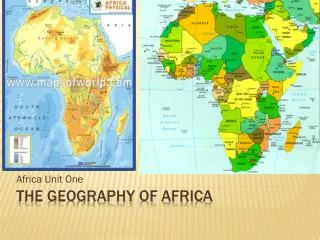
TYPES OF MAPS • 1. Political Map- this is a map that shows political boundaries, borders, area of political entities (countries, states, territories, districts, zones, counties, provinces, etc) These types of maps may also show capitals/ other cities. • 2. Physical Map- This type of map uses colors to show elevation and other land/water features of the earth. This map may also show any physical feature such as mountains, oceans, rivers, valleys, etc. • 3. Thematic Map- This type of map shows “themes” or subjects on a map- basically any information. Anything can be shown on a map using symbols, colors, pictures, numbers, contour lines, etc. ALL THEMATIC MAPS MUST HAVE A KEY- this tells the reader what each picture/symbols/color/etc represents on the map i.e. +represents a hospital
ATLAS • Any collection of maps, graphs, and charts is called an atlas. • We use atlases as a geographic resource for looking up all kinds of information= • From where places are located • To population and economic information • To topographic information about the surface of the earth.
USING AN ATLAS • Remember to use the INDEXto help locate the location of cities, states, and countries around the world. • Use the KEY on the maps to read information • Use the SCALE of the map to find distances • Use the COMPASS ROSE to locate and pinpoint orientation or direction.
MAP PERSPECTIVE • Map Perspective is to look at a map with a DIFFERENT point of view. • Think, for example, how people from Africa would look at a map versus someone from Far East Asia….or someone from Australia versus someone from Europe. • Everyone has a different point of view when it comes to maps….it’s not that they're wrong, it’s just different.
LATITUDE AND LONGITUDE • Reading coordinates is very important in finding location in geography. • Remember that you read the “x-axis” (latitude) first and then read the “y-axis” (longitude) second. (x,y) X- AXIS Y- AXIS
THE GLOBAL GRID The Earth is divided by latitude and longitude lines. There are several important lines to know on the earth's surface: #1 is the ARCTIC CIRCLE found at 66 ½ o NORTH of the Equator #2 is the TROPIC OF CANCER found at 23 ½ o NORTH of the Equator #3 is the EQUATOR which splits the earth into two hemispheres at 0o Latitude #4 is the TROPIC OF CAPRICORN found 23 ½ o SOUTH of the Equator. #5 is the ANTARCTIC CIRCLE found at 66 ½ o SOUTH of the Equator 6 #6 is the PRIME MERIDIAN which runs north to south at 0o LONGITUDE
READING COORDINATES • Read the coordinates for LATITUDE first…. 33o NORTH latitude • Read LONGITUDE next….97o WEST longitude • Which means that coordinates for Dallas, Texas would look like this: • 33oN, 97oW
GRID MAPS • Grid maps are another way to look at finding location. Instead of latitude and longitude lines, use grid squares to find a specific place on a small area of the earth. Cheddar, England is found in grid square A-9
MAP PROJECTIONS • To find just the right map to use, ask yourself “What am I trying to show on my map?” • You don’t want to use a map that has too much distortion (being mis-shapen on a map) • Usually you ask the question for one of the following four map topics: • AREA • DIRECTION • DISTANCE • SHAPE
MERCATOR • Mercator Map Projection: Shows accurate direction, but area & shapes are severely distorted at the poles. Mercator projections are based on cylinders. • ***Sailors would use these for true direction Look how big I am on a Mercator Map!!!
ROBINSON • Robinson Map Projection: Shows accurate shape & size of continents, but water areas are expanded to fill in area. Robinson projections are based on ovals. ***These maps are good for data collections like in a classroom or lab.
INTERRUPTED (aka Goode Projection) • Interrupted Map Projection: Shows accurate area & shape of continents, but oceans have open pie-shaped wedges that are there to adjust for distance.
C0NICAL • Conical map Projection: Used for mapping a large piece of Earth's surface. It shows accurate distance, direction, & shape for the limited area mapped. Conical projections are based as cone-shape.
AZIMUTH (aka POLAR) • Polar Map Projection: Used for mapping hemispheres instead of whole Earth. Shows accurate distance & direction but shape and size are distorted at the edges. Polar view is called Azimuth. • ***Airline Pilots would use these maps to follow Great Circle Routes (the shortest path between two points along the curve of the Earth)
MANY USES FOR MAPS • You MUST be familiar with maps for many different reasons… • Driving (Road Maps) • Locating places (Political Maps) • Traveling (Political or Physical Maps) • Researching (Thematic Maps) • Building (Topographic Maps) • And basically knowing where you are in relation to your surroundings!!!!
Distance • Linear Distance • How far across the earth a person, an idea, or a product travels • From point A to point B • Time Distance • The amount of time it takes for a person, an idea, or a product to travel • Psychological Distance • Refers to the way people view distance. • May influence decisions about many different human activities.