Download
1 / 12
140 likes | 236 Views
Explore the importance and structure of the Lower Coralline Limestone Aquifer in Malta through a comprehensive case study. Learn about the aquifer's capacity, monitoring techniques, proposed gauging network, and current quantitative and qualitative status.

E N D
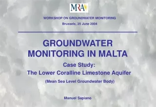
WORKSHOP ON GROUNDWATER MONITORING Brussels, 25 June 2004 GROUNDWATER MONITORING IN MALTA Case Study: The Lower Coralline Limestone Aquifer (Mean Sea Level Groundwater Body) Manuel Sapiano
STRUCTURE OF THE MALTESE ISLANDS • The Maltese Islands are located in the central region of the Mediterranean Sea (around 90km south of Sicily); and consist of three main islands, Malta, Gozo and Comino. • The geological structure of the Maltese Islands permits the division of the islands into several distinct ‘Groundwater Body’ blocks with limited communication of groundwater. • The main aquifer rocks are the Upper Coralline Limestone and the Lower Coralline Limestone, with the Globigerina Limestone functioning only locally as an aquifer. • Groundwater is sustained in the Upper Coralline Limestone formation by the underlying impervious Blue Clay formation and by denser sea water in the Lower Coralline Limestone formation. (not to scale)
IMPORTANCE OF THE LCL AQUIFER • The Malta MSL Groundwater Body is by far the largest underground water storage capacity and yields an estimated 66% (or 21Hm3) of the total groundwater extracted in the country. It stretches over an area of 200km2 which amounts to around 70% of the total area of Malta. • Under optimum conditions the MSL system is estimated to store up to 1.5 Gm3 of groundwater.
STRUCTURE OF THE AQUIFER • The LCL Aquifer is in lateral and vertical contact with sea-water and reaches a maximum potentiometric height of 3m above sea level, tapering out towards the coast. • Due to the density contrast of freshwater and saltwater a Ghyben-Herzberg system is developed: a freshwater lens floating on saltwater with a thickness approximately 36 times more below sea level than the height of freshwater above sea level. Source: UNESCO • However, the interface in reality is a mixing zone, whose limits are generally defined by the 1 and 95% sea water content, called the Transition Zone. The thickness of this zone depends both on the hydrodynamic characteristics of the aquifer and the fresh and sea water fluctuations.
MONITORING FOR QUANTITATIVE STATUS • Groundwater levels in Malta are gauged using level recorders in vertical boreholes. • The monitoring network, which is managed by the Water Services Corporation, consists of 38 gauging boreholes that are equipped with data logging facilities. • The existing network was established in the late 1940’s by utilising low yield production boreholes for gauging purposes. Certain areas of the GW body are thus poorly represented. (courtesy: Hydro-climatology Section WSC)
PROPOSED GAUGING NETWORK • A new gauging borehole network is being proposed which while utilizing, wherever possible, current stations; will be geometrically based on a 4x4km mesh system in order to increase representativity. • It is also being proposed that these gauging boreholes be deepened so as to monitor for the status of the Transition Zone; since the quantitative status of a Ghyben-Herzberg groundwater body depends also on the thickness of this mixing zone.
FRESHWATER LENS PROFILING • A pilot project was initiated involving five deep gauging boreholes in which conductivity logs are taken twice every year. • Miaco 2 Gauging Borehole: a sharp interface between fresh and salt water is registered • Mosta Road Gauging Borehole: disturbance of the aquifer has led to a thick (around 40m) transition zone • Both gauging boreholes register almost the same hydraulic head, but the quantitative status is extremely different.
AQUIFER QUANTITATIVE STATUS • The Quantitative Status of the Lower Coralline Limestone Groundwater Body is dependent not only on the hydraulic head but also on the vertical distribution of the chloride content. • From a purely quantitative point of view, the hydraulic head in the central regions of Malta has receded to around 1m amsl. • Initial results show that the Transition Zone in these areas has reached a thickness of around 40m. Further research is required to monitor the trends in the Transition Zone thickness.
MONITORING FOR QUALITATIVE STATUS • Currently, groundwater is analyzed by the WSC on a monthly basis from 85 production boreholes and 7 pumping stations. • Parameters analyzed include temperature, pH, turbidity, conductivity, hardness, TDS, nitrates and chlorides. • However, analysis are performed only on stations which are operational in that particular month. Since a number of boreholes are periodically put off-line; data is not collected all year round from these stations.
CURRENT AQUIFER QUANTITAIVE STATUS • Groundwater in the LCL Aquifer is prone to saline intrusion from the bounding seawater and pollution from human activities. • Groundwater abstracted from the LCL Aquifer has high levels of chloride as a result of localized sea-water intrusion. Chloride levels in pumping stations ranged between 400 – 2100mg/l in 2003. • Nitrate concentrations measured at pumping stations indicate a steady increase of Nitrates in groundwater. Average Chloride values at Pumping Stations Average Nitrate values at Pumping Stations Source: Axiaq and Sammut 2002
MONITORING AT ABSTRACTION POINTS • Due to the structure of the groundwater body, chemical analysis performed on samples collected from pumping sources are not expected to give a true picture of the qualitative status of the aquifer. • Chloride content is expected to be higher than in the surrounding groundwater due to localized sea water intrusion (upconing) beneath the abstraction source. • This upconing phenomenon is also expected to result in lower Nitrate content since groundwater is mixing with intruding sea water which has a very low Nitrate content. Source: UNESCO
PROPOSALS FOR QUALITATIVE STATUS MONITORING • MRA is currently formulating proposals to change the monitoring strategy in line with the requirements of the WFD. • The current monthly monitoring of basic chemical parameters at groundwater production sources (which are intended for the public supply) will have to maintained. • A geometrically based network of abstraction sources has been proposed, in which the quality of the extracted groundwater will be measured. In the same time the groundwater quality at the gauging stations will be measured, since this is expected to be more representative of the status of the groundwater body. The results obtained will be used to formulate the basic monitoring network.